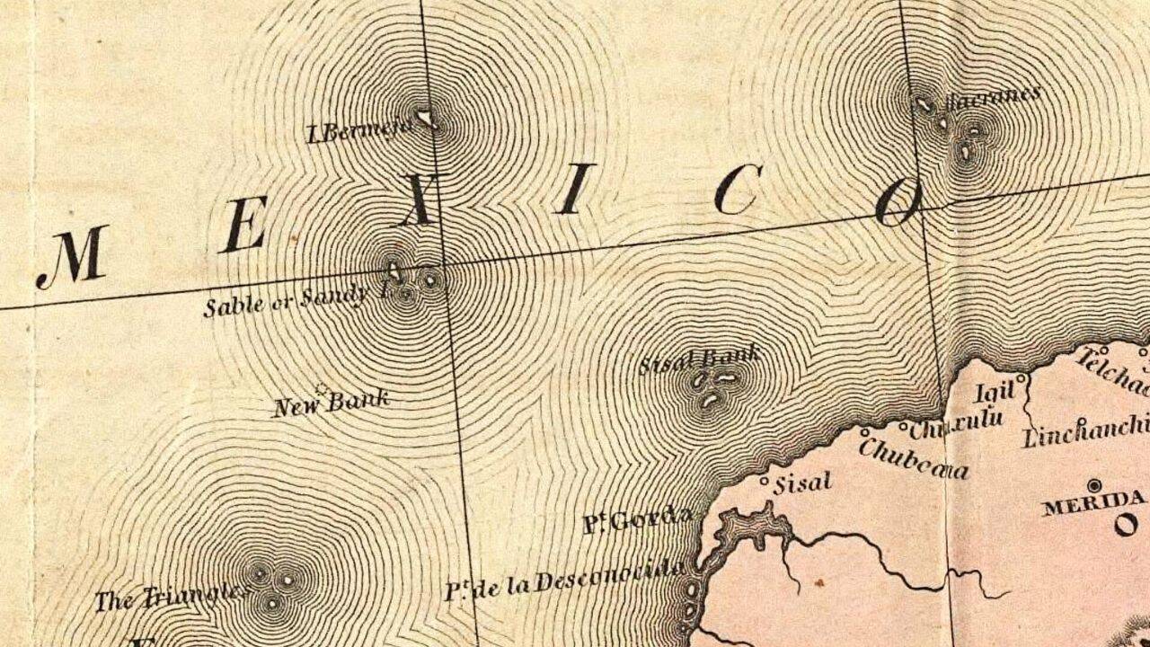
Isla Bermeja is recorded in history as a small, rocky island located in the Gulf of Mexico, almost 100 kilometres off the coast of the Yucatán Peninsula. For over 400 years, it was a fixed visible point on official maps, situated at the coordinates 22 degrees 33 minutes north and 91 degrees 22 minutes west. Starting fromthe 16th century, cartographers described a light wooded island of approximately 80 square kilometres, observing its unique reddish or blondish appearance.
Get breaking news anytime, anywhere. Download the TOI app now!
However, the island's legacy took a sharp turn in the late 20th century when researchers discovered that it had vanished from the physical world. This was not just an academic curiosity, because the island’s presence or absence decided the maritime boundaries between Mexico and the United States. Its disappearance caused the loss of 22 billion barrels of oil from under Mexico’s control.
First appearance of the Bermeja island 500 years ago
The trail of Bermeja begins in 1535 with a map drawn by the Portuguese cartographer Gaspar Viegas, which is currently present in the archives of Florence, Italy. According to Mexico Unexplained, the name ‘Bermeja’ is derived from old Iberian dialects which means ‘reddish in colour,’ also a description that matches the ‘blondish’ appearance reported by early sailors.
In 1539, the island was mentioned in a list of regional islands by Alonso de Santa Cruz, and by 1544, it was featured on a map by Sebastian Cabot. The Historic Mysteries reports that these early depictions remained consistent for centuries, with the island shown alongside a small group of islets known as Negrillos. For 300 years, the island acted as a landmark for Spanish treasure ships and a hiding place for English and Dutch buccaneers. It was also included in official Mexican government schoolbooks as recently as 1946.
Why did the Bermeja island become so valuable for Mexico
In the late 20th century, Bermeja changed from a navigational landmark into a high-stakes geopolitical asset. As explained in the report from the University of New Mexico Digital Repository , the presence of the island would have allowed Mexico to claim a much larger Exclusive Economic Zone (EEZ). International law permits a nation to claim resources up to 200 nautical miles from its furthest land point.
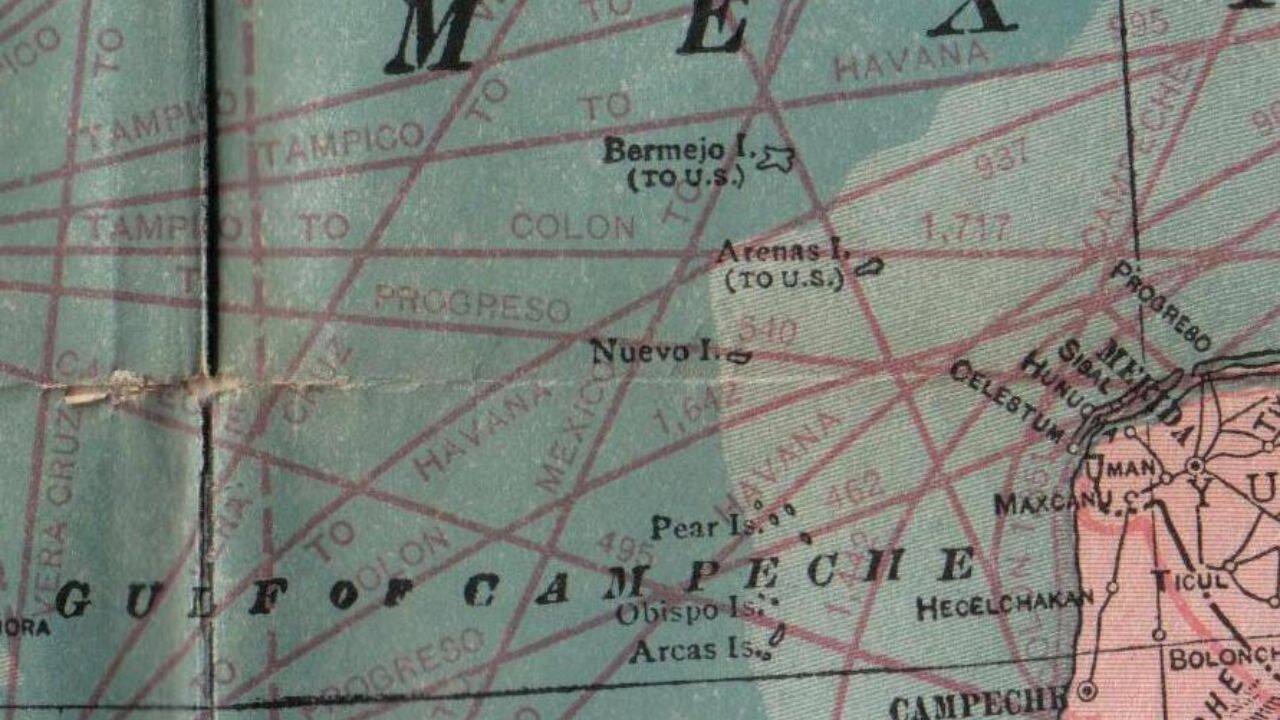
In his paper on phantom islands , C.S. Christensen mentions Bermeja as a ‘strategic island’ because its presence would have provided an additional 15% of territory to Mexico, in an area with probably 22.5 billion barrels of oil. Without Bermeja, the maritime boundary between the United States and Mexico was established using the Alacranes Islands. Because of this a vast, oil-rich region called the ‘Donut Hole’ came largely under American influence, a situation that would have been completely different if Bermeja had been found.
When did people start searching for this mysterious island
Mexico Unexplained highlights a diary entry from July 1775 by the Spanish cartographer Miguel de Alderete, who arrived at the coordinates and found nothing. However, the island continued to appear on maps for another two centuries without physical verification. Interest was generated again in the 1990s during the Clinton-Zedillo Treaty negotiations, which aimed to partition the Gulf’s resources.
In 1997, the Mexican Navy sent an oceanographic vessel to the area, but after covering 300 square nautical miles, they found no trace of land. Later, a study by the National Autonomous University of Mexico (UNAM) in 2009 used advanced scientific devices to scan the ocean floor. The team found that the sea at those coordinates was 1,472 metres deep and the bottom was totally flat, suggesting that no island had ever existed there.
Suspicions around the disappearance of Bermeja
The lack of physical evidence has given rise to several conspiracy theories. C.S. Christensen notes that the island’s disappearance around the year 2000 started the rumours that the CIA had destroyed it to ensure that the United States maintained the rights of oil reserves in the Gulf. This theory was championed by Senator José Ángel Conchello, who accused the US of ‘wiping out’ the territory to end Mexico's claims.
Tragically, Senator Conchello was killed in a car accident in 1998, just months before the signing of a treaty that ignored Bermeja's existence. The geographers like Israel Baxin Martínez dismiss these ideas as mere conspiracy, but the ‘layman's whisper’ is still strong in Yucatán fishing communities, where many people believe that the island was erased for ‘black gold.’
Is there a natural explanation for its vanishing act
Historic Mysteries mentions that since 1844, some British maps had reported that the island was sinking nearly 60 fathoms(360 feet) below the surface. C.S. Christensen suggests that rising sea levels or the intense force of hurricanes might have submerged the landmass, or perhaps the coastal erosion was the reason behind it.
Another possibility is that Bermeja was a ‘watermark’ island, a deliberate error added by cartographers to protect their work from copyright theft. Finally, a YouTube video surfaced in 2012 showing a fishing trip to an island with the reddish tones and bird life described in the 16th century, but the uploader provided no coordinates. Whether Bermeja was a victim of geological shifts, a strategic deception, or a simple mistake repeated through the centuries, it remains one of the most amazing mysteries of the modern maritime world.