It has been a drenching few days for south-east Queensland and northern New South Wales and there is more rain to come, according to the Bureau of Meteorology.
The largest total in the 24 hours to 9am Friday was 463 millimetres just south-west of Bundaberg, at the Old Range gauge.
Pomona, near Noosa on the Sunshine Coast, received 415mm and the rain has kept falling.
As of 12:30pm, the area had received another 97mm.
BOM meteorologist Jackson Browne said everywhere south-east of Oakey and Gympie had received in excess of 100mm in the seven days to 9am on Friday.
But there are many locations that have received literal bucketloads.
Pomona station received 786mm in the last week while Upper Springbrook, in the hinterland near the NSW border, has had a whopping 383mm in gauge.
The totals have been staggering, but Mr Browne says the big wet is not over yet.
What's to come?
If you were planning a picnic this weekend, scrap it.
The rain is expected to persist until Monday for south-east Queensland and northern NSW.
Mr Browne said the upper-level system driving the rainfall onto the coast had "not been terribly motivated to move around today".
Instead, it has stayed put and driven more and more rain onto the south-east of Queensland.
"Hence why we are seeing those pretty extreme rainfall figures," Mr Browne said.
The low is expected to move off in the coming days, but more rain is forecast for the weekend.
"We are expecting a renewal of rainfall again into Saturday night and then peaking Sunday and then trailing off on Monday," Mr Browne said.
"Anywhere in the south-east [of Queensland] could see heavy rainfall leading to flash flooding."
According to Mr Browne, falls in the coming days could bring 100mm to 300mm — at least.
The Mary River is already at major flood levels and Gympie is expected to reach that status by this evening.
The Logan River and the Lockyer and Laidley creeks, just east of Toowoomba, are also at major flood levels.
The creeks are notorious for flash flooding driven by rain crashing down from the Great Divide.
Flood warnings are in place for NSW and more are likely to be issued this evening.
Cyclone brewing
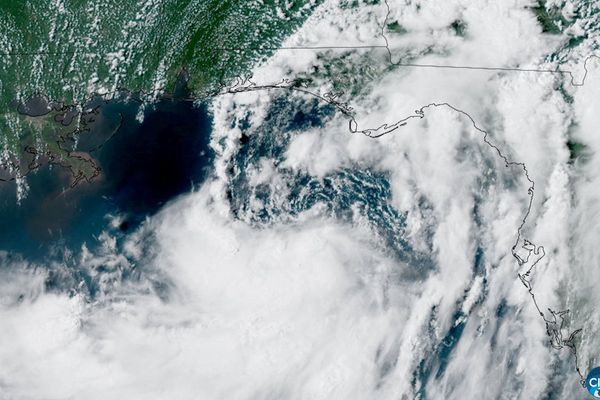
Queensland is not the only part of the country dealing with a slow-moving low.
A tropical low has been brewing in the Timor Sea, west of Darwin, for the last few days.
"The system's had a good night — it's starting to show signs of development," Mr Browne said.
"The current forecast track does have it just meandering around the southern Timor Sea, and then moving down towards the very remote northern Kimberley Coast come late Saturday into Sunday."
But 24 hours is a long time in the world of cyclone forecasting so we will have to wait and see.
With plenty of wild weather around this weekend, as usual, stay out of floodwaters and follow the advice of your local emergency services.
For more information on how to prepare for disasters near you, check in with ABC Emergency.