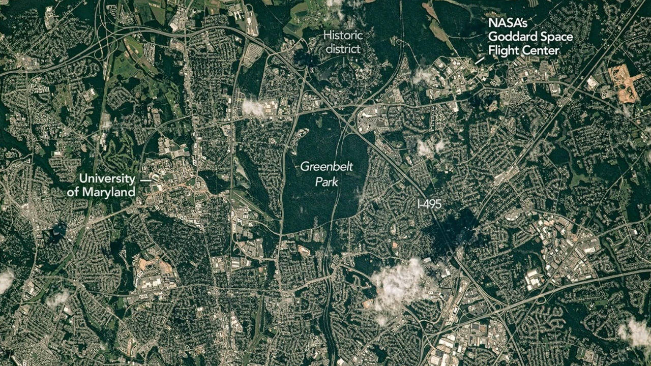
If you have ever driven the Capital Beltway around Washington, DC, you will know the feeling. Mile after mile, the landscape is filled with roads, rooftops and traffic, until a patch of green suddenly breaks up the view. NASA's Earth Observatory recently put a name to that feeling with a feature called Belts of Green in the Washington Suburbs , built around a photograph an astronaut took aboard the International Space Station in July 2023 and only released to the public this year. It shows how much of that greenery has survived on the northeast side of the Beltway, around the historic Maryland city of Greenbelt. Looking straight down from orbit, a neat, square park sits right at the centre of town, with slim green strips branching outward towards homes, offices, a university campus and a cluster of government buildings, a pattern you would never clock from street level but one that is unmistakable from space. It suggests that even one of the busiest, most heavily developed corners of a major American city can still hold onto pockets of nature, provided planners leave space for them.
Get breaking news anytime, anywhere. Download the TOI app now!
How a planned suburb gained a protected greenbelt
The largest patch of green in the image is Greenbelt Park, but its history is tied closely to the planned community around it. The land was originally part of the wider Greenbelt development project, where planners envisioned additional residential development. In 1950, however, Congress formally established Greenbelt Park as a national park, preserving the woodland as the suburb continued to grow. Today, the park covers about 1,100 acres, or roughly 4.5 square kilometres, and offers wooded trails, picnic areas and a 174-site campground.
Just north of the park sits Greenbelt's historic district, laid out in a distinctive crescent shape that still shows up clearly in aerial photographs. It was one of three planned communities built in the 1930s under President Roosevelt's New Deal, designed to provide jobs and create affordable cooperative housing with shared green space. Homes were connected by footpaths that led to what is now one of the country's oldest planned shopping centres.
The rest of the image is marked by similar green corridors. A short distance east of the Beltway sit the buildings of NASA's Goddard Space Flight Center, established in Greenbelt on May 1, 1959, as NASA's first spaceflight complex. Patches of forest separate parts of the site, while farther north, the landscape opens into a mix of woodland and agricultural fields around Beltsville. NASA notes that these areas include agricultural research sites operated by the University of Maryland and the US Department of Agriculture. The university's main campus is visible just west of the park, in nearby College Park, and nearby towns have also invested in tree cover.
Why a small park keeps doing so much for a big city
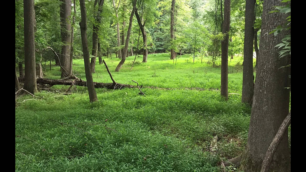
The significance of Greenbelt Park goes well beyond simply looking pretty from a satellite camera. The National Park Service's Foundation Document Overview records that Congress formally established the park on 3 August 1950, alongside the creation of the Baltimore-Washington Parkway. Sitting on roughly 1,100 acres, the park contains nine miles of trails, three picnic areas and a 174-site campground.
The land also provides important ecological benefits, not just an attractive backdrop. The forest is mostly mixed pine and deciduous woodland, with wildflowers and ferns on the ground. Two small streams, Still Creek and Deep Creek, wind through the park before joining the Anacostia River. The park's stated purpose includes protecting water quality, while its habitat supports a range of wildlife and neotropical migrant birds.
The park has also become an ordinary part of daily life for nearby residents. Locals can use it as a nearby retreat, whether for a run, a weekend camping trip or a quiet walk beside a stream. That everyday usefulness may be part of what makes the NASA photograph so striking. From above, the park is not simply an isolated patch of woodland but part of a larger network of green spaces woven through the suburban landscape.
Seen from the ground, Greenbelt looks like a Maryland suburb on the edge of a major city. Seen from space, the relationship between the planned community, protected woodland and surrounding green corridors becomes much easier to recognise. The photograph taken by an astronaut in July 2023 captures that pattern clearly, showing how planning decisions made decades ago continue to shape the landscape today.