Indonesian authorities have successfully rescued over 170 individuals caught by the sudden eruption of Mount Semeru, Java island's highest volcano, on Wednesday. The operation concluded Thursday, amid warnings that ongoing seismic activity suggests further eruptions are likely.
A total of 178 people – comprising climbers, porters, guides, and tourists – had been ascending the 3,676-metre (12,060-foot) peak in East Java's Lumajang district. They became stranded at the Ranu Kumbolo camping area when the volcano unexpectedly erupted.
“They are safe and now being helped to return,” said Priatin Hadi Wijaya, head of the Center for Volcanology and Geological Disaster Mitigation, told a video news conference.
Another official at the center, Hetty Triastuty, added that Ranu Kumbolo is a safe area located outside the main danger zone of 8 kilometers (5 miles) from the crater. The camping area is on the northern slope of the mountain, which is not in the path of the hot cloud flow that was observed moving south-southeast. However, the climbers may have been exposed to volcanic ash.
Mount Semeru in East Java province unleashed searing clouds of hot ash and a mixture of rock, lava and gas that traveled up to 13 kilometers (8 miles) down its slopes in succession from midday to dusk Wednesday, while a thick column of hot clouds rose 2 kilometers (1.2 miles) into the air, prompting scientists to raise the volcano's alert to the highest level, Indonesia’s Geology Agency chief Muhammad Wafid said.
He said a series of pyroclastic density currents traveled down the mountain's slopes and incandescent avalanches of volcanic material were visible descending through the Besuk Kobokan River valley on the southern flank.
“Mount Semeru's seismicity activity indicated that the eruption continued at a high level with increasing numbers of signals indicating avalanches,” Wafid said.
He warned people to keep away from an area along the Besuk Kobokan River, which is the path of the lava flow as searing gas flowed down Semeru’s slopes, adding that authorities are considering to expansion of the danger zone from the current 8 kilometers (5 miles).
Mapped: Mount Semeru
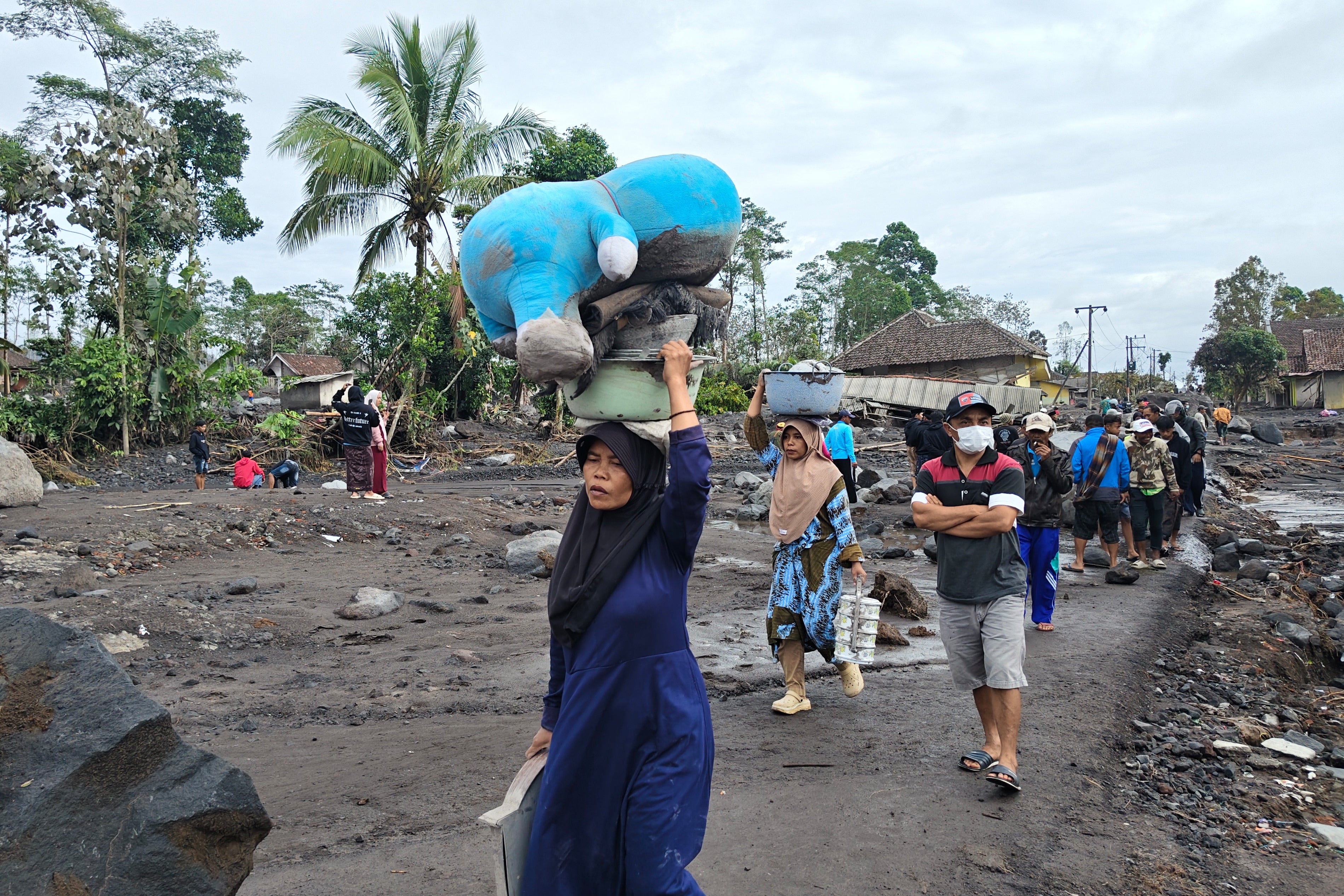
Nearly 1,000 residents in three villages most at risk in the district of Lumajang were evacuated to government shelters, said National Disaster Mitigation Agency spokesperson Abdul Muhari. No casualties have been reported.
Videos on social media showed a dense cloud of ash sweeping through plantations and a forested valley to a river beneath a bridge.
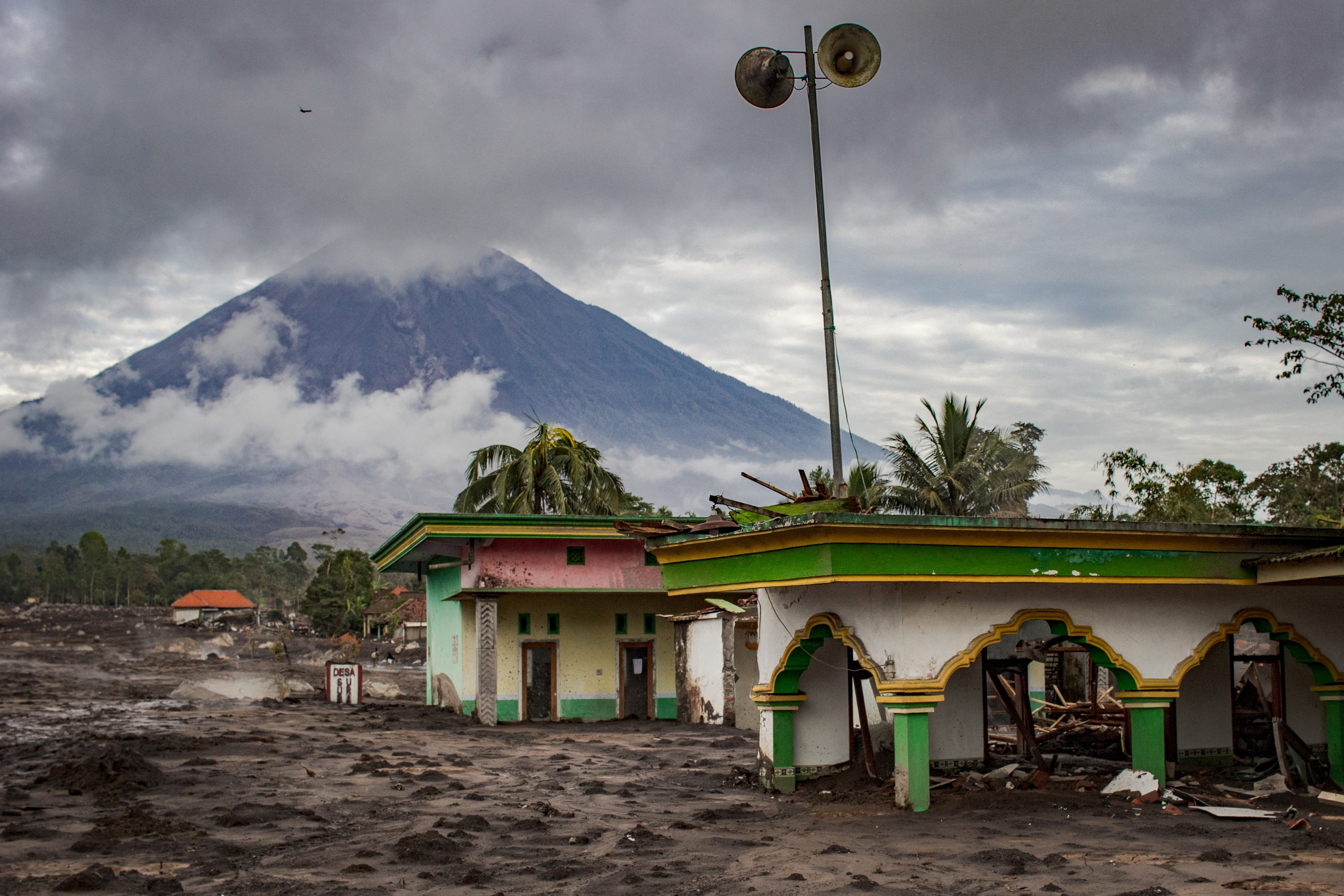
The eruptions that unfolded throughout the day blanketed several villages with thick volcanic ash and blocked sunlight. Local media reported some residents were exposed to an odor of sulfur and that two motorcyclists crashed due to hot ash on a bridge, resulting in severe burns on their bodies.
Mount Semeru, also known as Mahameru, has erupted numerous times in the past 200 years. Still, as is the case with many of the 129 active volcanoes in Indonesia, tens of thousands of people continue to live on its fertile slopes.
Semeru’s last major eruption was in December 2021 when it left 51 people dead and several hundred others burned in villages that were buried in layers of mud. The eruption forced the evacuation of more than 10,000 people. The government moved about 2,970 houses out of the danger zone.
Indonesia, an archipelago of more than 280 million people, sits along the Pacific “Ring of Fire,” a horseshoe-shaped series of fault lines, and is prone to earthquakes and volcanic activity.
An earthquake of magnitude 6 struck Seram, Indonesia, the German Research Centre for Geosciences (GFZ) said on Thursday. The quake was at a depth of 136 kilometers (84.51 miles) GFZ said.