Millions of people across the US are facing extreme weather this week as forecasters warn of strong storms in the west, the threat of tornadoes forming in the south, and a winter blast that may produce widespread flooding in the east.
“Widespread hazardous weather impacts are expected for the eastern third of the US,” the National Weather Service (NWS) said on Tuesday, adding that flood risks extended from the Florida Panhandle up to Maine. The downpours will be accompanied by widespread strong winds gusting up to 50mph.
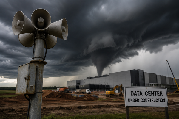
The intense storms are expected to fuel the formation of more tornadoes from northern Florida to the coastal plain of the Carolinas, and the NWS has already received 10 tornado reports since Monday night, including one that tore through properties roughly two hours outside Florida’s state capital of Tallahassee.

The western US, meanwhile, is bracing for another round of heavy rain and snow. Officials warned residents in Washington to stay home and avoid mountain passes after issuing a rare warning for blizzard conditions in the area. Winds across inland areas reached 50mph, creating whiteout risks on snow-covered roadways.
Forecasters also issued blizzard warnings for central Oregon, as the unusually intense weather is expected to deliver heavy snowfall and whipping winds at the same time. Rapid accumulation of up to 2in an hour is possible Tuesday night into Wednesday, as strong gusts stir up snow and increase risks from falling trees and downed wires.
Major swells will also continue slamming into the west coast, with the high surf producing waves breaking at up to 30ft in the Pacific north-west.
More than 100,000 homes and businesses had lost power in Washington and Oregon on Tuesday morning, according to poweroutage.us, as the storms bore down.
It's REALLY unusual for the NWS to issue a blizzard warning here. But they have, so PLEASE take this seriously. Our crews will be out, but we lack the ability to stop heavy snow and high winds. It's going to be REALLY challenging in the passes. https://t.co/it8yceJLPn
— Washington State DOT (@wsdot) January 7, 2024
The south-west will also get dusted in white this week, as a second storm moves in on Wednesday, dropping rain in the valleys and snow in the mountains of Arizona and New Mexico.
Severe thunderstorms remained a high risk for the south-eastern region on Tuesday, the NWS said, with warnings in place for southern counties in Alabama and Georgia. More than 200,000 utility users in Alabama, Florida and Georgia are also facing power outages amid storms. Areas of south-east Mississippi and Louisiana were under a coastal flood advisory.
Some midwestern cities were expected to receive up to 6in of snow, including Kansas City, Missouri, and Grand Rapids, Michigan, AccuWeather reported. Forecasters predicted up to 10in of snow in Topeka, Kansas; Des Moines, Iowa; and other metro areas. Some areas in Illinois and Wisconsin already received up to 4in of snow overnight.
Much of the Chicagoland area was under a winter weather advisory or winter storm warning, as intense snowfall and high winds were predicted, NBC Chicago reported. More than 100 flights out of Chicago-area airports had been cancelled amid poor travel conditions.
Forecasters have also warned that the east coast may face excessive rainfall into Tuesday evening, the New York Times reported.
While California won’t see as much snow and rain on Tuesday, a second system blowing in on Wednesday is expected to wreak havoc on travel for the second time in a week, after storms hammered the state over the weekend. Wind gusts of up to 100mph could blow through the Sierra Nevada ridges, dropping to 50mph at lower elevations. More snow is a welcome sign for water managers in the state, especially after the winter got off to a slow start, but it will create headaches and hazards for those hoping to traverse through the mountains this week.
“Remember Saturday’s snowy travel mess?” the local office of the NWS office said in an area forecast discussion. “This storm queued up to arrive on Wednesday will bring similar travel impacts with snow levels down to all valley areas.”