US satellites reveal true extent of melting polar ice
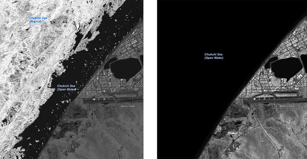
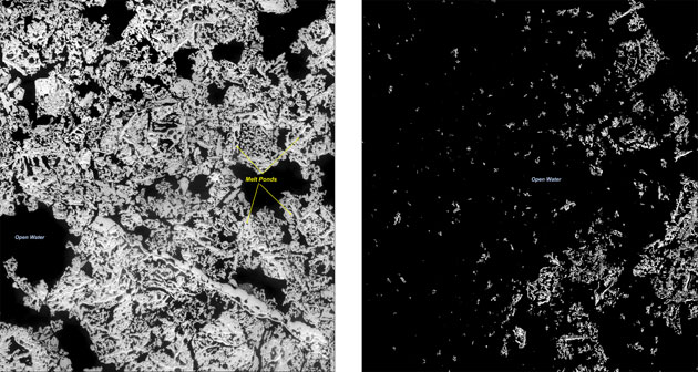
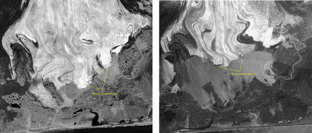
Barrow, Alaska: Sea ice forms along the coast in the winter, and generally melts or breaks away by mid-July. Observations of sea ice positions reveal considerable year-to-year variability. The image on the left was taken in 2006, and that on the right in 2007Photograph: USGSBeaufort Sea, Alaska: This area is near the edge of the ice pack. In summer, as shown here (left in August 2001, right in August 2007), ponds of meltwater form on the surface. These dark pools absorb more of the summer radiation than the surrounding ice, enhancing meltingPhotograph: USGSBering glacier, Alaska: The Bering glacier is the largest and longest in continental North America. In 1996 (left), its size reached a late 20th century peak. Since then, parts of its terminus have retreated more than three miles and thinned by more than 200ft. These images show the 1996-2005 retreat of the glacierPhotograph: USGS
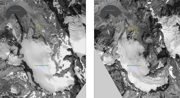
South Cascade glacier, Washington:The advance or retreat of mountain glaciers is a phenomenon under close study. These images, from autumn 2000 (left) and 2006 (right), show the retreat of the glacier terminusPhotograph: USGS
Sign up to read this article
Read news from 100’s of titles, curated specifically for you.