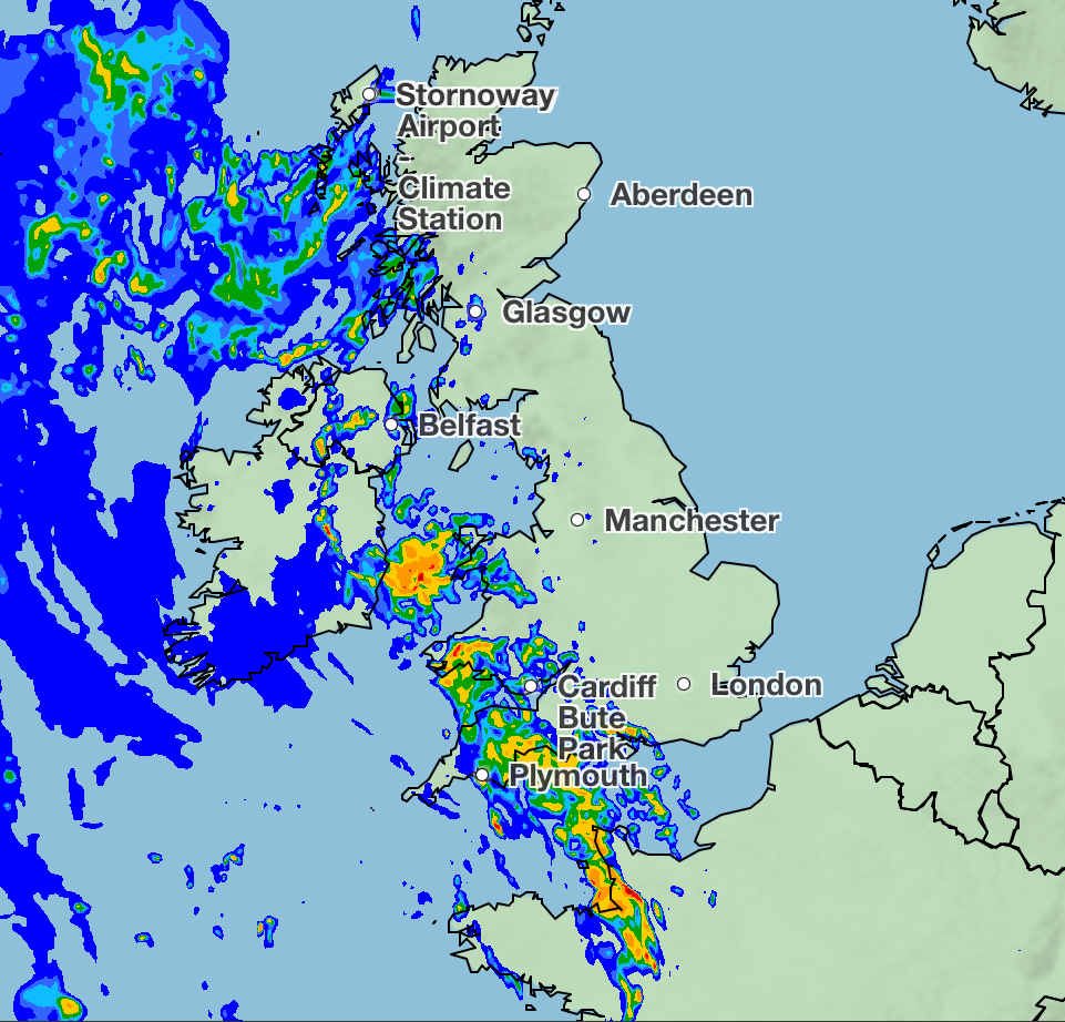
Parts of Britain can expect a battering of rain as humid air drives up temperatures and is expected to bring thunderstorms to the UK.
The Met Office reported heavy, thundery showers overnight on Wednesday moving through the west of the country, which could see 20 to 40 mm of rain over just a few hours during intense downpours. Frequent lightning can be expected amid these bursts of heavy rain as the wet weather moves slowly through the North and East on Thursday.
Met Office deputy chief meteorologist, Mike Silverstone, said: “After largely benign weather early in the week, some intense, thundery showers will move in on Wednesday evening. These thunderstorms are being triggered by some warm, humid air that is moving into the UK from the South.
“The intense rainfall could see 20 to 40mm accumulating over just a few hours, which could cause some disruption. While there are no severe weather warnings issued at the moment, it is possible thunderstorm warnings may be issued this week.”

Much of the intense downpour will be focused in the South West, with Northern Ireland and western Wales also facing the wet weather.
The turbulent weather is being caused by a plume of warm air moving in from the south, driving a change to the weather later in the week. By Friday, much of the country should see more settled weather, although another band of thunderstorms is expected to move in again from the South West late on Friday, bringing intense rainfall in the early hours of Saturday morning.
As well as torrential rain, the humid plume of air will see temperatures climb throughout the week. The forecaster predicted highs of 27C on Wednesday, 27C for Thursday with 29C possible by Friday, particularly focused in South East and central England.
Temperatures are set to climb into the twenties across the country, with Newcastle experiencing 22C and York seeing 23C.
Meteorologist Craig Snell said that a plume of warm air from Iberia and France is causing the changeable weather.
He added: “After Wednesday, we start to draw up some very warm and humid air from Iberia and France, and that will make it quite humid across much of the UK and that humidity will potentially spark off some thunderstorms.
“From late Wednesday and especially into Thursday, we start to see the risk of some thunderstorms around and that will continue as we go through Thursday and Friday and potentially into Saturday as well.
“By the time we get to midweek, it will feel very different out there, with quite humid night times also becoming a good deal warmer than what we have been experiencing over the last couple of nights, so probably borderline uncomfortable for some people by day.”
Today:
Low cloud and patchy light rain across the south this morning, will become restricted to the far south during the afternoon. Otherwise increasing amounts of sunshine developing throughout today with morning showers tending to die out. Feeling warmer for many.
Dry for most tonight with variable cloud and clear spells. The clearest skies in the north, where it will turn chilly. Mild in the south though with some patchy fog.
Wednesday:
Morning low cloud across the south will burn away to leave a largely dry and sunny day for many, with a few showers in the west. Widely very warm.
Thursday to Saturday:
Very warm and humid on Thursday and Friday with the risk of some heavy and thundery downpours developing. Further heavy rain possible on Saturday, but feeling fresher from the south.
What is new Covid variant NB.1.8.1? Symptoms as cases confirmed in UK
Thunderstorm warnings could be issued this week as ‘intense rainfall’ looms
Geologists unveil UK ‘super regions’ with best potential for transition projects
UK sanctions two far-right Israeli ministers over ‘monstrous’ Gaza comments
Civil Service workforce up 2,000 to almost 20-year high, figures suggest