The Bureau of Meteorology has declared that Australia is now in the grip of an El Niño climate pattern.
The US government’s National Oceanic and Atmospheric Administration had made its own declaration that El Niño was under way in June, followed by a similar warning from the World Meteorological Organization, the UN’s weather agency, in July. It foreshadowed a “surge in global temperatures and disruptive weather and climate patterns” around the planet.
Now that the BoM has declared an El Niño, what might Australians expect for the summer ahead?
What is El Niño?
El Niño is the warm phase of a natural cycle known as the El Niño-Southern Oscillation (Enso), which is one of the key drivers affecting global climate.
During an El Niño, sea surface temperatures in a central region of the equatorial Pacific become warmer than average, resulting in a shift in atmospheric circulation.
In an El Niño, there is a weakening or reversal of a pattern of air flow known as the Walker circulation, which includes trade winds that typically blow from east to west over the Pacific.
As a result, there is less atmospheric moisture and heavy rainfall over the north of Australia, which shifts to the central and eastern parts of the Pacific.
Enso has a timescale between one and eight years; the last El Niño event occurred in 2018-19.
What impact does El Niño have on weather in Australia?
The effects of El Niño can be globally far reaching, resulting in extreme rainfall and floods in the southern US and Central America, and failed monsoons on the Indian subcontinent.
In Australia, El Niño has been linked with an increased risk of drought, heatwaves, bushfires and coral bleaching.
The climate event has tended to result in warmer-than-average temperatures across most of the south of the country. For eastern Australia, nine of the 10 driest winter-spring periods on record have occurred during El Niño years.
The impacts of an El Niño depend on how strong the phenomenon is, as well as where it forms in the Pacific. Experts say El Niños that arise from warm surface water located in the central Pacific are more associated with lack of rainfall in Australia than those where the warmer water is farther east.
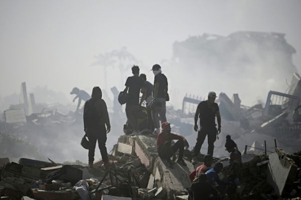
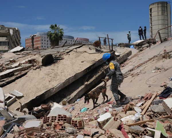
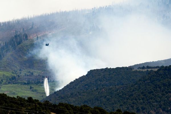
Will El Niño make bushfires worse?
Because of reduced rainfall and hotter-than-average temperatures, the risk of a significant fire danger season is significantly higher after an El Niño year, according to the BoM. Previous examples of this occurred during the summers of 2002-03 and 2006-7.
However, the 2019-20 black summer bushfires, one of the most destructive on record, did not occur in an El Niño year but a neutral Enso phase, intensified by a positive Indian Ocean dipole (IOD).
The IOD, like Enso in the Pacific, is determined by differences in sea surface temperature between the eastern and western Indian Ocean. A positive IOD, which the BoM has confirmed is under way, can increase the drying influence of El Niño.
Climate scientists and bushfire experts have expressed concerns that “prolific” vegetation growth after three wet years associated with a rare triple La Niña could result in dangerous bushfire conditions this summer.
Communities have been urged to prepare for what may be the most significant bushfire season since the 2019-2020 fires.
Why did the BoM take longer to declare an El Niño than international weather agencies?
For the BoM to declare an El Niño, it requires that sea surface temperatures in the Nino3 or Nino3.4 regions of the Pacific be 0.8C above average – a higher threshold than the 0.5C used by Noaa in the US. Both those thresholds have been met.
But the Bureau also wants to see a coupling between the ocean temperature changes and what happens in the atmosphere, as measured through what is known as the southern oscillation index (SOI).
An SOI of -7 or below is typically associated with an El Niño. Back in July, when the WMO declared the event, the 90-day average SOI was -5.9. In September, the 90-day SOI has hit -7.7, meeting El Niño thresholds.
What is the link between El Niño and climate change?
The last strong El Niño, along with global heating, resulted in the hottest year on record globally, in 2016.
A study led by CSIRO scientists found in May this year that global heating from greenhouse gas emissions had likely been making El Niños and La Niñas more frequent and severe since the 1960s.
Other research has shown that fires driven by El Niño can increase the amount of carbon dioxide in the atmosphere.
In Australia, the risk of intense fire weather has already risen since 1900 “by more than a factor of four”, according to scientists, with bushfire crisis conditions projected to be eight times more likely if global heating reaches 2C.
Australia’s climate has warmed by an average 1.47C since records began in 1910.