A “major incident” has been declared in the wake of Storm Chandra, as parts of the country continue to be disrupted by the heavy rainfall.
Declaring the emergency, Somerset Council said there had been “extensive flooding overnight” and the risk of flooding on the Somerset Levels and Moors “remains high as rainwater moves through the system”.
Storm Chandra also brought disruption to other parts of the South West, the south coast, and north of England, as well as Wales, Scotland and Northern Ireland.
Domestic flights were cancelled on routes serving Birmingham, East Midlands, Edinburgh, Glasgow, Heathrow, Leeds Bradford, London City, Manchester and Southampton airports on Tuesday.
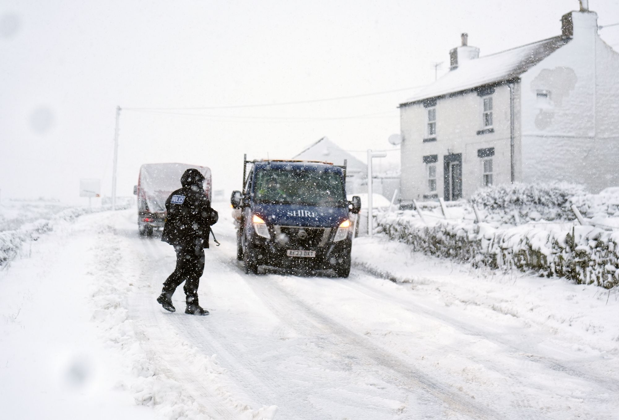
Yellow weather warnings have been issued for ice on Wednesday morning covering much of England, Wales, Northern Ireland, and southern and central Scotland.
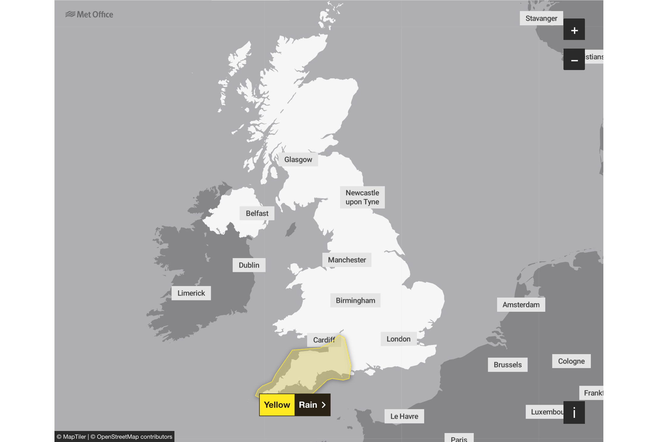
A yellow weather warning for rain is also in place for South West England on Thursday, with the Met Office saying that further rain could bring more flooding and transport disruption.
Key Points
- Storm Chandra sets new January daily rainfall records in several places
- Severe 'danger to life' flood warning issued in Devon
- Woman hospitalised after tree falls on car in Co Fermanagh
- Two ice warnings issued for Wednesday
- Belfast City Airport cancels more than two dozen flights
- 'Truly horrendous night' as Devon river reaches 'highest recorded level'
Storm Chandra map: Where heavy rain and flooding could hit UK today with ‘danger to life’ warning issued
04:00 , Shaheena UddinStrong winds, heavy rain and snow are forecast across much of the UK on Tuesday, the Met Office has warned, as the newly named Storm Chandra brings weather chaos.
Storm Chandra is expected to hit with “very strong winds”, which may damage buildings and dislodge tiles that could cause life-threatening injuries.
Several weather warnings have been issued, including an amber warning for wind along the east coast of Northern Ireland and including Belfast.
The Independent reporter Shaheena Uddin writes:
Storm Chandra map: Where flooding could hit today with ‘danger to life’ warning
Storm Chandra sets new January daily rainfall records in several places
03:00 , Shaheena UddinThe Met Office have announced that several sites have provisionally set new January daily rainfall records due to Storm Chandra.
Plymouth (Mountbatten) has set a new record despite over 100 years of observations, while Katesbridge has provisionally recorded its wettest day on record with 100.8mm of rain.
Several sites have provisionally set new January daily rainfall records, some are shown in the table below 👇
— Met Office (@metoffice) January 27, 2026
Katesbridge has provisionally recorded its wettest day on record, while Plymouth (Mountbatten) also saw a notable record at a site with over 100 years of observations pic.twitter.com/9zFGBsoUYi
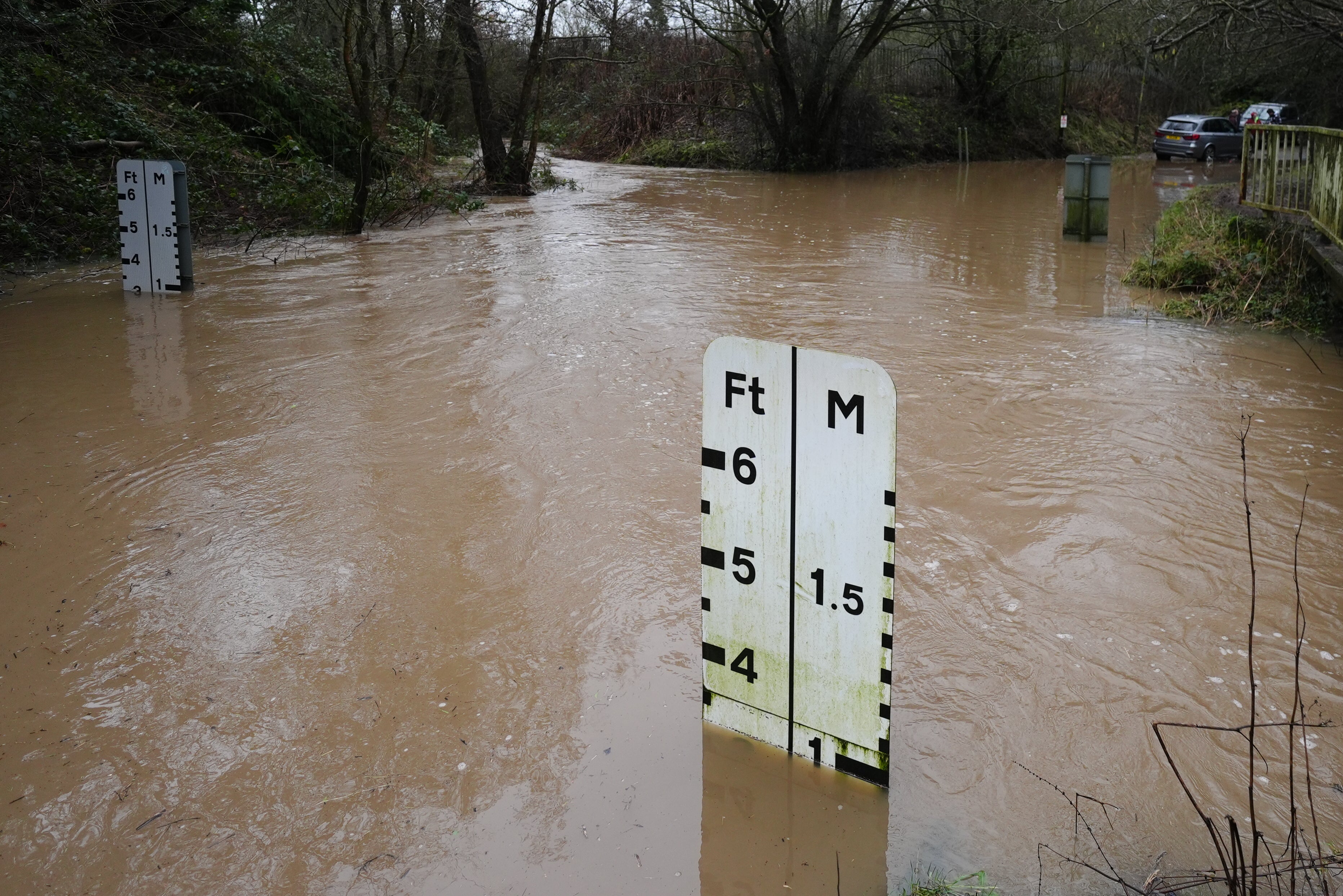
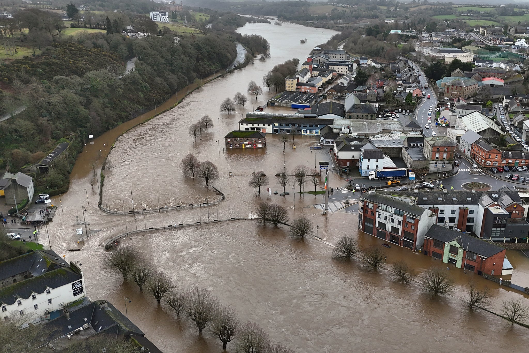
River Otter reaches record level of 2.83m due to floodwater
02:00 , Shaheena UddinThe Environment Agency said the River Otter at Fenny Bridges, close to Ottery St Mary, has reached its highest recorded level, surpassing the previous record set in December 2000.
Levels reached 2.81m on December 7 that year but were at 2.83m at 5.45am on Tuesday, with a severe flood warning issued five minutes later due to predicted overtopping of flood defences.
A spokesman said: “Storm Chandra brought significant rainfall across Devon and Cornwall overnight, falling on already saturated ground.
“East Devon received 67mm of rain in the last 12 hours, with 88mm recorded at Whitebarrow on Dartmoor. Across south and mid Devon, rainfall averaged 40-50mm.
“There are currently 33 flood alerts and 39 flood warnings in force across Devon and Cornwall. Approximately 20 properties have flooded at various locations, with this number expected to rise.”
Drivers urged to carry floodkits due to heavy rain
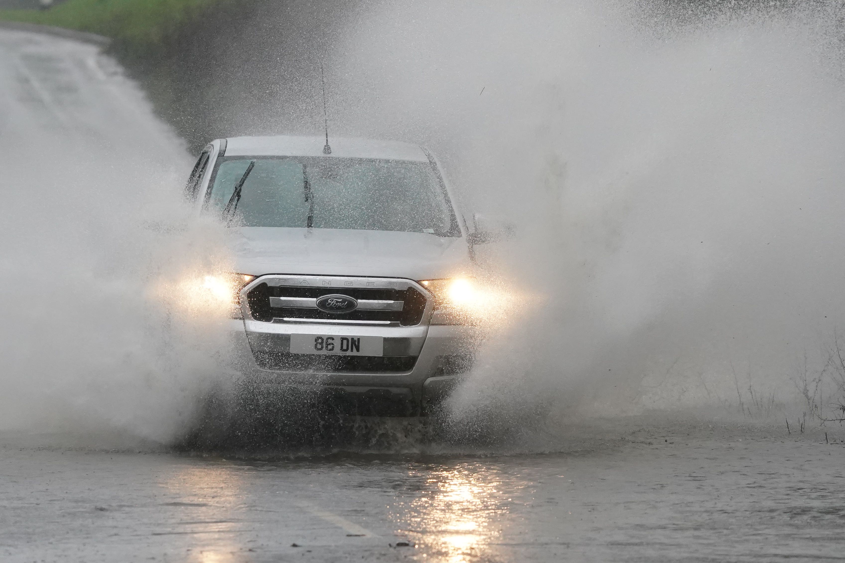
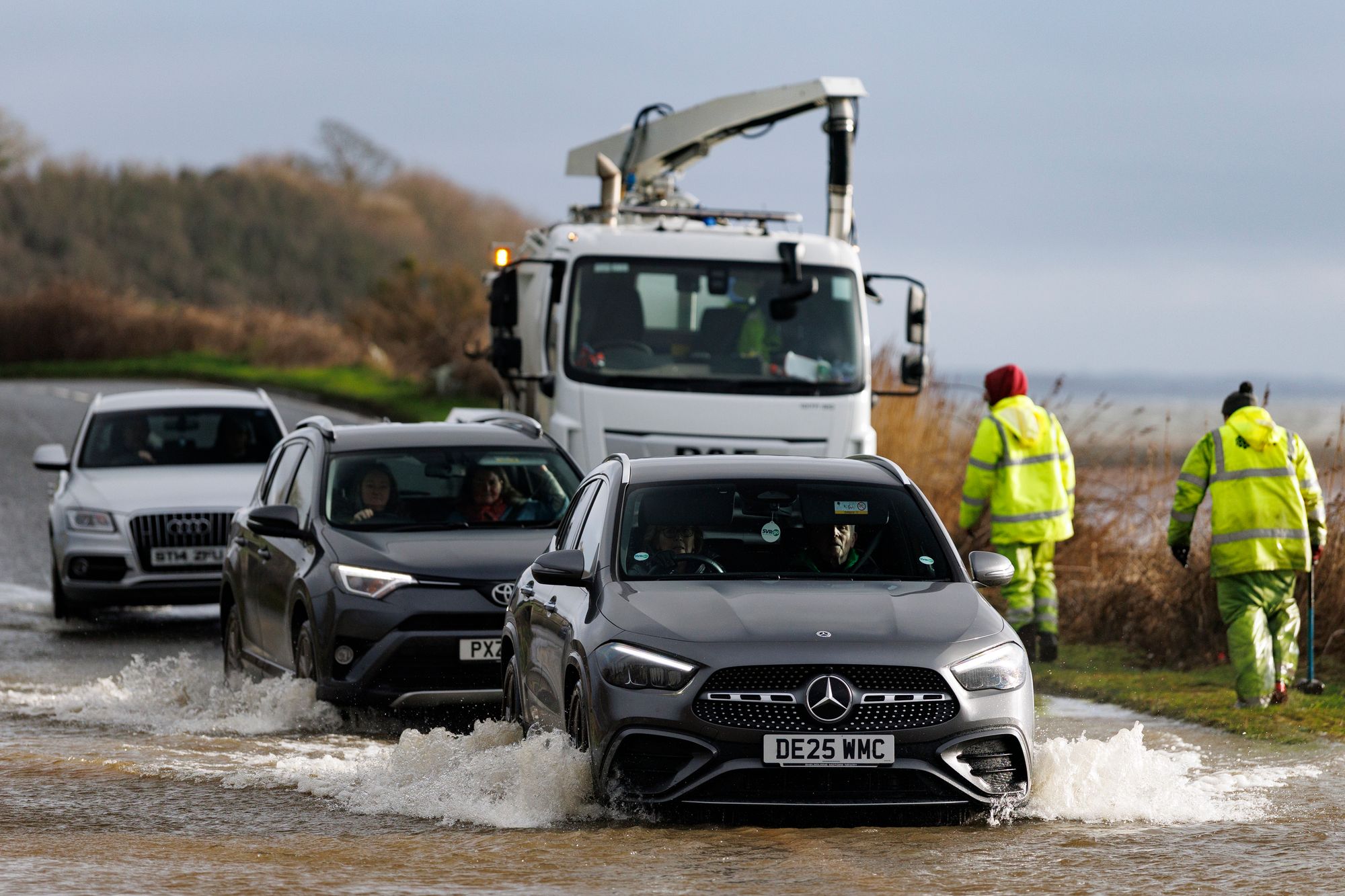
01:00 , Shaheena UddinThe Met Office have warned drivers and residents in affected areas to prepare a floodkit, to help in the event that their home, business or car becomes damaged.
It is not safe to drive or walk or swim through floodwater, avoid it where possible and if you are affected by fast flowing or deep water call 999 and wait for help.
Preparing a floodkit should include:
- Insurance documents and list of contact numbers
- Torch & spare batteries
- First aid kit and any prescription medicines
- Warm waterproof clothes and blankets
- Bottled water and snacks
- Battery or wind-up radio
- Supplies for looking after your baby or pet
Recap: Woman hospitalised after tree falls on car in Co Fermanagh
00:00 , Shaheena UddinA woman was taken to hospital after a tree fell on a car in the Snowhill Road area, Lisbellaw.
The Northern Ireland Ambulance Service said it received a 999 call shortly after 8am on Tuesday, following reports of an RTC.
The PSNI have said her injuries are not believed to be serious. A spokesperson added: "NIAS tasked one Emergency Ambulance to the scene.
"Following assessment and initial treatment at the scene, 1 person was taken to South West Acute Hospital, by Ambulance."
The PSNI said the Snowhill Road in Enniskillen is blocked by fallen trees.
A spokesperson said: "A woman was taken to hospital after a tree fell on a car on Snowhill Road, Lisbellaw at around 8.30am this morning.
"At this time her injuries are not believed to be serious. The Snowhill Road remains blocked by fallen trees and should be avoided by motorists at present."
Storm Chandra impact hits airports and flights
23:00 , Shaheena UddinThe Independent’s travel correspondent Simon Calder reports:
Storm Chandra is continuing to sweep across the UK, causing significant disruption to flights.
The worst-hit airport is Belfast City, which is in the middle of the area affected by the Met Office amber warning for high winds. At least 27 flights across the Irish Sea to Great Britain have been grounded: 18 Aer Lingus Regional links to a range of British airports, as well as nine British Airways arrivals and departures serving London.
The Scottish airline Loganair has grounded 20 flights, including links from:
- Manchester to Newquay
- London Heathrow, Manchester and Liverpool to the Isle of Man
- Glasgow to Barra, Campbeltown, Islay and Tiree
Under air passengers’ rights rules, travellers whose flights are cancelled are entitled to be flown to their destination as soon as possible on any airline, and to be provided with meals and hotels until they get there.
Watch: BBC presenter calls out weather man after he forgets Storm Chandra name
22:00 , Shaheena UddinA 'major incident' of flooding declared in Somerset
21:15 , Shaheena UddinA “major incident” of flooding was declared in Somerset, as agencies ramp up their response to Storm Chandra.
Somerset Council, the Environment Agency and emergency services have been working closely to aid communities affected by heavy rain and extensive flooding overnight.
The major incident has been declared as a precautionary measure to allow resources to be distributed, should the response need to be escalated.
Although the weather is forecasted to be drier tomorrow, the risk of flooding on the Levels and Moors is still high as rainwater moves through the system. Further flood warnings are expected to be issued in areas such as Moorland.
Met Office shares 4 tips for staying safe in ice
21:00 , Shaheena UddinWhen there is an ice warning in place, the Met Office have shared some advice on things to be aware of...
1. What if you need to drive somewhere?
Icy, wintry weather can cause delays and make driving conditions dangerous, follow these few simple steps to prepare before journeys:
- Plan your route.
- Check for delays and road closures.
- Leave more time to prepare and check your car before setting off.
- Check wipers, tyres and screen wash.
- Pack essentials in your car (warm clothing, food, drink, blanket, torch).
- Take a fully charged mobile phone
- Pack an in-car charger.
2. How to drive safely on ice
It is safer not to drive in icy conditions, but if you absolutely must drive, keep yourself and others safe by:
- Looking well ahead for potential hazards and keep your speed down.
- Accelerating, braking, steering and changing gear as smoothly as possible to reduce the risk of a skid.
- Using a higher gear may be more appropriate to help grip on packed ice.
- Using a higher gear helps manage engine power making it easier to find traction.
3. What if you’re walking or cycling?
- Plan to leave the house five minutes earlier than normal. Not needing to rush reduces your risk of accidents, slips and falls.
- If making a journey on foot, try to use pavements along main roads which are likely to be less slippery. Similarly, if cycling, try and stick to main roads which are more likely to have been treated.
- Take extra care when walking on untreated pavements and prepare for journeys by wearing footwear with a good grip.
- Where possible do not cycle on untreated roads as accidents are more likely.
4. Look out for elderly relatives or neighbours
During icy and cold weather there are some simple ways you can support elderly relatives or neighbours:
- Check to see if they need any practical help and that they are well.
- Make sure they have enough food supplies in case they cannot go out.
- Offer to clear their paths when you clear yours and spread salt. You can use ordinary table or dishwasher salt - a tablespoon for each square metre you clear.
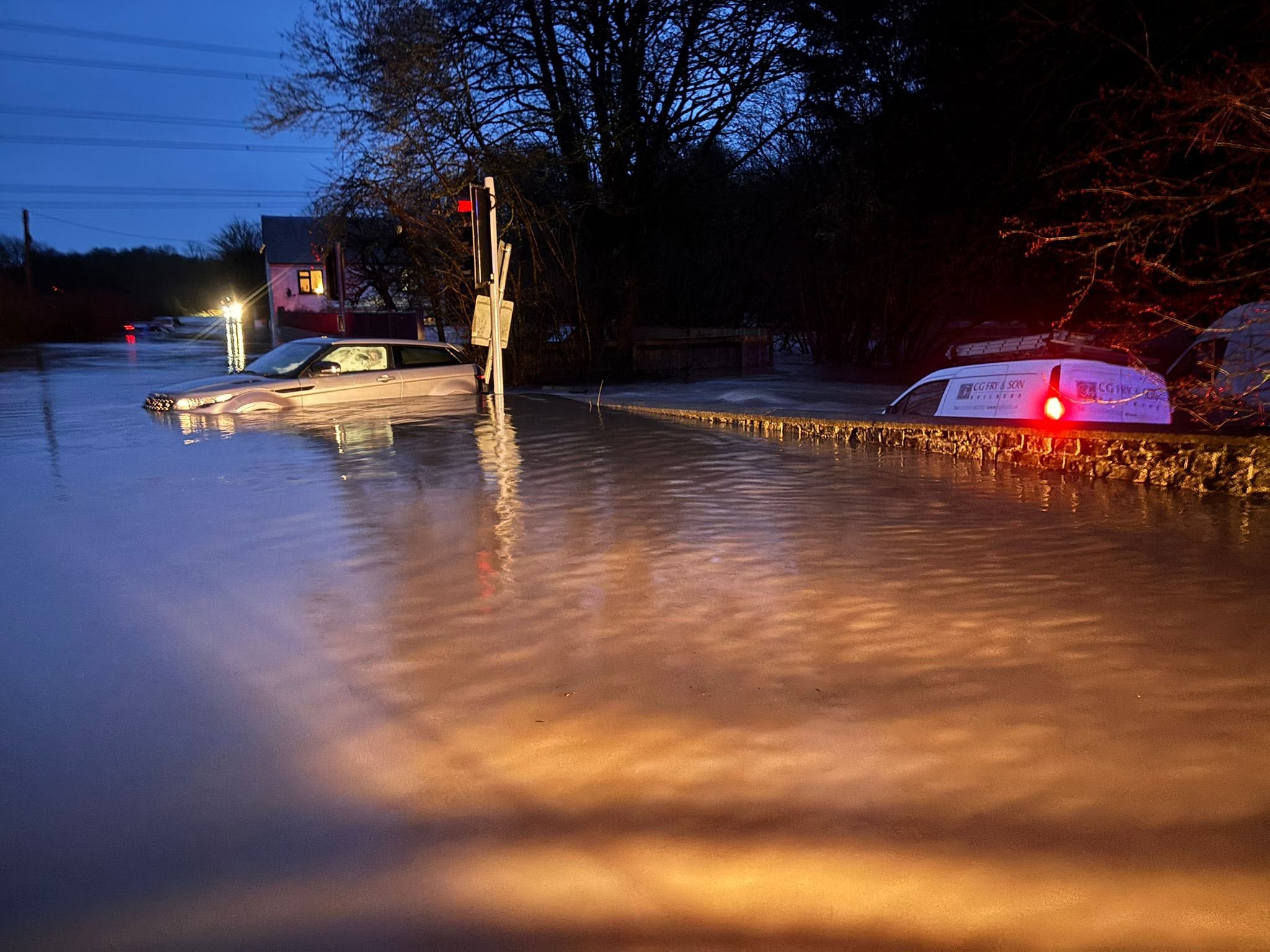
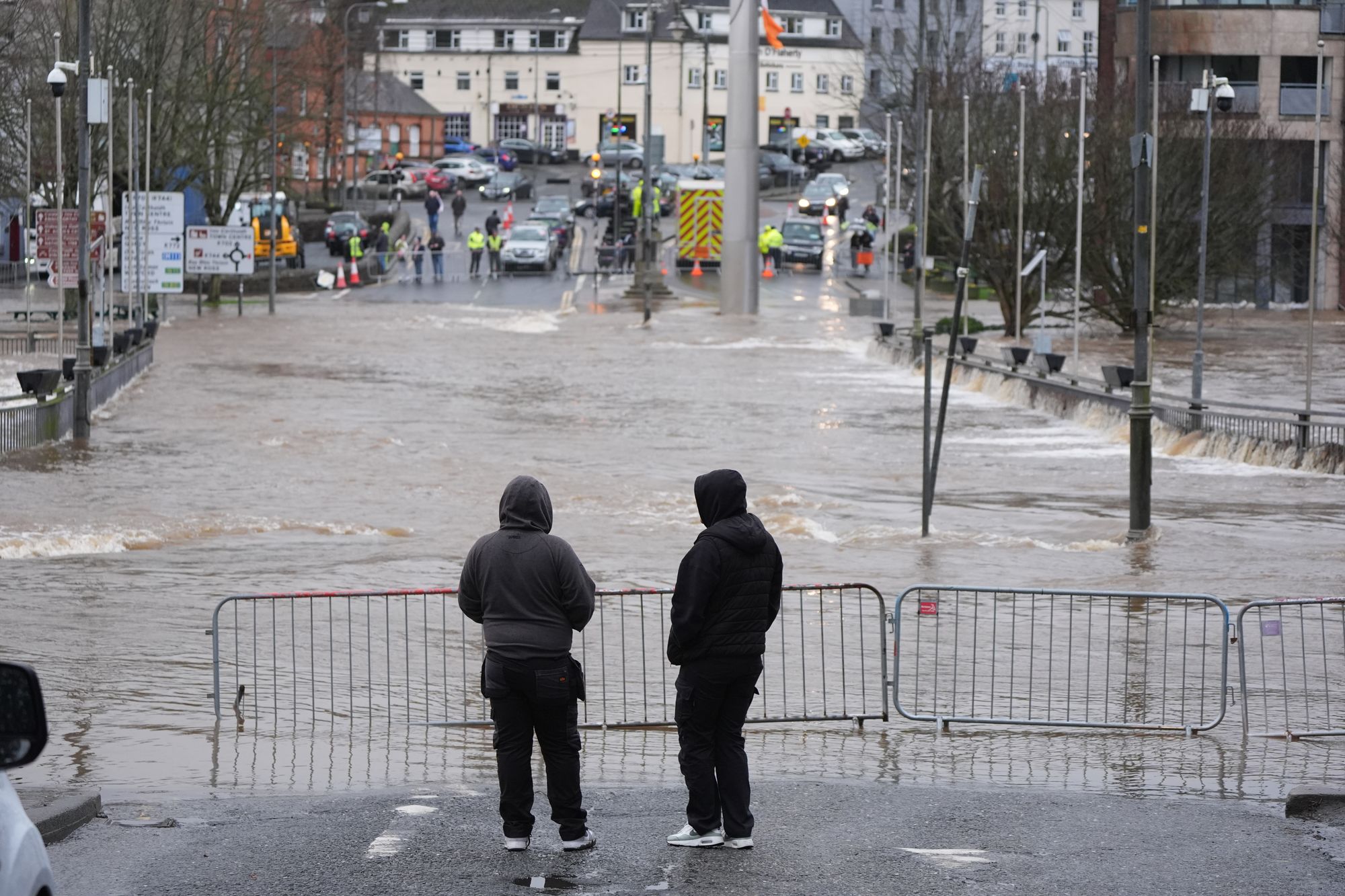
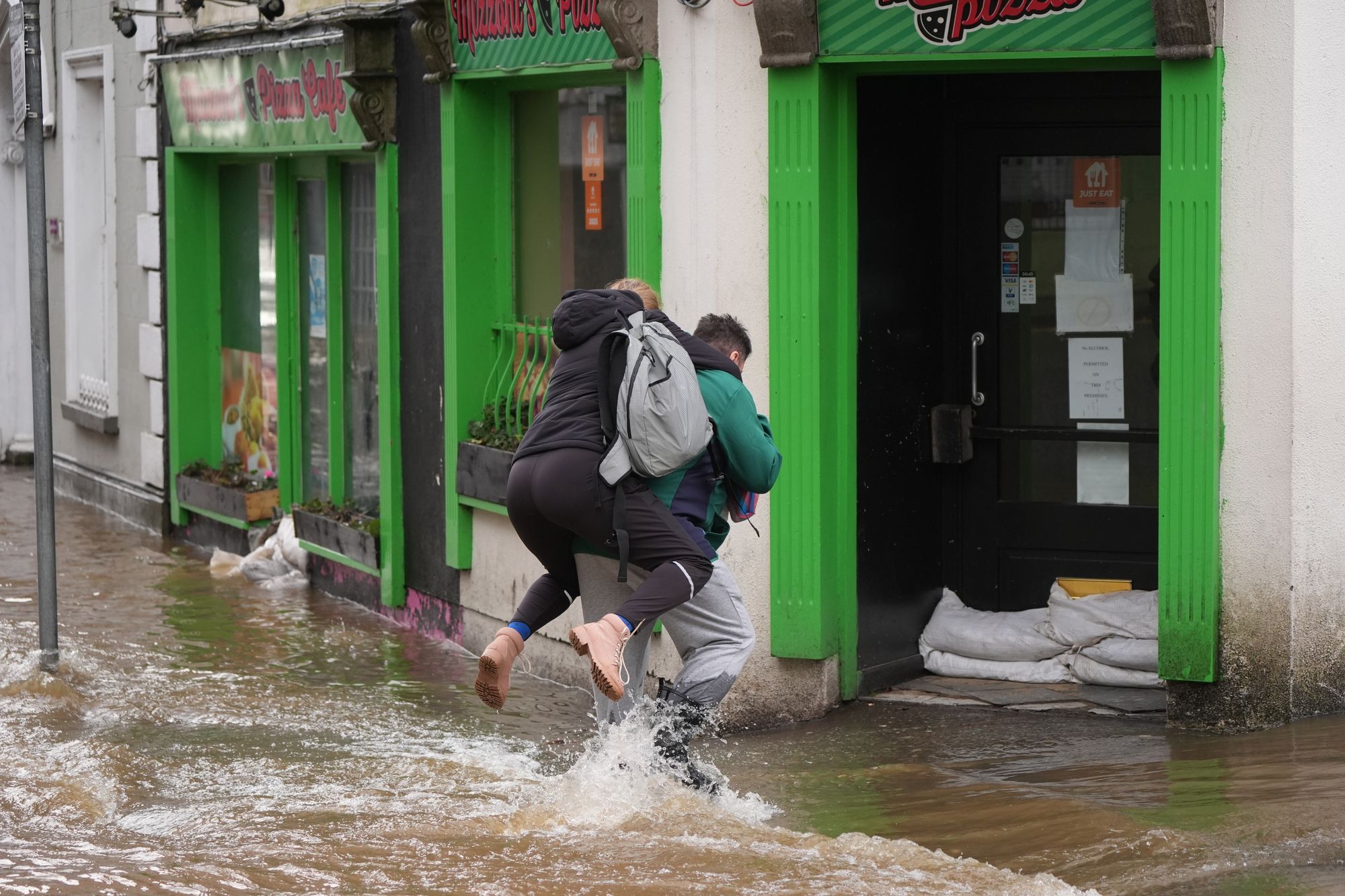
In pictures: Heavy rainfall brings widespread flooding
20:30 , Shaheena Uddin
‘Further disruption possible’ after Storm Chandra causes flooding and power cuts
20:00 , Shaheena UddinForecasters have warned of possible further disruption as Storm Chandra continues to batter Ireland on Tuesday evening.
Wind and rain warnings are in place for Northern Ireland until midnight on Tuesday, while a nationwide wind warning is in effect in the Republic, along with a rain warning for south-eastern counties, until 11pm.
Hundreds of schools were shut and tens of thousands of people were left without power after the storm swept across the island of Ireland.
The poor weather is likely to continue into Wednesday morning, with the Met Office issuing a yellow-level ice warning for all of Northern Ireland between 3am and 10am.
In the Republic of Ireland, ESB said around 20,000 homes, farms and businesses lost power due to the storm.
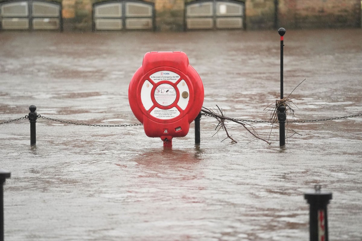
88 flood warnings were issued today
19:30 , Shaheena UddinThe Environment Agency issued 88 flood warnings on Tuesday for areas where flooding was expected.
The government organisation also issued 251 flood alerts for regions where flooding was possible.
In the last 24 hours 93 flood warnings were removed.
Local flooding is also possible more widely from rivers in parts of England from Wednesday to Friday. Land, roads and some properties may flood and there may be travel disruption.
On Thursday local flooding is possible but not expected from surface water and rivers in parts of England. Properties may flood and there may be travel disruption.
In pictures: Severe flooding across the UK and Ireland
19:00 , Shaheena Uddin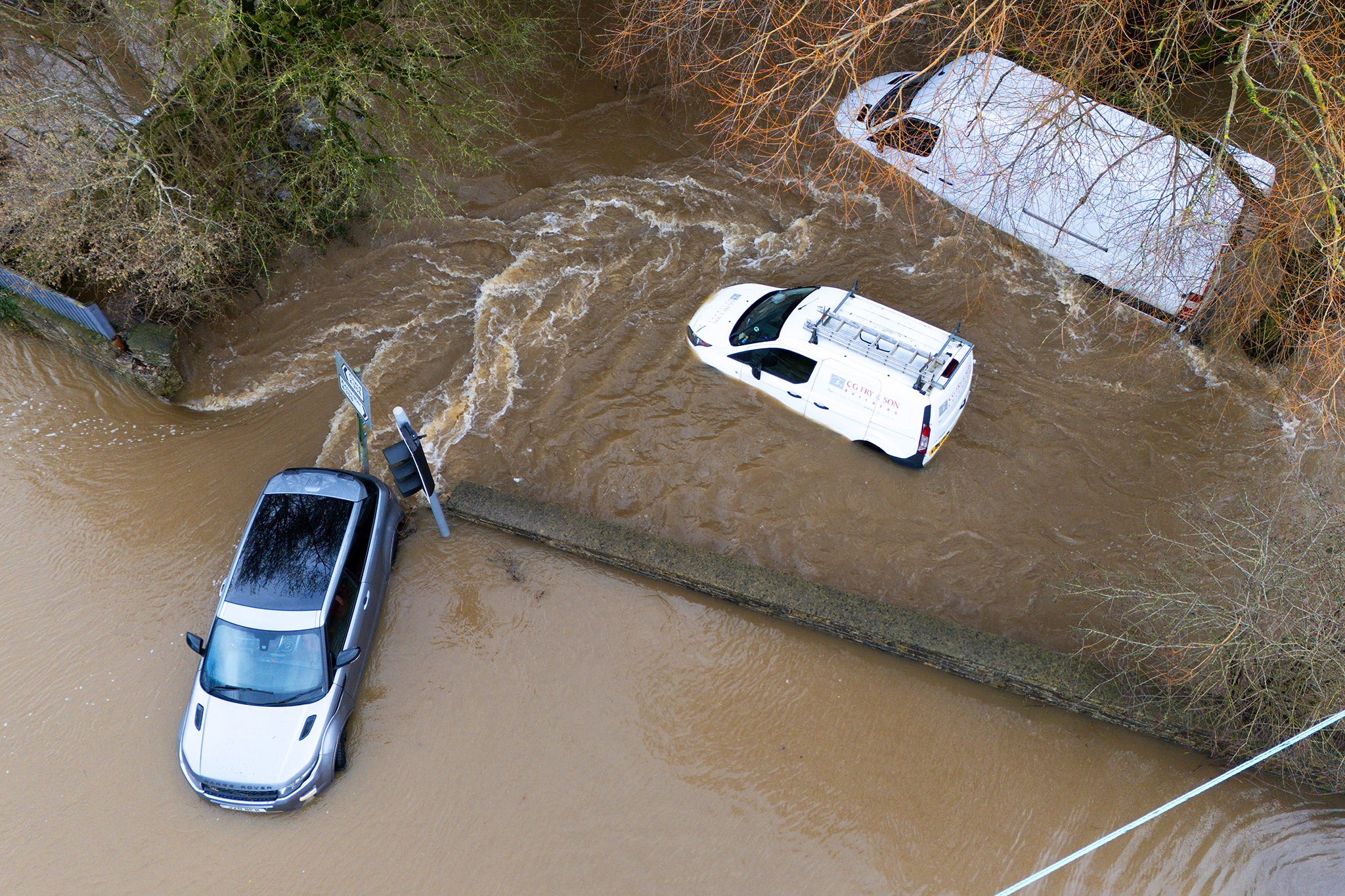
How to prepare a winter kit for car
18:30 , Shaheena UddinIt's worth packing a few necessities in your car's boot to make sure you're prepared in case of getting stuck in cold and wintry weather.
RAC experts have shared the following advice on what to put in your car winter kit:
- Ice scraper and de-icer
- A large torch with spare batteries or a wind-up torch
- Paper road atlas
- In-car phone charge
- Warm clothes and blankets
- High-visibility clothing
- Jump leads
- Empty fuel can
- Food and drink
- Shovel
- Warning triangles
- Sunglasses
What rights do you have to compensation for cancelled or delayed flights?
18:00 , Shaheena UddinAs passengers face delayed or cancelled flights on Tuesday due to Storm Chandra, The Independent’s travel correspondent Simon Calder takes a look at what rights you have to compensation.
You can read his analysis below:

Can you get a refund for cancelled or delayed flights? Your rights explained
Latest radar of rain and showers this evening
17:45 , Shaheena UddinTake a look at where the rain and showers are this evening in the latest radar📡 pic.twitter.com/yM0n2o74xY
— Met Office (@metoffice) January 27, 2026
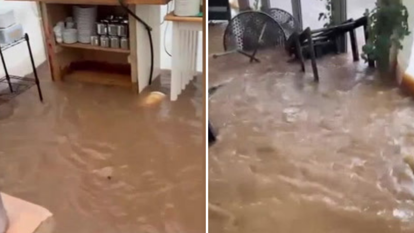
Watch: Otterton Mill devastated by Storm Chandra flooding
17:30 , Shaheena UddinWhat is the forecast like for the rest of this week?
17:15 , Shaheena UddinStorm Chandra is expected to clear with possible icy stretches predicted overnight, according to the Met Office.
This Evening and Tonight:
Rain and hill snow is likely to clear to the north, and the weather will turn drier for many, with just a few showers in the south.
The forecasters predict it to be windy in the north at first, but winds will gradually ease. It is likely to feel cold with a few icy stretches on untreated surfaces.
Wednesday:
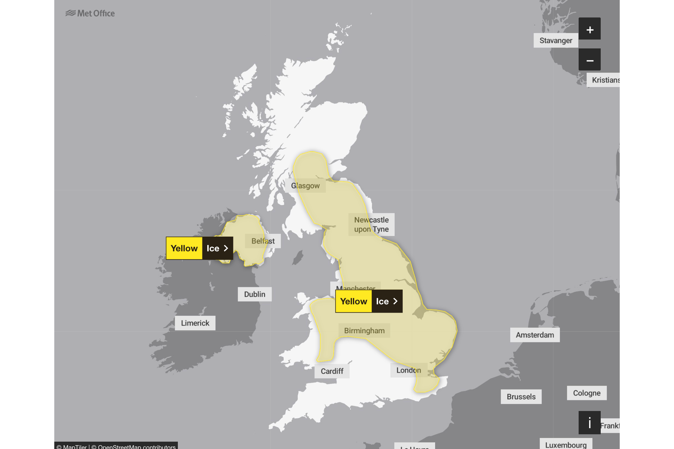
There are two yellow warning issued for ice in parts of Northern Ireland and another affecting central England, the East Midlands, the east of England, London and South East England, North East England, North West England, Scotland and Lothian borders, Strathclyde, Wales, West Midlands, and Yorkshire and Humber.
Forecasters expect patchy fog in the east at first. They predict there to be outbreaks of showery rain in the southwest and northeast, but it will otherwise be dry for many with some sunny spells. Breezy, but generally less windy.
Outlook for Thursday to Saturday:
Staying unsettled with further showers or longer spells of rain, particularly in the southwest and eastern Scotland. Some drier interludes too, particularly in the east. Feeling chilly in brisk winds
Local flooding is possible but not expected from surface water and rivers in parts of England on Thursday. Properties may flood and there may be travel disruption, according the Environment Agency in England.
Rain and hill snow predicted to move into the far northeast of Scotland this evening
17:00 , Shaheena Uddin#StormChandra continues to move northwards this evening with rain and hill snow moving into the far northeast of Scotland ⚠️
— Met Office (@metoffice) January 27, 2026
Heavy showers in parts of Northern Ireland and southwest England & Wales 🌧️
Otherwise, turning colder with clear skies and easing winds 🥶 pic.twitter.com/U6dFJfmf5S
Met Office issues travel advice for driving in storms, rain and strong wind
16:45 , Shaheena UddinThe Met Office have issued travel advice for the following weather conditions:
Rain and flooded roads:
- If heavy downpours are expected, avoid starting your journey until it clears.
- If you can, choose main roads, where you are less likely to be exposed to fallen branches and debris and flooding.
- Roads will be more slippery than usual in wet weather – be sure to give yourself more time to react when approaching a hazard. Increase your following gap to at least four seconds from the moving traffic in front.
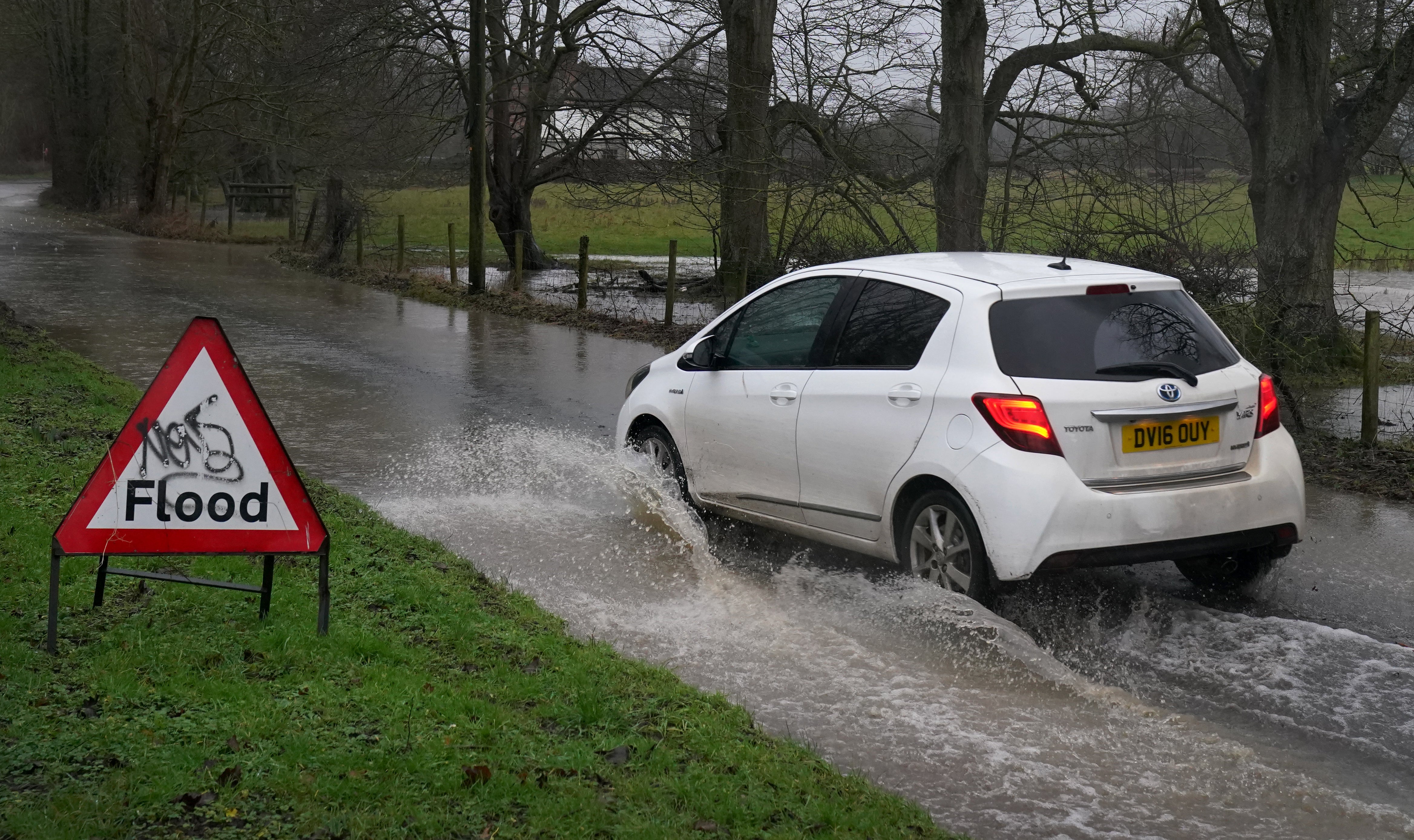
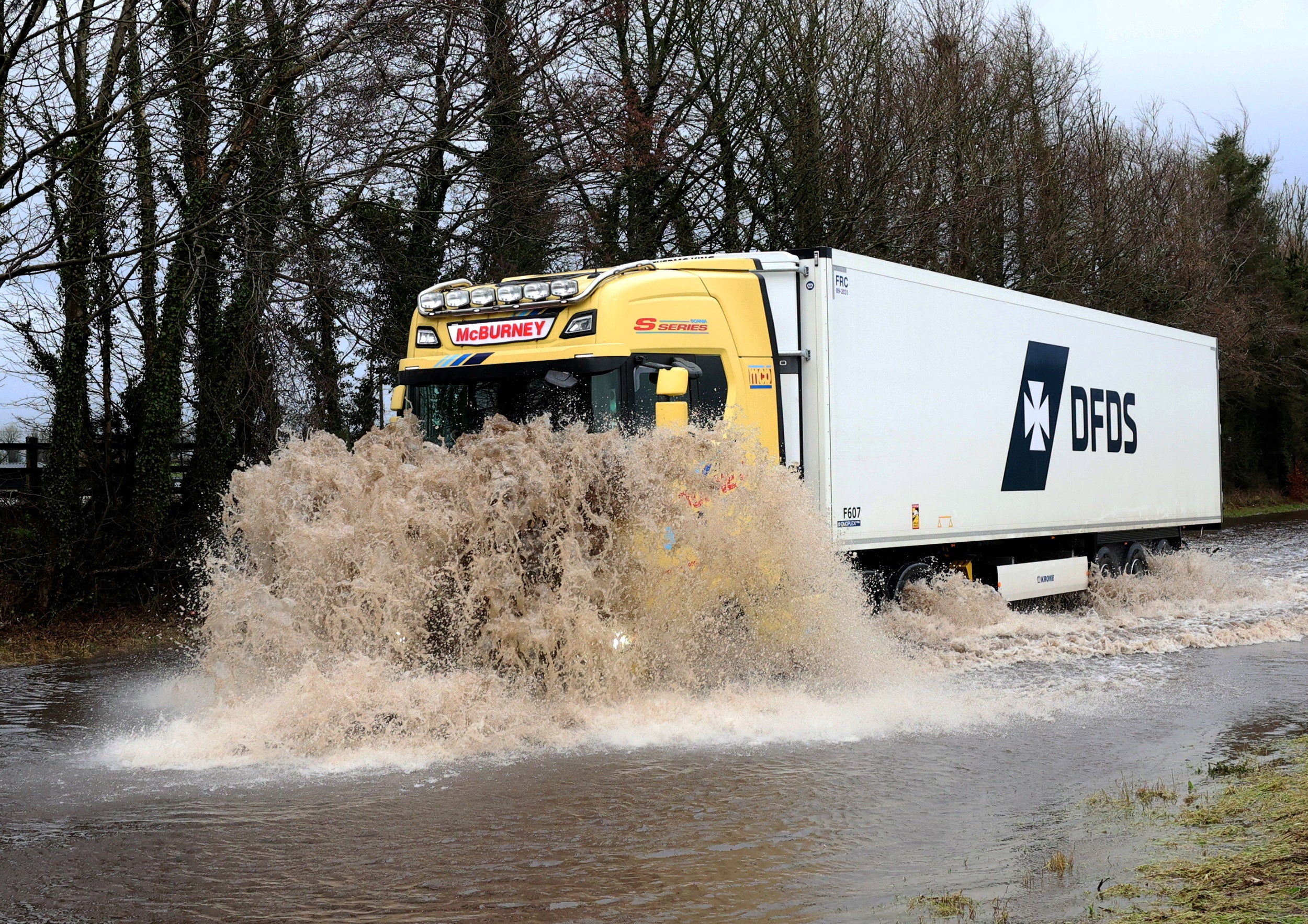
- If the road is flooded, turn around and find another route. The number one cause of death during flooding is driving through flood water, so the safest advice is turn around, don’t drown.
- Although the water may seem shallow, just 12 inches (30cm) of moving water can float your car, potentially taking it to deeper water from which you may need rescuing.
- Flood water also contains hidden hazards which can damage your car, and just an egg-cupful of water sucked into your car’s engine will lead to severe damage.
- Never drive through flood water. Turn around.
Low visibility:
- Use dipped headlights if visibility is seriously reduced.
- Even moderate rain can reduce your ability to see and be seen. A good rule of thumb is ‘if it’s time for your wipers, it’s time to slow down’.
- Keep your eyes peeled on the road at all times as spray from other vehicles can suddenly reduce your visibility. Remember it affects others too, so anticipate their actions and be prepared.
Strong winds:
- Gusts of wind can unsettle vehicles – grip your steering wheel firmly with both hands. This is particularly important when planning to overtake.
- Keep an eye out for gaps between trees, buildings or bridges over a river or railway – these are some of the places you are more likely to be exposed to side winds.
- Ensure that you maintain enough room either side of your vehicle so you can account for it being blown sideways.
- Remember to give vulnerable road users including cyclists, motorcyclists and pedestrians more room than usual. They are more likely to be blown around by side winds – always keep a safe distance.
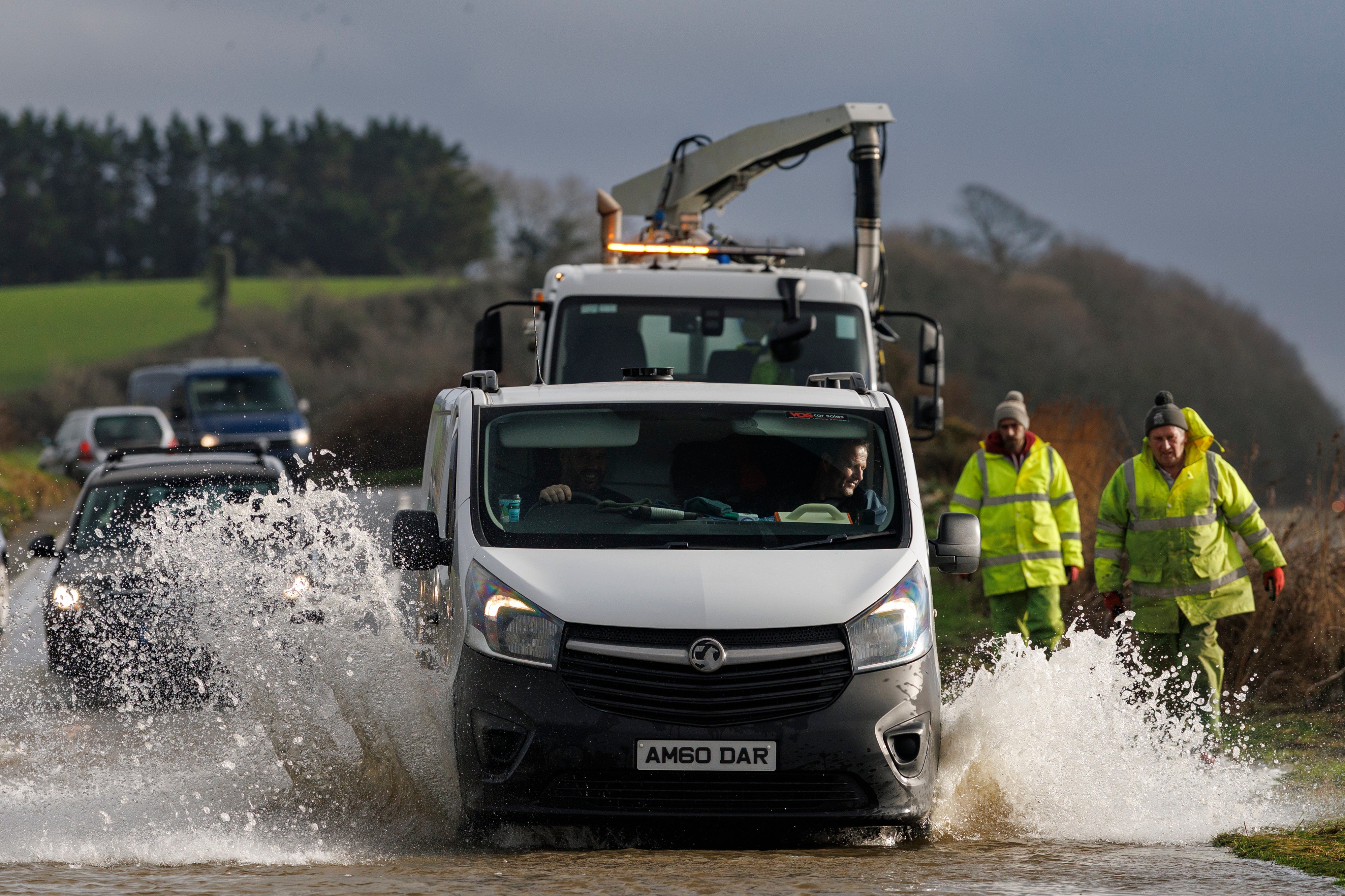
In pictures: Storm Chandra floods roads in Ireland
16:30 , Shaheena Uddin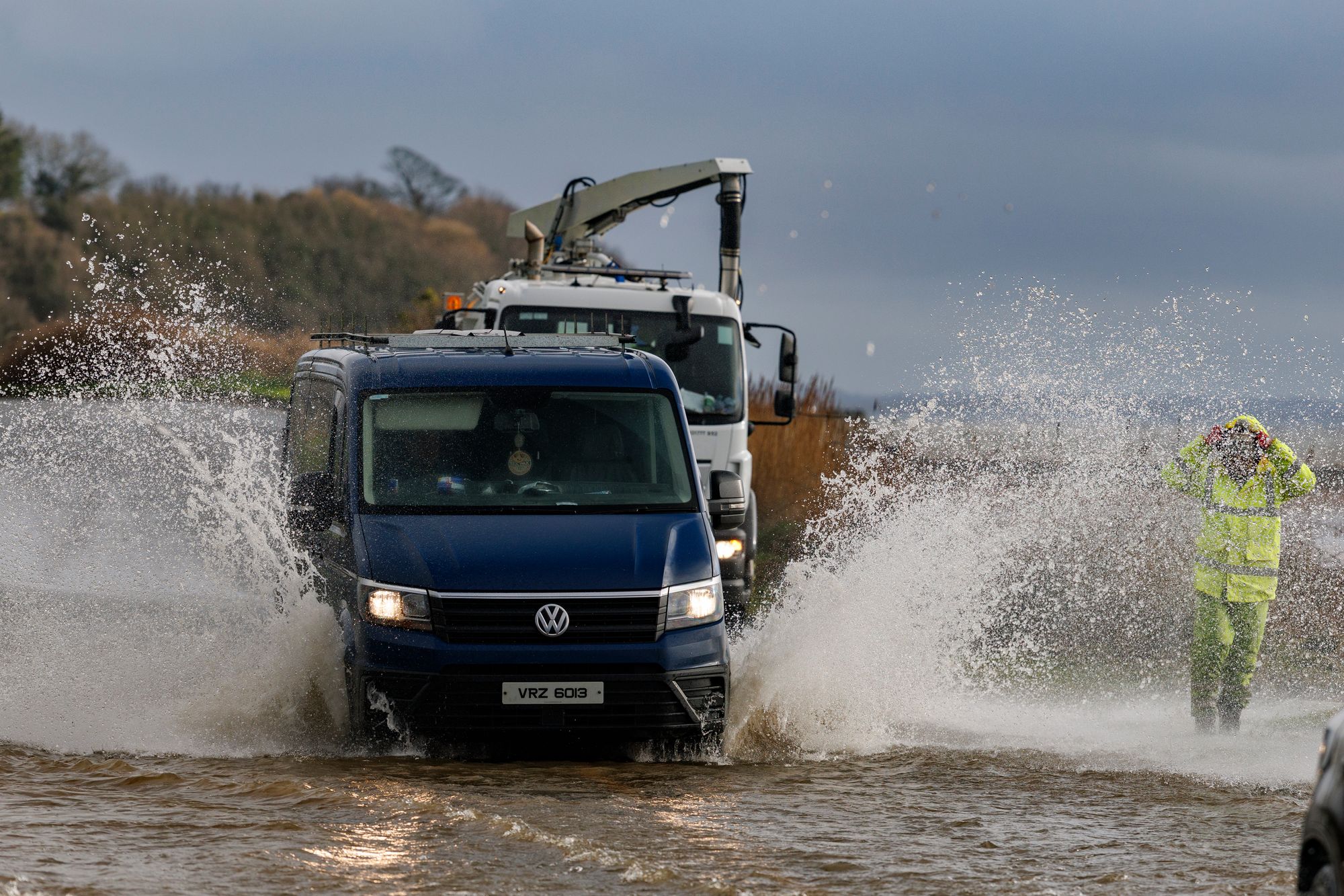
Storm Chandra triggers travel chaos across railways, roads, flights and ferries
16:15 , Shaheena UddinTravel chaos has returned as Storm Chandra sweeps across many parts of the UK. Dozens of flights and ferry sailings have been cancelled, and several rail lines blocked.
The Independent’s Travel correspondent, Simon Calder, reports:

Storm Chandra triggers travel chaos across railways, roads, flights and ferries
Watch: Dozens of flights cancelled and thousands without power as UK hit by ‘horrendous’ flooding
16:00 , Shaheena UddinSchools shut and thousands experiencing power cuts in Ireland
15:45 , Shaheena UddinStorm Chandra has battered the island of Ireland, causing hundreds of schools to close and leaving tens of thousands of people without power.
Torrential rain has caused travel disruptions and flooded roads. Strong winds have also knocked down several trees across the nation.
The public have been warned of danger to life from flying debris, large waves at coasts, travel disruption, buildings damage, flooding, fallen trees, and possible power cuts.
In Northern Ireland, more than 300 schools have been closed.
There is a yellow rainfall alert currently in place for all six counties.
There is an amber warning for wind until 9pm in Antrim, Down and Derry, and the yellow rain warning is in effect until midnight.
Northern Ireland Electricity said the number of households without power peaked at 9am when 10,000 properties were without supply.
In the Republic of Ireland, ESB said around 20,000 homes, farms and businesses lost power as a result of the storm.
Translink has warned that passengers should allow for delays and possible disruption to their journey.
Strangford Lough Ferry Service is currently cancelled, the crew is onsite and will resume service when it is considered safe.
Summary of the latest yellow and amber weather warnings
15:30 , Shaheena UddinThe Met Office has issued several yellow and amber warnings for rain, snow and wind this week.
Want a quick summary of the latest warnings? Look below 👇
— Met Office (@metoffice) January 27, 2026
Want more details? Look here 👉 https://t.co/QwDLMfRBfs
Stay #WeatherAware⚠️ pic.twitter.com/ikzqsc1GdP
Katesbridge has its wettest day on record
15:15 , Shaheena UddinSeveral sites have provisionally set new January daily rainfall records, according to the Met Office.
Katesbridge has provisionally recorded its wettest day on record with over 100 mm of rainfall recorded.
Plymouth (Mountbatten) also saw a notable record of 43.2 mm at a site with over 100 years of observations.
Other records include: Hurn with 44.4mm, Dunkeswell Aeordrome with 52.8 mm, Cardinham, Bodmin with 44.4 mm and Shobdon Airfield with 27.8 mm.
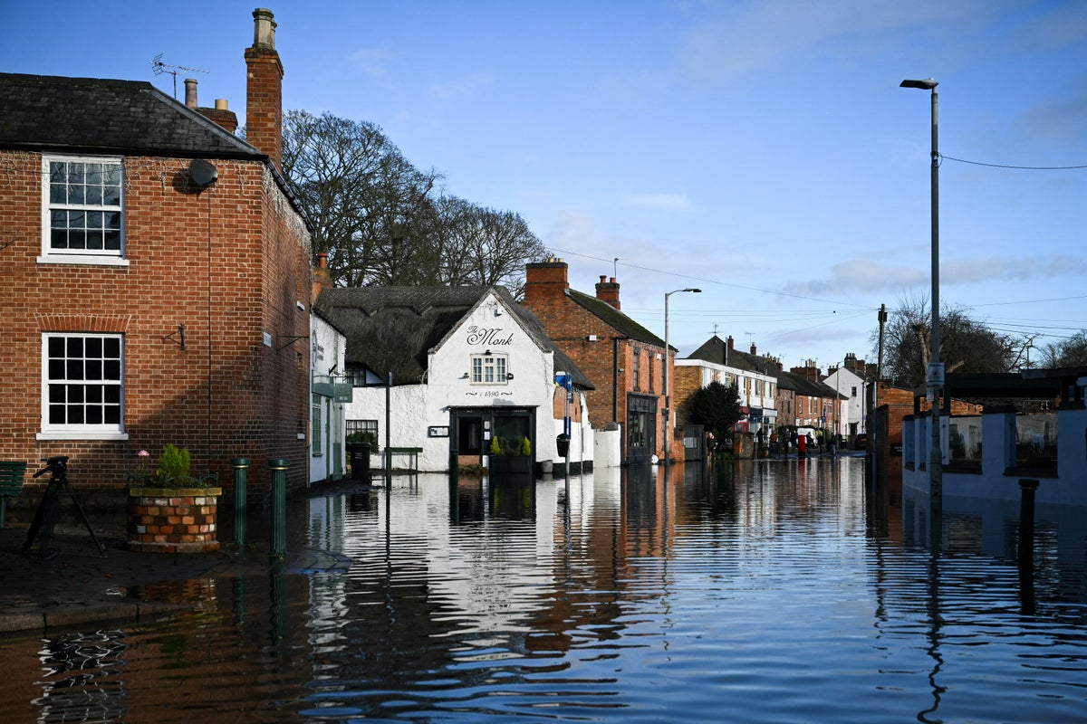
In pictures: Heavy rainfall brings widespread flooding
15:05 , Holly EvansBelfast university closes due to weather conditions
14:55 , Holly EvansQueen's University Belfast has closed its campus today due to the amber weather warning.
In a post on social media, the university said that safety and wellbeing of students was the “top priority” and that teaching had been moved online.
Student support services remain available remotely while the McClay Library is due to reopen at 9pm this evening.
Your safety and wellbeing are our top priority. That's why the University campus will be closed tomorrow, Tuesday 27 January, due to the amber weather warning across Northern Ireland.
— Queen's University Belfast 🎓 (@QUBelfast) January 26, 2026
Where appropriate and possible, teaching will move online for our students and your School or… pic.twitter.com/GuTNsHOlI7
Woman hospitalised after tree falls on car in Co Fermanagh
14:43 , Holly EvansA woman has been taken to hospital after a tree fell on a car in the Snowhill Road area, Lisbellaw.
The Northern Ireland Ambulance Service said it received a 999 call shortly after 8am on Tuesday, following reports of an RTC.
The PSNI have said her injuries are not believed to be serious. A spokesperson added: "NIAS tasked one Emergency Ambulance to the scene.
"Following assessment and initial treatment at the scene, 1 person was taken to South West Acute Hospital, by Ambulance."
The PSNI said the Snowhill Road in Enniskillen is blocked by fallen trees.
A spokesperson said: "A woman was taken to hospital after a tree fell on a car on Snowhill Road, Lisbellaw at around 8.30am this morning.
"At this time her injuries are not believed to be serious. The Snowhill Road remains blocked by fallen trees and should be avoided by motorists at present."
Drivers urged to carry floodkits due to heavy rain
14:38 , Holly EvansThe Met Office have warned drivers and residents in affected areas to prepare a floodkit, to help in the event that their home, business or car becomes damaged.
It is not safe to drive or walk or swim through floodwater, avoid it where possible and if you are affected by fast flowing or deep water call 999 and wait for help.
Preparing a floodkit should include:
- Insurance documents and list of contact numbers
- Torch & spare batteries
- First aid kit and any prescription medicines
- Warm waterproof clothes and blankets
- Bottled water and snacks
- Battery or wind-up radio
- Supplies for looking after your baby or pet
Heavy rain and floods batter Ireland as tens of thousands remain without power
14:24 , Holly EvansHundreds of schools are closed and tens of thousands of people are without power as Storm Chandra batters the island of Ireland.
There is also travel disruption caused by the strong winds and torrential rain.
In Northern Ireland more than 300 schools have been closed and there is a yellow rainfall alert currently in place for counties Armagh, Down, Fermanagh, Londonderry and Tyrone.
There is an amber warning for wind until 9pm and the yellow rain warning is in effect until midnight.
At least 30 flights at Belfast City Airport were cancelled on Tuesday.
Translink has warned that passengers should allow for delays and possible disruption to their journey.
The public have been warned of danger to life from flying debris, large waves at coasts, travel disruption, buildings damage, flooding, fallen trees, and possible power cuts.
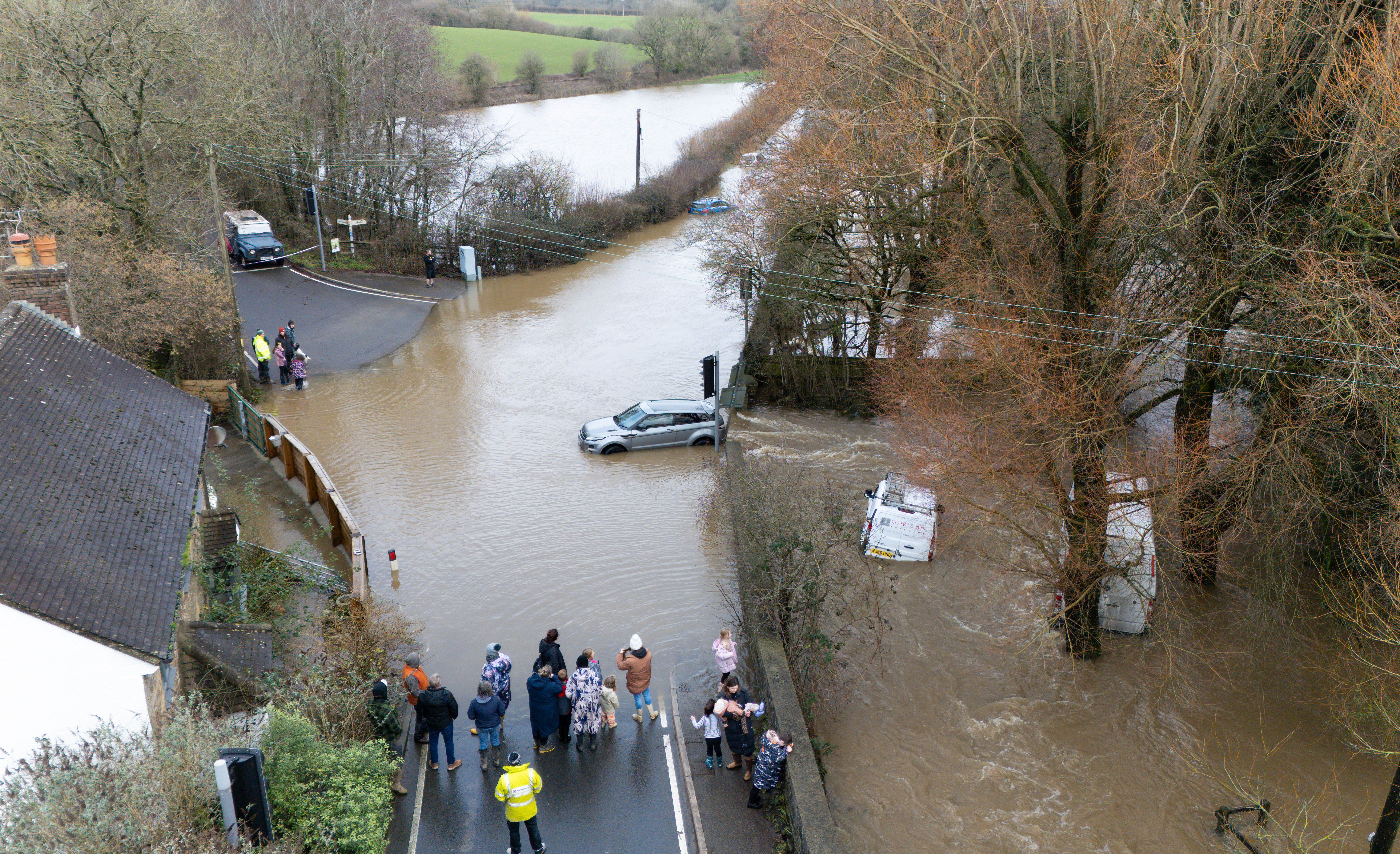
Second danger to life flood warning issued
14:05 , Holly EvansA second severe flood warning has been issued by the Environment Agency for the Upper Frome at Dorchester.
Flood water is expected to be deep and fast flowing and will affect low lying lands and roads.
There are currently 111 flood warnings in place and another 238 alerts across England.
Watch: Otterton Mill devastated by Storm Chandra flooding
13:52 , Holly EvansFlood warnings in place across Scotland
13:34 , Holly EvansA Met Office yellow warning for rain and snow came into force at midnight and affects parts of the south, including Dumfries and Galloway, Ayrshire, and the Borders. It remains in place until 5pm.
Another for much of northern Scotland came into force at 6am and ends at 11.59pm, while a warning for wind affects parts of the Hebrides and Dumfries and Galloway until 11.59pm.
The Met Office said winds could reach up to 60mph, and rainfall is expected to reach up to 50mm in the worst affected areas.
The Scottish Environment Protection Agency has two flood warnings in place for Aberbothrie and the River Isla at Coupar Angus in Perth and Kinross.
It also has eight less severe flood alerts in place for Aberdeenshire and Aberdeen, Ayrshire and Arran, Central Scotland, Dumfries and Galloway, Dundee and Angus, the Scottish Borders, Tayside, and west central Scotland.
One 'danger to life' alert and 118 flood warnings in place
12:26 , Nicole Wootton-CaneOne red “danger to life” flood alert and 118 flood warnings are in place across England this afternoon.
The most serious red alert has been issued for the River Otter (Lower) at Ottery St. Mary in Devon.
More than 100 other flood warnings are in place in areas where flooding is expected.
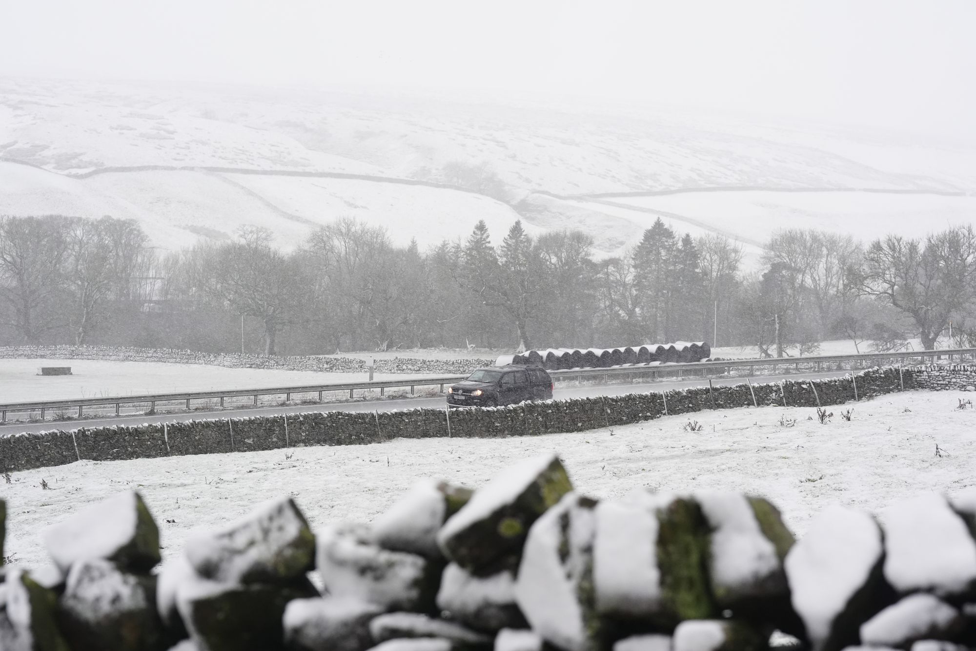
In pictures: Snow hits County Durham
12:04 , Holly Evans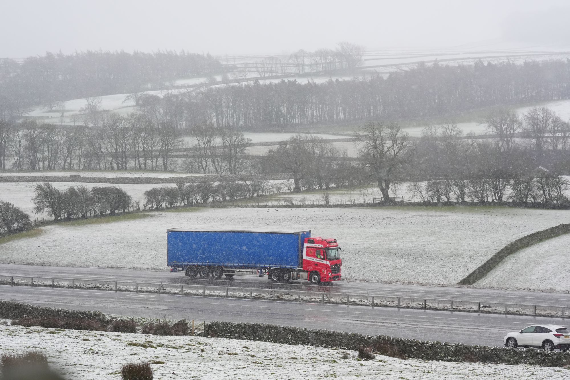
New yellow weather warning issued for Thursday
11:57 , Holly EvansA new yellow weather warning has been issued for Thursday covering south-west England.
The Met Office have said that a band of rain is likely to hit Cornwall and Devon that afternoon, which could lead to further flooding and transport disruption.
The yellow rain warning will come into force at 12pm on Thursday and remain in place until 11:59pm.
River Otter reaches record level of 2.83m due to floodwater
11:52 , Holly EvansThe Environment Agency said the River Otter at Fenny Bridges, close to Ottery St Mary, has reached its highest recorded level, surpassing the previous record set in December 2000.
Levels reached 2.81m on December 7 that year but were at 2.83m at 5.45am on Tuesday, with a severe flood warning issued five minutes later due to predicted overtopping of flood defences.
A spokesman said: “Storm Chandra brought significant rainfall across Devon and Cornwall overnight, falling on already saturated ground.
“East Devon received 67mm of rain in the last 12 hours, with 88mm recorded at Whitebarrow on Dartmoor. Across south and mid Devon, rainfall averaged 40-50mm.
“There are currently 33 flood alerts and 39 flood warnings in force across Devon and Cornwall. Approximately 20 properties have flooded at various locations, with this number expected to rise.”
Full list of UK schools closed today as Storm Chandra causes disruption
11:44 , Holly EvansHundreds of schools across the UK are closed today as Storm Chandra brings strong winds, heavy rain and more than 100 flood warnings.
Over 350 schools are now confirmed to be closed in Northern Ireland, alongside 47 in Devon.
Northern Ireland is experiencing severe weather, with an amber Met Office wind warning issued in the east, alongside and a yellow warning for wind and rain covering all regions.
Read the full article from Albert Toth here:
Full list of UK schools closed today as Storm Chandra continues to cause disruption
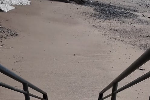
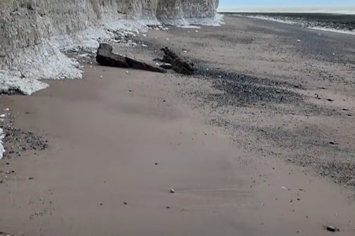
Well-known pebble beach in Sussex turns sandy
11:34 , Holly EvansA well-known pebble beach in Sussex has turned sandy due to the recent stormy weather.
In the wake of Storm Changra and Storm Ingrid, sand has been revealed at Birling Gap beach near Eastbourne.
The National Trust said the beach was "known for its seasonal changes".
"The action of strong waves during storms and high tides can reveal sandy patches on the beach, which are usually covered by flint pebbles at other times of the year," said the spokesperson.
20,000 homes without power in Ireland
11:16 , Holly EvansIn the Republic of Ireland, ESB said around 20,000 homes, farms and businesses are currently without power.
Dublin Fire Brigade said it had responded to a number of flooding incidents in the city.
A Status Yellow rain warning is in effect for Carlow, Kilkenny, Louth, Wexford, Wicklow and Waterford until 11pm.
The entire country also remains under a Status Yellow wind warning.
Iarnrod Eireann said there are disruptions to Dart services and a number of ferry sailings have been cancelled between Dublin and Holyhead.
Dublin Airport said flight cancellations are possible.
What is the five day weather forecast?
11:05 , Holly EvansHere’s a look at the five-day weather forecast:
Today:
Heavy rain spreads across the country today with hill snow in the north. Turning brighter in the southwest with blustery showers. Windy with coastal gales, and severe coastal gales in parts of the west. Feeling rather cold.
Tonight:
Rain and hill snow clearing to the north, turning drier for many, with just a few showers in the south. Windy in the north at first, but winds gradually easing.
Wednesday:
Patchy fog in the east at first. Outbreaks of showery rain possible in the southwest and northeast, otherwise dry for many with some sunny spells. Breezy, but generally less windy.
Outlook for Thursday to Saturday:
Staying unsettled with further showers or longer spells of rain, particularly in the southwest and eastern Scotland. Some drier interludes too, particularly in the east. Feeling chilly in brisk winds.
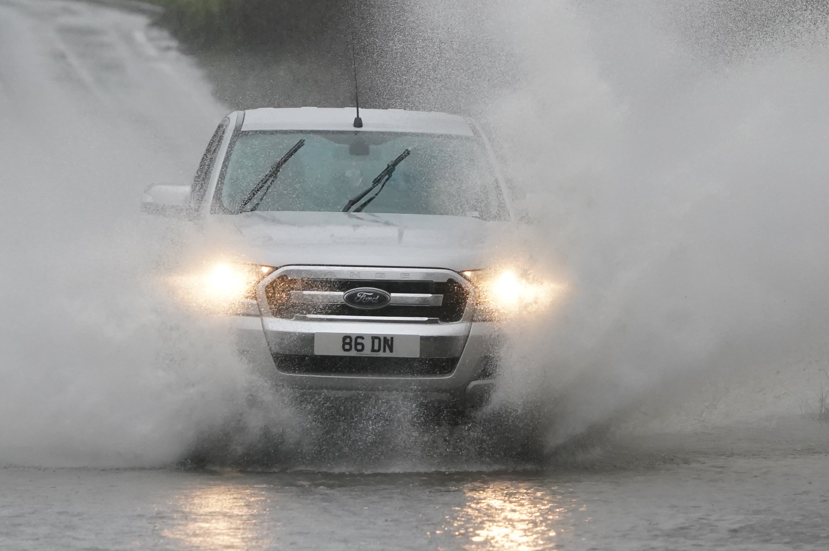
In pictures: Vehicles drive through flooded roads and heavy rain
10:57 , Holly Evans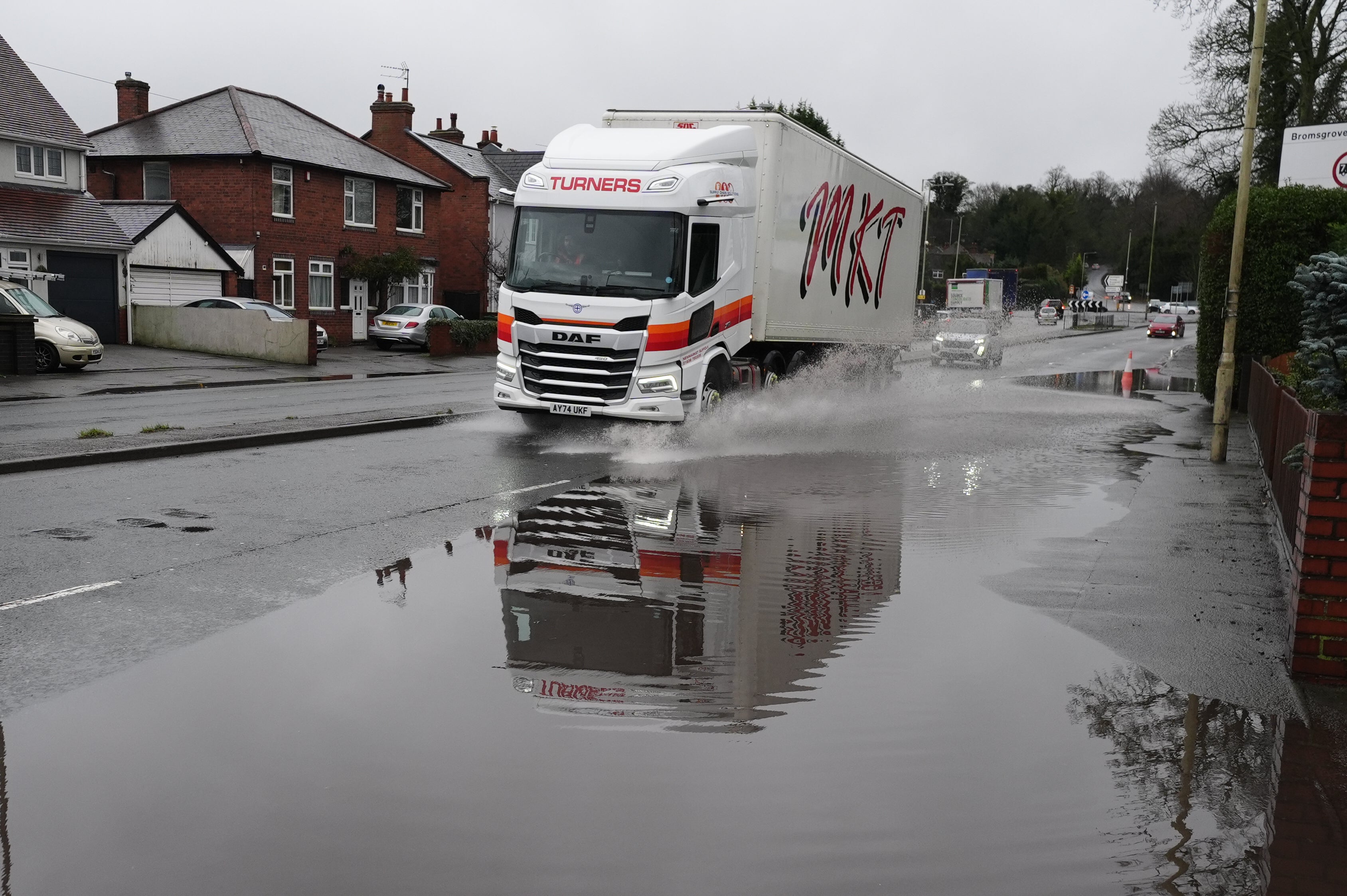
Belfast Airport warns passengers may be kept on planes
10:48 , Holly EvansBelfast International Airport have warned that passengers may be kept on planes until the wind abates
A spokesperson has told The Independent that there are "delays on some flights this morning due to impact of the storm".
They said: “Arriving passengers may experience delays to disembark aircraft due to wind speeds.
“We would advise any passengers planning to travel today to check with their airlines for the latest flight information.
“Updates will also be provided on our social media channels. Please take care on the roads if you are travelling.”
Two ice warnings issued for Wednesday
10:40 , Holly EvansTwo yellow ice warnings have been issued across vast swathes of the UK on Wednesday.
The new weather warning in Northern Ireland comes into force at 3am on Wednesday until 10am. The yellow warning for ice in England and Wales , which covers the Midlands and the north towards Glasgow, will come into effect at midnight and will also lift at 10am on Wednesday.
The forecaster warned that patchy ice is likely to form on untreated surfaces and may lead to some disruption, as well as injuries from slips.
Six flood warnings issued in Wales
10:28 , Holly EvansThere have been six flood warnings issued by Natural Resources Wales.
These warn flooding is expected along the Afon (River) Lwyd in Ponthir, Llanyrafon, Croesyceiliog and Pontnewynydd.
Warnings are also in place for the River Monnow at Skenfrith and Osbaston, in south-east Wales.
There are a further 26 flood alerts, meaning flooding is possible, across southern and mid-Wales.
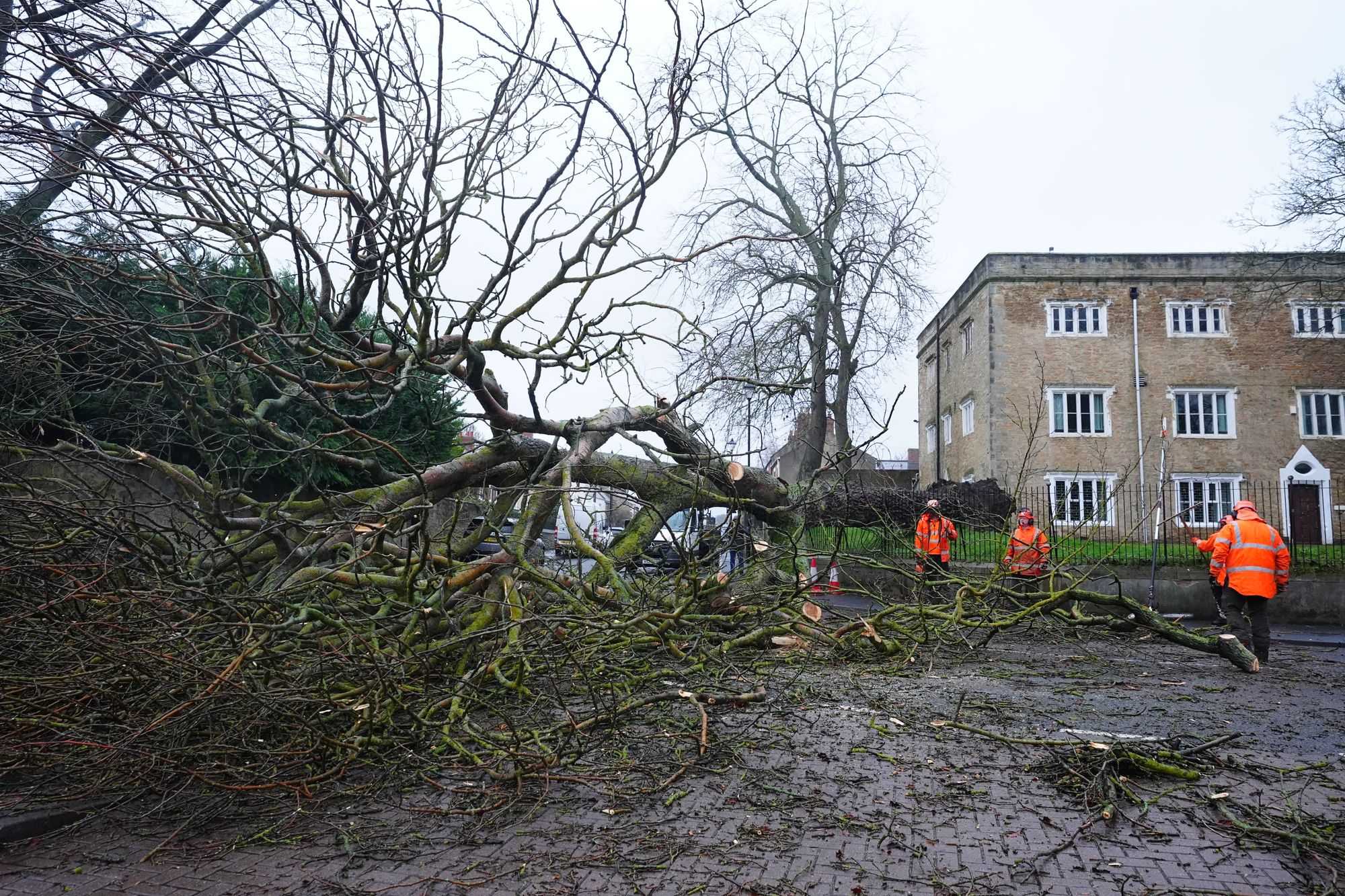
In pictures: Fallen tree blocks the road in Durham
10:25 , Holly Evans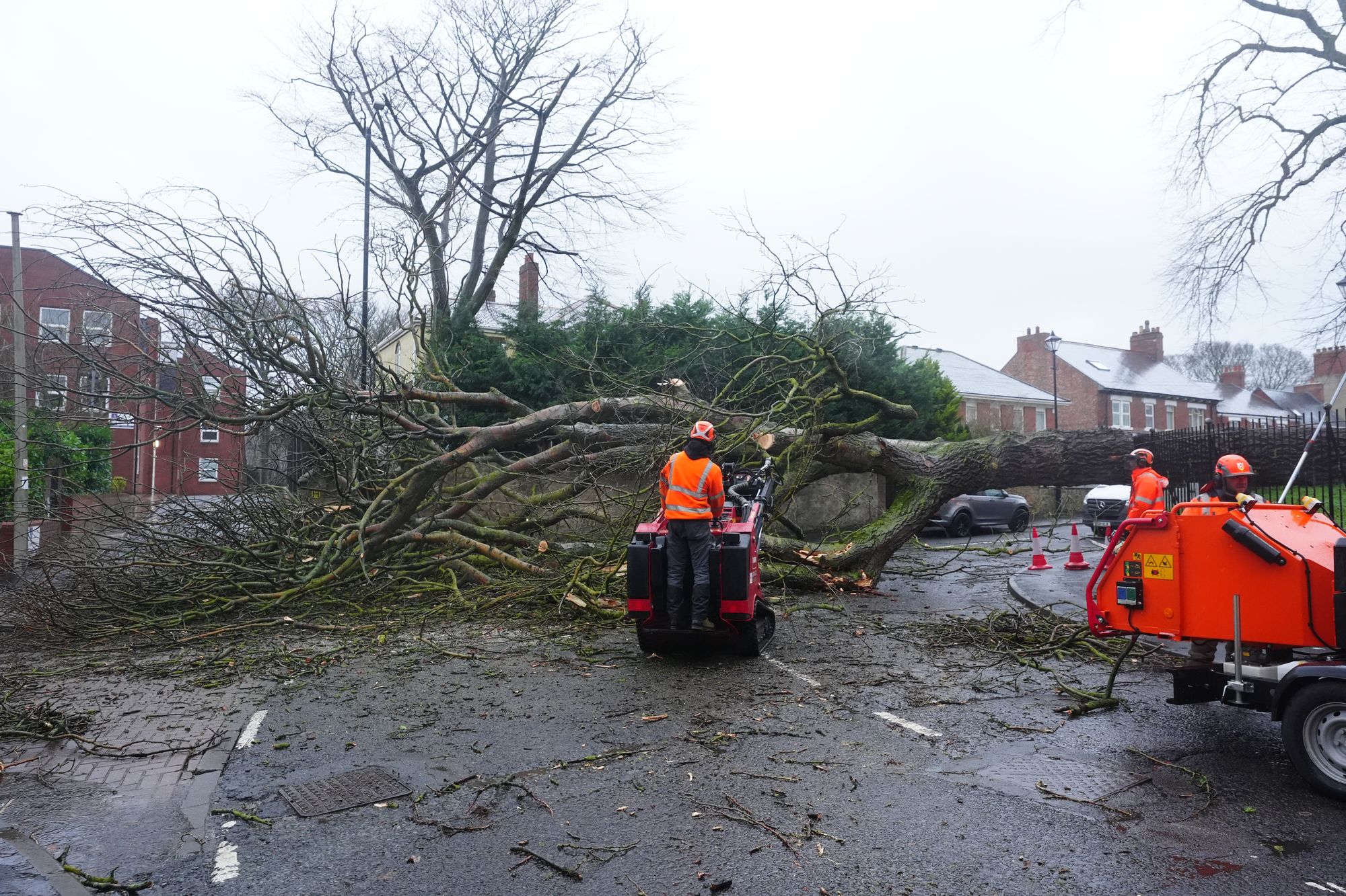
River Otter is a 'raging torrent' due to Storm Chandra
10:11 , Holly EvansBBC Radio Devon listener Jackie Blackford, who lives in Ottery St Mary, said she can see the River Otter from her house.
She said: “I live on a hill overlooking part of the Otter and it’s normally quite a nice little river.
“At the moment, it’s a raging torrent. It is horrendous – I’ve never seen anything like it.”
Ms Blackford said there had been a lot of traffic trying to get out of Ottery St Mary and she had seen people turning around.
'Truly horrendous night' as Devon river reaches 'highest recorded level'
10:07 , Holly EvansRichard Foord, Liberal Democrat MP for Honiton and Sidmouth, paid tribute to council and Environment Agency staff as well as emergency services working through Storm Chandra.
He posted on social media: “It has been a truly horrendous night. If you live in or around Ottery St Mary, please take note of the update this morning, just received.
“The River Otter has reached its highest recorded ever level. The Environment Agency has issued a Severe Flood Warning on the River Otter, meaning possible danger to life.
“Flooding is expected this morning, with heavy rain continuing to fall throughout the day. We are predicting that some flood defences will be overtopped.”
He said there were reports of around 20 flooded properties across Devon and Cornwall, which was expected to increase as river levels peak and further reports were received.
Mr Foord added: “I want to pay tribute to staff from the Environment Agency, Devon County Council, East Devon District Council, who have been out in risky conditions to help keep residents safe. Also to emergency services personnel who have been rescuing people from floodwater.”
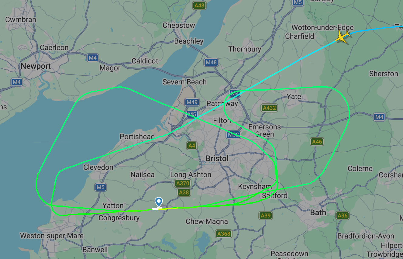
Ryanair passengers land successfully at Bristol airport on third attempt
09:59 , Simon CalderThe first arrival of Tuesday morning at Bristol airport had to fly a holding pattern for around 40 minutes before landing safely on the third attempt.
Ryanair flight FR4134 took off from Budapest at 5.35am and reached the Bristol area two hours and 10 minutes later.
The pilots flew an approach to the east, but chose not to land. The aircraft then descended to the west, but again made a go-around – a standard procedure when a decision is made not to land.
The Boeing 737 touched down at the third attempt. The return flight to the Hungarian capital departed from Bristol 90 minutes behind schedule.Ryanair is the safest airline in the world in terms of passengers flown without a fatal accident.
List of road closures affected by flooding in Devon
09:52 , Holly EvansLater, Devon and Cornwall Police released the details of the roads hit by surface water or flooding in East and Mid Devon and urged motorists to avoid them.
“Motorists are also being asked not to attempt alternative routes around the affected areas as these are also becoming treacherous, with the fire services currently dealing with several incidents of cars becoming stuck in water,” a spokesman said.
Current roads effected:
– A30 Daisy Mount – both directions
– A30 – closed either end of Honiton
– London Road, Cranbrook junction at Gribble Lane
– A3052 Clyst St Mary, both approach at Cat and Fiddle and approach from Clyst St George
– A377 – impassable at Downes and Newton St Cyres
– A303 Upottery
– B3177 Iron Bridge
– A382 Wray Barton
– A396 Stoke Canon
– B3181 Five Bridges, Cullompton
– A379 Station Road, Dawlish
– A3052 Boshill Hill
– A358 Weycroft Bridge
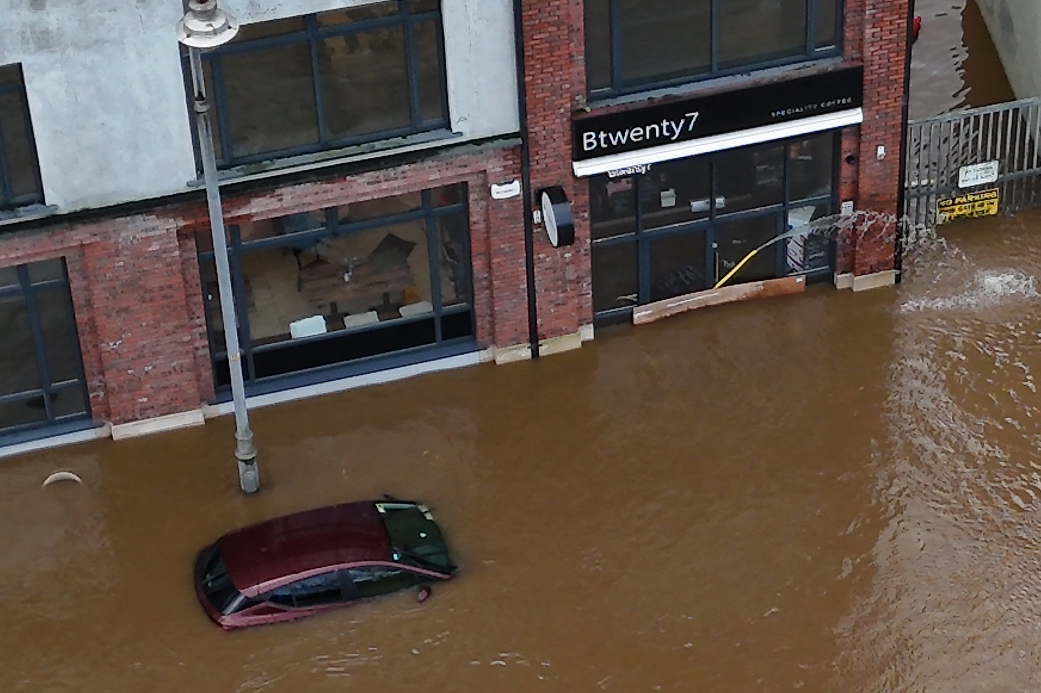
Firefighters in Devon rescue 25 people from vehicles
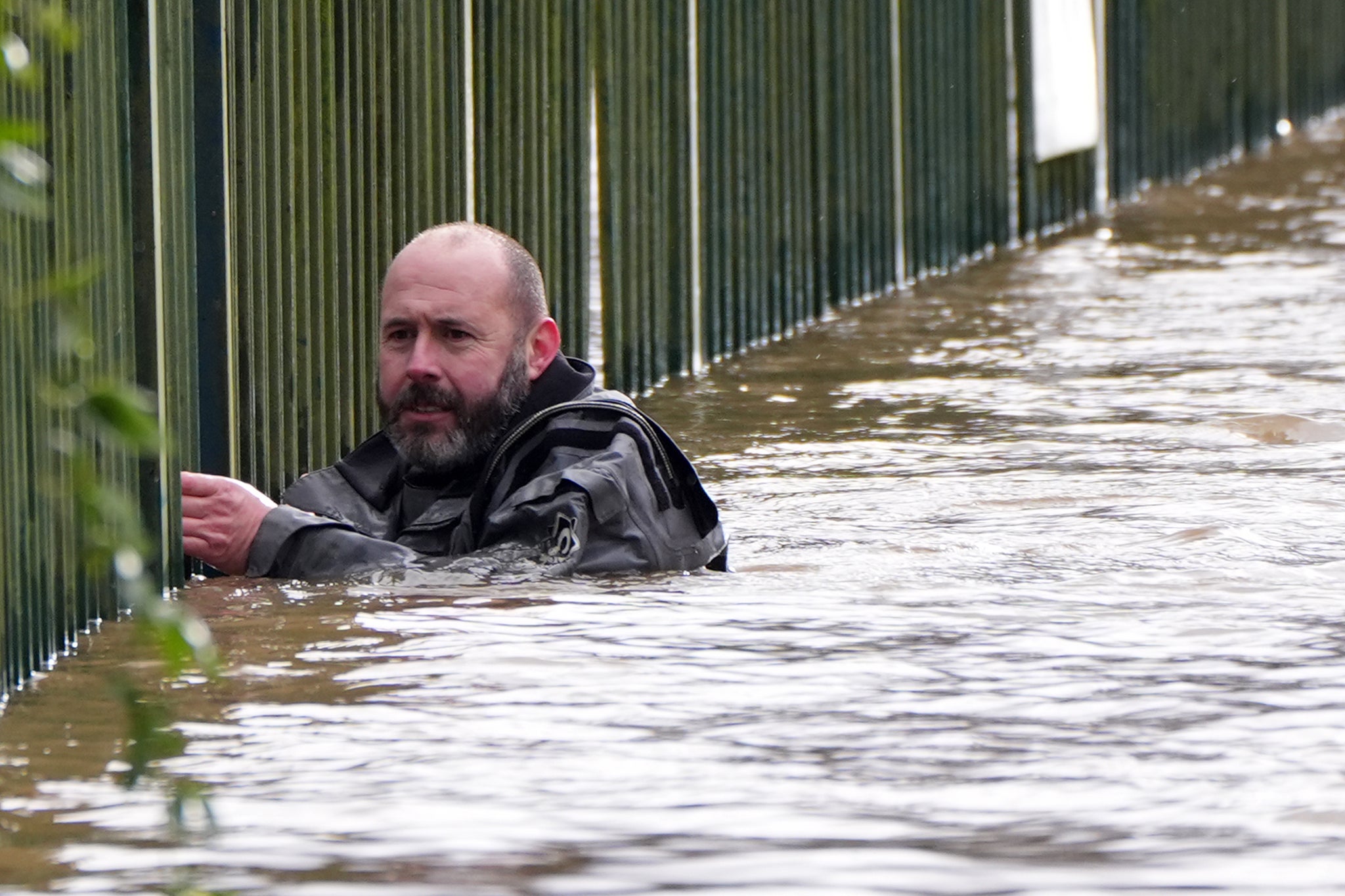
09:49 , Holly EvansFirefighters in Devon and Somerset rescued people from 25 vehicles in flood water on Tuesday morning.
A spokesman for Devon & Somerset Fire & Rescue Service confirmed there were no casualties.
Axminster Fire Station posted images of multiple vehicles in flood water on Facebook.
It said: “Flood water can be deeper and moving faster than it appears. Driving through it can quickly lead to vehicles becoming stranded and lives being put at risk.
“Please do not drive through flood water – turn around and find an alternative route.”