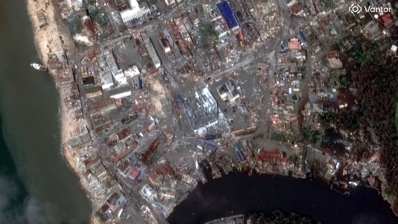
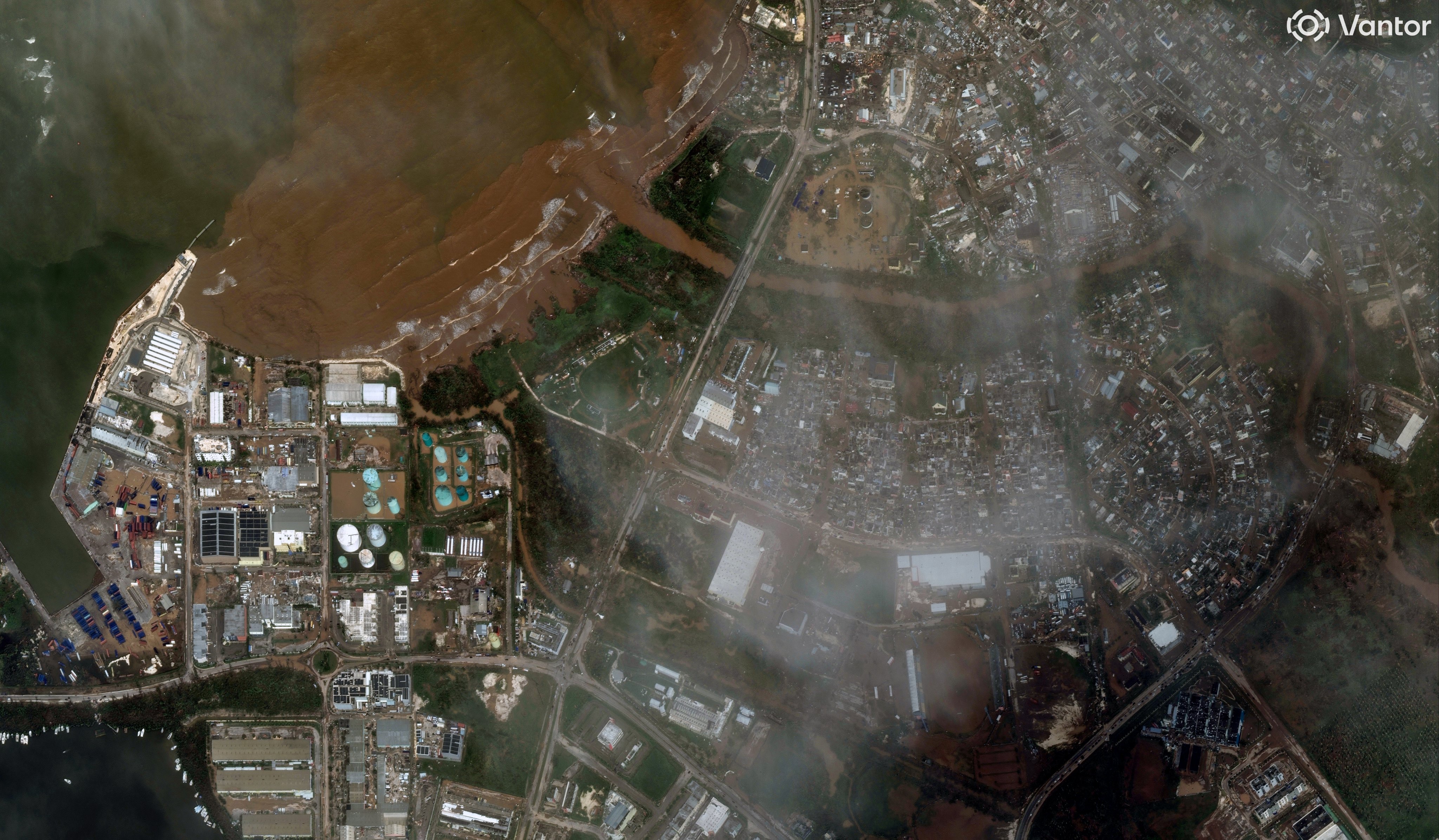
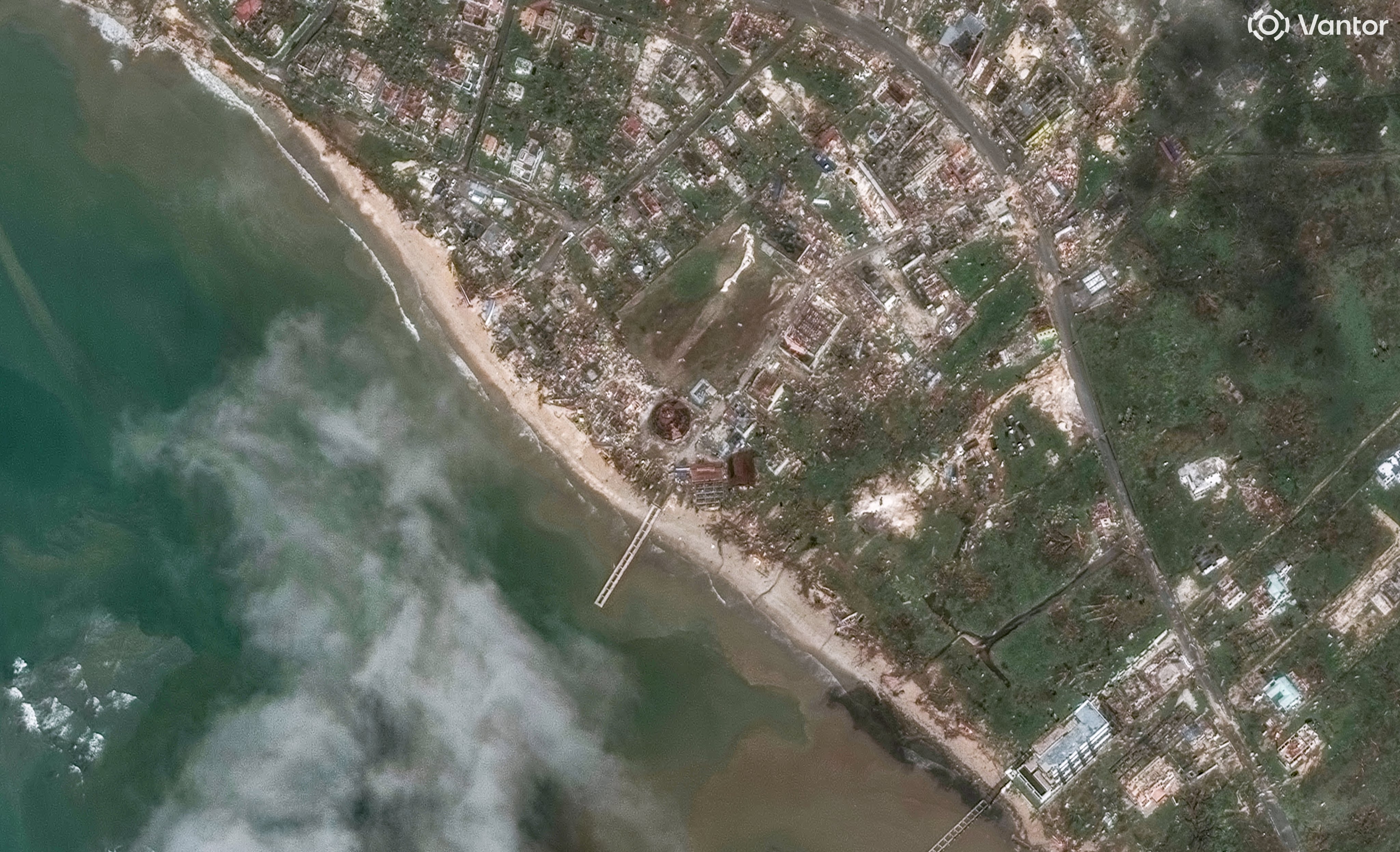
With the help of satellites, we are beginning to get an understanding of just how catastrophic Hurricane Melissa was.
On Oct. 28, Hurricane Melissa became the fourth hurricane in 75 years to make landfall on the island of Jamaica and shattered several Atlantic hurricane records. It is now tied with the 1935 "Labor Day" hurricane for the strongest Atlantic hurricane to make landfall on record, according to Yale Climate Connections. As of Oct. 31, at least 50 deaths have been reported in the storm's wake, and total damages could reach over $50 billion, according to Reuters. The full impact of the storm is still being assessed.
Satellite photos released by Vantor Technology (formerly Maxar) are beginning to reveal the extent of the damage left in Melissa's wake, which left the island of Jamaica unrecognizable in many parts. Vantor Technology recently shared imagery on X showing several locations throughout the island nation that flooded or were damaged by high winds brought by Hurricane Melissa.
Following Hurricane Melissa, Vantor made its satellite imagery available for free in order to help rescue and recovery efforts. "This imagery can be used by frontline organizations and geospatial community members to map changes on the ground and identify the most severely impacted areas, helping ensure resources are allocated quickly and effectively," Vantor wrote alongside the images.
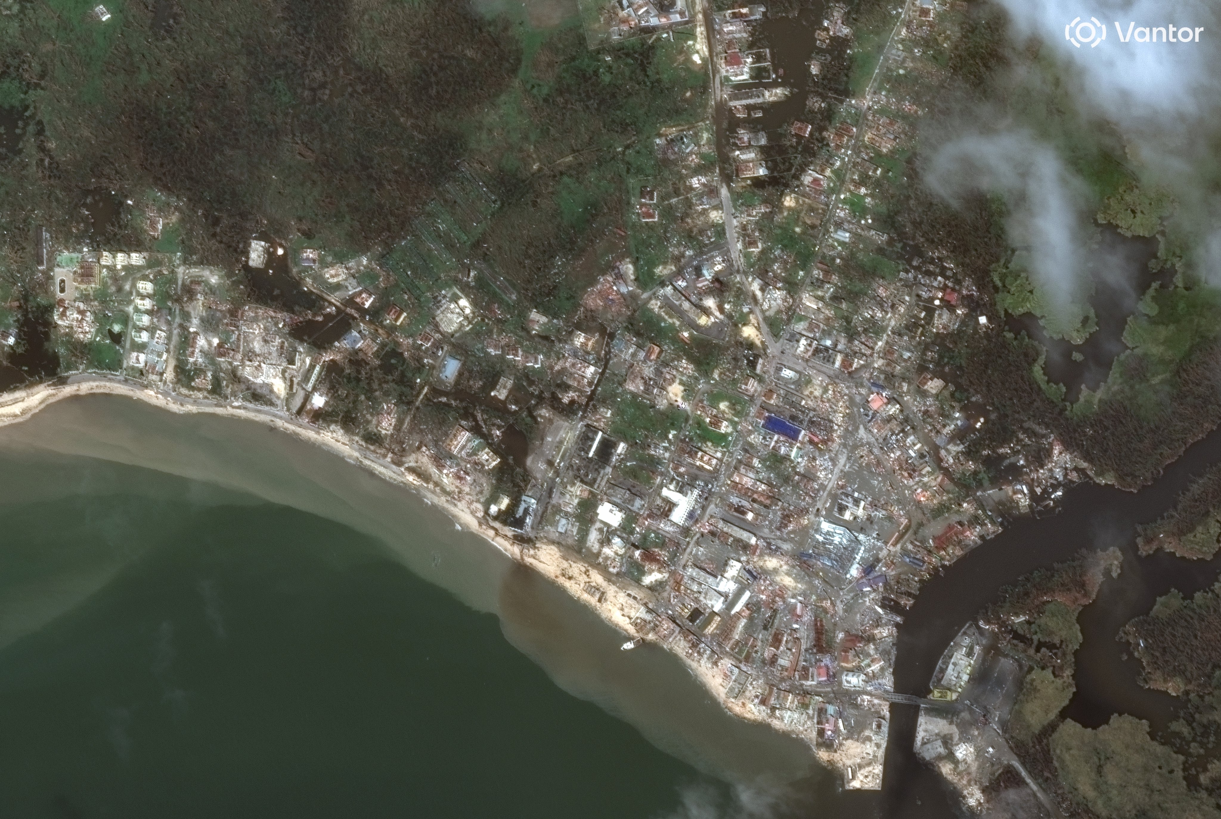
Imagery like this is useful to first responders and other organizations on the front lines as it can help them locate where the hardest hit areas are and where immediate help is needed most. And as the flood waters begin to recede, responders can also use satellite imagery to determine when it's safe to get into those areas to search for survivors and survey the damage.
There were only two hurricanes before Melissa, Hurricane Charlie and Hurricane Gilbert, that reached the status of a major hurricane on the Saffir-Simpson Hurricane Wind Scale when they made landfall on Jamaica.
But Melissa surpassed every Jamaican hurricane and is now ranked as the strongest ever to landfall on the island, reaching a Category 5 storm last week with sustained winds at 185 miles per hour mph (298 km/h).