Several parts of the UK are expected to get hit with blustery showers, wind, and hail across the weekend as unsettled weather spreads across the country.
Temperatures are likely to dip to around 3-4C in towns and cities across the UK on Saturday morning, with heavy rain due to hit northern England and Wales and move across East Anglia and the southeast by the afternoon.
Wet and windy weather will slowly move southwards again on Sunday, before temperatures rise to the mid-teens for most of the country on Monday.
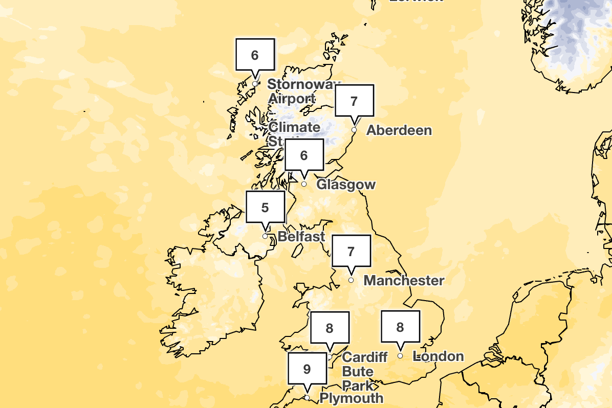
Met Office meteorologist Alex Deakin said: “Temperatures on Saturday will be back below average at 9 or 10C. Add on the wind, and it will feel quite a bit colder than that.”
Outbreaks of heavy rain over Scotland on Saturday could bring hail and possible snow on the hills. By around mid-morning, the bands of rain will clear towards the southeast.
Northern and western parts of the UK will have wet and windy weather on Sunday morning, with a heavy band of rain due to push steadily through Scotland and Northern Ireland, and arrive in northern England and Wales by lunchtime.
Sunday afternoon is expected to be wet and blustery across most of Wales and England, with possible hail and thunder.
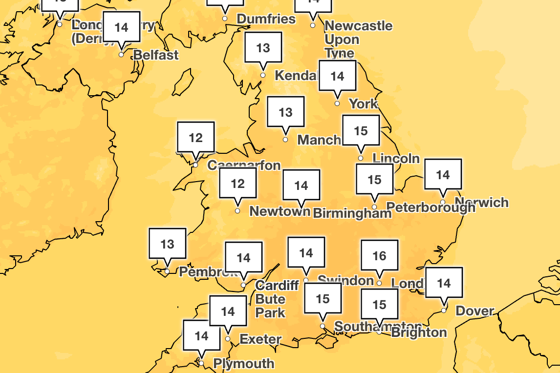
But warm and drier conditions are on their way, with temperatures forecast to climb to the mid-teens, and possibly reach 17C in the southeast of England by Tuesday.
A Met Office spokesperson said: “From Tuesday, milder air is expected to move in across the UK, bringing a noticeable change after the recent cooler conditions. Many areas will see temperatures lifting closer to, or slightly above, the seasonal average, particularly in the south and west.
“While this will make it feel more spring‑like at times, conditions will remain variable, with some cloud and outbreaks of rain, especially further north and west.”
Met Office five-day weather forecast
Today
Cloud and patchy rain move southeast across central areas before clearing to the southeast later. Brighter weather follows in the northwest with scattered showers, some heavy or wintry over northern hills. Windy in the north and less cold than Thursday.
Tonight
Any lingering rain clears the southeast. Clear spells elsewhere with wintry showers. Later, persistent rain and hill snow reach Scotland, Northern Ireland and northern England. Windy, colder, with frost.
Saturday
Sunny spells and showers, some heavy and wintry with hail, hill snow and isolated thunder. More prolonged showers for England and Wales later. Windy and blustery, feeling colder than Friday.
Outlook for Sunday to Tuesday
Sunday rain spreads southeastwards. Brighter later with northern gales and wintry showers. Monday, mostly dry, cloudier later with increasing winds. Tuesday, mild, cloudy with occasional rain; winds stronger.
UK consumer confidence plunges amid ‘twin threat’ fallout from Iran war
Council tax rises for April confirmed as some areas face 9% increase
Sarah Ferguson stripped of freedom of the city of York over Epstein ties
Jimmy Savile’s former Highland cottage finally demolished
More than 6m vapes and pods binned each week despite disposable use ban
US lawmakers urge Sarah Ferguson to say what she knew about Andrew’s Epstein links