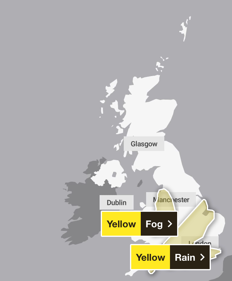
A yellow fog warning is in place across parts of the UK after swathes of the country were battered with heavy rain.
The Met Office issued an overnight warning across north-west England, Wales and the West Midlands, with concerns that fog may cause some disruption to travel during Thursday evening and overnight. The alert has been put in place between 8pm and 7am.
Fog patches are set to become more widespread and dense in places during Thursday evening, with visibility falling below 100m in some places. The fog will then thin and lift into low cloud late in the night or early on Friday morning.
The forecaster reminded people to avoid delays potentially caused by the thick fog by checking road conditions if driving, leaving extra journey time, or amending plans if necessary.
“Make sure you know how to switch on your fog lights, and check they are working before setting off on your journey,” the Met Office advised.
Bus and train services, as well as flights and ferry travel, may also be affected by the fog, as the Met Office advised people to be prepared for the weather warnings to change and follow advice from relevant travel companies.
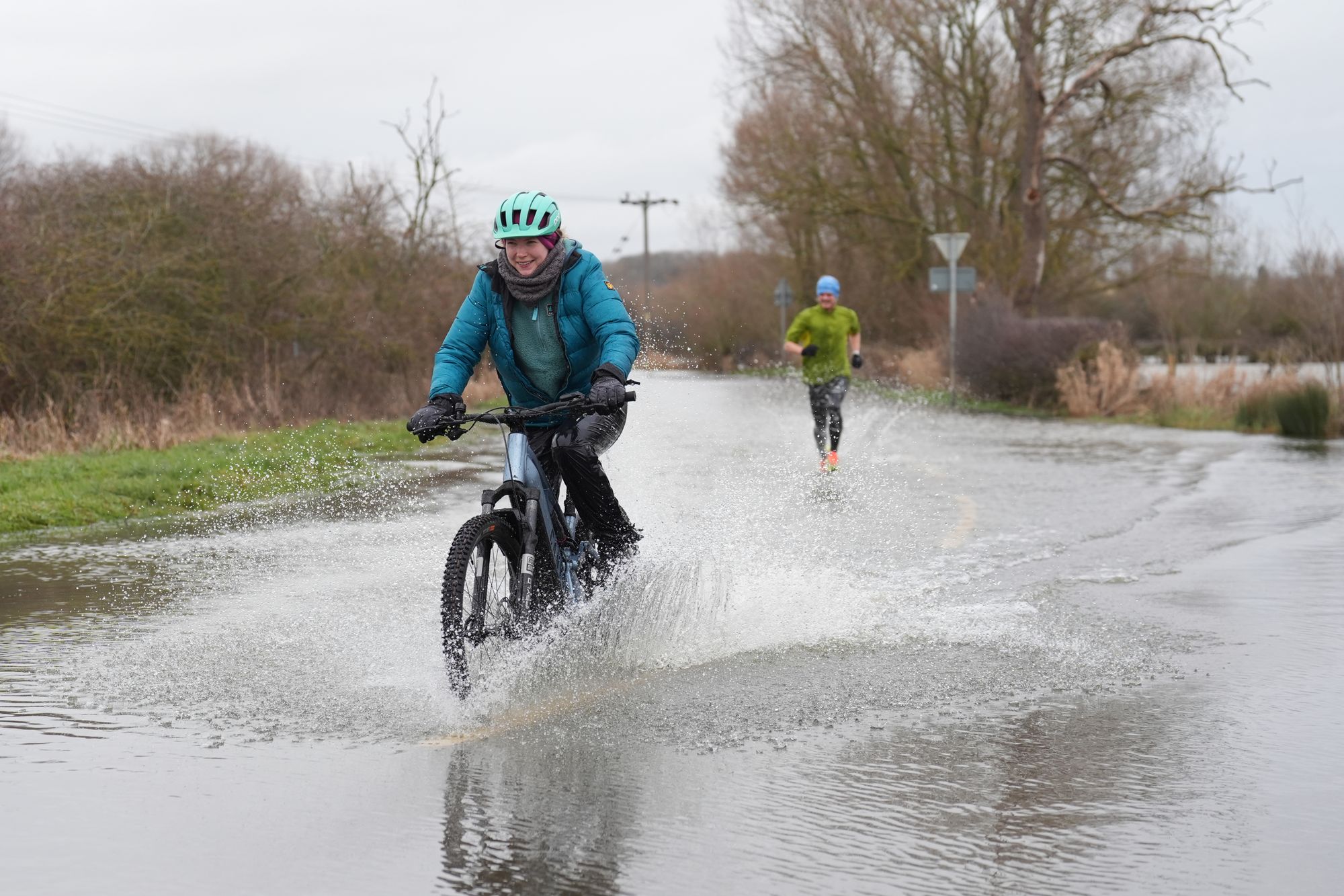
It comes as rain pelted parts of the UK, stretching from the East Midlands down south. Outbreaks of rain spread during the day, becoming persistent and heavy at times, before clearing to the North East through the evening and night. Parts of the country saw 20 to 30mm of rain, in some places falling in just a few hours. A few more isolated areas in southern England saw 40 to 50mm.
Five flood warnings were issued along the River Severn, the River Ouse, and Kidbrooke Stream amid the downpour, as the Environment Agency warned flooding was expected. Flooding remained a possibility elsewhere as the agency issued 117 alerts across the country.
The wet and foggy weather follows a cold start to the year as freezing temperatures hit the country, with a number of weather warnings for snow, rain, ice and wind across the UK.
A rare red wind weather warning was put in place across Cornwall and the Isles of Scilly last week as the French-named Storm Goretti swept through parts of the country.

Parts of Scotland saw snow so heavy that children were unable to go to school for a week as wintry showers disrupted life.
Temperatures have since returned to average for this time of the year, and low pressure remains in charge of the weather.
Met Office five-day forecast
Overnight
Rain and strong winds in the South East will clear eastwards from England during the first part of the night, leaving clear spells across the UK with showers in the west. Some frost and fog developing with icy stretches in Scotland.
Friday
Early frost and fog clearing to leave sunshine and showers. Showers heaviest and most frequent in the West and South West, with hail and thunder possible. Breezy, especially in the South West.
Outlook for Saturday to Monday
A changeable few days. A mix of bright or clear spells and showery outbreaks of rain. Some overnight frost and fog patches, the fog locally freezing and slow to clear.
Designer perfumes recalled for containing banned chemical which may harm fertility
Why doesn’t the home secretary have the power to fire police chiefs?
Districts warn of ‘catastrophic flooding’ without urgent funding boost
Tribunal nurse Sandie Peggie ‘has been through hell’, Kemi Badenoch says
Criminals in hospital to lose benefits as Labour closes ‘loophole’
Robert Jenrick attacks Tories as ‘failed’ party as he defects to Reform