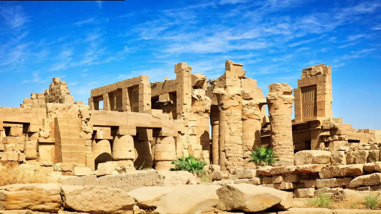
Ancient Karnak arose from a topography moulded both by water and stone. For more than a century, excavations have concentrated on temples, walls, and inscriptions, while the ground beneath them has received little attention. A recent geoarchaeological investigation has shifted the focus. Researchers drilled dozens of sediment cores over Karnak and its vicinity to determine how the River Nile previously travelled through the area. Their findings indicate that the massive temple complex was built on a natural river terrace that was previously ringed by canals. This site may have recalled Egyptian concepts of a holy mound emerging from primordial waters. The analysis also helps to narrow down when permanent construction at Karnak became feasible, providing a quieter but clearer picture of how landscape and belief evolved together.
Scientists discover Karnak was built on a hidden Nile river island
The study”Conceptual origins and geomorphic evolution of the temple of Amun-Ra at Karnak (Luxor, Egypt)” shows that Karnak was not placed randomly on the floodplain. Beneath the temples lies a body of sandy deposits left by fast-flowing water thousands of years ago. These sands form a raised terrace, higher than the surrounding land. At the time of its formation, the area would have been unsuitable for long-term settlement. Only later did the Nile cut channels on either side, leaving a stable platform that people could occupy.
Early settlement depended on river change
Dating of the sediments suggests this terrace became dry and stable around 2520 BC, give or take several centuries. Before that, seasonal flooding would have made construction difficult. This timing aligns with the oldest pottery found on site, which points to early occupation during the late Old Kingdom or First Intermediate Period. The evidence supports the idea that Karnak only became viable once the river landscape shifted.
The temple complex once sat like an island
Cores taken across the site reveal traces of former river channels both east and west of Karnak. These channels appear to have enclosed the terrace, turning it into an island of higher ground. Smaller channels even crossed parts of the site. Over time, some filled naturally with silt, while others remained active for centuries. The image that emerges is not a fixed setting but a patchwork of land and water that slowly changed.
Later builders adapted to shifting waters
As dynasties rose and fell, the Nile continued to move. During the Middle Kingdom, some channels began to silt up, linking once separate areas of land. By the New Kingdom, parts of the river system were deliberately filled with sand, likely to support major construction projects. These actions suggest people were not only reacting to nature but shaping it to suit religious and political needs.
A major Nile branch flowed east of Karnak
One of the clearest findings is evidence for a substantial Nile channel east of the temple complex. Pottery and sediments show it was active from at least the First Intermediate Period through the New Kingdom. At its widest, it may have stretched several hundred meters. This channel later shifted eastward and eventually silted up, turning into a floodplain by the late classical period.
Landscape echoes ancient belief
The idea of Karnak rising from surrounding waters has long been noted in texts and temple symbolism. Egyptian creation myths describe a primaeval mound emerging from chaos. While the researchers avoid strong claims, the physical setting of an island terrace surrounded by channels fits this imagery in a quiet way. It suggests that natural features may have reinforced religious meaning, even if they were not the original reason for the site’s selection.
A slower view of a familiar monument
The study does not rewrite Karnak’s history in dramatic terms. Instead, it adds depth. By combining sediment cores, pottery analysis and dating techniques, it fills gaps left by earlier work. The result is a calmer picture of a landscape in motion, where temples grew alongside changing rivers. Karnak appears less as a fixed monument and more as part of a living floodplain, shaped by time, water and gradual human choice.