Today, in his final instalment on curious points of interest on the drive from Canberra to the outskirts of Sydney, Tim explores the section of the Hume Highway M31 from Marulan to Menangle. Approximate distances are measured from the ACT border. Read the first part here.
Marulan Meridian (107km)
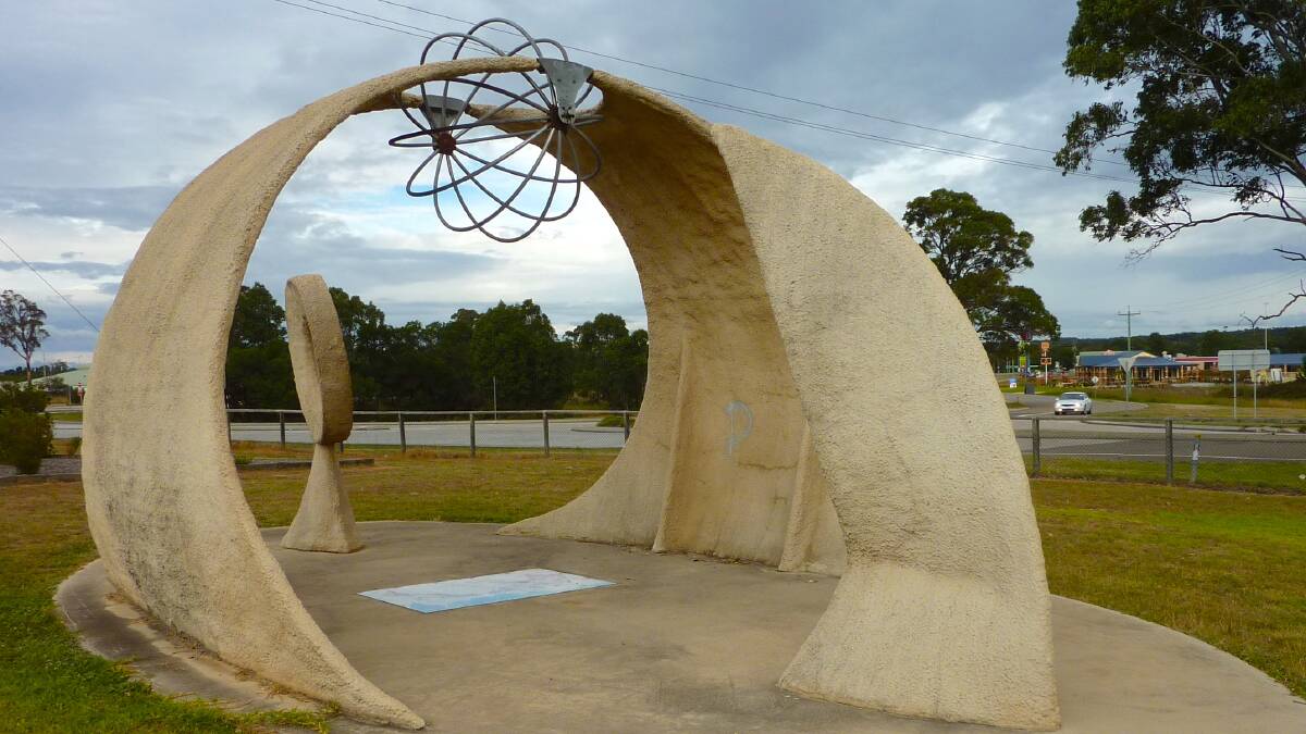
If you can pull your kids away from the fast-food outlets in at the service centre, head to Meridian Park where you can stand with one foot on either side of the 150 East line of longitude - the exact middle of the eastern standard time zone and where on every equinox, the sun rises at 6am and 6pm exactly. You can set your watch by it. Really.
Phantom Pubs (121km)
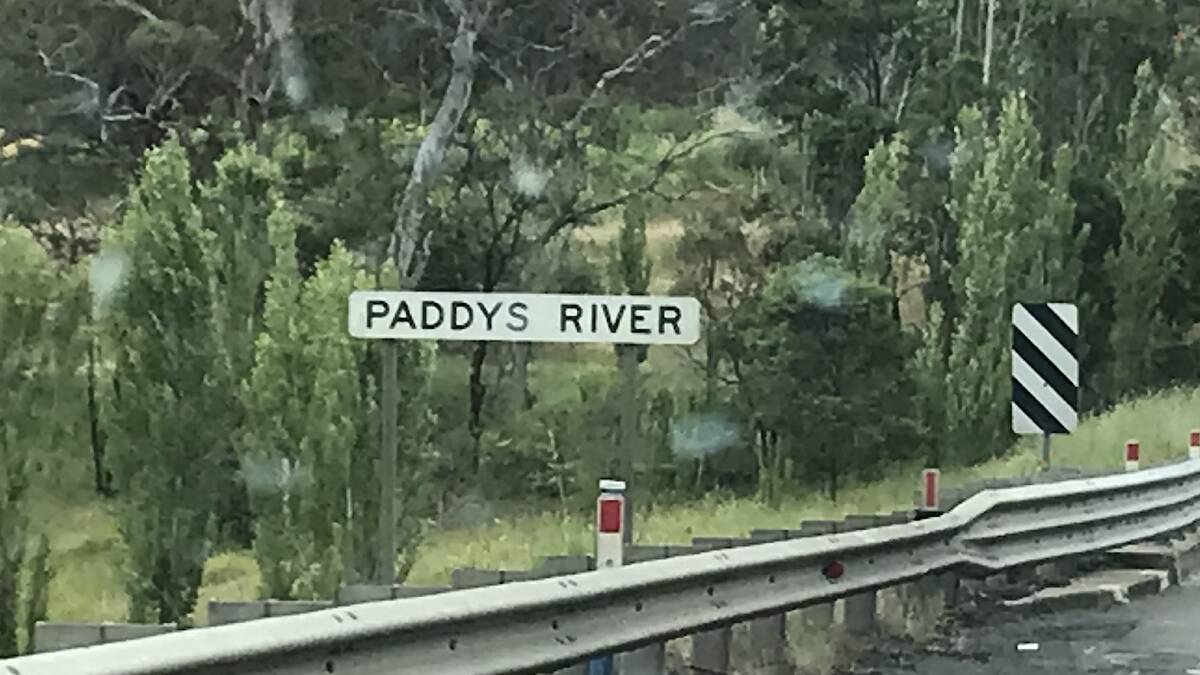
Today, when you drive over Paddys River there's not much to see except a deep swimming hole on the eastern side of the southbound lanes. However back in the 1830s it was much busier when a small village called Murrimba grew beside the river to service travellers on what was then called the Great South Road. Sadly, there are no obvious relics of the village, but there are tales of a ghost of a bullock driver who drowned while attempting to cross the river 180 years ago. Apparently he emerges late on foggy nights. Best keep your windows wound up and doors locked just in case!
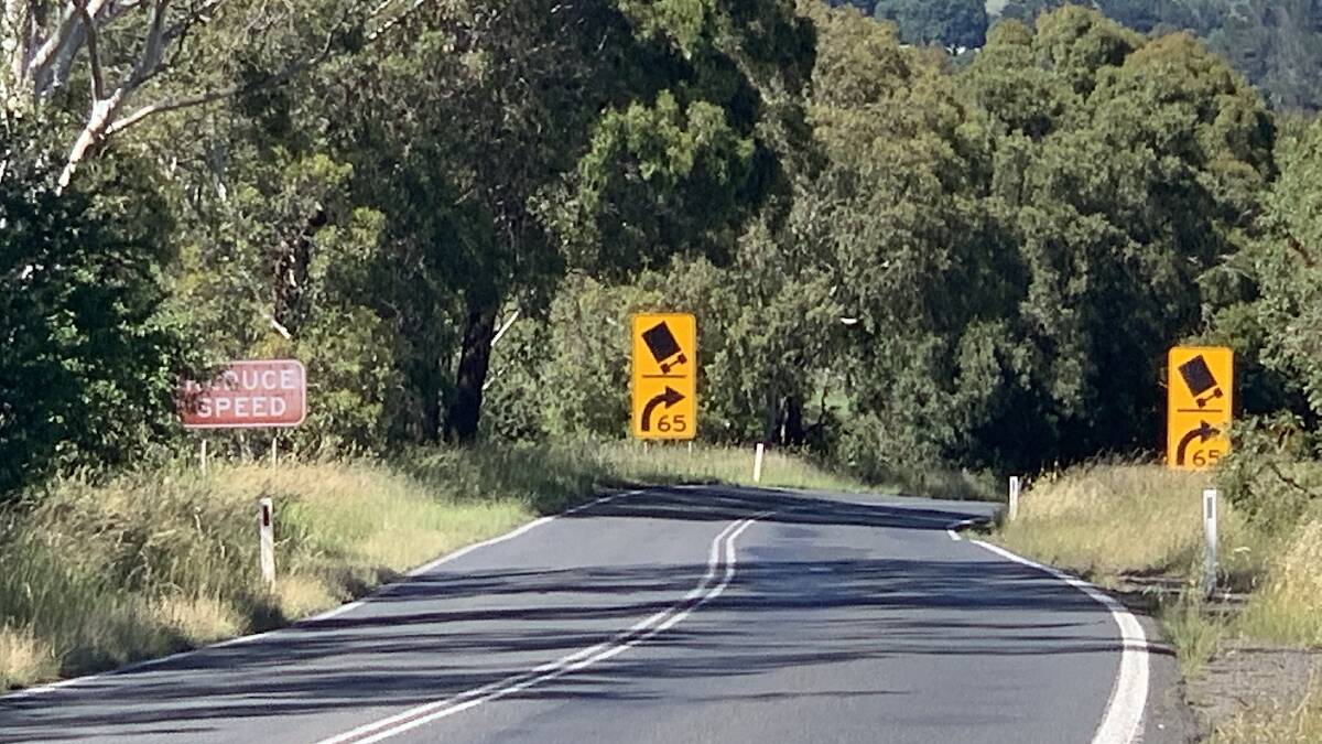
Suspended Stone (129km)
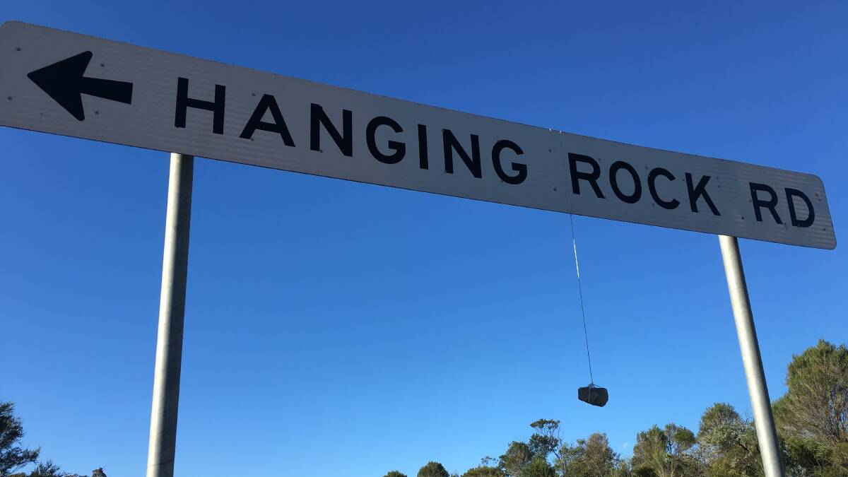
OK, this one is a bit of fun. One of the games the Yowie gang play in the car when heading to Sydney is to take bets on whether there will be a rock hanging from the "Hanging Rock" road sign just south of Sutton Forest Service Centre. For safety reasons, stopping your car right at the sign is not recommended. Instead, if you want to photograph the rock (or replace it with a bigger one...) just turn down Hanging Rock Road, park and then walk back along the nature strip to the sign.
Baffling Boat (130km)
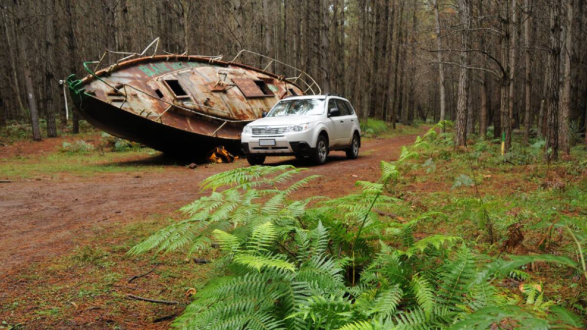
Around 10 years ago, a discarded yacht mysteriously appeared hidden amongst pine trees behind the Penrose State Forest Rest area. What made its appearance in a landlocked forest especially odd was that the rusting vessel was subsequently moved on at least three occasions to other spots in the forest. And not just dragged a few metres, but hauled over half a kilometre and then partially dug into the ground. One rumour is that it was dumped in near-new condition in the forest by a jilted wife after she caught her husband cheating. We may never know for sure, as it vanished in 2017.
Highway Hangout (132km)
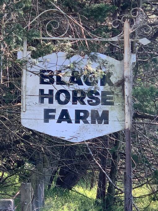
If you call in at the Sutton Forest Service Centre, on the left, just as you merge back onto the highway and concealed behind trees, is the former circa 1835 Black Horse Inn (now a private home). At the junction of several roads, it was robbed so many times by bushrangers, including the Ben Hall Gang, that police would often hide in the bushes waiting for the next robbery. Now the only highway robberies are the fuel prices at the nearby service stations.
Amazing Arch (136km)
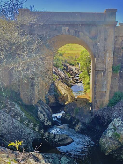
Only four kilometres further north is a spectacular site - one of the highway's oldest bridges that traverses a rocky gorge. First built in 1836 as a timber beam structure supported by sandstone abutments, in 1896 it was replaced by a concrete arch supported by the original sandstone abutments and retaining walls. Park at the Mackey VC rest area (located north of the Illawarra Highway junction) and walk 100 metres north along the track at the rear of the rest area. Take care on the slippery flight of steps carved into the rock that lead down to a waterhole on Black Bobs Creek that would have been a reliable water source for thirsty horses and later overheating car engines.
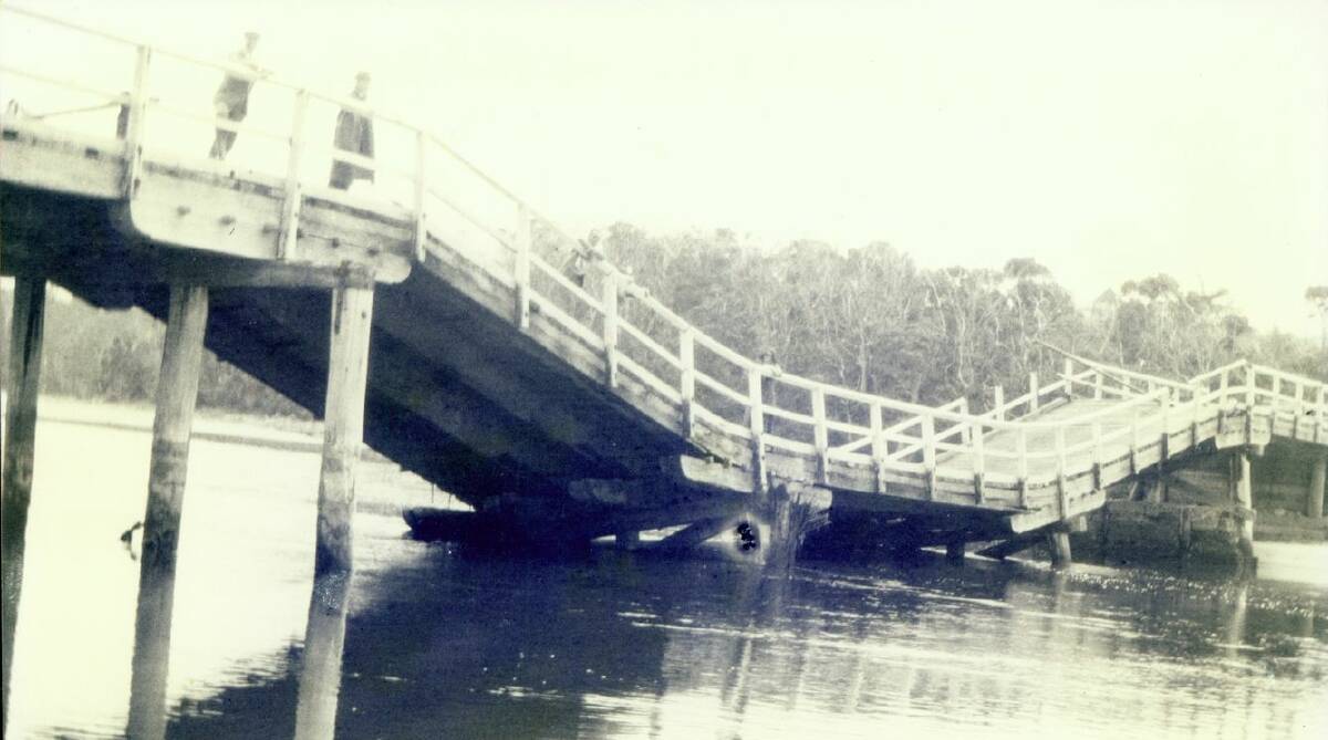
Bridge Bonanza (144km)
Travellers have long been intrigued by the name of the Three Legs O' Man Bridge on the old Hume Highway a few miles south of Berrima. Until the village was bypassed in 1989, it was one of the worst black spots in the country. However, the name doesn't refer to the dangerous bend, but rather a long-since demolished hotel run by a publican who hailed from the Isle of Man, whose flag is the Three Legs O' Man.
Bus Bomb (181km)
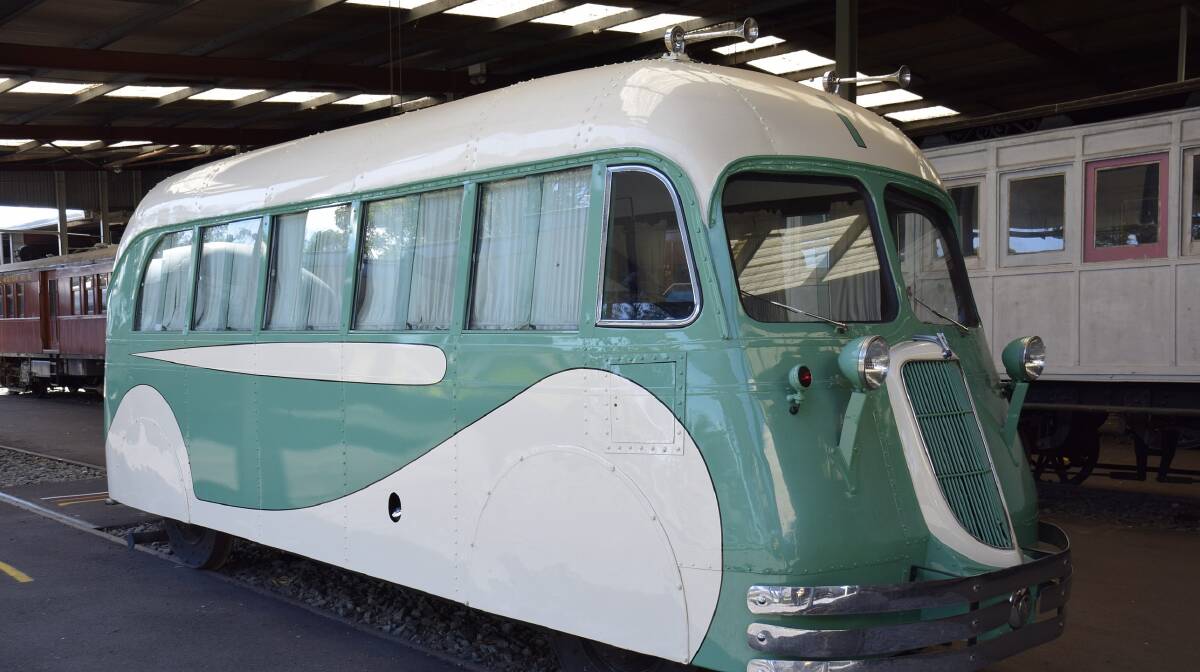
If you look left as you pass the Yanderra exit you can just see the railway line. It was near here in December 1941 that brazen bombers blew up a Rail Paybus (a bus that travelled on railway tracks), killing two of its occupants. Although the safe was left intact, cash was scattered over a large area. There's no sign of any cash on the roadside these days, sadly just a plethora of fast-food wrappers.
Tree Tank (209km)
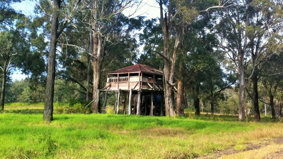
This elaborate wooden structure best viewed from the southbound lanes of the highway isn't, as many have speculated, a World War II air raid tower, but rather a water tank built in 1901 or 1902 to irrigate surrounding pastures via a system of gravity fed troughs. The curious tank stand is nestled among trees on the eastern side of the southbound lane of the M31, between the Menangle Bridge over the Nepean River and Moreton Park Road. It is on private property and there is no public access.
Menangle Machine (210km)
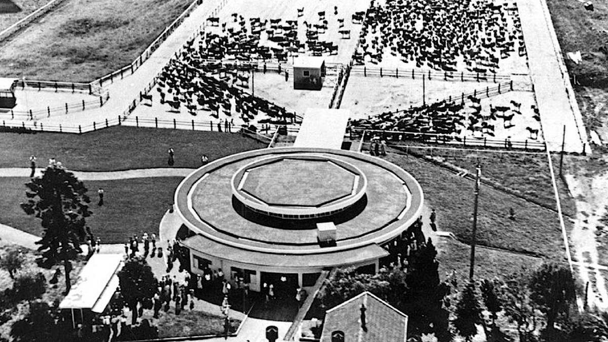
Opposite the tree house in the northbound lanes and again hidden behind trees are the ghostly ruins of a most unlikely tourist attraction - the Camden Park Rotolactor. The first of its kind in Australia and only the third in the world, the state-of-art factory was an automated circular milking machine, with a rotating platform capable of milking 375 cows every hour. After its construction in 1952 it became a popular stop for curious travellers. It closed in 1983. Do you remember it?
The Jervis Bay tsunami
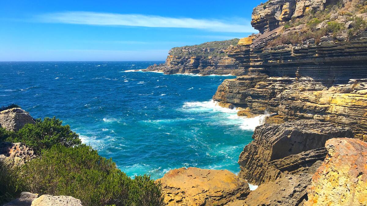
Unlike in Tonga, the impact of last weekend's tsunami on our South Coast was thankfully minimal. While it was powerful enough to reverse the tidal flow in some coastal estuaries such as at Mogareeka Inlet, just north of Tathra, its impact on the environment pales into insignificance if compared to the "five, probably six historic catastrophic tsunamis at Jervis Bay". The most recent of these occurred around 800 radiocarbon years BP, and was followed by a smaller event just over 240 years ago. In their scientific paper, The impact of tsunami on the coastline of Jervis Bay (January 1997, University of Wollongong), a quintet of scientists reveal the locations around the bay where you can still see evidence of these tsunamis by way of out-of-place boulders. Add these on your next visit to Jervis Bay.
-
Northern Headland (Beecroft Peninsula): On the cliffs of Mermaid Inlet, 32 metres above sea level, are large overlapping slabs of sandstone the authors believe were deposited by tsunamis. Just south of here, at Gum Getters Inlet, is another impressive array of sandstone slabs as large as six or seven metres in diameter which have been rammed up to 25 metres above sea level into a small indent in the cliffs. Heck!
- Southern Headland (Booderee National Park): On rocks near the mouth of Stoney Creek is a four-metre boulder which sits on a fragile pinnacle of sandstone, and which shows no sign of damage, indicating the boulder was possibly dropped from suspended flow during a tsunami. There are more out-of-place boulders atop the cliffs of Steamers Beach.
- Inside the bay: Boulder deposits that rise well above the limits of regular storm waves also occur inside Jervis Bay, including at Greenfields Beach (Vincentia), where large overlapping slabs of sandstone rise to heights of five metres above the high-tide level.
WHERE ON THE SOUTH COAST?
Rating: Medium
Clue: In the news.
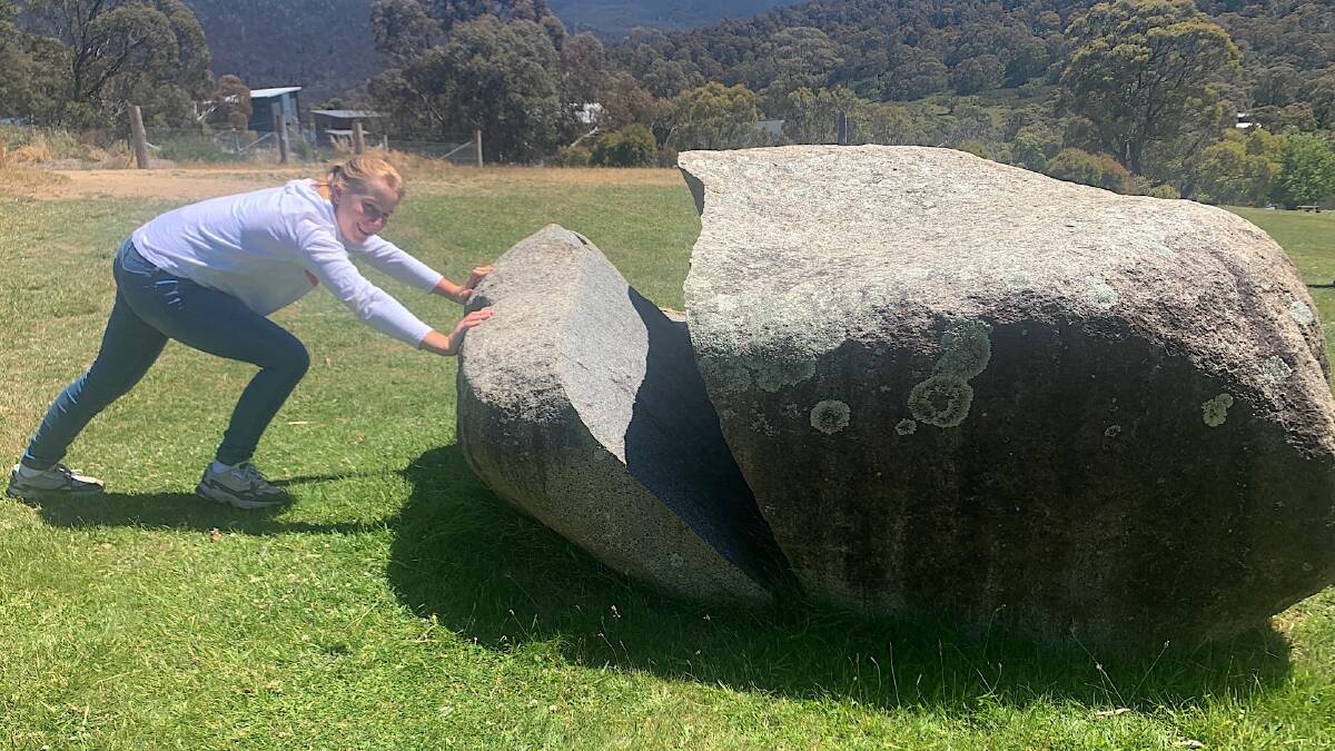
Last week: Congratulations to Teresa Mammoliti of Ngunnawal who was the first to correctly identify last week's photo as a split granite boulder on the lawns at Lake Crackenback Resort & Spa. Located midway along the popular mountain bike route of the Thredbo Valley Track, these days the resort seems even busier in summer than during its traditional peak winter season.
How to enter: Email your guess along with your name and suburb to tym@iinet.net.au. The first correct email sent after 10am, Saturday January 22, 2022, wins a double pass to Dendy, the Home of Quality Cinema.
SPOTTED
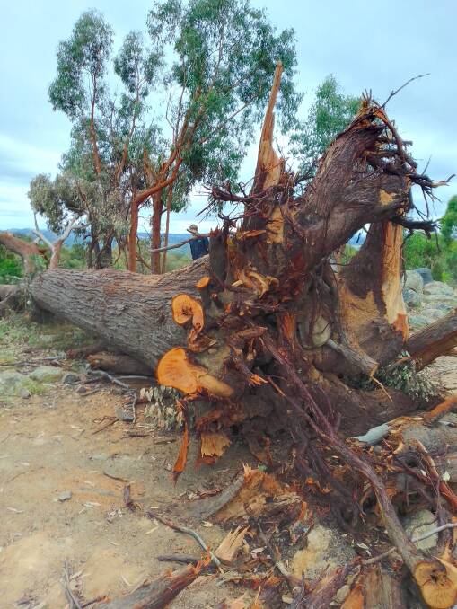
The freak storm that swept through parts of Belconnen earlier this month felled many trees, including the grand old stringybark that for decades marked the highest point on the Pinnacle Nature Reserve near Hawker.
"The tree withstood fires and vandalism (fire lit in the hollow trunk at the base) and will be missed by many," laments Gilbert Hughes of "Friends of the Pinnacle", adding "it was such a distinctive landmark you could see from far away in every direction".
Meanwhile, at the nearby Yowie Bunker, the same storm brought down a 50-year-old grand coastal banksia which, following the 2003 bushfires, was a favourite of yellow-tailed black cockatoos, which feasted on the cones.
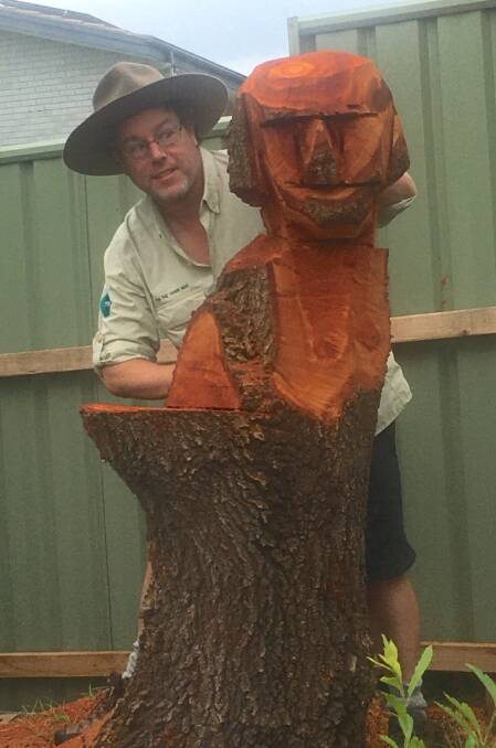
Earlier this week, somewhat foolishly, I left my imaginative chainsaw-wielding friend, who was helping clean up the mess, to his own devices for 10 minutes. And the result? Allow me to introduce you to Omi (short for Omicron).
Has anyone else attempted any post-storm chainsaw sculptures?
- CONTACT TIM: Email: tym@iinet.net.au or Twitter: @TimYowie or write c/- The Canberra Times, PO Box 186, Fyshwick, ACT, 2609.