ISRO’s meteorological satellite, INSAT-3DS, has initiated Earth imaging operations with the meteorological payloads (6-channel Imager and 19-channel Sounder) capturing the first set of images on March 7.
The INSAT-3DS satellite was launched on February 17. After completing orbit-raising operations, it reached the designated geostationary slot for the In-Orbit Testing (IOT) on February 28.
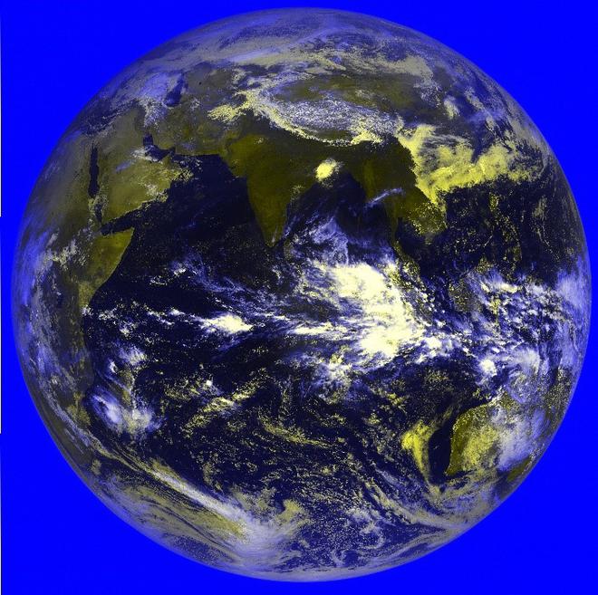
IOT of the satellite communications was conducted between February 29 and March 3. “As part of meteorological payload IOT, the first session of imaging for Imager and Sounder payloads was carried out on March 7. The payload parameters are found to be nominal, complying with payload specifications. Thus, all the payloads of INSAT-3DS have been tested to perform nominally,” ISRO said.
Imager and Sounder payloads onboard INSAT-3DS are similar to the payloads flown on INSAT-3D and INSAT-3DR satellites.
ISRO said that significant improvements have been achieved in radiometric accuracy, black body calibration, thermal management, and imaging throughput, among others.
The payloads were designed and developed at the Space Applications Centre, Ahmedabad, and the first images were processed and released at the Master Control Facility, Hasan.
The 6-channel imager equipment captures images of the Earth’s surface and atmosphere across multiple spectral channels or wavelengths. The use of multiple channels allows for gathering information about various atmospheric and surface phenomena, such as clouds, aerosols, land surface temperature, vegetation health, and water vapour distribution.
The imager could be configured to capture specific features of interest. The 19-channel Sounder captures radiation emitted by the Earth’s atmosphere through channels carefully chosen to capture radiation emitted by different atmospheric constituents and properties like water vapour, ozone, carbon dioxide, and other gases, while others may be designed to measure temperature variations in different layers of the atmosphere.
These payloads generate over 40 geophysical data products for the user community, such as sea surface temperature, rainfall (precipitation) products, land surface temperature, fog intensity, outgoing longwave radiation, atmospheric motion vectors, high-resolution winds, upper tropospheric humidity, cloud properties, smoke, fire, mean surface pressure, temperature profiles, water vapour profiles, surface skin temperature, total ozone, etc.
ISRP said that the data collected derives information about the vertical structure of the atmosphere, which is crucial for weather forecasting, climate monitoring, and understanding atmospheric processes.