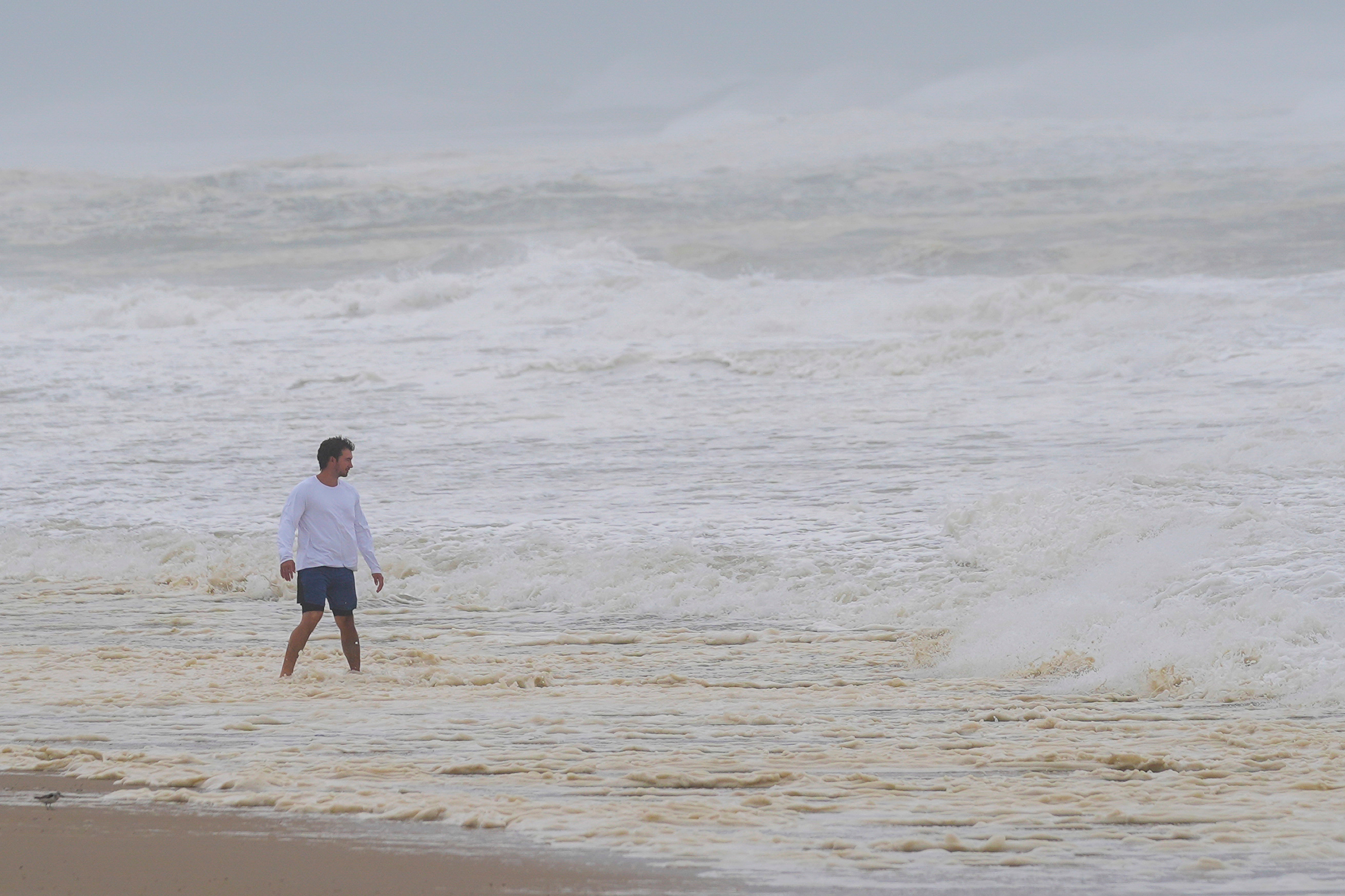
Hurricane Erin moved away from the U.S. on Friday after battering North Carolina’s Outer Banks and deluging other areas of the East Coast.
The storm has weakened to a Category 1 as it continues to move towards Nova Scotia in Canada, having failed to make landfall in the U.S, according to The National Hurricane Center in Miami.
Erin, the first hurricane of the 2025 season, is expected to become a post-tropical storm later on Friday or Saturday morning as it continues to advance out to sea. Forecasters say that the strong waves and swells created by the storm could last for several more days.
Officials in Virginia moved resources to Virginia Beach and other coastal areas to prepare for any potential flooding or damage from the outer bands of the hurricane.
Erin produced swells that impacted Bermuda, the U.S. East Coast, Atlantic Canada, and the Bahamas during its journey up the edge of North America. Rough ocean conditions and dangerous rip currents were seen along virtually all of the North American East Coast from Florida northward.
The National Weather Service issued tropical storm warnings for eastern North Carolina from Beaufort Inlet to Chincoteague, Virginia. The warnings included Pamlico and Albemarle Sounds in North Carolina.

Local officials in the Outer Banks reported that sections of Highway 12 — the only road connecting the Outer Banks to mainland North Carolina — were flooded and closed off, preventing travel off the island until the swells receded. Some residents and vacationers evacuated from the Outer Banks ahead of the storm’s approach, according to USA TODAY. Dare County officials — who represent part of the Outer Banks — ordered evacuations on Monday.
As the hurricane passes by Cape Hatteras, North Carolina, the NWS predicts it could generate waves between 8 and 20 feet. Those waves could contribute to coastal flooding and erosion in the region.

Residents in parts of Florida — like Ponce Inlet — were subjected to large waves generated by Hurricane Erin early on Wednesday morning. On Monday, thousands in Puerto Rico were left without power due to the storm.
Erin began as a cluster of storms off the northwest coast of Africa before it spun into a tropical storm and then a hurricane. The storm is notable for reaching major hurricane status — given to any storms that reach Category 3 or higher — this early in hurricane season.
According to the NHC, major hurricanes tend to form in the middle of hurricane season, usually in September through mid-October.
Hurricane Erin dramatically shifts trajectory after lashing the Caribbean with rain and high winds
Hurricane Erin gusts shut down East Coast beaches and swimmers from Carolinas to NYC to Cape Cod
Strong winds and waves batter Nantucket, Martha’s Vineyard as Hurricane Erin moves out to the sea
Hurricane Erin shifts trajectory after lashing the Caribbean with rain and high winds
Maxwell ‘never’ saw Trump engage in inappropriate activity, interview reveals


