Low-lying parts of Newcastle, Lake Macquarie and Port Stephens could be submerged in less than 80 years if new sea level rise modelling becomes a reality.
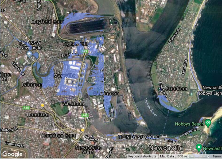
The Coastal Risk Australia modelling indicates parts of Carrington, Wickham and Maryville would be flooded by 2100.
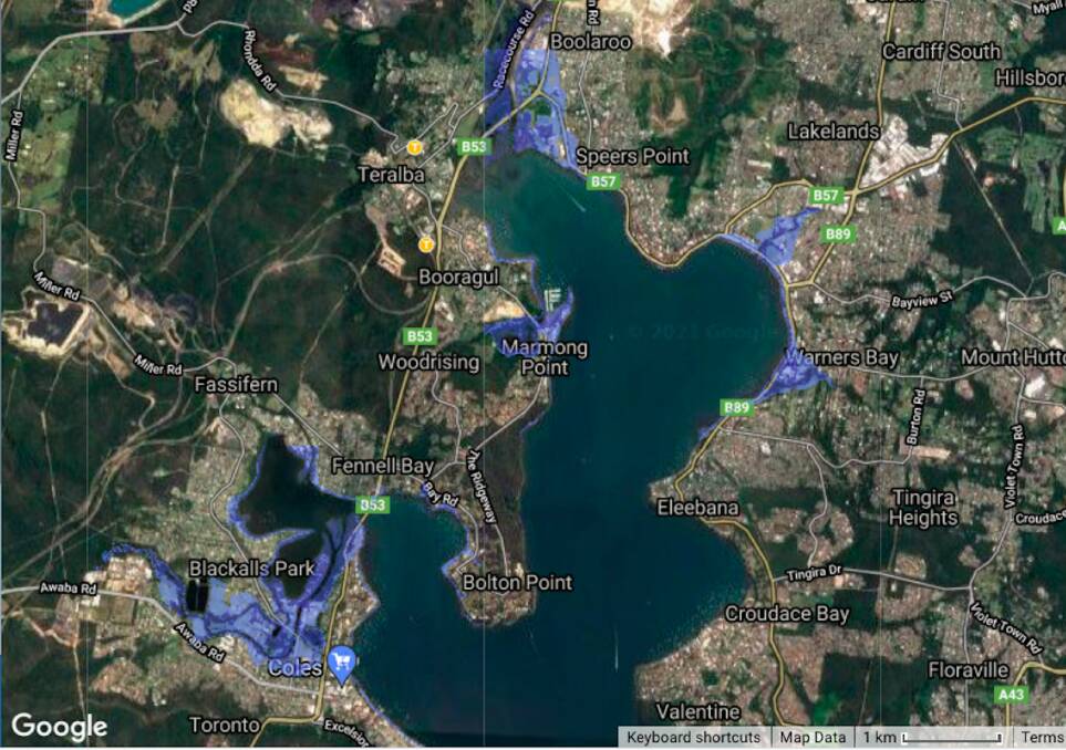
Further south, parts of Boolaroo, Warners Bay and Blackalls Park would also be under water.
The modelling, developed in partnership with FrontierSI and NGIS Australia, uses the latest Intergovernmental Panel on Climate Change data on ice sheet melting rates.
If current trends continue the modelling indicates global sea levels could have increased by 0.84 metres by 2100.
Under a worst case scenario of very high emissions, a two metre sea level rise could occur by 2100 and five metre rise by 2150.
"Australia is facing significant challenges, one of which is being more resilient to climate," FrontierSI chief executive Graeme Kernich said.
The Coastal Risk Australia tool aims to place scientific modelling into the hands of the people so they can see for themselves how the areas they live in could be impacted in the future by climate change
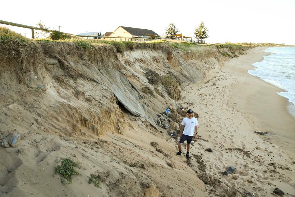
The new data complements research published last year in the journal Nature Climate Change that indicated 40 per cent of the country's sandy beaches could be lost over the next 80 years due to sea level rise.
The research was based on satellite images mapping shoreline change between 1984 and 2015, combined with Intergovernmental Panel on Climate Change sea-level rise forecasts for the year 2100.
Most of the increase in sea level rise to date had come from the thermal expansion of warmer water but by mid-century melting ice sheets are likely to be the cause of sea level rise.
The researchers predicted that if carbon emissions peak in 2040 at least 12,324 kilometres of Australia's sandy coast will be threatened with erosion by 2100.
If emissions continue to rise, 15,439 kilometres of coastline will be under threat.
"Storm erosion is typically followed by beach recovery but some events may leave a footprint that takes decades to recover, if at all, while the additional shoreline retreat renders the backshore more vulnerable to episodic coastal flooding and its consequences," the paper said.