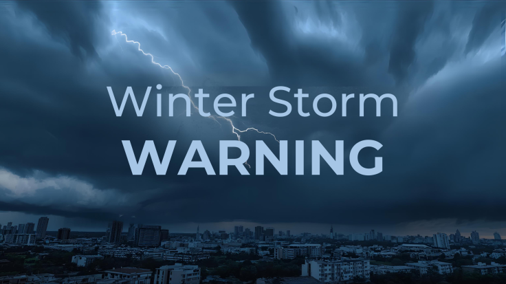
A powerful winter storm is battering four US states today, forcing mountain pass closures and creating life-threatening conditions as authorities urge residents to avoid all non-essential travel.
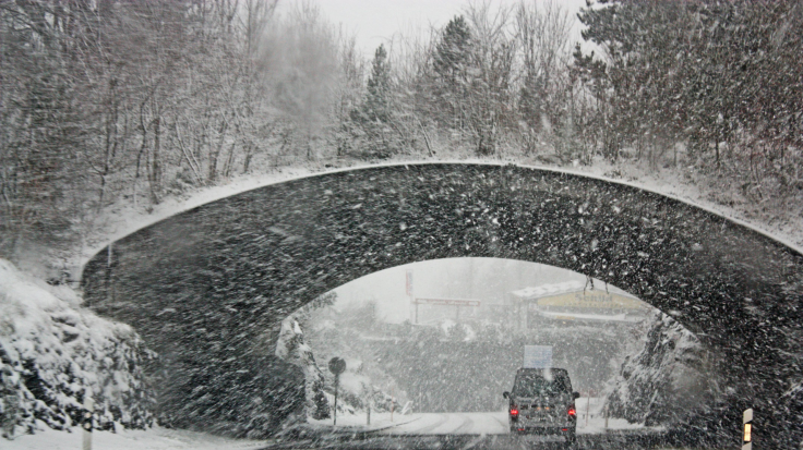
Idaho, Montana, Washington and Colorado are experiencing snowfall of up to 61 centimetres (24 inches), with wind gusts reaching 100 kilometres per hour (62 mph), rendering roads impassable across the northern Rockies. The severe weather system has already paralysed transport networks across multiple high-altitude mountain passes.
The National Weather Service has issued urgent winter storm warnings through Saturday, 6 December, affecting key routes including Lookout Pass, Vail Pass and Stevens Pass.
Meteorologists warn the system is among the most significant December storms to impact the region in recent years, with conditions expected to worsen before gradually improving.
Mountain Passes Shut Down Amid Whiteout Conditions
Transport officials have closed several major highways as heavy snowfall and powerful winds produce near-whiteout visibility. Tyre chains are mandatory on multiple routes, while other mountain roads remain completely impassable.
'Travel could be very difficult to impossible,' the National Weather Service warned. 'The hazardous conditions could significantly impact both morning and evening commutes.'
In Montana, storm warnings remain in effect across the Little Belt, Big Belt, Bridger and Gallatin mountain ranges until 2:00 pm MST Saturday. In Colorado, the Sawatch and Gore ranges are under similar advisories, with dangerous conditions forecast to persist into early Sunday morning.
Parts of eastern Idaho's Teton Valley have been especially hard hit, with snowfall rates nearing 2.5 centimetres per hour (one inch per hour) in some areas.
Wind gusts ranging between 70 and 100 kilometres per hour (43 to 62 mph) are generating blizzard-like blowing snow over exposed ridges and high passes.
Record Snowfall Totals Across Four States
The Idaho Panhandle Mountains are reporting snowfall totals of 15 to 30 centimetres (6 to 12 inches) above 900 metres (3,000 feet) in elevation. Mountain ranges across eastern Idaho and Montana have already accumulated 25 to 46 centimetres (10 to 18 inches).
Meanwhile, higher terrain in Colorado and Montana could reach totals of 30 to 61 centimetres (12 to 24 inches) by Sunday morning.
The heaviest accumulation has been recorded across the Bear River and Caribou ranges in Idaho, where some locations have seen as much as 46 centimetres (18 inches) of snow.
Lower-elevation valleys have fared slightly better with 2 to 8 centimetres (1 to 3 inches), although snow totals climb rapidly closer to mountain passes.
In Washington's western Chelan County, including Stehekin and Stevens Pass, forecasters are calling for 13 to 25 centimetres (5 to 10 inches) of snow, accompanied by wind gusts of up to 55 kilometres per hour (34 mph), creating dangerous blowing and drifting conditions.
Heavy, wet snow paired with strong winds has increased the risk of falling tree limbs and downed power lines across affected areas.
Emergency Services on High Alert
Authorities are urging motorists to carry winter survival kits, including tyre chains, water, food, blankets and first-aid supplies. Backcountry travel remains extremely hazardous, with whiteout conditions and an elevated avalanche risk reported across mountainous zones.
Emergency responders have confirmed multiple vehicles stranded along mountain passes, with rescue operations complicated by hazardous road conditions and limited visibility.
The National Weather Service has warned that gusts along exposed ridges remain strongest, occasionally reaching levels capable of snapping tree branches and severing power lines.
Travellers are advised to check local road reports before setting off and to postpone journeys where possible until conditions improve. Key passes including Teton Pass, Togwotee Pass and Kings Hill Pass remain under active winter storm warnings, with treacherous driving conditions expected to continue through Saturday evening.
While storm warnings are scheduled to expire late Saturday afternoon and evening, weather advisories in lower-lying areas may extend into Sunday morning.
Residents across the region are being urged to monitor official forecasts closely and delay all non-essential travel until the storm system weakens.