A cyclone has hammered northern New Zealand by causing relentess rain and strong winds that have led to evacuation warnings.
Cyclone Gabrielle has come as the Auckland, the country’s largest city, barely recovered from extensive damage caused by extreme flooding and record rain at the end of last month.
“The worst is yet to come,” warned prime minister Chris Hipkins, ahead of officials’ concerns and alarm over the storm surge caused on Monday night.
Eight North Island regions, including Auckland, are under states of emergency and at least 30 severe weather warnings and watches are in place as some areas experienced heavy inundation, damage from winds and power outages.
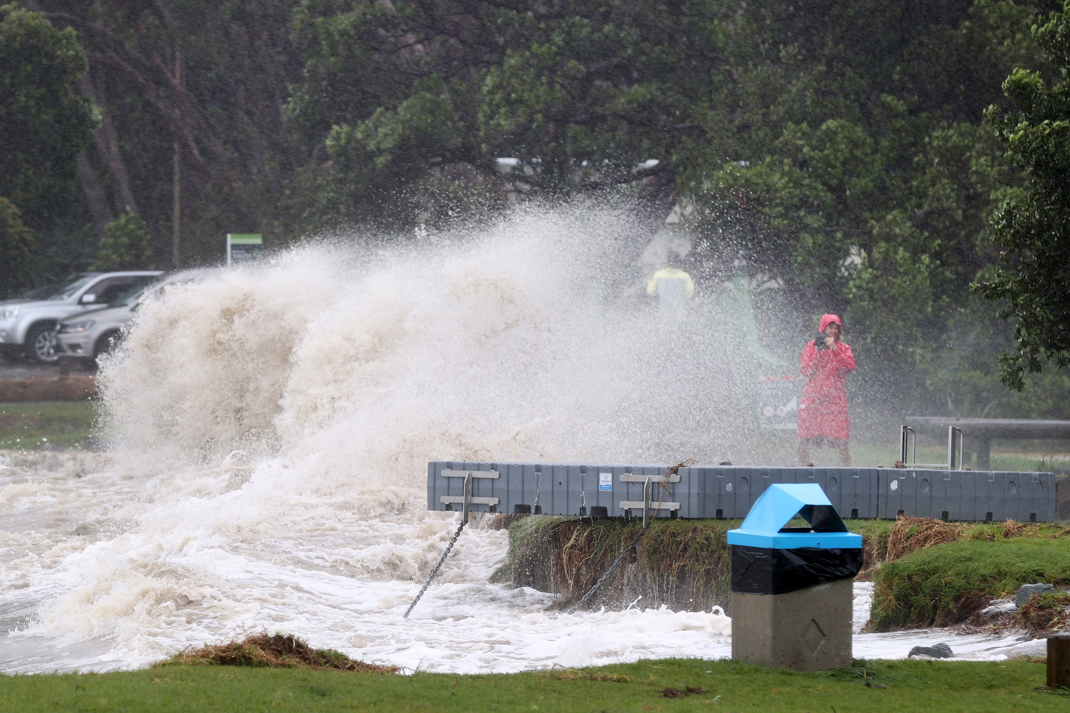
Thousands of residents in Auckland hunkered down after the cyclone dumped 220mm (9 inches) of rain in New Zealand’s largest city.
The cyclone caused widespread power outages, cutting electricity to about 58,000 homes.
The MetService warned Aucklanders to be on alert for heavy rain, flooding and landslips as well as storm surges during high tides in the east coast area after 2am.
At an emergency response conference in Auckland, deputy controller Rachel Kelleher issued a self-evacuation warning and said: “We’re certainly not out of the woods yet.”
“I can’t stress this enough, please have a plan to leave if you see water levels rising around you. Do not wait to be told to leave if you think you’re in danger.”
The city came to a grinding halt after train services were cancelled and offices as well as most schools were closed.
Air New Zealand canceled more than 500 flights till Tuesday, affecting more than 10,000 international customers, the airline said, with thousands still to be rebooked.
Air New Zealand canceled all domestic flights to and from Auckland through Tuesday morning and grounded many international flights.
But the airlines said some international routes would continue operating after diverted flights from Auckland. The carrier also canceled domestic flights to and from the cities of Hamilton, Tauranga and Taupo.
Garry Towler, a government official at the Thames Coromandel district that attracts many tourists, said “we’re on one knee now”.
The storm surge is their biggest concern as it could lead to a “big blow”, he told radio network Newstalk ZB.
“It’s going to be a miserable, uncomfortable night for the Coromandel,” he said. Several houses were beginning to flood in Coromandel towns and people in the low-lying areas were asked by officials to evacuate due to the risk of high tidal flooding.
In Ōpōtiki, more than 300km southeast of Auckland, more than 500 homes will be evacuated by Tuesday. “We are expecting large sea swells and inundation along low-lying areas of Ōpōtiki’s coastline,” said the local council.
“We are taking action now to avoid a scramble in the middle of the night as the situation worsens.”
“The worst is yet to come. We have to adapt and respond as the weather that we are dealing with changes,” warned Mr Hipkins, who was himself stuck in Auckland briefly after domestic air services were grounded.
He acknowledged people’s frustration because of the “incredibly challenging” weather since the start of the year for people in Auckland and other northern areas.
“Extreme weather event has come on the back of extreme weather event,” Mr Hipkins said. “For families and businesses, I know that that has been just exhausting, and I want to acknowledge how hard many of them are doing it.”
In the Whitianga area of New Zealand’s North Island, a “record storm surge” was been recorded on Monday.
Winds as high as 160km/h (100 miles) were recorded in the northern Coromandel Peninsular and other islands that were in the path of the cyclone.
Gales in Auckland hit 130km/h after windspeed was downgraded.
MetService warned people to prepare for “extreme, impactful, and unprecedented weather” over many regions, with heavy rain, strong winds and large waves.
The cyclone was tracking northeast of New Zealand and the eye of the storm is expected to be off the coast of Auckland by late Monday or early Tuesday.
Mr Hipkins said the storm has not yet met the threshold for a national state of emergency but officials are on alert and are updating the government every four hours.
His government has announced an NZ$11.5mn ($7m) package for relief and rescue work.
The cyclone has battered New Zealanders two weeks after Auckland experienced the wettest day on record as the amount of rain that would typically fall over an entire summer hit in a single day.
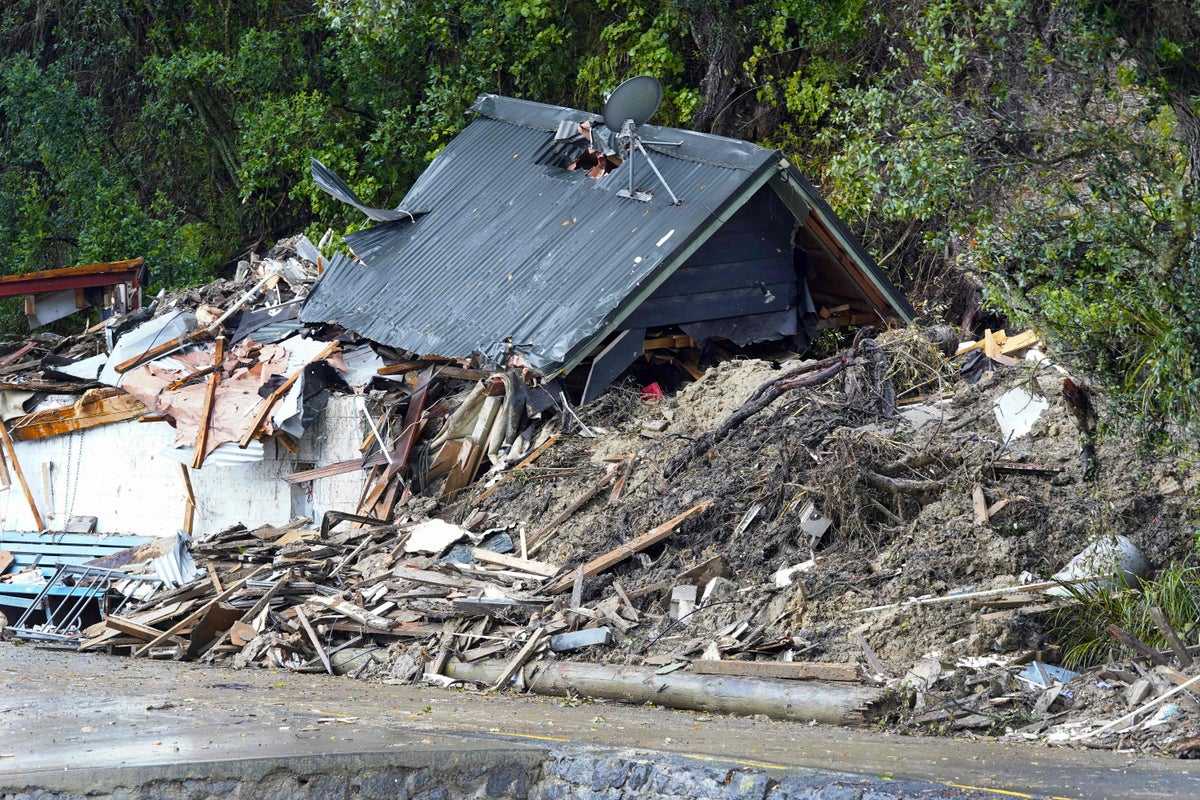
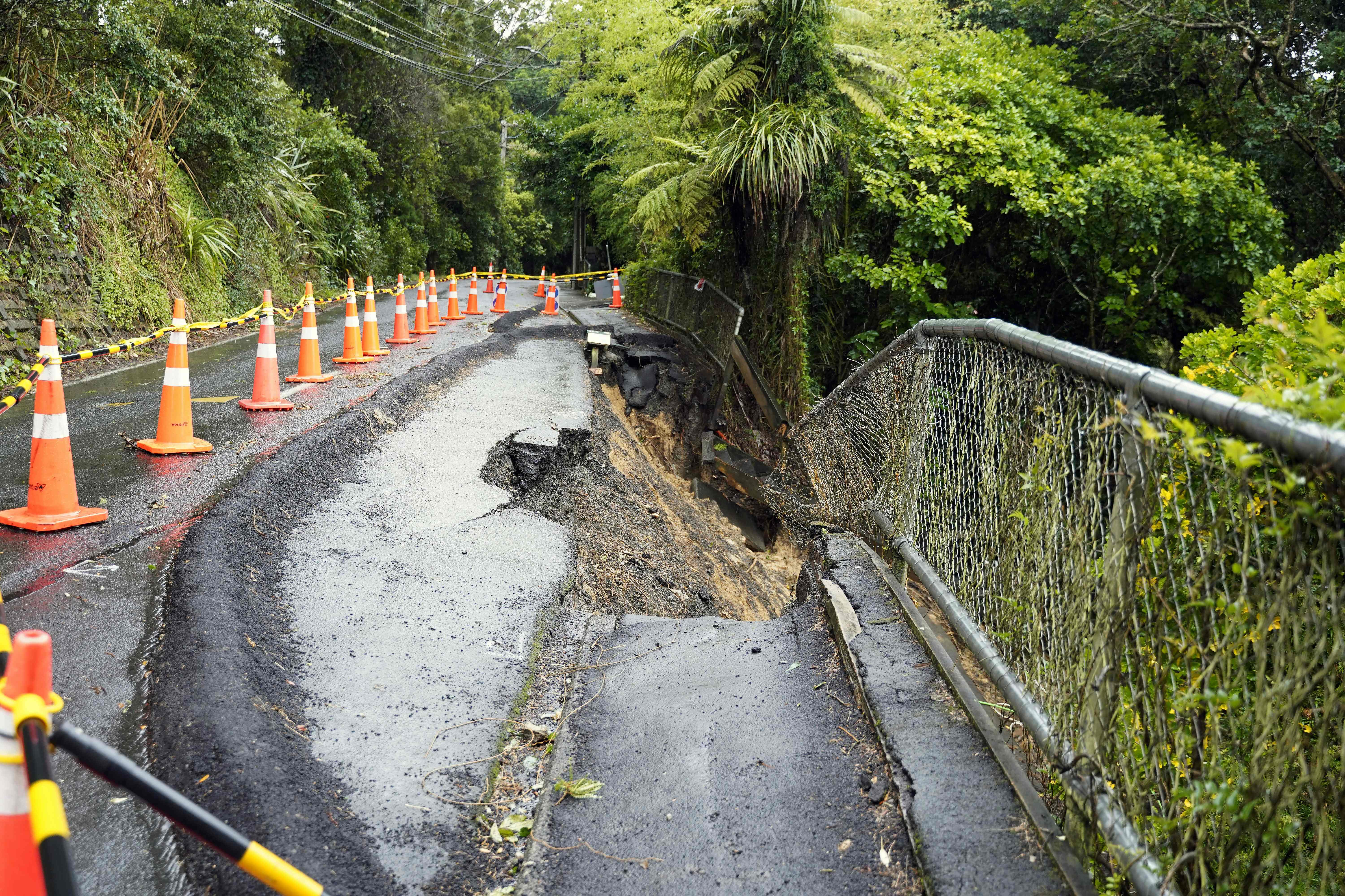
Extreme weather conditions, including floodwaters and landslides, had killed four people, caused widespread disruption and left hundreds of homes damaged.