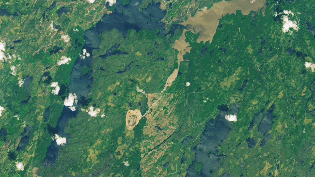
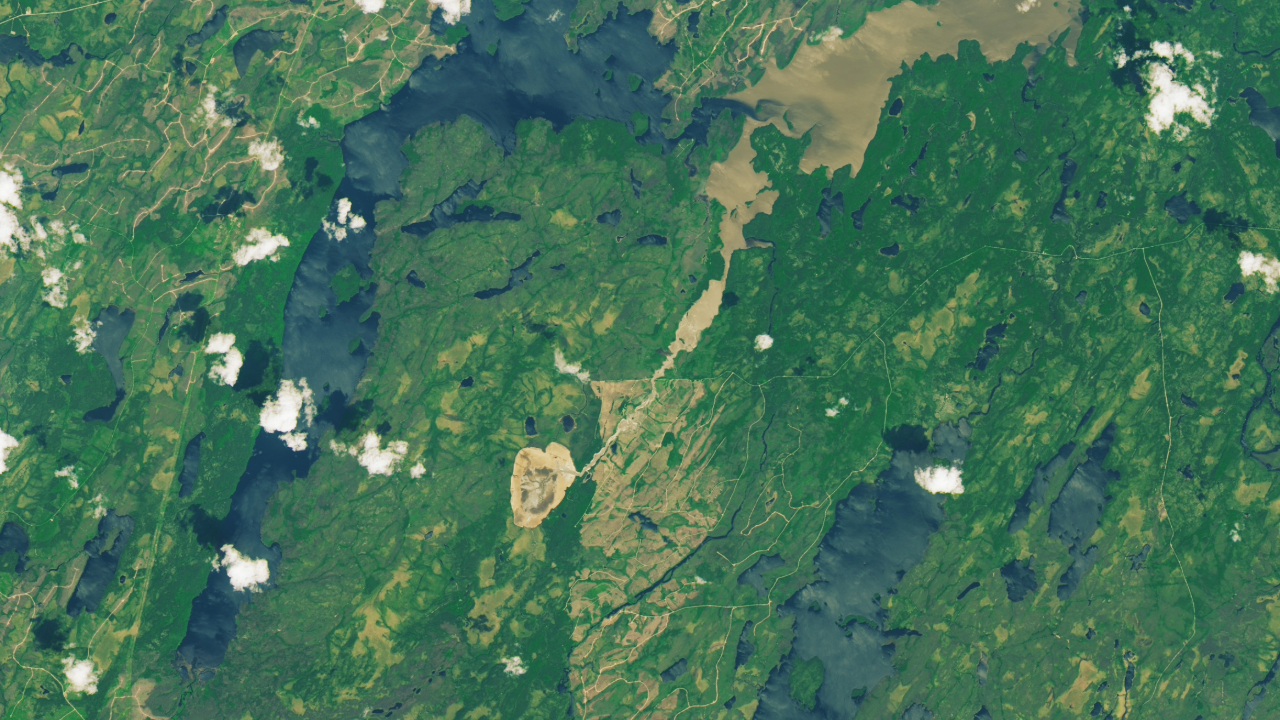
In May 2025, residents living around Lac Rouge discovered a washed-out road near the lake, triggering investigations that revealed the lake had completely emptied almost overnight, an extremely rare and puzzling event for the area.
Using both ground and air searches, experts found that the land around the lake had collapsed on itself, causing the lake to drain.
What is it?
Lac Rouge is a small lake, only about a 0.86 square miles (1.4 square kilometers) around. According to the European Southern Observatory, it was used by the Cree First Nation based in the nearby community of Waswanipi for fishing, hunting, and trapping.
Where is it?
Lac Rouge is based in the the Lac-Walker region of Sept-Rivières in Quebec, Canada.
Why is it amazing?
According to a statement from the Cree First Nation of Waswanipi, the cause of the lake draining is still unknown. Possible theories suggest wildfires, recent rainfall or snowmelt may have been involved. Wildfires raged near the lake in both 2019 and 2023 which could have weakened the soil.
While the Landsat 9 satellite, hovering in low-Earth orbit, captured images before and after Lac Rouge was drained, the actual timing of the draining is not known, with experts guessing it happened between April 29 and May 14, 2025.
According to ESO, the lake emptied by flowing to smaller ponds and rivers against its usual outflow path, where the water finally reached Lac Doda, around 6 miles (10 kilometers) away. Residents and visitors are worried that the draining will affect the local wildfire, such as moose and sturgeon.
As the Landsat 9 satellite was designed to study the Earth's processes, its ability to capture events like this show how serious the effects of climate change can be on our environment.
Want to learn more?
You can read more about Earth-scanning satellites and other flooding events.