Geography shapes human life in multiple ways, from the resources we have available all the way to our diverse cultures. How we study it has evolved significantly over the years, moving from basic drawings to more sophisticated high-resolution satellite maps and interactive GIS platforms. In this collection, you’ll find 50 photos of interesting geography from around the world. The images not only highlight breathtaking landscapes and oceans, but also a variety of maps and charts. They also give us a fascinating glimpse into how we interact with the world around us and how geography influences our daily lives.
#1 Canada Still Has 91% Of The Forest Cover That Existed At The Beginning Of The European Settlement
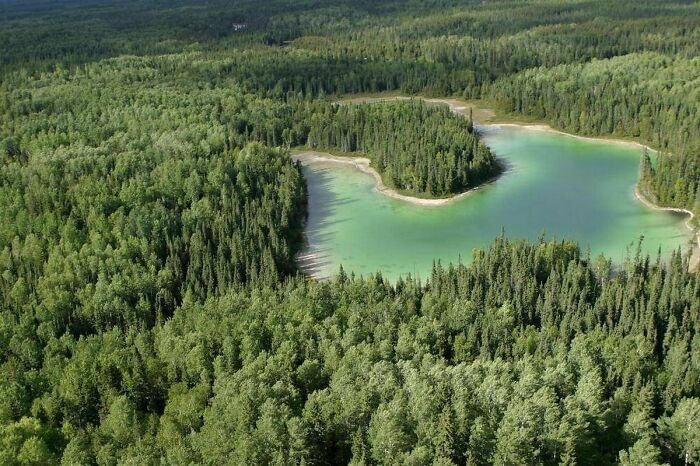
Image credits: WdrFgt
#2 Tracking Of An Eagle Over A 20 Year Period
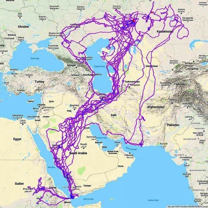
Image credits: HDeo950
#3 I Went To An Unknown (For Me) Island 2 Hours From Home And Mapped It From Scratch With A Compass And A Rangefinder!
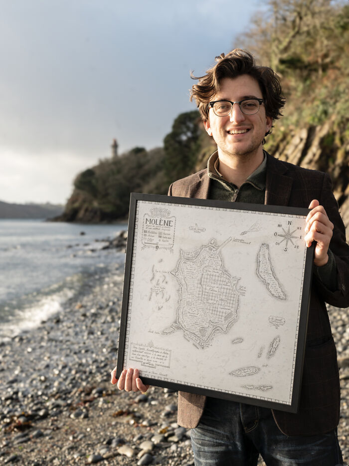
Image credits: mydriase
#4 Fun Fact I Found On A Snapple Cap
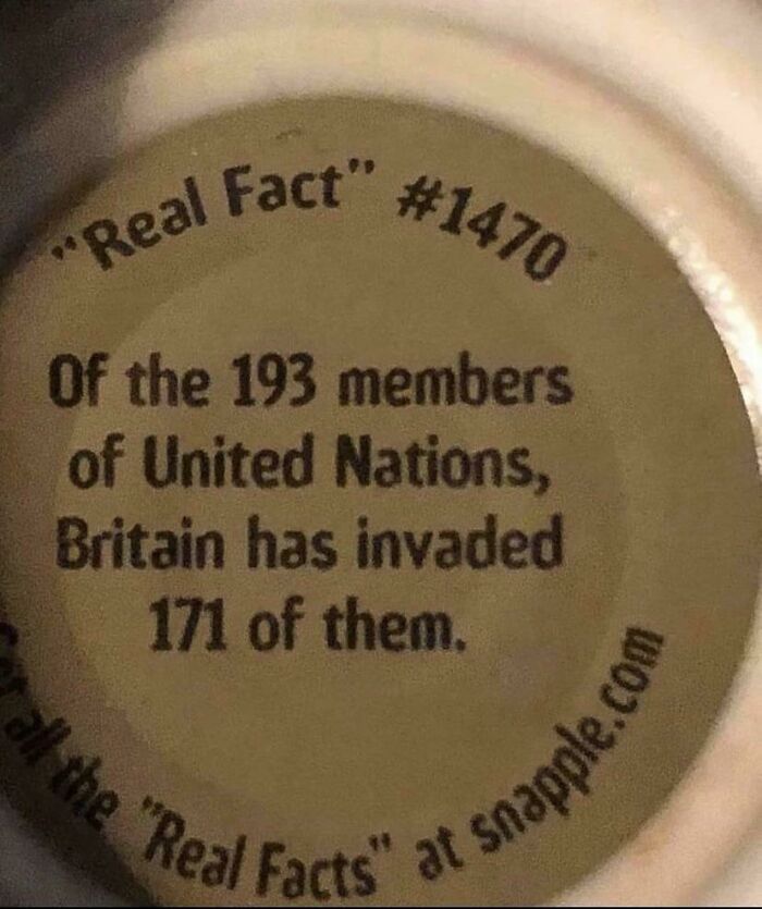
Image credits: Nfl-nbA
#5 Thought This Sub Would Appreciate A Window Seat Picture Of The Maldives
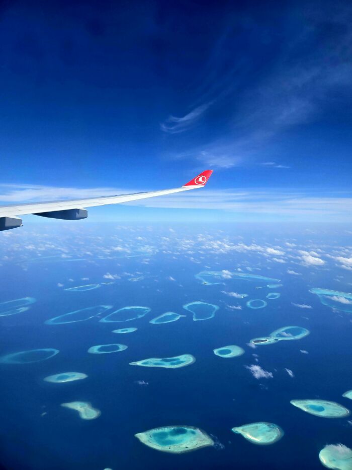
Image credits: freecodeio
#6 LA Is A Wasted Opportunity
Imagine if Los Angeles was built like Barcelona. Dense 15 million people metropolis with great public transportation and walkability.
They wasted this perfect climate and perfect place for city by building a endless suburban sprawl.
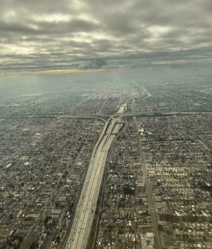
Image credits: villehhulkkonen
#7 The Sahara Desert After Heavy Rain In Morocco
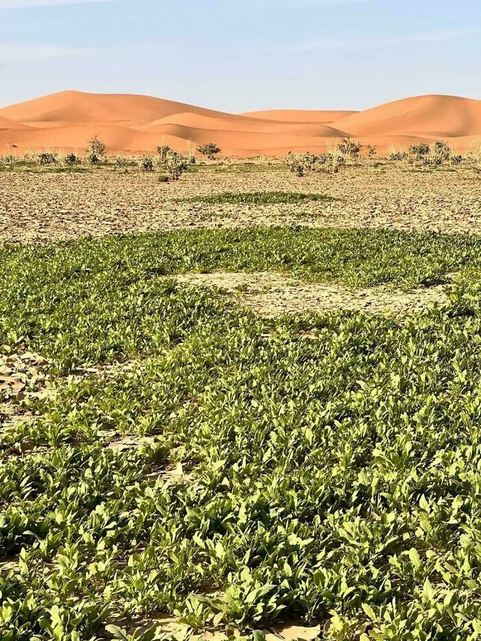
Image credits: Specific-Minimum-185
#8 Friendly Reminder Of Just How Ridiculously Big The Pacific Ocean Is
Image credits: Thin-Pool-8025
#9 The Scottish Highlands, The Appalachians, And The Atlas Are The Same Mountain Range, Once Connected As The Central Pangean Mountains
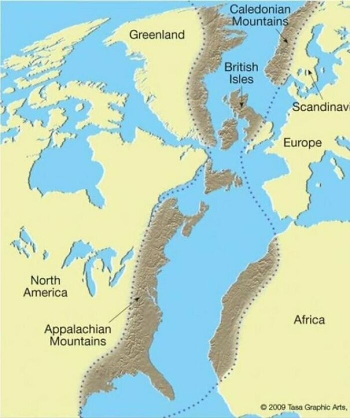
Image credits: reddit.com
#10 Mt. Fuji From The ISS
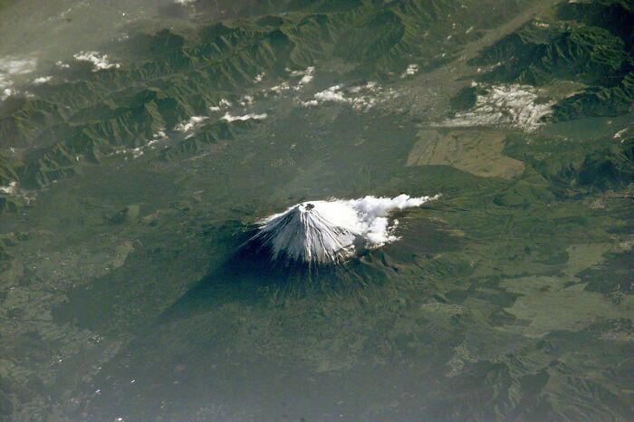
Image credits: ZannaSmanna
#11 There's A Lake In Finland That Looks Like Finland!
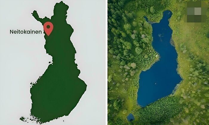
Image credits: Master1_4Disaster
#12 The Parking Lot By My House Has Been Flooded Long Enough For Google Maps To Recognize It As The Natural Wonder That It Is
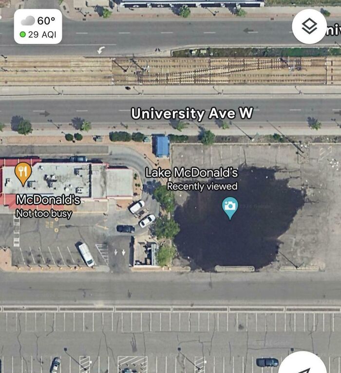
Image credits: kingbob123456
Maps play a crucial role in the study of geography. From cave wall drawings to inscribed clay tablets, a variety of maps have existed for decades. The oldest ones in the world date back to the 9th Century and were created in Babylon. By the 20th century, satellite imagery and aerial photography had transformed mapping into a sophisticated and precise science.
#13 While I Was On The Highway I Witnessed The Eruption Of Etna Live... It Was Exciting
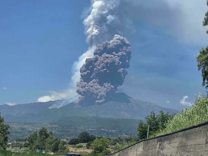
Image credits: xDavid83x
#14 Namib Desert: Yesterday’s Underrated Desert
Fog is the primary source of water in the site, accounting for a unique environment in which endemic invertebrates, reptiles and mammals adapt to an ever-changing variety of microhabitats and ecological niches.
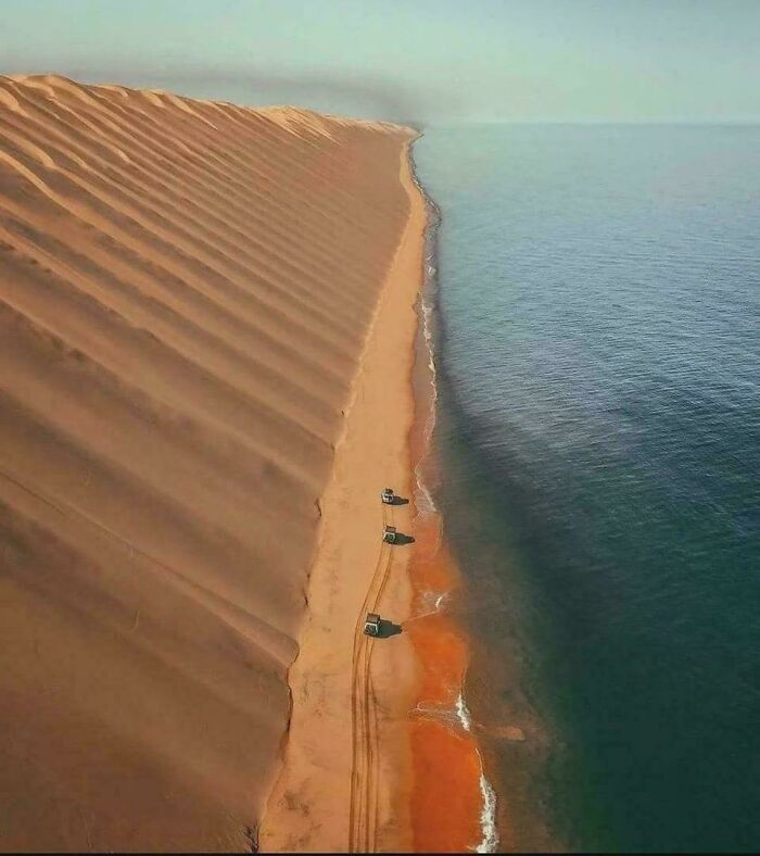
Image credits: mabaezd
#15 Devil's Tower, Wyoming. A Large Butte, It Reaches 5112 Feet Above Sea Level
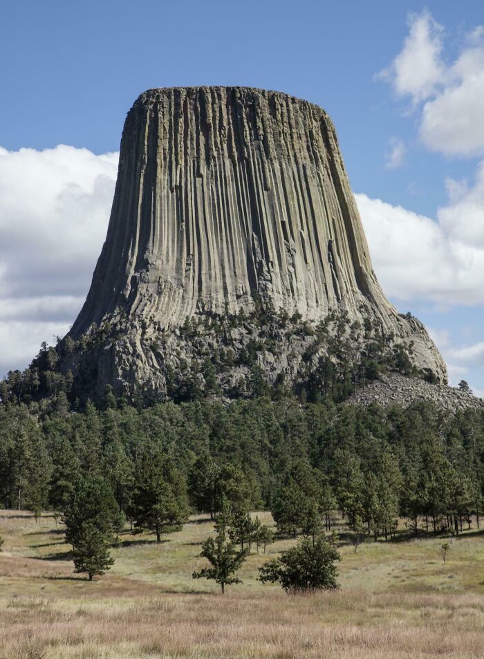
Image credits: Jonnyboo234
#16 No Hurricane Has Ever Crossed The Equator
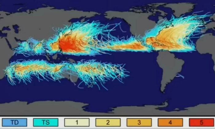
Image credits: Hockputer09
#17 50 Percent Of Canadians Live South Of The Red Line
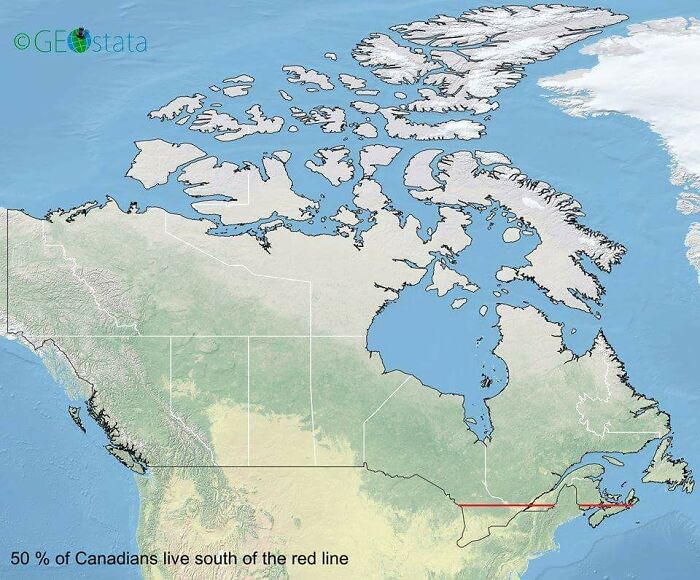
Image credits: Outlaw_Genitals
#18 Chances Of Being Born In Each Continent
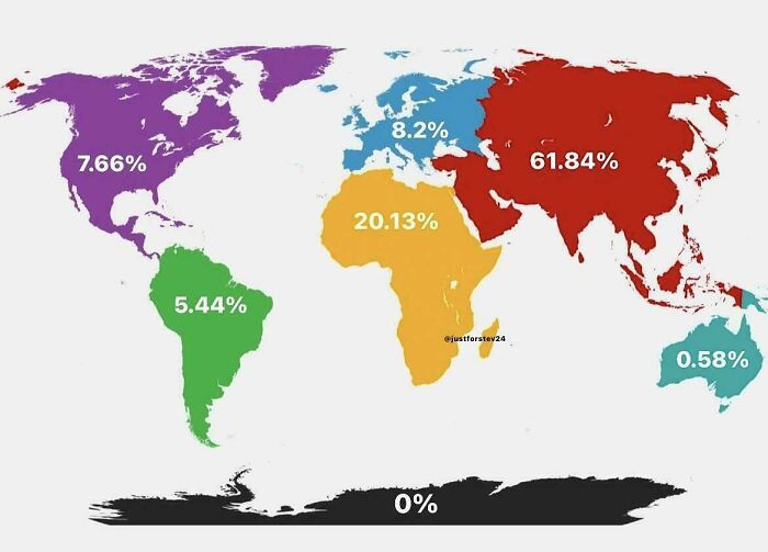
Image credits: timroAlabamasis
#19 Topography Of The Indian Subcontinent
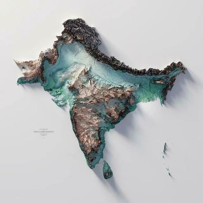
Image credits: KingLeopldII
#20 Look At This Curiosity!
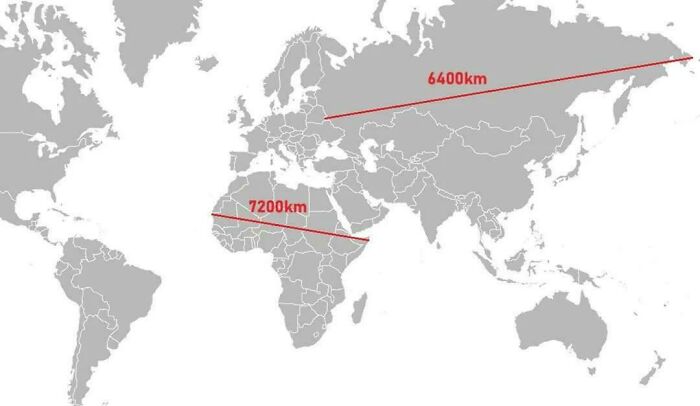
Image credits: CzarEDII
#21 This Person Really Took The Time To Travel To The Right Spot
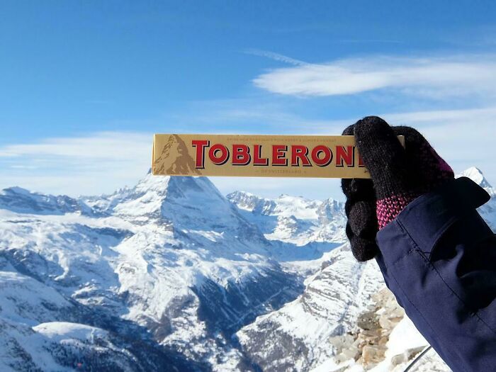
Image credits: kajola1969
#22 A Modern Photo Compared With A Photo Taken Over A Century Earlier In The Same Place
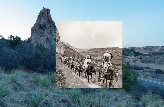
Image credits: birdyroger
#23 [Close-Up View] Of Antarctica From Space
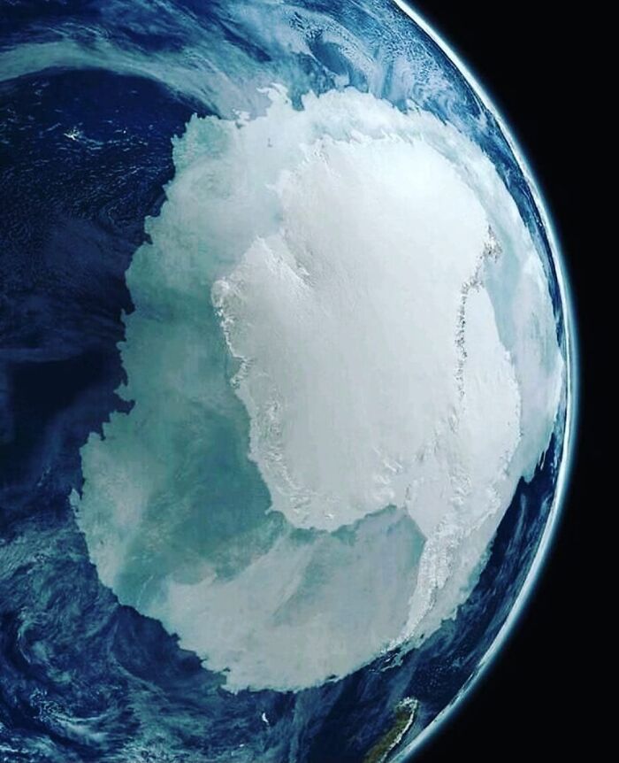
Image credits: reinascythe7
#24 Never Knew These Big American Cities Were So Close Together
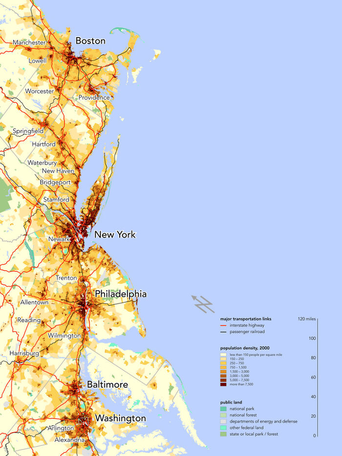
Image credits: Smoke_Me_When_i_Die
#25 North Korea Is Strange
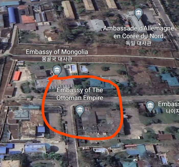
Image credits: mcherycoffe
#26 How Antarctica Would Look If All The Ice Melted
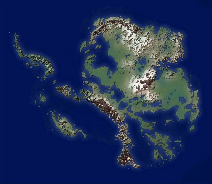
Image credits: Geo-ICT
#27 Fun Fact About Patagonia That Most People Don't Know: 90% Of It Looks Like This
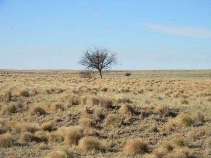
Image credits: spait09
#28 Bro Why Not Use The Metric System?
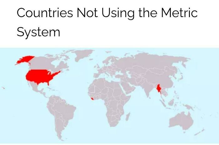
Image credits: Master1_4Disaster
#29 Huge Landslide Causes Whole Village To Disappear In Switzerland
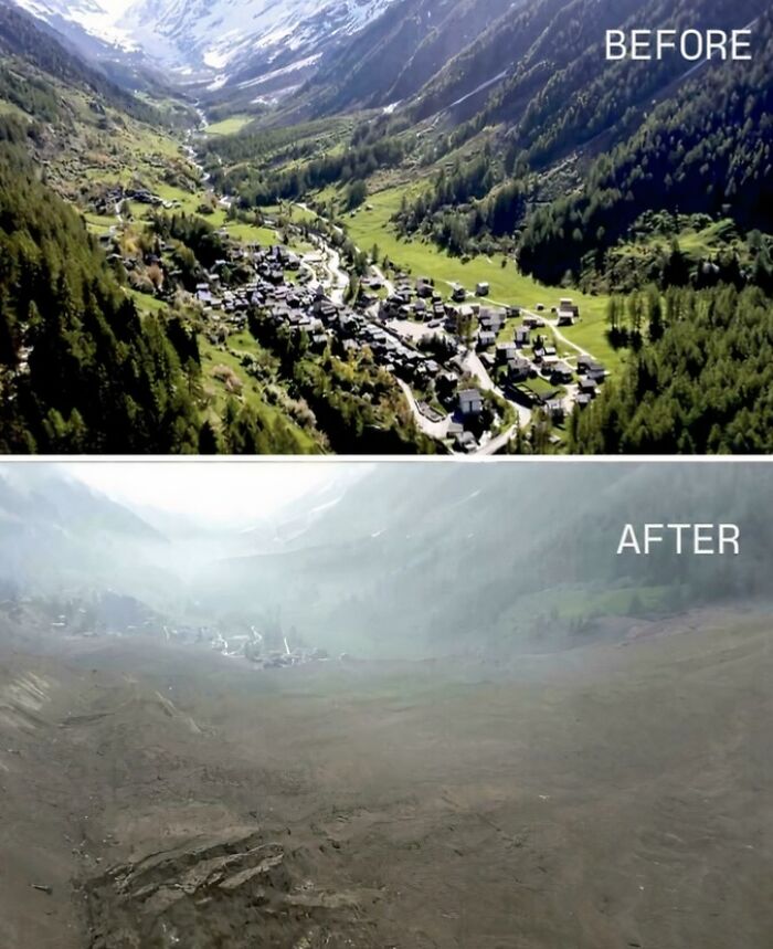
Image credits: BalanceNo1216
#30 A Map Of Nations When Asked The Question "Which Country Is The Largest Threat To World Peace?" - In 2013
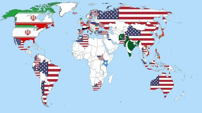
Image credits: history-remaster
#31 Europe Used To Look Like This!
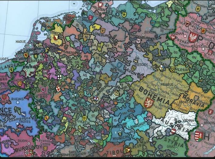
Image credits: Master1_4Disaster
#32 Madagascar Is Way Bigger Than I Thought
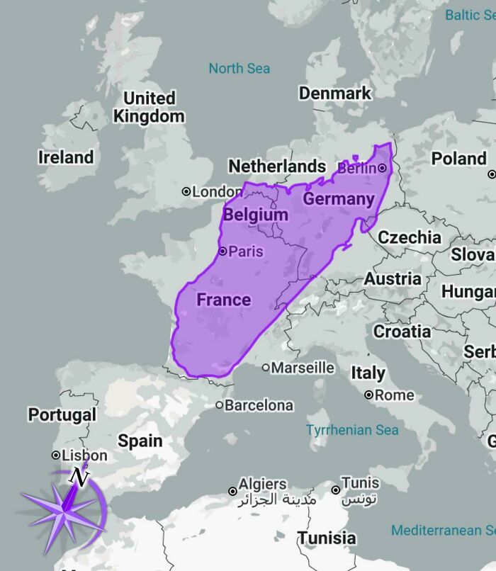
Image credits: LordLorkhan
#33 All Cities In The World
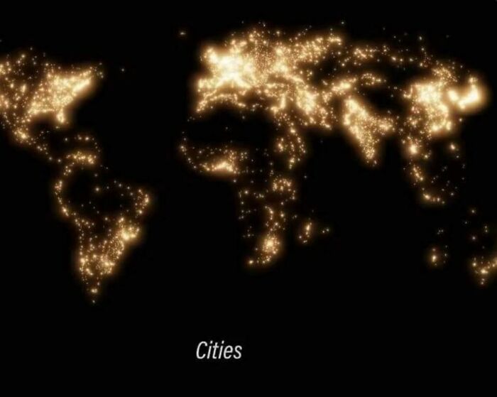
Image credits: Master1_4Disaster
#34 Who Owns More Wealth, The Bottom 80% Or The Top 0.001%?
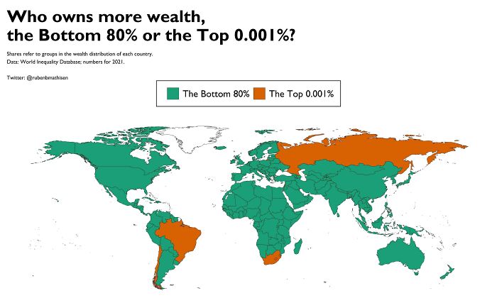
Image credits: AravRAndG
#35 I Feel As If Someone Just Got Bored Of Naming Things Here

Image credits: TastyMiscarriageSmeg
#36 Cross Sea Is A Very Beautiful And Rare Phenomenon That Happens When There Are 2 Wave Systems In The Sea Moving At Oblique Angles
It might be beautiful from above, but if you get caught in these waves, your vessel can easily turn upside down or lose its way.
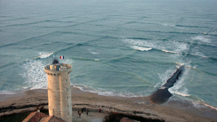
Image credits: JesseBBrown
In addition to making up over 97% of the Earth’s water, oceans also cover 71% of the planet’s surface. The Pacific Ocean, which is the largest of the five major oceans, makes up 31% of the surface and averages about 13,000 feet in depth. Second in size is the Atlantic Ocean, which covers 20% of the planet’s surface. Surprisingly, only 5% of the world's oceans have been explored, with the other 95% remaining a complete mystery.
#37 The Actual Map Of Ship Traffic
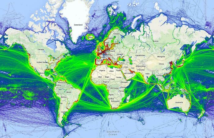
Image credits: harrison822
#38 The Roman Empire Administrative Divisions In 395 Ad
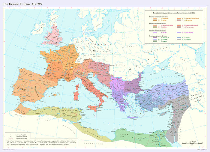
Image credits: M-Rayusa
#39 Every Territory England, Great Britain, And The UK Ever Controlled
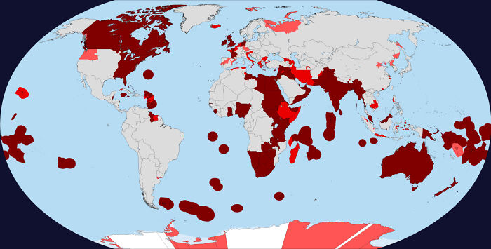
Image credits: bluesheepreasoning
#40 Mean Age Of Women At Birth Of First Child
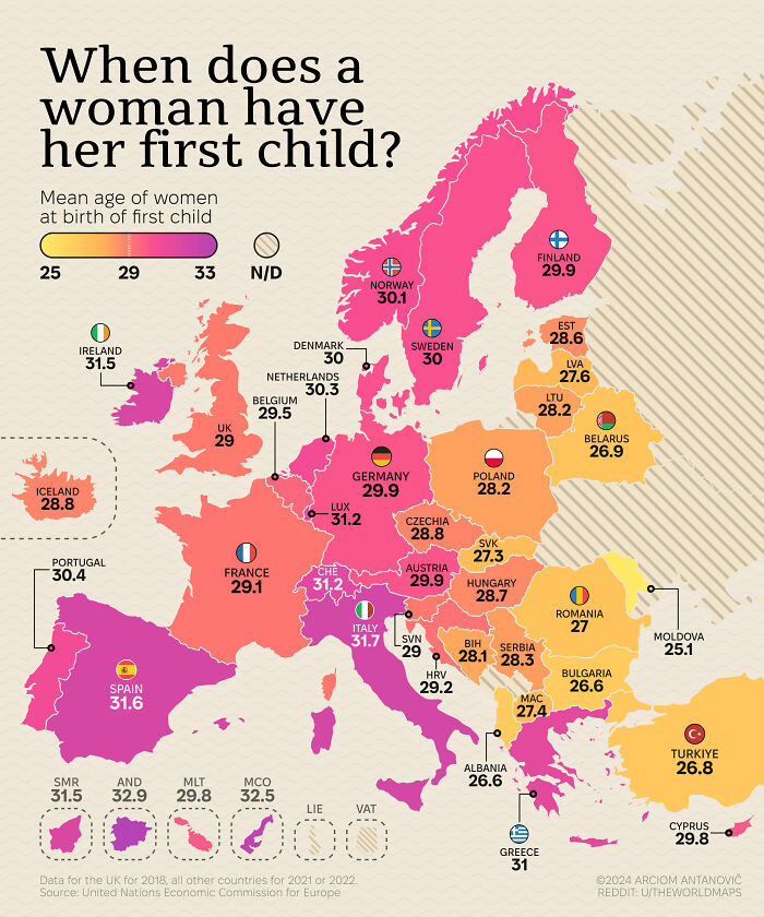
Image credits: theworldmaps
#41 Estonia Is The Northernmost Country In The World With No Part Of It Being In The Arctic
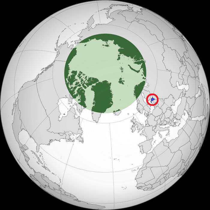
Image credits: Double-decker_trams
#42 U.S. Counties With A Life Expectancy Above 80 Years
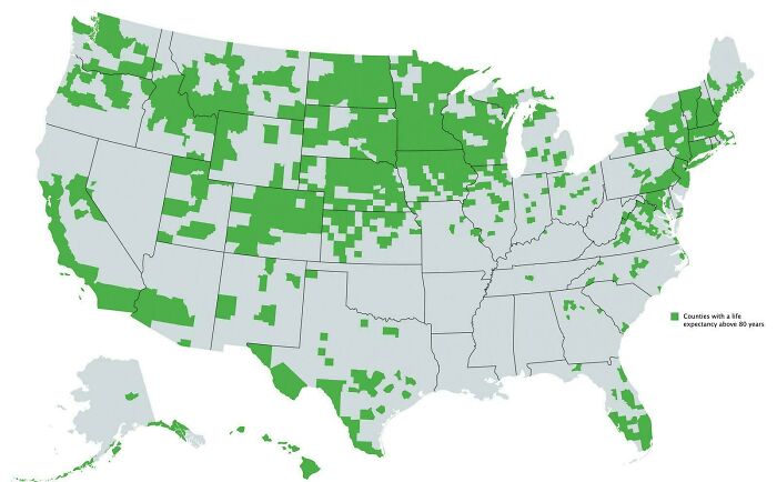
Image credits: Nidzovantije
#43 Countries With State Religion
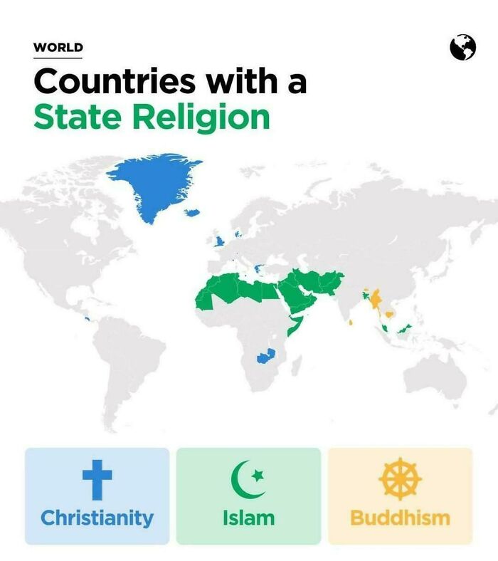
Image credits: Ill_Tonight6349
#44 American Fast Food Chains In Europe
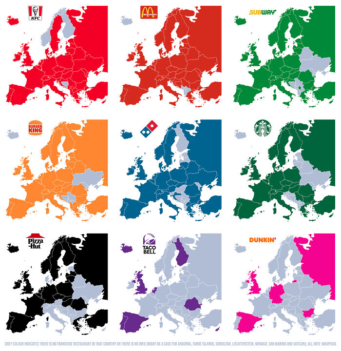
Image credits: PepperBlues
#45 Asia (And Surrounding Areas) In 1444
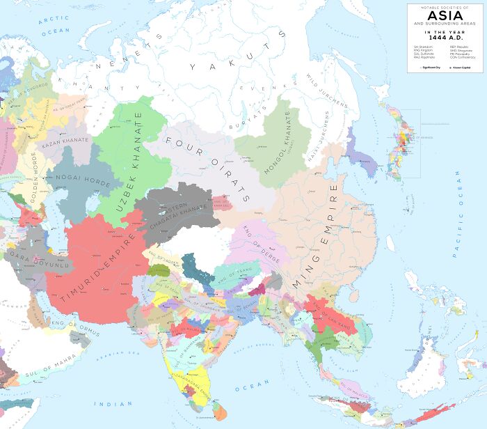
Image credits: girthynarwhal
#46 Nato As Of 2024
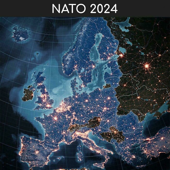
Image credits: biswajit388