No major progress has been made to designate flood risk areas along small and midsize rivers even though the rivers burst their banks and flooded when Typhoon No. 19 hit the nation last October. According to a nationwide Yomiuri Shimbun survey, 4,367 river areas need to be given the designation.
As of Sept. 1, 3,608 areas were designated as prone to flooding, but this figure needs to be doubled. Without such a designation, municipalities and other entities cannot create hazard maps that include information on the rivers. This could delay evacuation in an emergency.
About 20,000 rivers are under the administration of prefectural governments. Prefectural governments are obliged to designate flood risk areas along 1,678 rivers of them, such as those with large basins, under the Flood Control Law. As for the remaining 18,796 small and midsize rivers, prefectural governments decide whether flood prone areas need to be designated along them. Over the past year, 12 prefectures newly designated 689 river areas, an increase of only 20%.
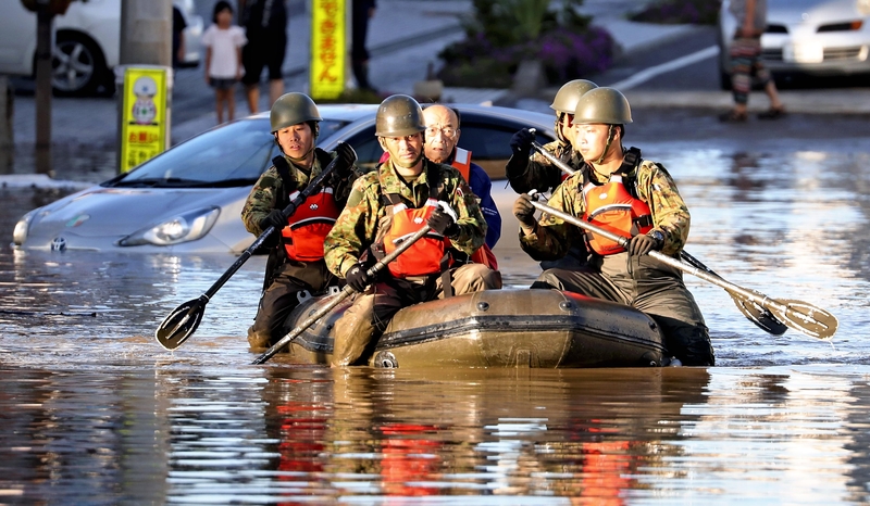
Last year, Typhoon No. 19 caused 43 small and midsize rivers to burst their banks in six prefectures, including Miyagi and Fukushima. Flooding of nine of the rivers, in Tochigi and Saitama prefectures, caused damage across wide areas as work to designate them as flood prone had been delayed. In Saitama Prefecture, where facilities including homes for the elderly suffered flood damage, the prefectural government designated flood prone areas along all 148 small and midsize rivers in the prefecture after the typhoon. According to the Yomiuri Shimbun survey, 23 prefectural governments said they need to increase the number of designated areas, citing specific figures.
However, the designation requires accurate surveys to collect topographic data, as well as assessments and analysis of damage from flooding. Securing funds and a workforce is a challenge for the prefectural governments.
"Tens of millions of yen are needed. The work cannot be done without state subsidies," the Akita prefectural government said in the poll. The Oita prefectural government said the designations involve a considerable amount of work as there are 501 small and midsize rivers in the prefecture.
In a 2015 revision to the law, the yardstick in terms of projected rainfall for flood hazard areas was changed from "once in 100 years" to "once in 1,000 years." Prefectural governments such as Iwate, Shizuoka and Okayama are prioritizing a review of areas along rivers with large basins that meet the conditions for designation.
On the other hand, the Fukui prefectural government regards Inokuchi River, which runs through Tsuruga, as a large river rather than a small river, citing the fact that Tsuruga city hall is located in the projected flood area, and has made it subject to the obligatory designation for flood hazard. The Gunma, Yamanashi and Niigata prefectural governments also plan to review the classification of rivers based on population density in the basins and other factors.
Read more from The Japan News at https://japannews.yomiuri.co.jp/