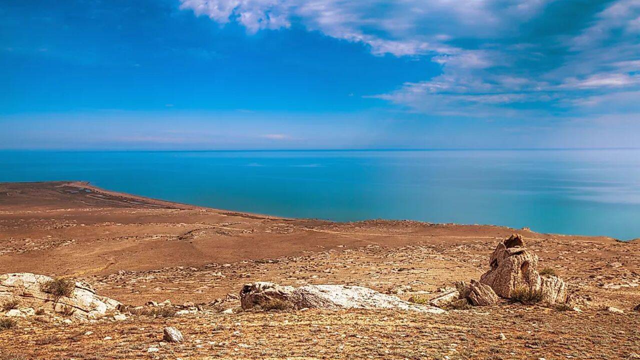
The Caspian Sea occupies an unusual place on the map. It carries the name of a sea, stretches beyond the horizon in every direction from many points along its shoreline, and contains salt water rather than fresh. Yet geographers generally place it in a different category altogether. Despite its immense size and maritime appearance, the Caspian is usually regarded as a lake.
At first glance, that sounds like a technical distinction with little significance outside geography textbooks. In reality, the question has influenced international negotiations, resource ownership, fishing rights and border arrangements among the five countries that surround it. The Caspian sits between Europe and Asia and remains one of the most unusual bodies of water on Earth, largely because it does not fit comfortably into ordinary definitions.
Get breaking news anytime, anywhere. Download the TOI app now!
Caspian is Sea classified as a lake, not a sea: Here’s why
The simplest explanation comes down to connection. Most seas are linked to the global ocean system. Some are attached directly, while others communicate through narrow channels or straits. Their waters are part of a wider network that ultimately joins the world's oceans.
The Caspian does not share that connection. It is entirely enclosed by land, bordered by Russia, Kazakhstan, Azerbaijan, Turkmenistan and Iran. No natural waterway carries its waters to any ocean. Rivers flow into it, but none flow out.
This places it within a category known as an endorheic basin, a closed drainage system where water enters but has no natural route to the sea. Instead, water leaves mainly through evaporation. By the standard geographical definition used by many scientists, that makes the Caspian a lake, regardless of what its name suggests.
Ac cording to WorldAtlas , rivers continuously feed the basin, with the Volga River supplying the overwhelming majority of incoming water, while evaporation acts as the primary means by which water is lost from the system.
Why the Caspian Sea earned its name despite being a lake
The label "lake" often creates a misleading image. People tend to picture relatively modest freshwater bodies surrounded by land. The Caspian bears little resemblance to that stereotype.
Its north-to-south length extends for roughly 1,200 kilometres, creating a vast expanse where opposite shores are often invisible from land. Strong winds can generate substantial waves, and many coastal settlements have historically developed cultures more associated with maritime regions than inland lakes.
Its water also contains salt. While far less saline than the open ocean, it is not freshwater. Conditions vary across the basin, with northern areas receiving large volumes of river water and remaining comparatively less salty, while some isolated sections elsewhere contain significantly higher concentrations of salt.
These characteristics explain why generations of travellers, merchants and mapmakers referred to it as a sea. The name endured long before modern geographic classifications became standard.
What separates the Caspian Sea from the world’s oceans
Salt water alone does not determine whether a body of water qualifies as a sea. Several recognised lakes around the world contain large quantities of dissolved salts. The Dead Sea and Utah's Great Salt Lake are among the best-known examples. Their salinity developed because water enters enclosed basins carrying minerals, while evaporation removes water and leaves those minerals behind.
The Caspian follows the same broad pattern. Its isolation from the global ocean is the defining factor. According to WorldAtlas, geological changes severed the basin from the ancient marine systems to which it was once connected millions of years ago. Since then, the Caspian has operated independently. Its water level does not rise and fall in response to global ocean conditions. Instead, fluctuations depend largely on regional rainfall patterns, river inflows, evaporation rates and human activity across its drainage basin. That independence is one of the strongest arguments for classifying it as a lake rather than a sea.
The ancient ocean origins of the Caspian Sea
The debate does not disappear entirely because the Caspian possesses characteristics that distinguish it from most lakes. Beneath parts of its southern basin lies geological evidence suggesting remnants of ancient oceanic or transitional crust. This is unusual. Many lakes occupy depressions within the continental crust, whereas the Caspian appears to preserve traces of a much older marine environment.
Its origins are tied to prehistoric seas that once spread across large areas of Eurasia. The basin represents a surviving fragment of those vanished waters, separated from the ocean through tectonic shifts and changing sea levels over geological time.
According to WorldAtlas, geophysical studies have identified dense crustal structures beneath the southern section of the basin, contributing to ongoing discussion about the Caspian's geological identity.
These ancient roots help explain why the Caspian differs from familiar inland lakes. They also help explain why the argument over its classification has persisted for so long.
Why the Caspian Sea is the world’s largest lake
When measured by surface area, the Caspian occupies a category of its own. Covering roughly 371,000 square kilometres, it is by far the largest inland body of water on Earth. No other lake approaches its scale. Even Lake Superior, the largest freshwater lake by surface area, is considerably smaller.
The Caspian also contains an extraordinary volume of water. According to WorldAtlas, it accounts for roughly 40 to 44 per cent of the world's inland lake water by volume. Its southern basin reaches depths exceeding 1,000 metres, making it one of the deepest lakes on the planet, although it remains shallower than Siberia's Lake Baikal.
Those statistics often surprise people because the Caspian is so frequently discussed as a sea. In purely geographical terms, however, it surpasses every other lake in size.