IT'S been two years or so since offshore dredging emerged as the source for sand to replenish the perennially endangered waterfront at the southern end of Stockton Beach.
In October 2020, I wrote a two-page Saturday news spread titled "Stockton's loss is Nobbys' growth", which looked at the situation at the two beaches from a surfer's point of view.
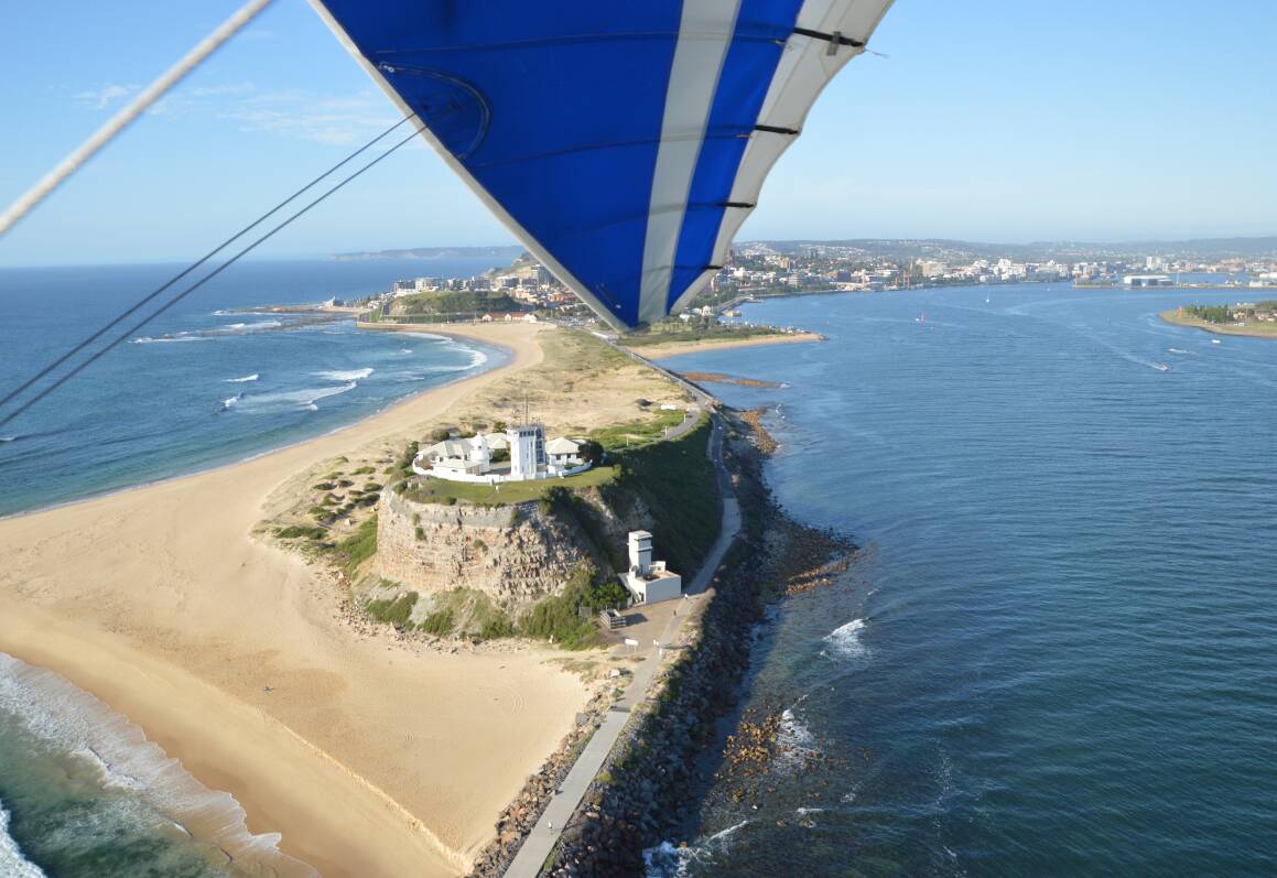
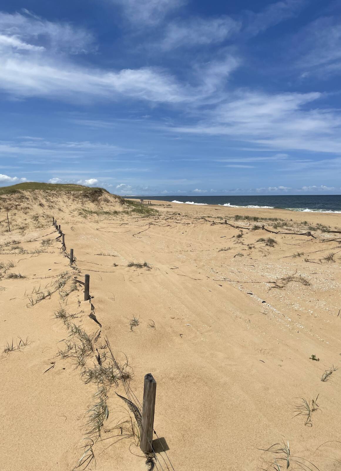
At the time, The Spit - a triangle of sand at the northern end of Nobbys, just out of shot in the adjacent hang-glider picture - had built up to such a point that you could walk on the lower tides to the big rocky outcrop that is normally well off the shore in deep water.
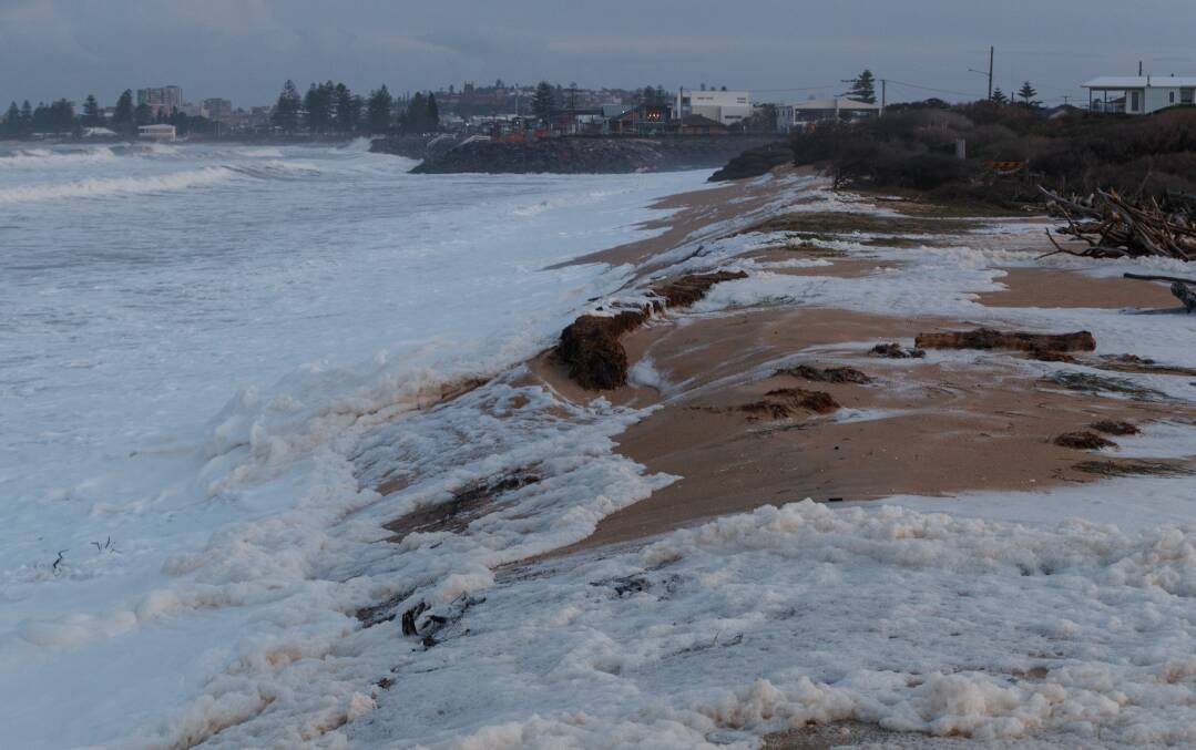
That sand has gone and returned and guttered again in the meantime, while, as everyone knows, the troubled end of Stockton Beach has been repeatedly battered by a succession of big swells.
I noted at the time that while south Stockton was certainly eroding, it was a very different picture for most of Stockton Bight, where the sand (to use the geological term) is definitely accreting.
Building up, in other words. I know the decision makers have opted for offshore dredging, but I still think using land sand is a much better idea than disturbing an ocean floor off Stockton that's already suffered decades of disturbance from the steel chains and otter boards of fish and prawn trawlers.
Not to mention the material dredged from the Port of Newcastle and dumped every two to three hours, on average, offshore at the aptly named "spoil ground" some three kilometres to the south-east offshore - typically about 400,000 cubic metres a year.
As various Newcastle Herald articles about Stockton have reported, the main "littoral" or close to shore movement of sand on the NSW coast is south to north.
The "natural" flow of sand that once washed across the Hunter River mouth and onto the south Stockton shore (back when Nobbys was an island) is now disturbed by breakwalls either side of the harbour.
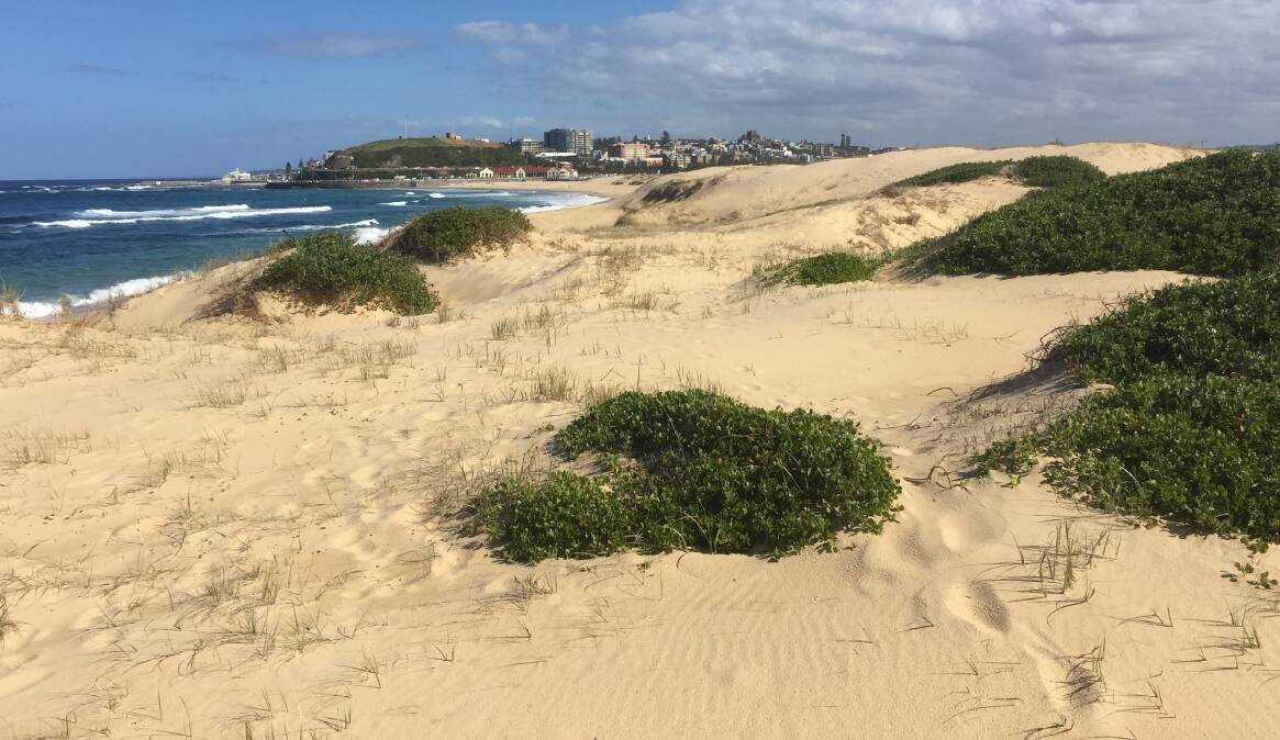
Some sand is pushed wider, and ends up settling onshore starting at about the now-closed Stockton Centre, and more noticeably from Fern Bay north.
Some settles on the Nobbys side of the harbour.
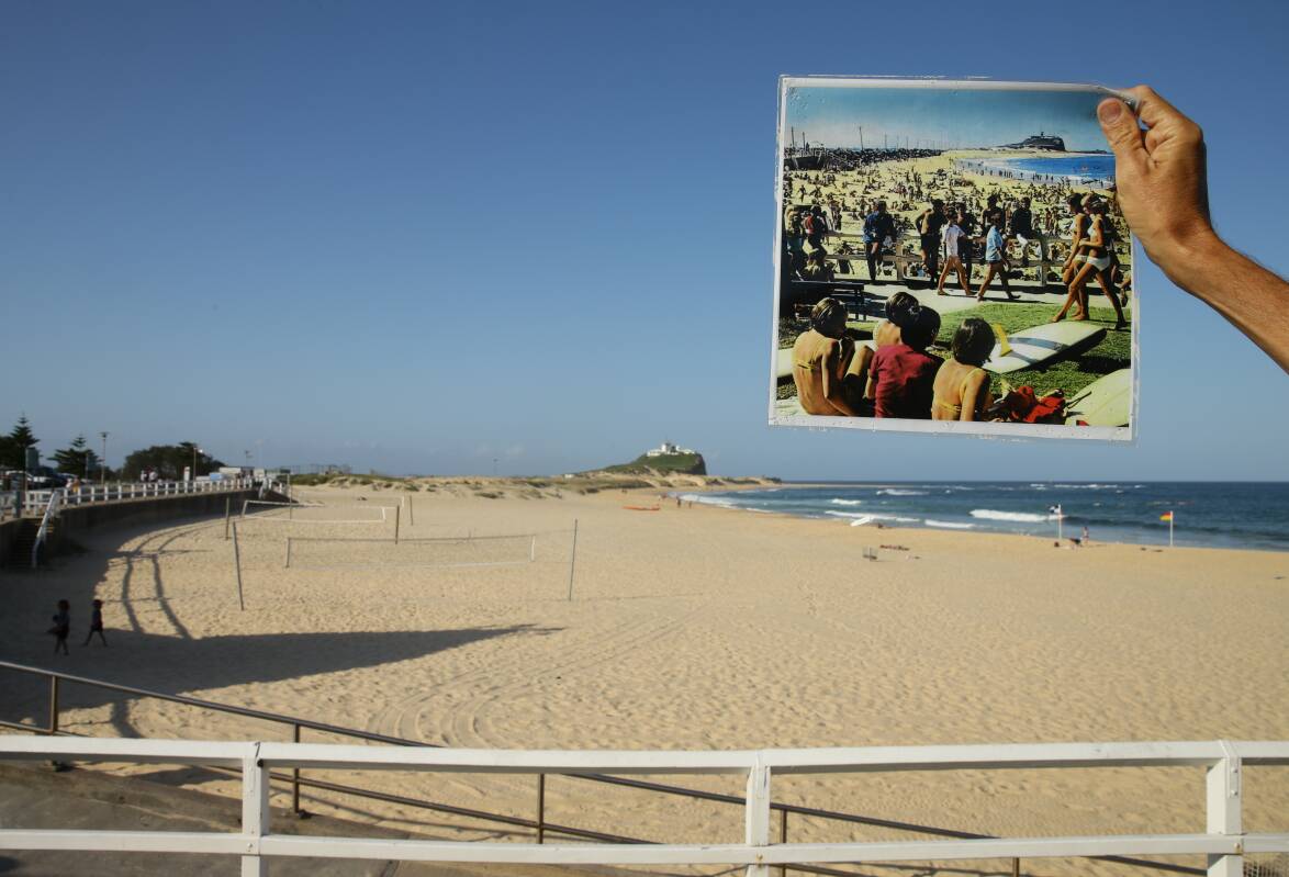
Regardless of the state of The Spit, Nobbys Beach is still growing. Look at the accompanying photograph showing the beach in 2020 and 1967. Everything from Fort Scratchley to the end of the breakwall is artificial, and so sand, which would otherwise end up at Stockton, never crosses the river.
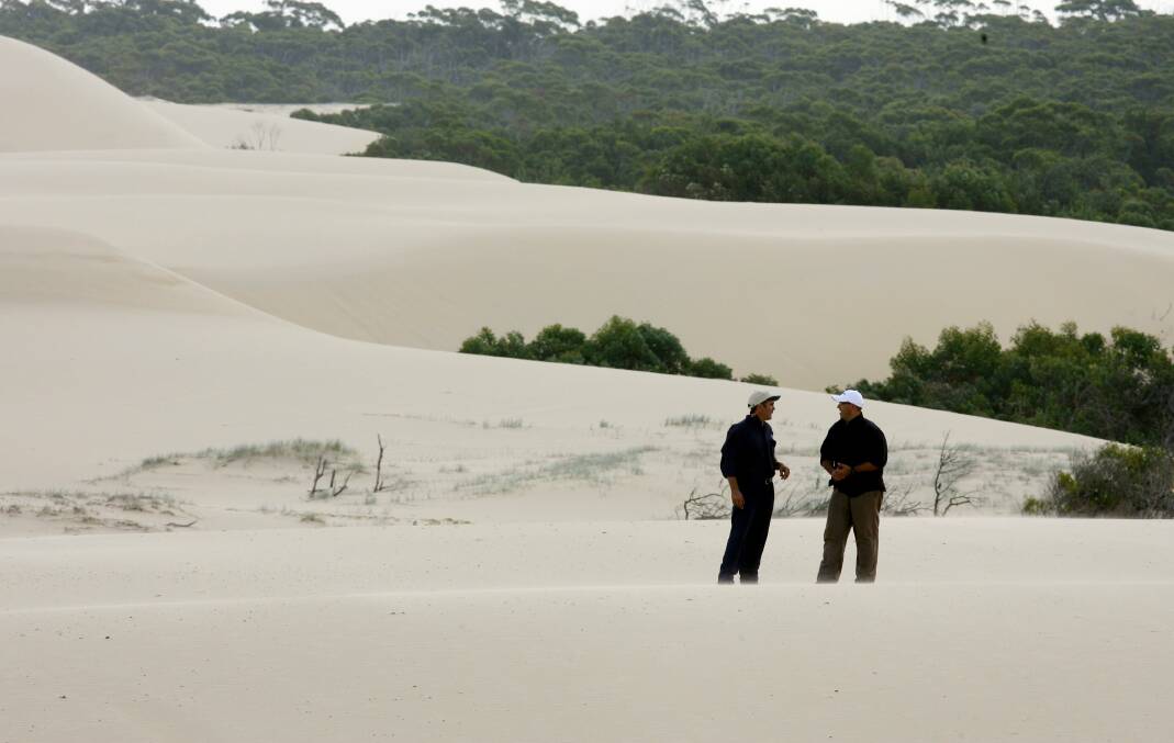
Sure, there's another erosion cycle taking place at the same time, but the net effect is more and more sand at Nobbys, a steady loss of sand at Stockton for the length of the township, and sand growth north of the old Stockton Centre, to the point where the dunes around Williamtown are rolling inland at noticeable rates.
Expert reports are one thing, but surfers watch waves.
They learn how they break. Why they break. And, more importantly, in this instance, why they don't break.
Look at Newcastle Baths. You can have solid surf either side at the Cowrie Hole and Newcastle Beach, but the rock shelf behind the baths will have no whitewater, because the sand is gouged away, or never built up, and the water is too deep for all but the biggest waves to break. (The "rogue" waves that pluck off rock fishers everywhere.)
At Stockton, big swells, especially those hitting unimpeded from the nor-east, batter the temporary sand-bagging and cut deep gutters in front of the rock walls.
Sand does build back, or accrete, but the net trend is erosion.
Sand absorbs wave energy. Rock reflects it.
So as the swells hit the rock walls along the (former) beach, they bounce out to sea, taking more sand with them.
The end result could be a Newcastle baths scenario off the rock walls, and increased erosion at their ends, where the swell hits soft sand.
But only, as I've said, south of about Fort Wallace. North from there to Anna Bay is so much sand you'd never notice the amount needed to fix Stockton.
The politically attractive thing about offshore dredging is that it's largely out of sight, so out of mind. That's if the permit ever arrives.
Much of this area of coast has already been mined for rutile and other minerals - the Myall Lakes National Park is a prime example - and sand-mining was once a big environmental controversy here.
That era left the practice with a bad name.
But this is a different situation. It's an emergency.
All we're talking is a moving pond, a dredge, and a pipe to pump the slurry to its destination. It could be trucked, but a slurry pipe seems a lighter touch.
Remember, Nobbys is not a natural beach.
The sand beside the breakwall is not only getting wider, the dunes are getting noticeably higher.
Stockton's erosion has nothing to do with sea levels, otherwise it would be more widespread.
Taking sand from the dunes at the foot of Nobbys would keep this growing beach "in check", so to speak.
The far greater volumes available north of Stockton would provide a royalty to the Worimi.
It's a specific response to a single issue - the potential inundation of residential Stockton - while the coast north and south of the town more than holds its own.
That's my amateur view. I'm interested in what the experts have to say.