Heavy snow fell across the UK this week, burying areas under up to 30cm amid warnings of the “worst snowfall in a decade”, with more expected soon.
Storm Goretti swept across the Channel to the UK on Thursday evening and into Friday, battering the Isles of Scilly and Cornwall with hurricane-force winds and covering much of the UK with snow.
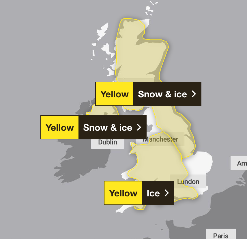
The Met Office issued a number of weather warnings for snow, ice and rain across much of the country on Friday, as people faced travel disruption and schools closed.
But while Storm Goretti slowly edged away towards the end of Friday, it won’t be long until the UK can expect to see its next spell of snow.
Three yellow snow and ice warnings have been extended into Saturday by the Met Office. The warnings cover Scotland and large swathes of Northern England, the Midlands, and parts of the South West, as well as Wales and Northern Ireland.

A yellow warning for snow and ice came into force from midday on Friday and was extended until 3pm on Saturday, with further snowfall possible across parts of northern England and much of Scotland, while a widespread risk of ice is expected to cause disruption.
A separate yellow warning for ice is covering large parts of England and Wales from midday on Friday until midday on Saturday as partially thawed snow refreezes, accompanied by wintry showers and freezing fog.
In Northern Ireland, a yellow warning for snow and ice came into force from 5pm on Friday and runs until 11am on Saturday, with the Met Office warning of icy patches and some hill snow.
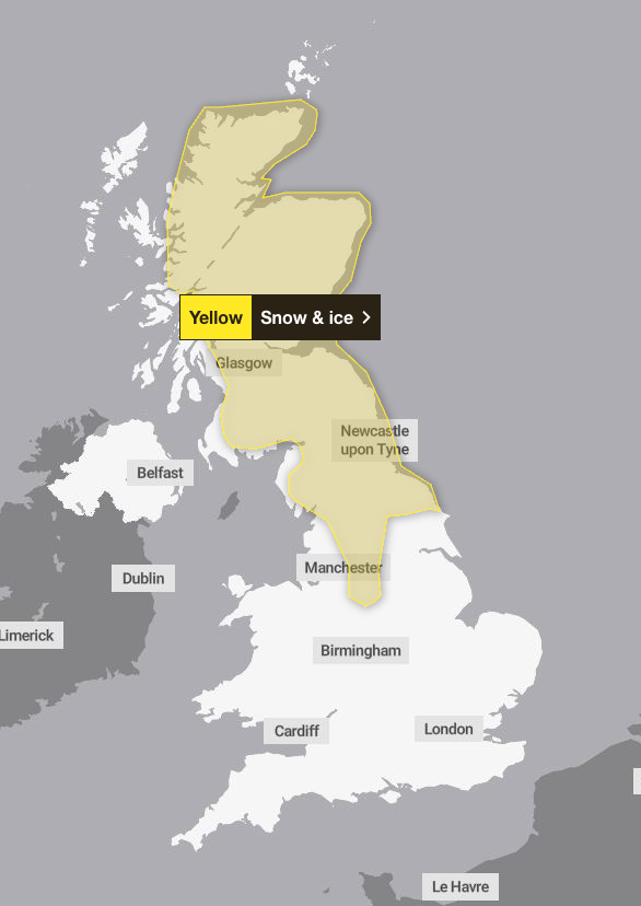
A yellow weather warning for snow and ice has also been issued across Scotland, the north of England, and parts of the Midlands for Sunday. The Met Office said parts of the affected area could see as much as 30cm of snow, with 5cm likely more widely, with the alert running from 2am until 3pm.
Forecasters say the band of snow will move across the warning area on Sunday morning, with high ground once again most likely to see the most intense snowfall.
Temperatures are expected to hover largely above freezing, at around 2C in most of the affected areas.
People are being urged to plan travel routes ahead of time as snow is set to bring “possible delays” that could leave people and cars stranded. The Met Office has also told residents in the affected areas to prepare for potential power cuts, which it said could also impact mobile phone coverage.
Met Office five-day weather forecast
Saturday
Wintry showers will continue to affect some coastal countries, these will become increasingly confined to the north and east later. Elsewhere, dry with variable amounts of cloud and remaining frosty all day in places. Much lighter winds than of late.
Saturday evening
Mostly dry overnight with a widespread frost, particularly in the east. Skies clouding over across western areas with outbreaks of rain, preceded by some sleet and snow in the north.

Sunday
Further wet and windy weather moving east, with some snow across the north. As temperatures recover, the snow will become confined to high ground later. Strengthening winds with coastal gales.
Outlook for Monday to Wednesday
Turning milder into next week, with periods of heavy showers or longer spells of rain. Winds will strengthen at times, though there will also be some occasional brighter interludes.
Minneapolis ICE shooting live updates: Thousands of protesters march nationwide
Weather warnings remain in place across UK after Storm Goretti
Scots face weather warnings for snow, ice, rain and wind throughout Sunday
How AI deepfakes are humiliating teachers and pupils in British schools every day
Founding Grateful Dead band member Bob Weir dies aged 78
Holyrood Budget to focus ‘resolutely’ on people’s priorities, vows Robison