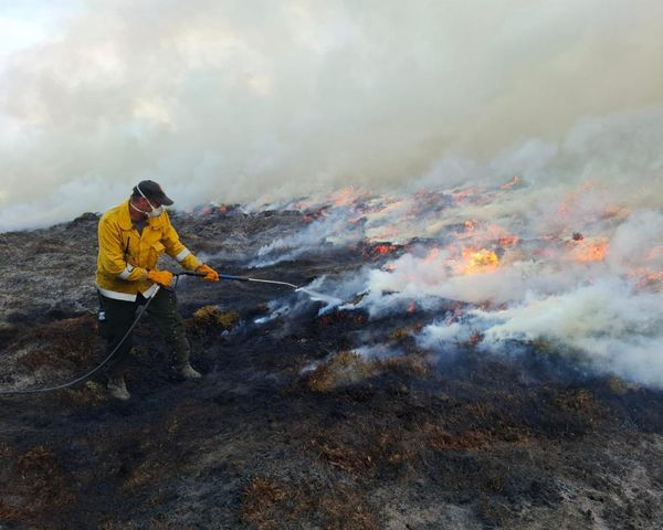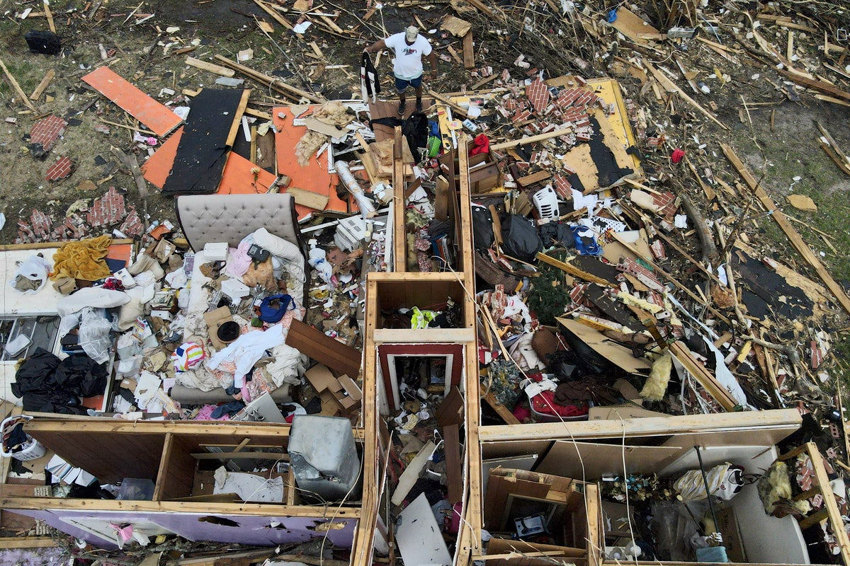
A seemingly relentless series of severe storms, likely with deadly tornadoes, are forecast to rip across parts of America’s Midwest and South over the next couple weeks, especially Friday, meteorologists said.
An unusual weather pattern has set in, last week triggering the devastating tornado that hit Rolling Fork, Mississippi, and meteorologists fear this Friday will be one of the worst days, with much more to come. The National Weather Service said 16.8 million people live in the highest risk zone, and more than 66 million people overall should be on alert Friday.
“It’s pretty darn clear that somebody is going to take it on the nose on Friday,” said Northern Illinois meteorology professor and tornado expert and chaser Victor Gensini. “It’s just a matter of where and exactly when.”
The weather service is cautioning a large area of the country – including parts of Iowa, Missouri, Arkansas, Illinois, Indiana, Kentucky, Tennessee, Mississippi, Alabama, Louisiana, Alabama, Texas, Oklahoma, Ohio, Wisconsin, Minnesota, Michigan, West Virginia, Georgia and Kansas – to be alert for intense thunderstorms, tornadoes and other damaging winds. Big cities in the highest danger area include Memphis, St. Louis, Des Moines and Little Rock.
Gensini fears Friday’s onslaught will be deadly.
The storms are expected to start Friday afternoon and go overnight, which is particularly dangerous because people can't see them coming and often won't seek shelter, weather service Storm Prediction Center warning coordination meteorologist Matt Elliott said Wednesday.
“The storms will be moving very quickly,” Elliott said. “So you won't have a lot of time to react to warnings as well. So now's the time to start preparing.”
Though all the ingredients are there for dangerous storms, it's possible they may not combine precisely enough to pose the threat that meteorologists are warning about, Elliott and others said.
Another batch of severe storms, powered by a “firehose” of unstable waves in the atmosphere that keep flowing from the cold west and combine with moist air from the east, could hit next Tuesday and the next few days after that, said Walker Ashley, another meteorology professor at Northern Illinois and Gensini’s storm-chasing partner.
“You could see these things coming days in advance,” Ashley said. They will be “continual punches, one, two, three, four.”
The weather service is already forecasting another batch of intense storms next Tuesday in the same general area as Friday with fairly high confidence, Elliott said.
At least the first 10 days of April will be rough, said Accuweather meteorologist Brandon Buckingham.
The current persistent pattern of storm ingredients reminds Gensini of the April 2011 tornado onslaught that killed 363 people in six states, hitting Alabama hardest. That was one of the largest, deadliest and most destructive tornado outbreaks in American history, the weather service said.
Even before Friday, "it's been the most active we've seen in several years'' starting around last November, with a large number of winter storms through this year, Elliott said. The deadly storms that hit Rolling Fork were part of that pattern.
Buckingham and the other meteorologists said current conditions come along only once every few years to create the potential for a train of supercells, which spawn the worst of the tornadoes and damaging hail.
Central to this is a fast-moving rollercoaster-like jet stream, the shifting river of air that moves weather systems, such as storms, from west to east. On the west side of the jet stream is extreme cold air and to the east, parked off Florida and Caribbean, is a very warm and dry high-pressure system.
“When you kind of combine the two it kind makes those hairs on the back of your neck stand up,” Buckingham said. “The ingredients are here. They're primed towards the extreme end of things.”
Add to that the Gulf of Mexico, which provides moisture heat and energy for storms, is roughly 2 to 5 degrees (1 to 1.5 degrees Celsius) warmer than average or more, meteorologists said — “on fire,” as Ashley put it.
“The additional warmth and humidity really get these thunderstorms firing up,” Buckingham said.
The worst weather will be "underneath the clashing'' of hot and cold air, a battleground of sort, Gensini said. Friday's lunchtime forecast at Storm Lake, Iowa, is around 67 degrees (19 degrees Celsius) but just 140 miles (225 kilometers) to the northwest, Brookings, South Dakota is forecast to be barely above freezing.
“The greater the temperature gradient, the stronger the storm systems are,” Gensini said.
The winds twirling at opposite directions on the west and east of the jet stream battleground add to the problem, the meteorologists said.
Ashley said current conditions are mostly random weather variability, though he said the hotter Gulf of Mexico and human-caused climate change may have made a small contribution.
“These events have always occurred,” Ashley said. “The question is are we turning the knob a little bit by contributing more moisture, more heat, more instability?”
___ Follow AP’s climate and environment coverage at https://apnews.com/hub/climate-and-environment ___ Follow Seth Borenstein on Twitter at @borenbears ___ Associated Press climate and environmental coverage receives support from several private foundations. See more about AP’s climate initiative here. The AP is solely responsible for all content.