Rain and thunderstorms are forecast to return to eastern Australia, including over flood-hit regions of northern New South Wales and south-east Queensland, ending the longest dry spell many areas have had for a month.
Last month’s widespread rains that were fed from an atmospheric river of moist tropical air dumped persistent heavy rain over towns like Lismore. This time, though, the forecast rain from Wednesday onwards is “going to be all storm-related”, Jordan Notara, a senior Bureau of Meteorology forecaster, said.
A frontal system will move through Sydney on Wednesday morning, bank around the Blue Mountains and form a line of storms up through the Hunter Valley and the mid-north coast, he said. Thursday’s unstable conditions will shift further north, with the northern tablelands rather than Lismore more likely to get a soaking.
Friday, though, is where the “problem comes in”, as uncertainties between weather models create a range of projections about the location and quantity of rain, Notara said.
Eastern Australia, but especially the NSW coast looking at rain totals of 100mm or more accumulating over the next eight days. @BOM_au pic.twitter.com/6N4PiAqplf
— Peter Hannam (@p_hannam) March 22, 2022
“We have still got quite a lot of moisture coming across,” he said. “There is obviously a risk that in isolated areas of the state, you could get a high amount of rainfall in a small pocket on any of the days into the next seven days really.”
As of Tuesday afternoon, the bureau was predicting as much as 15mm of rain for Lismore on Thursday, up to 30mm on Friday, with days of showers extending into next week.
For Sydney, falls could reach 10mm on Wednesday before rising to as much as 20mm and 25mm on Thursday and Friday. Inland areas such as Penrith and Richmond, which were flood-hit earlier this month, can expect as much as 35mm on Friday, currently the wettest day in the bureau’s forecast period.
Widespread rain is likely to affect parts of eastern Australia during the coming week. Models are still figuring out where & how much rain will fall. At this stage, parts of Qld & NSW will be affected and some areas are likely to see heavy rain, possibly enough to cause flooding. pic.twitter.com/O4IcCOQ0XE
— Weatherzone (@weatherzone) March 22, 2022
Ben Domensino, a senior Weatherzone meteorologist, said Sydney had collected 931.6mm of rain so far in 2022, placing it the second wettest start to any year.
In 1956, the city had just over 1 metre of rain to this point. Depending on how wet the next five days are, this year may reclaim the top spot, he said. The European model, for instance, is indicating 100mm of accumulated rain by Sunday, but others forecast less.
An upper-level trough is moving in from the west, generating the instability as it hits warmer and moist air coming in off the Tasman Sea. However, forecasters were not seeing any strong suggestions of another east coast low to form offshore, which would likely intensify the rain and wind should one develop.
Sydney's dams remain at 99%-plus full, including Warragamba at 100, thanks to on-going rains over the past week. More to come in the next couple of days. pic.twitter.com/e04D1o6WuT
— Peter Hannam (@p_hannam) March 22, 2022
“A large area in eastern Australia from central Queensland down to southern NSW will be affected by rain and thunderstorms between about mid this week out to early next week,” Domensino said.
“Anywhere that’s recently had flooding in eastern Australia, and anyone living in those areas, should keep a close eye on the forecasts and the warnings over the next week,” he said. “The ground is saturated and there is potential for heavy falls from this system.”
Sydney’s dams won’t need much rain to resume spilling. Across the network they are sitting at 99.6% full, with the main dam at Warragamba at capacity, according to WaterNSW.
#Insurers have received 157,254 #claims related to the #SEQ & #NSW #floods, a 2.3% increase on yesterday’s figs. Based on previous #flood events the estimated current cost of #claims is now $2.359 bn. pic.twitter.com/GVx500qvum
— Insurance Council of Australia (@ICAUS) March 22, 2022
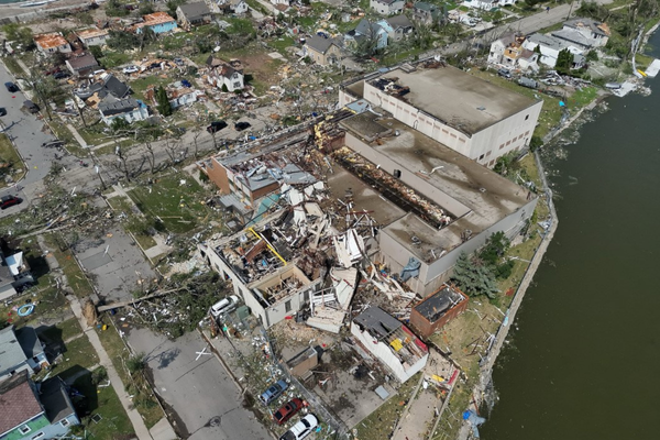
Flood-hit areas in the east coast were still to restore some services. As of 4pm Tuesday, 1,083 customers remained without power across Lismore, Essential Energy said.
“Additionally, 2,748 customers remain disconnected from the network due to flood inundation and are awaiting inspection by a private electrician,” Essential said.
The insured loss claims continued to mount from the NSW and Queensland floods, and now exceeded $2.35bn, the Insurance Council of Australia said. Uninsured losses were higher still.
Tropical Cyclone #Charlotte at its peak as a category-4 tempest. @BOM_WA pic.twitter.com/nLhi3L3IHw
— Peter Hannam (@p_hannam) March 22, 2022
Meanwhile in the west, Tropical Cyclone Charlotte had strengthened to a major category 4 storm in the Indian Ocean, the second such tempest this season.
The cyclone, though, would remain well off the Western Australian coast as it weakened over the next few days. It should later bring some much needed rain to WA.