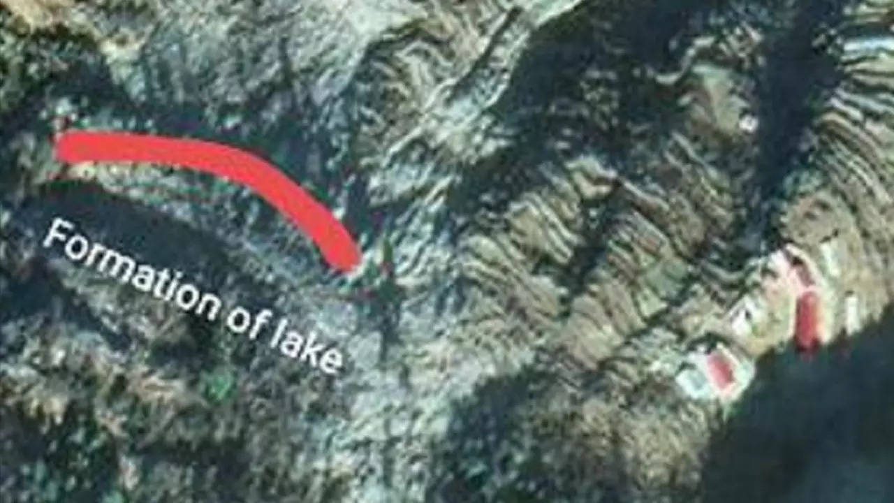
DEHRADUN: Scientists and experts in Uttarakhand conducting ground survey work for a proposed river-linking project at Pindari glacier, the "first-of-its-kind" in the country as reported by TOI earlier, have stumbled upon a v-shaped lake that is a km-long and 50-m wide which has formed near Bageshwar's Kuwari village (situated at an altitude of about 1,700 m) because of landslides in the area in 2013 and 2019.
Due to the impact of the landslides and the lake, the hill slope on which the village is located is slowly sliding down and obstructing the natural flow of the Pindar river, which merges into the Alaknanda at Karnaprayag in Chamoli, an official said.
The official from the Bageshwar district administration, who wished to remain anonymous, told TOI, "Though the water from the lake is seeping naturally right now, it may cause a massive flash flood later, leading to severe damage in settlements along the Pindar and Alaknanda river."
He added, "The lake has formed near the Pindar river, around Kuwari village in Kapkot block. Due to landslides in 2013, the village had already been affected. But after 2019, the landslides intensified. Due to this, the village would soon be completely destroyed as the whole hill slope is sliding down. This has also further increased the blockade, trapping more water in the lake."
The official, however, said that "there was no immediate danger" due to the lake. "But the monsoon season may pose a danger as we don't know the depth of the lake. A cloud burst or heavy rain spell may cause flash floods. If that happens, the damage could be substantial in Chamoli district's Karnprayag town, where the Pindar river merges into Alaknanda. The district administration is taking required measures to ensure that there is no loss of life in case of a tragedy," said the official.
Meanwhile, Anand Srivastava, additional secretary, Uttarakhand State Disaster Management Authority (USDMA), said he was "not aware" of the details about the lake. "However, the department will take all necessary steps to ensure minimum damage if any tragedy strikes," he added.
Secretary of USDMA and district magistrates of Chamoli and Bageshwar could not be contacted despite several attempts. TOI had reported earlier that the project aims to connect rivers fed by the Pindari glacier in the Kumaon region with rain-fed ones in Bageshwar and Almora districts. The ground survey work for the same was conducted from June 8 to 12 in the areas concerned.