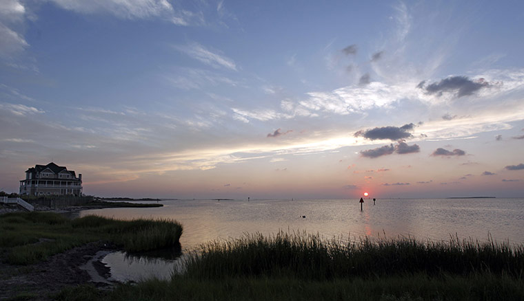
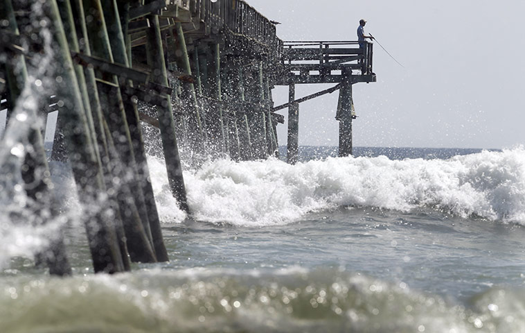
1 September: Calm before the storm. Hatteras Village, North CarolinaPhotograph: Richard Clement/Reuters1 September: Camera crews broadcast from the beach while tourists take a walk in Nags Head, North Carolina, as hurricane Earl approachesPhotograph: Davis Turner/EPA1 September: A fisherman waits at the end of the Oceanana Pier as hurricane Earl heads toward the eastern coastPhotograph: Chuck Burton/AP
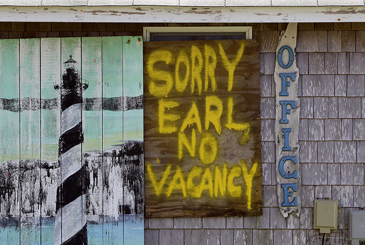
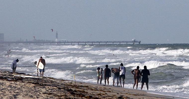
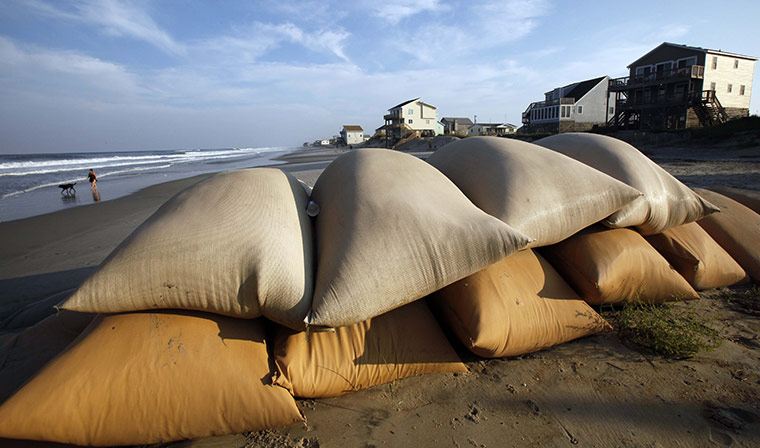
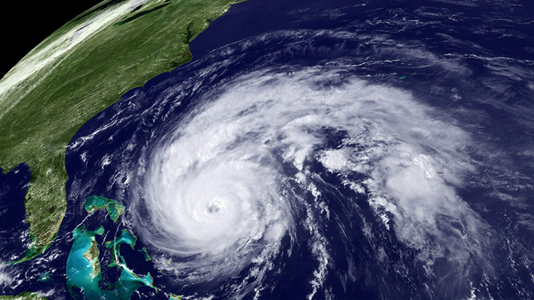
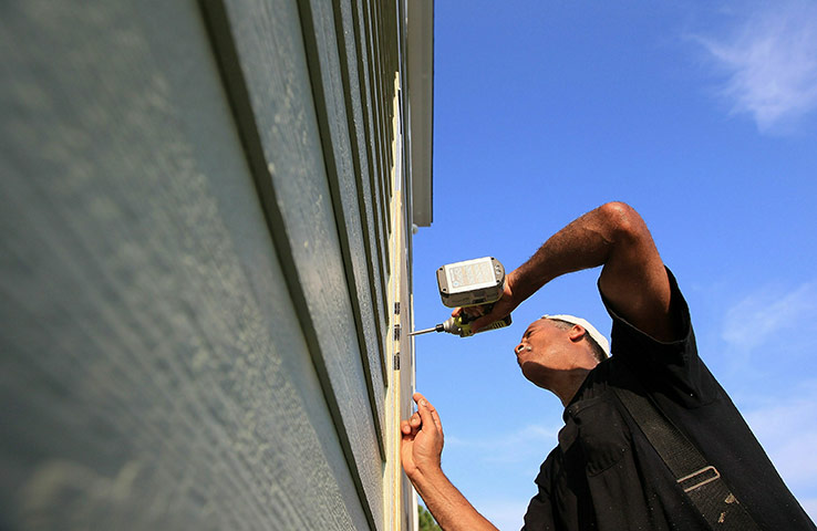
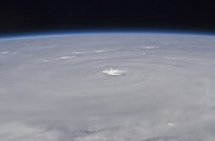
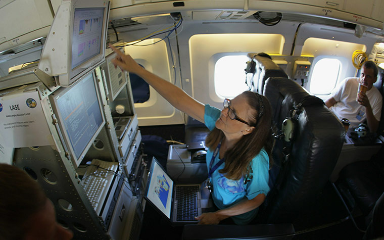
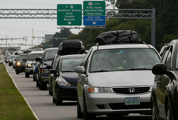
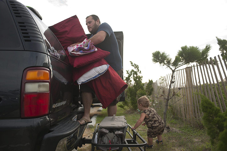
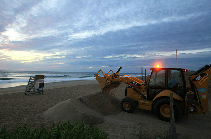
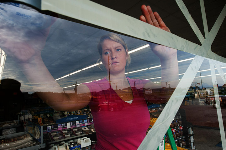
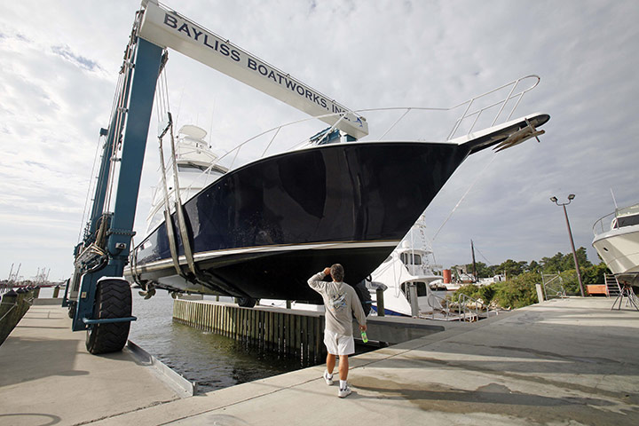
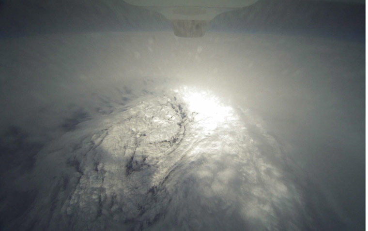
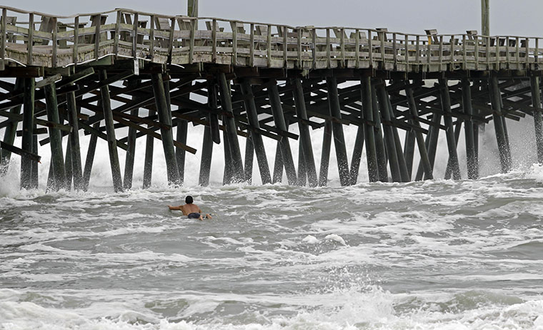
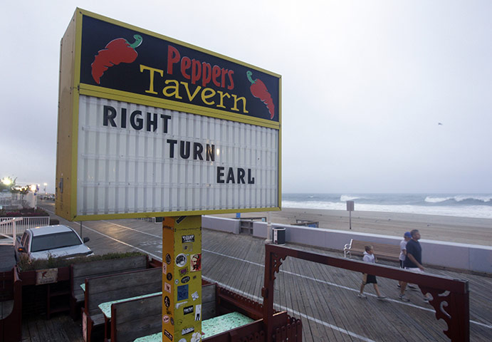
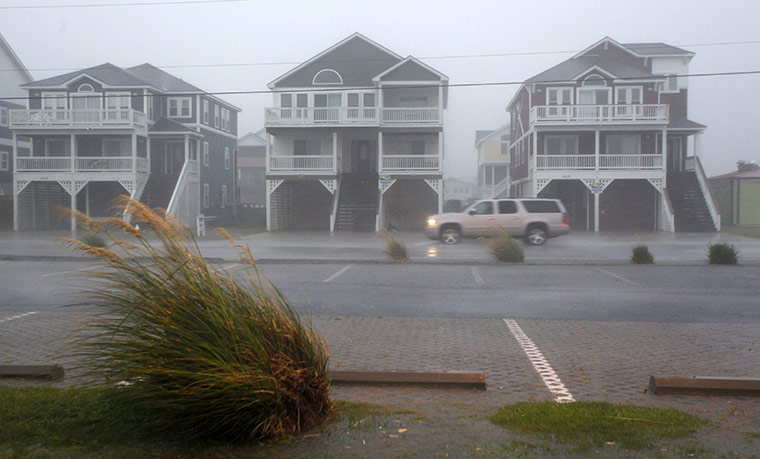
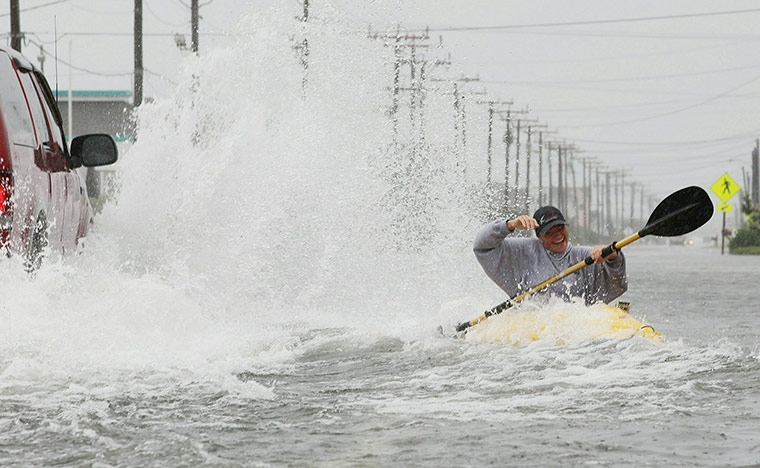
1 September: A window is boarded up with a message at the Buxton Beach Motel in Buxton, North Carolina, as hurricane Earl approaches the state's Outer Banks areaPhotograph: Gerry Broome/AP1 September: People enjoy a day at Fort Lauderdale beach Photograph: Alan Diaz/AP1 September: Sandbags that protected now-condemned houses along the southern beach are seen in Nags Head, North CarolinaPhotograph: Gerry Broome/AP1 September : Satellite image provided by the National Oceanic and Atmospheric Administration, shows hurricane Earl moving through the Atlantic OceanPhotograph: NOAA/Getty Images1 September: Don Jones screws down a sheet of plywood over a window to protect it from the winds of the approaching hurricane Earl in Buxton, North CarolinaPhotograph: Mark Wilson/Getty Images1 September: Families from Newport News, Virginia, stand on the balcony of their rented beach house waving at passing cars. They said they would ride out the approaching stormPhotograph: Mark Wilson/Getty Images30 August: This satellite image, taken by an Expedition 24 crew member on the International Space Station, shows an oblique view of the eye of hurricane Earl just north of the Virgin Islands near 19.3 north latitude and 64.7 west longitude packing 115km winds. The photo was taken with a digital camera using a 50mm lensPhotograph: NASA/Reuters1 September: Carolyn Butler, a computer scientist, talks to reporters about the data gathered from Hurricane Earl. Butler is part of a research programme using three NASA aircraft flying over the Gulf of Mexico, the Atlantic Ocean and Caribbean sea to collect information aimed at discovering why hurricanes form and strengthenPhotograph: Joe Raedle/Getty Images2 September: People evacuate the Outer Banks area in Southern Shores, North Carolina. A mandatory evacuation notice has been issued for Dare CountyPhotograph: Mark Wilson/Getty Images2 September: Nathan King and his son Ethan load the family's luggage as they vacate a hotel and cut short a holiday in south Nags Head, North Carolina. The Dare County Control Group has issued a mandatory evacuation for all visitors in the areaPhotograph: Davis Turner/EPA2 September: A digger dumps sand on a beach in Kitty Hawk, North Carolina, to help prevent inland flooding from hurricane EarlPhotograph: Mark Wilson/Getty Images2 September: Sherwin-Williams paint store assistant manager Emily Venable takes precautions and duct tapes the store windows as hurricane Earl approaches the Outer Banks city of Kitty Hawk, North CarolinaPhotograph: Paul J. Richards/AFP/Getty Images2 September: Captain Dave Graham watches as his boat is pulled from the water in Wanchese, North Carolina, in preparation for Hurricane EarlPhotograph: Gerry Broome/AP2 September 2010: Hurricane Earl's eye taken from the HDVis camera on the underside of the Global Hawk aircraft. The Global Hawk captured this photo from an altitude of 60,000 ft (about 11.4 miles). It is one of three aircraft involved in the Genesis and Rapid Intensification Processes (GRIP) experimentPhotograph: NASA / NOAA /EPA2 September 2010: A lone surfer battles the waves near the Oceana Pier as Hurricane Earl heads toward the eastern coastPhotograph: Chuck Burton/AP3 September 2010: People walk past a sign along the boardwalk referring to Hurricane Earl, in Ocean City, MarylandPhotograph: Rob Carr/AP3 September 2010: Rain and high winds from Hurricane Earl hit Nags Head, North CarolinaPhotograph: Richard Clement/Reuters3 September 2010: Surfers ride waves in the water off Montauk lighthouse in New York. Much of the east coast is preparing for Hurricane Earl, now a category 2 storm with sustained winds of 105 miles per hour. While current projections are that Earl will continue to weaken as it moves over cooler waters, it still described as a dangerous storm and the largest to make it into the New York City region since Hurricane Bob in 1991Photograph: Spencer Platt/Getty Images3 September 2010: Kellie Maier gets splashed by a passing car while kayaking on water-covered Highway 12, in Kill Devil Hills, North CarolinaPhotograph: Mark Wilson/Getty Images
Sign up to read this article
Read news from 100’s of titles, curated specifically for you.