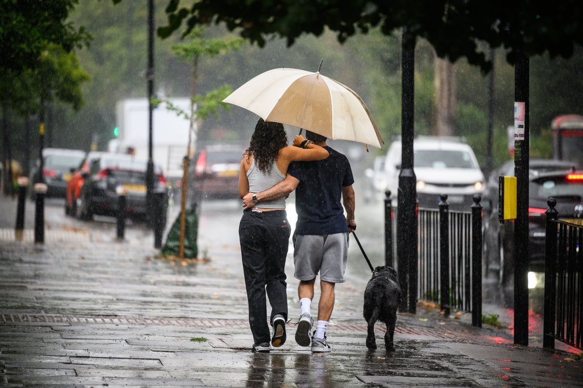
While much of southern Europe has been battling 40C heat and out-of-control wildfires in recent weeks – the latest disturbing illustration of the climate crisis in action – the UK has been enduring one of the most damp and dismal summers in recent memory.
This time last year, the country experienced precedent-shattering temperatures but, 12 months on, several areas including Preston, Lancashire, and Castlederg in County Tyrone, Northern Ireland, have reported their wettest July since records began, according to the BBC.
There appears to be no let-up either, with the Met Office forecasting further downpours this week as we enter into August.
Meteorologist Alex Deakin warned that the “drab” weather seen on Monday, which brought heavy rain to Scotland and northwestern England, would gradually ease on Tuesday, only for a fresh belt of rain to materialise on Wednesday over Cornwall, pushing up from the south west and bringing further torrential rain to southern England and Wales.
That expected shift will be driven by an area of low pressure from out over the Atlantic, making its way eastwards towards the UK before lingering over the Republic of Ireland and bringing unusually windy conditions to the Channel for the time of year.
There will still be no relief after that, according to Mr Deakin, who warns that northerly winds racing south through Scotland will bring “a cool feel” and a mix of further sunshine and showers on Thursday.
The culprit behind all of this misery is the jet stream, a channel of strong winds blowing from west to east five to seven miles above the Earth’s surface, which typically brings high pressure and therefore sunny, dry, stable conditions to Britain in summer but is not currently occupying its customary place.
While it normally lies to the north of the UK at this time of year, it is presently positioned to its south, meaning Europe is being subjected to low pressure and more unsettled conditions than the continent is typically accustomed to, explaining both the damp squib of the British summer and the dangerous temperatures seen in Italy, Spain and Greece.
The Met Office’s Stephen Dixon explains: “Typically we are to the south of that jet stream and what that allows and what it allowed last summer is for a high pressure to build over the UK and allows the UK to kind of draw up warmer air from the south.
“More air was kind of fed in from the equator, almost, and moved over the UK and so that high pressure, coupled with the time of year it was, allowed that day-on-day to rise to the UK to that record level of 40.3C that we saw at Coningsby [in Lincolnshire] in July.
“We just haven’t been in that weather pattern this summer. It’s down to that jet stream and how it how it develops weather towards the UK. At the moment, it’s kind of directed towards the UK, which helps to develop these low pressure systems and gives us a bit of a little autumnal-feel for the weather that we’ve seen in recent weeks and yeah, not so much for what we saw last year.”
Forecasters are currently warning that there is little chance of any meaningful change to this pattern until late August as present conditions persist.
But there are hopes of a warmer, dryer September prevailing – particularly welcome news for farmers struggling with waterlogged fields and oversaturated crops.