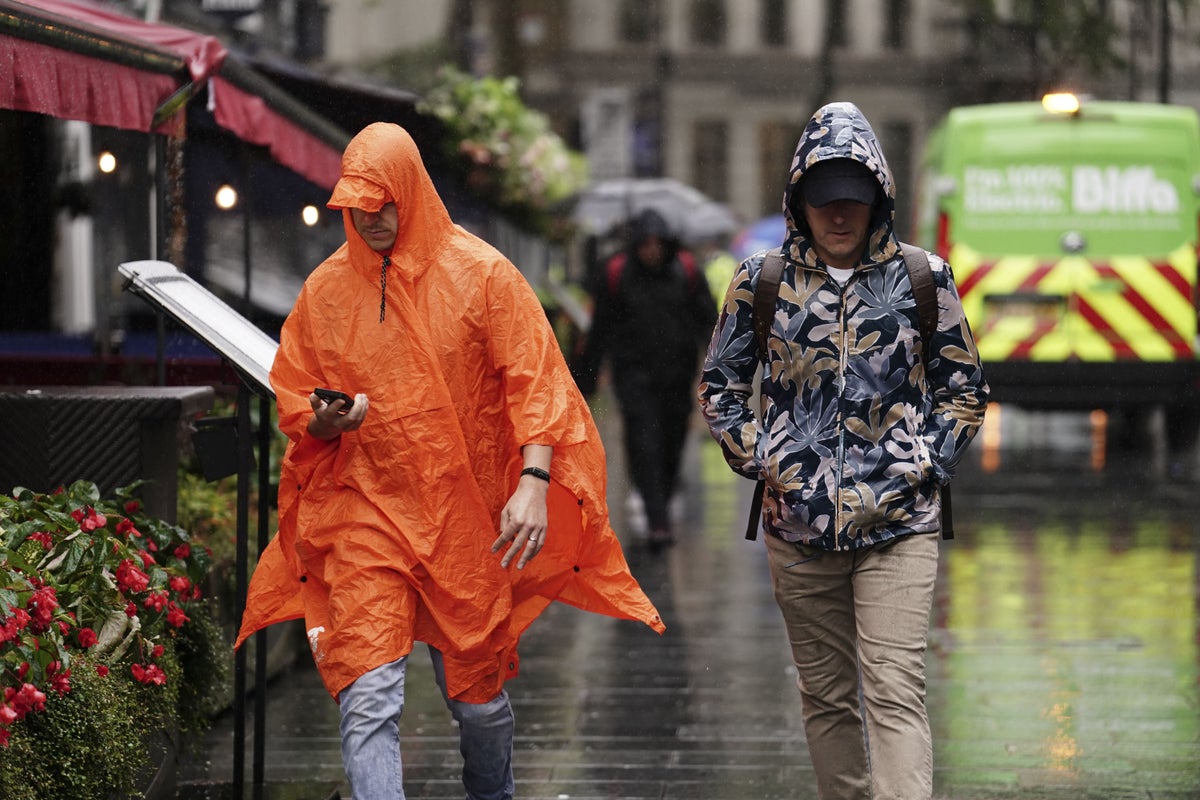
Downpours, thunderstorms and high winds and low temperatures are continuing to be forecast for parts of England and Wales this week before the wet weather will potentially let up.
Last year, the UK saw record breaking temperatures of more than 40C recorded, wildfires destroying houses and train tracks melting.
However, this July was the UK’s sixth wettest July on record.
Here are some answers on what is causing the rain and whether there is a chance that the weather will improve:
– Why has July been so wet and cold?
Met Office spokesman Oli Claydon said the changeable weather is down to the UK being an island that is more “exposed” to the Atlantic along with position of wind pressure.
He said: “It’s being driven by the position of the jet stream that sort of has been steering low pressures towards the UK through July.
“Of course, don’t forget, June was an exceptionally dry and warm month for many so we’ve had both ends of it this year.”
– How wet has July been compared with previous years?
Last month was the UK’s sixth wettest July on record, and the wettest ever July in Northern Ireland, according to provisional figures from the Met Office.
The UK saw an average of 140.1mm rain across the month, the sixth highest total for July since records began in 1836.
1988 holds the record for the UK’s wettest ever July, with an average of 150.5mm of rain, followed by 2009 (145.5mm), 1939 (143.5mm), 1936 (142.6mm), 1888 (142.2mm) and now 2023.
Northern Ireland had an average of 185.4mm of rain last month, just above the previous record of 185.2mm set in 1936.
This figure could be revised once all rainfall data for July is collected and reviewed, the Met Office said.
– What about temperatures?
Met Office figures show July was slightly cooler than usual, with a mean temperature across the month of 14.9C, 0.3C below the average for the period 1991-2020.
By contrast, the previous month was the warmest UK June on record, with a mean temperature of 15.8C, 2.5C higher than average.
The mercury this July has failed to hit the heights of last year, when a UK record temperature of 40.3C was found in Coningsby, Lincolnshire on July 19 2022.
– When will the rain come to an end?
Forecasts by the weather agency point to an easing of the downpours later in August but conditions are unlikely to reach anywhere near the sweltering temperatures of last year.
The west of England is likely to see more settled conditions on Friday before the downpours return, Mr Claydon said.
He added: “There are some early signs, there could be some potentially more settled or warm by the end of next week so there’s a lot of uncertainty around that because of the movement of the various low pressure systems across the Atlantic that would lead to that.”
Looking further ahead, the current forecasts suggest there will be warmer and drier conditions in the second half of August with some spells of rain.
– Is climate change to blame?
When asked whether the changeable UK weather was down to climate change, Mr Claydon said: “I don’t think there’ll be necessarily a link to climate change driving the unsettled nature of the weather here.”
He pointed instead to the position of the jet stream which has brought low pressure to the UK.
In contrast, the strong winds above the Earth’s surface have caused exceptional high temperatures of more than 40C and wildfires in Europe.
Mr Claydon said these high temperatures were down to the jet stream but had been “exacerbated by climate change”.