Areas across the UK could be hit by flash flooding as more “torrential” rain is set to batter the country, forecasters have warned.
A yellow thunderstorm warning has been issued across parts of the south of England as heavy rain, hail, and lightning are expected to cause disruption to roads and public transport. The warning, which covers London, Bristol, Oxford, Southampton, Kent and Ipswich, is in place from 10am until 9pm on Thursday.
People living in areas at risk of flash flooding have been advised to “consider preparing a flood plan and an emergency flood kit” to minimise potential damage, the Met Office advised. It said the storm could bring as much as 60mm of rainfall within two hours, with “frequent lightning and hail” also expected in some places.
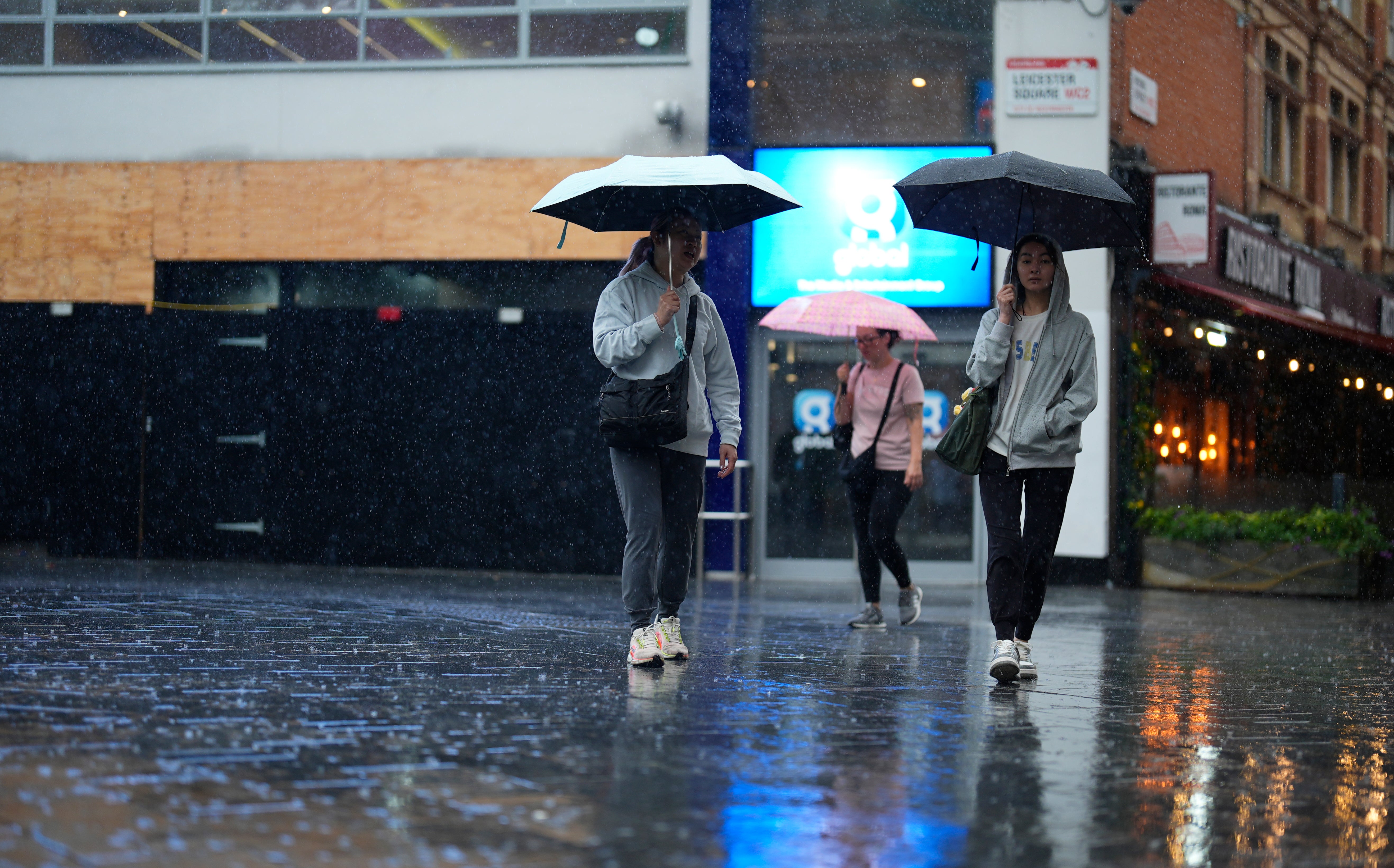
Heavy rain has already battered London on Thursday, as pictures show people rushing under umbrellas to shelter from the storm.
The Environment Agency advised flash flooding was “possible” but not expected during the heavy rainfall, which is set to develop throughout Thursday morning. They added that there could be flooding damage to homes and buildings, and said people should be aware of potential travel disruption.
“Surface water flooding impacts from heavy, thundery showers are possible but not expected on Thursday across the Midlands, South and East of England and London,” it said. “Localised surface water flooding is also possible elsewhere across England. Properties may flood and there may be travel disruption.”
The Met Office warned motorists to check road closures and be aware of “difficult” driving conditions ahead of any journeys. It also said there was a “small chance” of damage to buildings from floodwater, lightning strikes, hail or strong winds.
“Thunderstorms and heavy showers are expected to develop during Thursday morning and through the afternoon,” the forecaster said. “These could produce torrential downpours in a few places with as much as 25 to 35mm of rain falling within an hour and perhaps 60 mm within 2 hours.
“Frequent lightning and hail will be additional hazards. Storms will tend to become more confined to the south and east of the warning area later in the afternoon before dying out during the evening.”
Here is a full list of areas covered by the weather warning:
East of England
- Central Bedfordshire
- Essex
- Hertfordshire
- Luton
- Southend-on-Sea
- Suffolk
- Thurrock
London & South East England
- Bracknell Forest
- Brighton and Hove
- Buckinghamshire
- East Sussex
- Greater London
- Hampshire
- Isle of Wight
- Kent
- Medway
- Oxfordshire
- Portsmouth
- Reading
- Slough
- Southampton
- Surrey
- West Berkshire
- West Sussex
- Windsor and Maidenhead
- Wokingham
South West England
- Bath and North East Somerset
- Bournemouth Christchurch and Poole
- Bristol
- Dorset
- Gloucestershire
- North Somerset
- Somerset
- South Gloucestershire
- Swindon
- Wiltshire
The latest weather warning follows a series of heatwaves earlier in the month, which also brought thunderstorms and heavy rain to the UK. A host of warnings were issued over the hot temperatures, including amber and yellow heat health alerts in place across England warning of the potential for a rise in deaths. Fire chiefs also urged people to stay safe over the increased risk of wildfires, with blazes breaking out in London, Surrey, and Perth in Scotland.
Sunny conditions are expected to return on Friday, with highs of 22C forecast and warmer temperatures expected over the weekend.
Parents urged to prioritise vaccine catch-ups as measles cases remain high
What does recognising Palestine as a state actually mean?
Next profit off M&S cyberattack and warm weather
18th century shipwreck among ‘best preserved’ of its time, experts say
Ofcom launches investigation into 34 porn websites over new age checks