Forecasters say it is highly likely the UK will see a white Christmas this year - in certain areas at least.
With millions planning their Christmas getaway, Britons will be keen to know whether ice and snow will be on the cards when they hit the roads and railways towards the end of the week. The Met Office said it had a “high degree of confidence” there would be snowfall over the festive period.
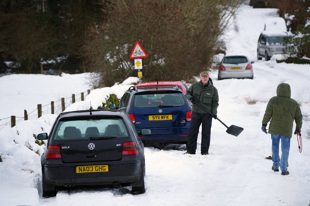
However, the forecaster stressed this does not necessarily mean the country will be covered in blankets of the white stuff and has urged people not to get their hopes up for a “picture perfect white landscape”.
The odds of a White Christmas have been slashed by the bookies— (PA)
“We can say with a high degree of confidence it will be a white Christmas this year,” Met Office spokesperson Grahame Madge told The Independent.
“However that does not mean we will see blankets of snow. It is more likely we will see snow in higher parts of the UK like the North Pennines or Scottish Highlands.”
Mr Madge said that despite warmer temperatures in the south of the UK, snow could not be ruled out completely for the region.
Met Office deputy chief meteorologist Helen Caughey, added: “As we begin Christmas Day wintry showers initially feeding in across the north in the colder air mass would technically make it a white Christmas, as we only need to see a single flake falling.
“Elsewhere, while it is likely at first to be mostly dry there is the potential for rain approaching from the west later on. As this moves east, we may see rain turning to snow, at least over high ground. It’s unlikely that we will see widespread or settling snow giving any proper accumulations. Although technically it might be a white Christmas, don’t get your hopes up for a picture-perfect white landscape.”
A yellow wind warning stretching from Norfolk to the northern-most points of Scotland was issued for Thursday— (Met office)
Betting company William Hill lowered its odds of a White Christmas with Glasgow now priced at just 6/5 to see snow on 25 December. In England, Newcastle (2/1) is most likely coated with snow on Christmas morning, followed by Leeds (5/2) and Manchester (3/1), while seeing Christmas Day snow in London is a 7/1 chance.
Before then though, Britons can expect more wet and windy weather in the week before the big day.
The Met Office issued a danger to life warning for large swathes of the UK amid strong winds and wintry showers on Thursday. The yellow advistory stretches from Norfolk to the northern-most points of Scotland as gusts are expected to reach 80mph.
Ms Caughey said: “Wind speeds will increase from the northwest through Wednesday evening and overnight, so that by Thursday there is a risk of gusts of 50-60mph for a large swathe of central and northern parts of the UK. Coastal locations, higher ground, and areas to the east of high ground could see gusts of 70-80mph.
“Due to the scale of the low pressure to the north of the UK, it is possible this event could persist across some areas into Friday, so we recommend keeping up to date with the Met Office forecast.”
Snow above the Hole of Horcum at the North York Moors National Park earlier this month— (PA)
In its long range forecast looking ahead from Monday 1 January until Monday 15 January, the Met Office said: “Most likely continuing unsettled with bands of rain crossing the UK with brighter conditions and showers in between.
“The wettest and windiest conditions are most likely in the north and west. Short-lived colder spells remain possible, with hazards such as snow and ice, particularly in the north.
“The chance of these colder spells slightly increases moving through January, with a low likelihood of a more prolonged spell of cold weather developing around mid-month.”
UK 5 day weather forecast
Monday:
Monday will be mostly cloudy with some rain, mainly in the west, heavy at times. However, southeast England should see some brightness, whilst sunny spells and showers develop across Scotland and Northern Ireland, where it will feel a little cooler.
Monday night:
Further locally heavy rain arrives from the southwest, spreading to most of England and Wales. Scotland and Northern Ireland staying drier, cooler with scattered showers in the north.
Tuesday:
Rain clearing southeast with drier, brighter conditions following from the north. Scattered showers in the north. Turning windy for all, gales in the north. Feeling a little cooler for all.
Outlook for Wednesday to Friday:
Windy throughout, especially on Thursday with severe gales possible in the north. Bright or sunny spells with showers or longer spells of rain, showers wintry in the north on Friday.