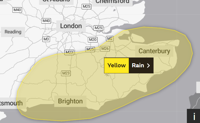
The Met Office has issued a weather warning for heavy rain that could lead to flooding in large parts of south-east England as the country braces for heavier downpours.
The forecaster issued a yellow alert, from 11pm tonight until 10am on Monday, that covers an area stretching from Chichester in West Sussex to Canterbury in Kent.
Homes and businesses could be hit by a deluge and public transport could be affected, the Met Office added. The Environment Agency has four flood warnings and 39 flood alerts in place, mainly across south-eastern parts of England.
Met Office forecaster Simon Partridge said: “We are expecting to see 15 to 25mm of rain but it’s basically mainly associated with some heavy showers.

“So a lot of it is to cover the potential for some very tricky driving conditions tomorrow morning, being obviously Monday morning so one of the busiest.”
Mr Partridge said the rain in the south-east will ease off later on Monday but showers are predicted across the UK for much of the coming week.
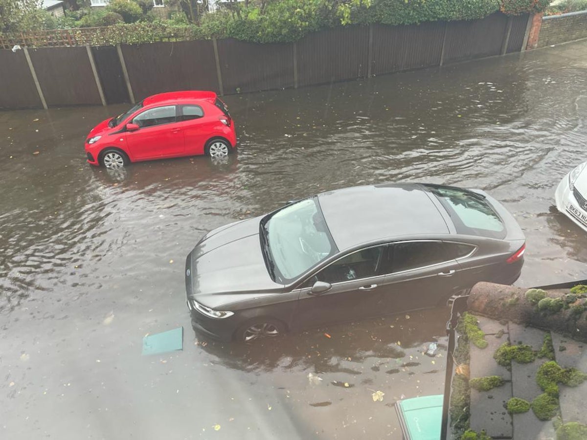
It comes after flooding swept across parts of the UK as torrential downpours brought up to two inches of rainfall on Sunday.
A yellow weather warning was in place until 4pm today, stretching from Chichester, West Sussex, to Canterbury, Kent and the Environment Agency issued 24 flood alerts.

Areas of London have suffered flooding caused by the heavy rain including Dagenham Heathway Tube Station having to temporarily close. Drivers in the capital have been sharing images of drenched roads on social media.
The Mayor of Hackney Philip Glanville posted on Twitter that the local authority had targeted areas such as the A10 to reduce the impact of flooding from the heavy rains seen overnight.
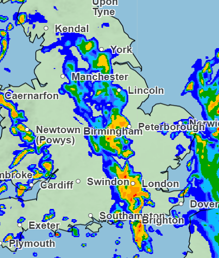
Some parts of England, near Brighton and St Albans, are set to receive up to 32mm of rainfall per hour on Sunday afternoon.
Plumpton, near Lewes, East Sussex, had already seen 39mm of rain in the previous 24 hours – more than a third of the average monthly rainfall for the area, the spokesman said.
A Met Office spokesman said earlier on Sunday: “Southern England and the South East has seen quite a heavy band of rain move fairly slowly.
“Following it is going to be a day of blustery showers, thundery at times, so it’s going to be a wet day ahead.”
Roads have been submerged by water in the worst affected areas. Flooding on the A38 has brought traffic to a standstill, affecting Devon and Cornwall. A junction in Sussex was closed this morning after heavy rains caused the road to become unpassable.
South Western Railway tweeted that they have train disruptions due to heavy rain flooding the railway between Rude Esplanade and Shanklin on the Island Line.
The Met Office said Monday is forecast to be cloudy with spells of rain mainly in the west, where it will become “very windy” later while remaining brighter in the east.
Heavy, squally rain is predicted to return overnight into Tuesday, making way for sunny spells and showers which ease on Wednesday, with more rain expected in north-western areas on Thursday when it is expected to be windy but mild.
The spokesman said South Wales could experience heavy rain and strong winds on Monday night into Tuesday.

Met Office Outlook
This Evening and Tonight:
Showers continuing for some areas, especially parts of northwest UK and coastal counties of southeast England, where they may be heavy. More general rain affecting some southwestern, western and central areas later, especially across hills. Turning windier and staying mild.
Monday:
Showery rain continues to move northeastwards across northern areas, heaviest over hills. Showers in southeast England easing. Heavy rain and gusty winds into far western areas by evening. Windy, mild.
Additional reporting by agencies