A tropical storm formed in the Pacific Ocean on Monday, just as another began heading away from the U.S.
Tropical Storm Henriette, which developed at around 5 p.m. in the eastern Pacific, was centered some 985 miles west-southwest of the southern tip of the Baja California peninsula, the National Hurricane Center in Miami said. Henriette has maximum sustained winds of 50 mph and was moving to the west-northwest at around 15 mph, according to the advisory.
Weather maps show the tropical storm edging over 2,200 miles east-southeast of Hilo in Hawaii.
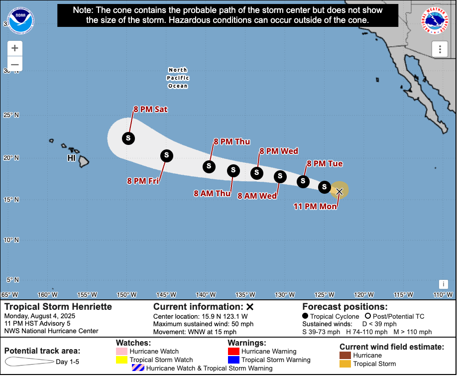
Forecasters have not issued coastal watches or warnings to land yet, but stressed Henriette is expected to strengthen over the next couple of days as it moves over the central east Pacific.
“Some slight strengthening is forecast during the next day or so, followed by gradual weakening,” forecasters said.
Dexter became a tropical storm on Saturday night. As of late Monday, it was stirring up in the Atlantic Ocean about 345 miles north of Bermuda, the NOAA said. It had maximum sustained winds of 40 mph on Monday and was moving northeast.
Forecasters expected it to continue moving away from the U.S. over the course of the week before being downgraded to a remnant system by the weekend.
However, they warned that the tropical storm could re-strengthen in a couple of days as Dexter “becomes an extratropical cyclone.”
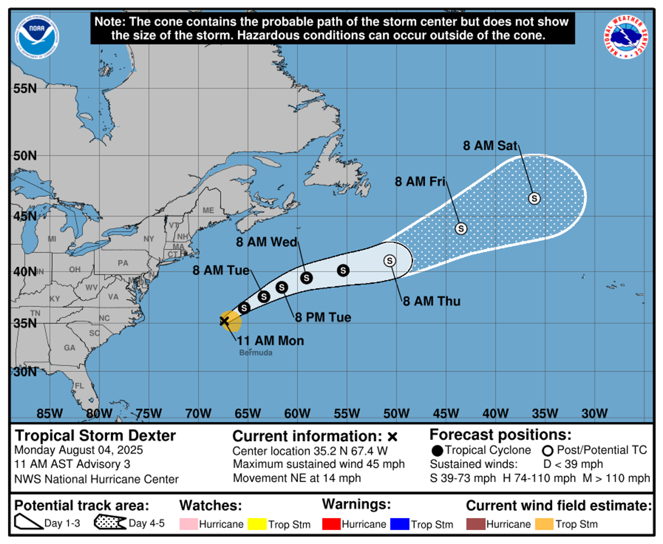
Dexter is the fourth named storm of the 2025 Atlantic hurricane season. Henriette is the eighth named storm of this year’s eastern North Pacific hurricane season.
At the weekend, Hurricane Gil was churning in the eastern Pacific Ocean but did not threaten and decreased in strength Sunday, forecasters said.

Gil had maximum sustained winds of 75 mph and was moving west-northwest at 20 mph.
With warmer-than-normal ocean waters, forecasters are expecting yet another unusually busy hurricane season for the Atlantic. Last year was the third-costliest season on record, as it spawned killer storms Beryl, Helene, and Milton.
The Associated Press contributed to this report.
Storm Floris map: Thousands left without power after UK battered by 100mph winds
Black storm warning paralyses Hong Kong as torrential rain triggers floods and landslides
Tropical Storm Dexter churns in the Atlantic, but it's expected to move away from the US coast
Gulf coast braces for flooding as storm system builds into possible tropical depression
System over Florida has potential to develop into tropical depression, weather service says
The odd detail that has authorities fearing Storm Floris
Tropical Storm Dexter churns in the Atlantic, but it's expected to move away from the US coast
What to know about the earthquake that shook the New York area Saturday night