Tropical Storm Barbara has strengthened into the first hurricane of the east Pacific hurricane season.
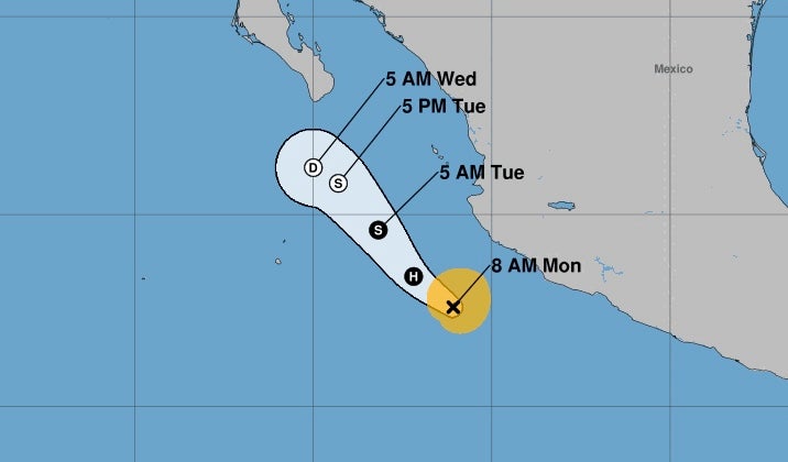
Located about 166 miles southwest of Manzanillo, Mexico, on Monday afternoon, the Category 1 storm had maximum sustained winds of 75 miles per hour, with higher gusts.
Forecasters said that gusty winds were likely along coastal southwestern Mexico during the next day or so and that some slight additional strengthening was possible before a weakening trend on Tuesday.
“There are no coastal watches or warnings in effect,” the National Hurricane Center said.
Swells generated by the hurricane were also likely to cause life-threatening surf and rip conditions.
Previously, the center had warned of outer bands leading to up to two inches of rain and “localized areas of flooding and mudslides.”
The probable path of Barbara’s center is veering to the left over the eastern Pacific Ocean, as it moves toward the northwest near 10 miles per hour. This general motion is expected to continue for the next couple of days.
Barbara formed early Sunday, becoming the second named storm of the Pacific hurricane season. The first named storm, Alvin, formed in late May. It brought heavy rain to the Southwest.
Forecasters are also watching Cosme, a tropical storm south-southwest of the southern tip of Baja, California.
Cosme is forecast to become a hurricane later Monday.
“Rapid weakening is expected Tuesday night and Wednesday,” the center said.