Summary
Thanks for following along with us again today. We’ll be closing the blog shortly, but, before that, let’s just recap the day’s events in Townsville.
The main story from today is the sad news that two men aged in their 20s have died in the floods. Earlier, police said they held grave fears for two men who were last seen on Monday morning. We will learn more about the circumstances in the hours and days to come.
On a brighter note, the flood waters have begun to subside around Townsville, though authorities have said there is more rainfall expected over the next few days. The monsoon trough over Townsville is not expected to shift until the weekend.
Locals are now going through the awful process of returning to their waterlogged homes and businesses. Our thoughts are with them as they do this – just as they are with the families of the two people who have lost their lives. The damage bill is expected to reach into the hundreds of millions of dollars. Some schools are beginning to reopen, but it’s unlikely normal daily life will resume for some time.
With that, thanks again for joining us. We’ll see you next time.
Updated
The Insurance Council of Australia has revised its current estimate of insurance losses up – it now sits at $45m from 3,500 claims.
The council expects that figure to rise as people return to their homes. This has been occurring gradually throughout the day, although authorities say many homes are still unsafe.
Updated
The RACQ Bank says it has suspended home loan repayments for three months for those impacted by the Townsville floods.
“We’ve initiated a three-month moratorium on home loan repayments for Townsville flood victims because we get it – when times are tough, paying off your home loan is the least of your worries,” the bank’s chief executive, Michelle Bagnall, said.
“What this means is, if people cannot meet their repayments, they needn’t worry about it. If they do want to continue paying their regular mortgage, that’s fine, but if they’re unable, they have a three-month pause.”
Updated
This is the Haughton River running back into #Giru. #BigWet pic.twitter.com/YaFicdTszY
— BurdekinShireCouncil (@BurdekinSC) February 5, 2019
Slowly, the dam levels are dropping. It was at nearly 250% above capacity on Monday afternoon.
Ross River Dam is currently at 197.5% capacity (460,649 Megalitres). Latest reading at 2:00pm on the 5th of February. #Townsville
— Ross River Dam (@RossRiverDam) February 5, 2019
Climate change is known to increase the frequency and intensity of extreme weather and the role of longer term climate trends will be assessed at a later date, said the senior meteorologist Grace Legge.
“Normally if we see this sort of intense rainfall we don’t see it for such a long period,” Legge said.
She said it was the first time Townsville had recorded more than seven days in a row of rainfall of more than 50mm per day.
Up to Monday morning, Townsville had received 1,158mm over a seven-day period. Its previous record over seven days was 886.2mm in 1998.
Legge said the immediate cause was the slow-moving nature of the monsoonal trough and a ridge from a high in the Tasman Sea that was keeping the trough stationary.
A burst of westerlies had intensified the weather over the weekend, but it was not enough to force it to the south.
“You’ve got two things fighting to make it move that are cancelling each other out. There’s nothing to push it one way or the other so it stays still,” she said.
As of Tuesday, the intense rain was beginning to slip further south but the Bom was still forecasting 50-100mm of rainfall in Townsville, with the potential for more severe weather.
Legge said towards the weekend, the rainfall might move out to the Coral Sea.
“We might see that low move out to the Coral Sea. That will drag the rainfall with it,” Legge said.
“So it’s looking like towards the weekend we might start to see these conditions ease.”
Updated
In a 10-day period, Townsville has received more than its annual average rainfall and broken records for its longest running period of days above 50mm of rain.
The Queensland premier, Annastacia Palaszczuk, has described the floods as “unprecedented”, but what is behind the weather that has dumped more than two metres of rain in some areas?
The immediate cause of the torrential rain, says the Bureau of Meteorology, is a monsoonal trough that has been sitting in one spot for more than a week.
“This weather pattern brings a lot of rain and usually flooding rain over northern Queensland,” said Vinord Anand, a forecaster with the Bureau of Meteorology.
“The last several days, all of the intense rainfall we’ve seen in that area has been due to that weather disturbance.
“The only thing different with this one is it’s been sitting in the same spot for a long time. What that means is the rain has continued to fall in the same spot for five to seven days.”
Our environment reporter, Lisa Cox, has just filed some analysis on the weather situation in Townsville. I am going to post it in two parts for ease of reading.
The premier said earlier that the education department would today assess which public schools could reopen. In the Catholic sector, all but one will be open tomorrow.
All Townsville Diocesan schools will be OPEN tomorrow (Wednesday, 6 February 2019) expect for St Margaret Mary's College.
— Townsville CEO (@TCEO) February 5, 2019
Information about kindergartens, outside school hours care and St Mary MacKillop Early Learning Centres to follow soon.
Never leave a kangaroo behind.
2 RAR soldiers demonstrate humility and affection by rescuing our national native symbol. A 'Skippy' soldier rescuing 'Skippy'. Well done to the men and women of the battalion. Great work#yourADF! pic.twitter.com/9PBDw1Chl3
— WO1 David Lehr (@RSM1DIV_DJFHQ) February 4, 2019
We learned earlier today that the Bruce Highway had reopened. That is crucial news given the food shortages that had arisen.
However there are still major road closures elsewhere, as this statement from the Queensland roads minister, Mark Bailey, points out.
“The Finders Highway is expected to be cut for some days with the Macrossan Bridge over the Burdekin River under water,” he said.
“We have also recorded multiple landslips on Hervey Range Road, between Townsville and Charters Towers, as well as a major landslip on Paluma Range.
“Inland supply routes from Mount Isa to the coast are still closed.
“When the water recedes, roads and bridges will be inspected as soon as possible to ensure they are safe before reopening.
“Authorities will continue to work with rural communities across the north-west of the state to monitor fuel and food supplies.”
Luke Henriques-Gomes here taking over again. Thanks to Michael for taking the keys just now.
Updated
Spare a moment today for the hundreds of ADF, SES, QFES and Police who've been working around the clock to keep the people of Townsville safe during the floods.
— Jackie Trad (@jackietrad) February 5, 2019
We couldn't have done it without these true Queenslanders. pic.twitter.com/C8b1KrCH8N
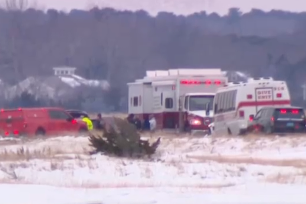
A bit more on the discovery of the bodies of two men in their 20s while we wait for official word from police.
It’s understood the two bodies were discovered in a stormwater drain in Aitkenvale, a suburb in Townsville.
Police said yesterday the two men were possibly missing, last seen in the same area on Monday morning. The ABC is reporting that police were searching for two men after an alleged break and enter in the area.
Updated
Two men found dead near flood waters: reports
Sad news. Local media are reporting the bodies of two men have been discovered in Townsville. It’s believed they are the same two men reported missing yesterday.
On Monday police said two men aged 21 and 23 were missing after they were last seen in Ross River Road in Aitkenvale near flood waters.
Police have yet to confirm to confirm the news but it’s being widely reported across local media.
Updated
What was that thing emergency services are always warning people not to do in flood waters?
It’s a pretty amazing story how emergency services rescued 2 policeman from the floodwaters. Full story on @9NewsQueensland #TownsvilleFloods pic.twitter.com/43XuDqhw5Z
— Rob Morrison (@RMorrison9) February 5, 2019
Updated
Just a quick note to let you all know that I’ll be taking the keys from Luke for the next little while. How about this rain, eh?
Drone vision of the Burdekin River in flood over Macrossan Bridge, west of #Townsville—taken by Charters Towers Regional Council. There are numerous warnings in effect around the region: Stay up to date https://t.co/CQJkcaE1rm. @QldFES #TownsvilleFloods #BigWet #QldFloods pic.twitter.com/O8SCmOuTcr
— Bureau of Meteorology, Queensland (@BOM_Qld) February 4, 2019
Stay away from flooded houses, residents told
In what must be incredibly frustrating news for many locals, authorities in Townsville say it is still too dangerous for people to return to flooded homes. That’s despite the fact that water levels are receding.
A statement from the Townsville Local Disaster Management Group warns that flooded areas are “still an active emergency zone with flooded waters hiding potentially fast-flowing water, debris and sewage”. And if the rain returns, the water may rise rapidly.
“Experts are still predicting rain and thunderstorms with the potential of up to 100mm of rain per day for the next few days,” the mayor, Jenny Hill, said.
“We are asking everyone to stay away from flooded houses and roads for the time being because there are a number of health and safety risks.
“Even if the rain slows there is still a danger of flooding and rising water going back into homes.”
Updated
The Ross River dam is slowly subsiding. It has just dropped below 200% capacity. Small steps.
Ross River Dam is currently at 199.9% capacity (466,034 Megalitres). Latest reading at 11:00am on the 5th of February. #Townsville
— Ross River Dam (@RossRiverDam) February 5, 2019
Updated
Yesterday the premier estimated that the damage bill in Townsville would be in the hundreds of millions. Here’s $2m of that – according to a local hockey club.
Townsville Hockey estimates the floods have caused $2m damage to their facilities. @antstew7 has the latest on Townsville's sporting grounds in @7NewsTownsville at 6pm. #qldweather #TownsvilleFloods #7News pic.twitter.com/N2H9Yvncyy
— Josh Martin (@JWMartin07) February 5, 2019
Good news from Townsville airport.
We're pleased to announce services are almost back to normal in the terminal, with most flights operating to schedule. Check with airlines and our website for updated flight times. All food, beverage and retail stores, car parking, car hire, taxi and shuttle services are open.
— Townsville Airport (@TSVAirport) February 5, 2019
The prime minister was sporting a camouflage jacket as he visited flooded areas of Townsville alongside the army.

Updated
Extra police have touched down in Townsville with more on the way today to help residents affected by the #Townsvillefloods and keep the community safe. pic.twitter.com/AjHJw9o220
— Queensland Police (@QldPolice) February 5, 2019
Just on the prime minister’s earlier no comment on climate change. My colleague, Ben Smee, noted these comments from Bill Shorten yesterday.
Bill Shorten has just made some fairly strong statements linking extreme weather – the flooding in Townsville and fires in Tasmania – to climate change.
The Labor leader says from Huonville in Tasmania that “even Australia’s most extreme climate deniers” would have to accept that extreme weather events are becoming more common and that “climate change is having some effect”.
“It is legitimate to talk about climate change. If we can’t talk about climate change now, with the range of weather events that we’ve got, when will we ever be able to talk about climate change?”
A reporter at the press conference notes there have been a “record number of weather events, cyclones”. “What’s your thinking on climate change?” the reporter asks Morrison.
The prime minister replies that he’s not focused on “politics” today.
My thinking is the support for Townsville people. I’m not engaging in broader policy debates today. I’m engaging in the needs of people here on the ground, people in evacuation centres, with some trepidation going back into their homes and finding what they’re going to find. That’s what I’m focused on today, not politics.

Updated
Commonwealth will provide 'Category C' assistance
Morrison says that the commonwealth will provide Category C disaster assistance following a request from the premier, Annastacia Palaszczuk.
This is from Department of Home Affairs:
Category C assistance is only made available when the impact of a disaster is severe. It is intended to be in addition to assistance under Categories A and B and is usually considered once the impacts of the disaster on affected communities have been assessed. Category C assistance is requested from the states and requires agreement from the prime minister.
“Every request being made of us, our answer is yes and quickly,” Morrison says. “We also initiated last night, I gave the instruction, for the defence forces to support airlifts.
“There is one that will be getting off the ground very soon and that is going into Cairns.”
Updated
The premier’s press conference has wrapped up – and Scott Morrison’s has begun. Morrison has been visiting homes as some locals return to survey the wreckage. The Nationals MP George Christensen and Liberal senators Linda Reynolds and Ian Macdonald are also there.
The prime minister says the “care and compassion” people are showing to each other has been a “privilege” to witness.
“It is who we are, and I want to thank everyone here in Townsville for all the incredible work they are doing,” he says.
Updated
The Queensland police deputy commissioner, Bob Gee, has reiterated the premier’s call for “patience”.
“It is not safe to go back to homes, it is not safe to go into those flood waters,” Gee says.
He is pleased there have only been two reported break and enter offences in flooded areas and adds that 60 police have been sent in to keep homes safe.
Gee says that police hold serious concerns for the two men reported missing. As mentioned earlier, they are Hughie Morton, 21, and Troy Mathieson, 23. There was one potential sighting of one of the men, but that has not been confirmed.
Updated
Richard Wardle, the acting state manager for Queensland for the Bureau of Meteorology, says the monsoon is expected to “remain active for the coming days, potentially easing over the weekend”.
“So there is an end in sight,” he says. “But we are expecting further periods of heavy rainfall, some of it very heavy, about the north-east tropics for the next few days, between about Cardwell and Mackay, and with that there is the real elevated risk of flash flooding.”
Updated
'A long way to go': Premier calls for 'patience' as recovery begins
The premier, Annastacia Palaszczuk, is addressing the media now. A few early points:
- There have already been nearly 9,000 applications for personal hardship grants. About 2,700 have been processed.
- The number of people without power has fallen from 17,000 to 11,000
- The Bruce Highway has reopened – allowing freight trucks to deliver fresh food
- Authorities are assessing which schools will be able to reopen
- There are reports that livestock has died out west, around Flinders and Cloncurry
“There has been a lot of great work happening on the ground up in Townsville, out west, up north,” Palaszczuk says.
“To all the agencies that are working together, our emergency services personnel, the Army, everyone that has been pitching in, helping, it has been a great team effort.
“We’ve got a long way to go. I know I’m asking now for people to have patience. We are doing everything we possibly can and good news today that that freight is now travelling north.”
Updated
Bruce Highway reopens
Good news from out on the roads. Highway closures had been contributing to food shortages at supermarkets along the north Queensland coast.
At 10:30am, the Haughton River Bridge was reopened to traffic.This means the Bruce Highway between #Townsville and #Ayr is now open to all traffic.
— Transport and Main Roads Queensland (@TMRQld) February 5, 2019
A big thank you to motorists for your patience while we completed assessments on the bridge to ensure its safety. #bigwet pic.twitter.com/DQJqYFNTF0
Bruce Highway between Ayr and Townsville just reopened. Some people we spoke to had been sleeping in their cars since Wednesday waiting for that. Now they’ll get home to assess damage @SkyNewsAust pic.twitter.com/7OGRalwsIz
— Charlotte Mortlock (@CMMortlock) February 5, 2019
Updated
As I mentioned earlier, the prime minister is in Townsville. Scott Morrison will be holding a press conference in the suburb of Cranbrook at 11.15am local time, so in about 50 minutes’ time.
What's causing all this rain? The Bureau of Meteorology explains
Queensland’s premier, Annastacia Palaszczuk, has described the floods as unprecedented. The cause of the prolonged rainfall is a monsoonal trough that has been sitting over the Townsville area.
While monsoonal rainfall occurs throughout summer in northern Queensland, the difference this time is the trough isn’t moving.
“This weather pattern brings a lot of rain and usually flooding rain over northern Queensland,” says Vinord Anand, a forecaster with the Bureau of Meteorology.
“The last several days, all of the intense rainfall we’ve seen in that area has been due to that weather disturbance.

“The only thing different with this one is it’s been sitting in the same spot for a long time. What that means is the rain has continued to fall in the same spot for five to seven days.”
The heaviest rainfall in the past week has been more than a metre.
In the Townsville region, Woolshed has had 1,663mm in the past seven days and Paluma 1,629mm. Townsville airport itself, the main entry point to the region, has had 1,558mm.
Ayr through to Townsville and up to Cardwell have all had in excess of one metre of rain.
Anand says there are likely to be two or three more days of intense rainfall to go: “We seem to be probably past the halfway mark.”
Updated
⚠️If you live in Burdekin, Cook, Douglas, Townsville or Wujal Wujal & have been affected by the #TownsvilleFloods you may be eligible for the Australian Government Disaster Recovery Payment or Disaster Recovery Allowance. Call 180 22 66 to claim or visit https://t.co/gUj5TxhfWx pic.twitter.com/WWmKdjS83o
— Human Services (@HumanServicesAU) February 4, 2019
Drone vision of the Burdekin River in flood over Macrossan Bridge, west of #Townsville—taken by Charters Towers Regional Council. There are numerous warnings in effect around the region: Stay up to date https://t.co/CQJkcaE1rm. @QldFES #TownsvilleFloods #BigWet #QldFloods pic.twitter.com/O8SCmOuTcr
— Bureau of Meteorology, Queensland (@BOM_Qld) February 4, 2019
Townsville is still technically in the rescue and evacuation phase. Among the thousands who have been evacuating is Brady Ellis, a radio host in Townsville. The video below shows his family leaving their waterlogged home, but the star of the show his is dog, Axl. About half way through, you can see him surfing through the water with the help of the army.
Updated
One of the things you might have been wondering if you’ve been following the floods crisis is how Townsville’s main catchment, the Ross River dam, has been at more than twice its capacity. On Monday, for example, it peaked at 244.8%.
In fact, as this excellent explainer from the ABC points out, the capacity level refers to the approved level for drinking or irrigation. And, in simple terms, owing to the flat slopes of the reservoir, the capacity level can increase without the water level rising too much.
Updated
And here’s a zoomed-out look at the rainfall in Queensland over the past seven days. As has been mentioned, Townsville has received about a year’s worth of rain in a week. Those red dots west of the coast, however, are a godsend for farmers in drought-stricken areas of the state.
Where has the #BigWet rain fallen this week across inland #Queensland? Not much for the Darling unfortunately, but plenty for parched catchments in the Gulf and upper Lake Eyre basin across #NWQld. A dramatic shift after weeks of 40+ #heatwave! Thanks to @BOM_SA for the graphic. pic.twitter.com/8NubWI2jCO
— Bureau of Meteorology, Queensland (@BOM_Qld) February 4, 2019
Updated
This map from the Bureau of Meteorology shows rainfall totals overnight.
Very heavy rainfall was recorded north of Townsville overnight. Another major #flood peak in Bluewater Creek but thankfully the #RossRiver missed the worst. The focus today shifts southwards to the #CentralCoast . See https://t.co/CVnq6ItA4N for more details pic.twitter.com/1olSfKNTjy
— Bureau of Meteorology, Queensland (@BOM_Qld) February 4, 2019
But here’s what the same area looked like over Sunday night-Monday morning.
Rainfall ☔ figures overnight in the 24 hours to 9am tell a grim story with 300-400mm in the Ross River catchment and 150-250mm around #Townsville. Another #monsoon rain band is approaching from the northwest now and visible on radar: https://t.co/vdC5ghuAJg pic.twitter.com/7gNikbl3vI
— Bureau of Meteorology, Queensland (@BOM_Qld) February 4, 2019
People affected by the #qldfloods have been displaced from their homes and have lost essential belongings. Please consider donating #fuelvouchers to assist with the recovery process. Thank you for your #help during this very difficult time.
— GIVIT (@GIVIT_AUS) February 4, 2019
https://t.co/qIwJ5NXWsu
Here’s a look at the front page of Townsville’s main newspaper, the Bulletin.
Front page wrap of tomorrow’s @tsv_bulletin ..yes we are surrounded by water but we are surrounded by floody legends too! #townsville down but not out 👏☔️🐊🍺💪🏾 pic.twitter.com/liWHOe55Zp
— Jenna Cairney (@JennaCairney1) February 4, 2019
The prime minister, Scott Morrison, is in Townsville.
PM in Townsville on his way to the army base @SkyNewsAust pic.twitter.com/gqwKtxVw34
— Ahron Young (@AhronYoung) February 4, 2019
Updated
Earlier, I mentioned that there were fears for two missing men. They are Hughie Morton, 21, and Troy Mathieson, 23. They were last seen on Monday morning near flood waters in the Townsville suburb of Aitkenvale.
Missing: Police searching floodwaters around Aitkenvale for Hughie Morton, 21 and Troy Mathieson, 23. They were last seen on Ross River Road early this morning. @10NewsFirstQLD @@10Daily pic.twitter.com/xtShse0iG4
— Tegan George (@tegangeorge) February 4, 2019
Updated
This morning there was significant rainfall – about 200mm in two hours – at Bluewater, just north of Townsville. There are concerns about flash flooding there, with an emergency warning in place.
In Townsville itself conditions have eased – the city only copped about 37mm of rain over the past 24 hours. That’s good news, but the city’s Ross River dam is still at double its intended capacity.
Ross River Dam is currently at 202.9% capacity (473,214 Megalitres). Latest reading at 7:00am on the 5th of February. #Townsville
— Ross River Dam (@RossRiverDam) February 4, 2019
Updated
Welcome
Hello and thanks for joining day two of our live coverage of the Queensland floods. My name is Luke Henriques-Gomes.
First, the bad news. Two men are feared missing as an area just north Townsville was hit by another deluge of monsoonal rain overnight. Rain is also forecast for central Townsville today. Authorities had warned on Monday that the crisis was far from over – it appears they were right.

Questions are also mounting over the response to crisis by officials, particularly the timing of opening of floodgates at the local Ross River dam. That lead to inundation of thousands of homes across the tropical city.
Please stay with us throughout the day – and, if you’re in north Queensland, stay safe.
Updated