Summary
- Bom cancelled its thunderstorm warning for metropolitan Sydney just before 4pm
- Its latest update shows the storm to now be moving towards the ACT and Hunter and Tablelands districts, and is forecast to bring those regions the kind of flash flooding, heavy rainfall, and hail that Sydney experienced earlier today
- Destructive winds may affect Port Macquarie, Taree, Newcastle, Gosford, Armidale, Orange, Tamworth and Dubbo
- Severe thunderstorms may affect Canberra, Cooma, Yass, Bredbo, Adaminaby and Tumut
- Bom’s next warning will be issued by 6:50pm
- It is continuing to keep a close eye on the weather in Sydney, Newcastle, Wollongong and surrounding areas
- The strongest wind recorded was in Kurnell around 10:30am, with gusts of 213km/hr – associated with a possible tornado
- Kurnell was the worst-affected region by far, with damage to residential and business properties and some injuries reported
- Gusts of more than 100km/hr were recorded in several parts of Sydney over the course of the day
- 140mm of rain was recorded in the 50 minutes to 10:30am at Island Point road, just south of Jervis Bay
- Hail the size of golfballs was reported at Cronulla at around the same time
Metropolitan warning cancelled but no joy for the non-Sydneysiders
Bom’s just released its most recent update, with the storm warning for metropolitan Sydney cancelled.
The storm’s now moving up towards the ACT and the Hunter and Tablelands districts, bringing those regions their share of flash floods and hail.
We’ll start wrapping up our coverage shortly.
Footage shot by Andrew McGregor in Kurnell shows debris flying through the air, while the storm’s advance on Sydney harbour can be seen in a timelapse.
Sydney commuters can expect a difficult trip home.
Enfield drive at Bondi Junction is like a scene from Walking Dead because of floods! Gridlock. #sydneystorm #9News pic.twitter.com/tiVzU3lUAb
— Bloodliners Comic (@Bloodliners) December 16, 2015
Paddo blowhole #sydneystorm pic.twitter.com/KxPGM0Vfko
— BP__________________ (@BP_____________) December 16, 2015
The view from our driveway #sydneystorm pic.twitter.com/wE3j6vx3gh
— Joneaux Seidler (@jonnoseidler) December 16, 2015
Traffic held back by the flood on Syd Einfeld Dr! Chaos whether today. #sydneystorm #sydneyweather pic.twitter.com/djczA3mSNp
— Simon London (@icanbelondon) December 16, 2015
Out our front door at Paddo. Sigh. #sydneystorm pic.twitter.com/Iro1ZbbUr1
— Alexa Moses (@AlexaEMoses) December 16, 2015
Updated
Bom’s latest outlook still warns of severe thunderstorms, now bound for Lake Macquarie and, later, Newcastle City. Large hailstones, very heavy rainfall and damaging winds are still likely.
Sydneysiders taking shelter from the storm under a bus stop in Randwick. #9News pic.twitter.com/qSoThowG8a
— Nine News Sydney (@9NewsSyd) December 16, 2015
More from AAP on Kurnell:
The desalination plant in Kurnell was evacuated after reportedly sustaining significant damage and workers were also cleared out of the Caltex refinery as a safety precaution.
The main road to Kurnell, Captain Cook Drive, is closed.
Two trucks were blown over by the wind on Chisholm Rd but nobody was injured.
Kurnell local Melanie Bowman said tiles had come off her roof and powerlines were down.
“I can see the sky from our garage... I can see lots of parts of roofs in the street,” she said.
“It felt just like a cyclone with hail and high winds.
“My husband has left to come home from work and he can’t actually get out here.”
The SES has received more than 417 requests for help with 31 volunteer team working in the Kurnell and Illawarra areas with reports of damage to infrastructure, power lines, trees and roofs.
Ausgrid crews are in Kurnell inspecting damage to the electricity network but tweeted that restoring the network will take time depending on the scale of damage.
Sutherland Shire council advised residents via its website that rubbish collection services have been cancelled until Thursday.
NSW fire crews are on the scene at the Bondi Junction shopping centre where water has poured in after a roof collapsed.
Bondi Pizza waiter Michael Seeff says people started shouting “the roof has collapsed” and some customers ran out before paying the bill.
“Water was coming down the sides of the walls and onto the floor,” he told AAP.
Kurnell has been by far the worst hit in today’s storm.
“It is so very rare to get a tornado inside Sydney, much less a strong tornado,” a BOM spokesman said.
Gusts in Kurnell reached up to 213km/h. “That is the fastest speed that has been recorded in NSW history,” he said.
An evacuation centre for Kurnell residents has been set up at the Cronulla Leagues Club on Captain Cook Drive, in the Sutherland Shire.
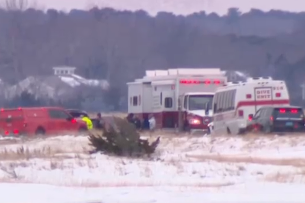
Injuries are minimal but three ambulances have been sent to the Kurnell Public School as a precaution “in anticipation of a second storm”, an ambulance spokesman told AAP.
A 40-year-old man in Kurnell suffered head injuries after reports of storm damage to a building, a 38-year-old man was treated for shock and another patient was treated for an unspecified conditio.
A 75-year-old woman received cuts to her leg, while a man was struck by debris and an elderly man was treated for anxiety.
All patients have been taken to Sutherland Hospital in a stable condition.
JUST IN: Further footage of the strong winds earlier in #Kurnell, causing significant damage throughout the area. pic.twitter.com/RoRa7JBIUc
— SutherlandShireNews (@SShireNews) December 16, 2015
Ariel photos of the current scenes at #Kurnell. Most damage has occurred particularly around Bridges Street. pic.twitter.com/Yl0czVaefW
— SutherlandShireNews (@SShireNews) December 16, 2015
Some of the scenes we are seeing in #Kurnell pic.twitter.com/vN6dEzFgeN
— Cameron Price (@campricenews) December 16, 2015
Some more photos from Kurnell. Staff from this business huddled in the toilet as the tornado moved through. pic.twitter.com/31CkiovJ95
— Cameron Price (@campricenews) December 16, 2015
The Westpac Life Saver rescue helicopter has recorded images over Kurnell showing major structural damage to homes.
Updated
The Public Information and Inquiry Centre has been opened to support the current severe weather response in New South Wales.
Members of the public can reach it on 1800 227 228 regarding information on the flood and storm operation.
Additional information in relation to the warnings can be viewed on emergency.nsw.gov.au.
The inquiry hotline does not replace any emergency numbers.
Striking scenes from Bondi. That top tweeted video appears to show part of the roof collapsing at Westfield Bondi Junction.
Omg!!! I was there. Scary 😱😱😱#sydneystorm pic.twitter.com/XVyqOUhUTM
— kuppies82 (@kuppies82) December 16, 2015
Roof collapsed over Zara at Westfield Bondi Junction, people are screaming and could have been killed! #sydneystorm pic.twitter.com/HCh38CZACU
— jasmine (@jaaasmiinne) December 16, 2015
Emergency at Westfield Bondi Junction - Lindt balls are getting ruined. Absolutely ruined. #sydnado pic.twitter.com/5x1h0VrqBQ
— Andy Park (@andy_park) December 16, 2015
Stuck inside the chemist. Send help! #sydneystorm #sydney #hail #thunderstorm #bondijunction @9NewsSyd pic.twitter.com/fy2d749N8J
— Stephanie Jeanes (@StephJeanes9) December 16, 2015
Water is pouring in at #BondiJunction Westfield. Shoppers evac'd but unsure where to go. @9NewsSyd pic.twitter.com/21L9EmRgRD
— Natalia Cooper (@Natalia_Cooper9) December 16, 2015
Casual river crossing 😂😂 #BondiJunction #9news #TenNews #7news #SydneyStorm #Flood pic.twitter.com/eWMc1bLFMq
— Ed Hayes (@EdHaysey) December 16, 2015
#sydneystorm at north bondi pic.twitter.com/YP4eon27hq
— Gemma Howells (@gemp123) December 16, 2015
Not a great day to be this guy. #sydneystorm pic.twitter.com/gc9pPKo266
— Laura Harwood (@_laura_inthesky) December 16, 2015
Storm over a deserted Bondi Beach #sydneystorm pic.twitter.com/1amKEabPLk
— Mick Tsikas (@AAPMick) December 16, 2015
I was gonna go to Bondi junction today but it's flooding and part of the Westfield roof collapsed so maybe not
— Alex Crozier (@grandpunkalex) December 16, 2015
Of course, life goes on:
Also, if you see a non-eaten fondue in Max Brenner, that's mine damnit!! #sydneystorm #bondiwestfield https://t.co/fwJ8nE97BU
— Ty (@AussieGamr) December 16, 2015
with WBJ event cinemas evacuated after the #sydneystorm, gotta wonder what's happening with the #StarWarsForceAwakens midnight screenings
— Patty Huntington (@pattyhuntington) December 16, 2015
There’s some sizeable hail out there.
Ice cubes the size of hailstones @surry_hills #sydneystorm pic.twitter.com/COGIcVxCeW
— Ambra Sancin (@ambradambra) December 16, 2015
Golf ball sized hail in the Shire. #sydneystorm pic.twitter.com/yz02GV6I4O
— Jonathan Row (@jonorow) December 15, 2015
That's a whopper! #sydneystorm pic.twitter.com/XL2nPpQRg3
— Triple M Sydney (@TripleMSydney) December 16, 2015
Just a little bit hail @BOM_nsw #sydney #hail #sydneystorm @smh @newscomauHQ @ Cronulla Beach pic.twitter.com/7hYSmeFC1L
— Rebecca Murphy (@rebeccamurphy) December 16, 2015
#sydneystorm Wee bit of hail here in Blackheath! pic.twitter.com/pmBpmyXteo
— Gidgit VonLaRue (@GidgitVonLaRue) December 16, 2015
Severe thunderstorms after tornado warning
- Severe thunderstorms have been wreaking havoc across Sydney, with flash flooding, golfball-sized hail, and winds in excess of 200km/hr
- A tornado warning was issued but downgraded in the early afternoon as the most destructive winds moved offshore
- The wind peaked with 213 km/hr gusts – a likely tornado – at about 10:30am in Kurnell, which caused significant damage and some buildings to be evacuated
- The Westfield Bondi Junction shopping centre was evacuated after part of the roof collapsed
- Thunderstorm warnings were until recently in place for people in parts of the Blue Mountains, Newcastle, Sydney and Gosford areas
- Bom reports that bad weather in the warning area have temporarily eased, but further storms are still possible
- The storm was thought to be moving towards the northeast, and forecast to reach Wollombi in the next half-hour
- The State Emergency Service has advised people to stay indoors if possible
Severe thunderstorms are currently underway near Sydney City, Sydney Airport, the Sydney Harbour Bridge, the Wollemi National Park north of Kurrajong and Dooralong.
The thunderstorms are moving towards the northeast, and are forecast to hit Manly, Terrey Hills and waters off Bondi Beach in about 20 minutes’ time. By 3pm, they’ll be at Mona Vale, Palm Beach and Wollombi.
BOM is still forecasting destructive winds, large hailstones and very heavy rainfall, with the possibility of flash flooding.
The destructive winds, peaking at 213 km/h, associated with the possible tornado that hit Kurnell at 10:30am have now moved well offshore.
Meanwhile, NSW Police have suggested we all go home early.
Work in an area hit by today's #sydneystorm? @nswpolice encouraging people to leave work early to avoid possible traffic & transport delays
— NSW Police (@nswpolice) December 16, 2015
Surge pricing for Uber in Sydney CBD is 1.3x the normal fare.
And the latest advice for Kurnell residents.
There is obvious evidence that we have had a tornado go through Cronulla today,” Bureau of Meteorologist Alan Sharp said.
Evacuation centre for #Kurnell residents has moved from Kurnell RFB station to Cronulla Leagues Club #NSWRFS pic.twitter.com/puaZ4wNaZ2
— NSW RFS (@NSWRFS) December 16, 2015
Updated
The latest from Fire and Rescue NSW
SYDNEY STORMS | 20+ #FRNSW crews assisting @NSWSES at KURNELL. Crews have attended 60+ storm incidents so far. pic.twitter.com/N1J9Qel3SB
— Fire & Rescue NSW (@FRNSW) December 16, 2015
Nominative determinism in Flood Street:
More from The Guardian’s Patrick Keneally:
Updated
Gabrielle Jackson has an update from Westfield at Bondi Junction:
I didn’t see anyone injured. There is now chaos in the car park. It was only a section of the roof in the restaurant precinct but water was streaming out from either side of the sprinklers onto escalators and inside restaurant and we were saying how dangerous it looked when a massive section of plasterboard roof fell from the 3rd floor to the ground. A section hit one woman at the top of the escalator but she was ok. An ambulance has arrived.
Updated
The Guardian’s intrepid Patrick Keneally shot this at home. Heaviest rain he’s seen in Bondi.
Updated
The storm front from the air. Flights diverted to Melbourne...
GA712 CGK->SYD tried to land in #sydneystorm, aborted and diverted to Melbourne. pic.twitter.com/VhsJYiQPXn
— Tomas Holderness (@iHolderness) December 16, 2015
Hailing now here at Guardian Australia HQ in Surry Hills. We are sending Jonny out to get photos. Have offered bike helmet.


Updated
From a (damp) shopper at Westfield in Bondi (Bondi is copping it by the sounds of it, lots of reports of hail).
The Guardian’s Gabrielle Jackson reports a part of the roof at Westfield Bondi Junction has collapsed. The shopping centre is being evacuated.
Updated
Serious damage to homes in Kurnell...
UPDATE: Pictures from @Lifesaverhelo showing the full extent of damage to homes in Kurnell following the storm. pic.twitter.com/XPRfYwWf6x
— Nine News Sydney (@9NewsSyd) December 16, 2015
Providing a real-time soundtrack to our BoM-watching, a menacing rumble was heard outside The Guardian windows (we have several - for the moment) as we watched this. ‘Activity’ is perhaps too benign...
Lots of activity on the Sydney rain radar at the moment. More to come. Check warnings: https://t.co/JNsYDWxzft pic.twitter.com/b3xr1xkybB
— BOM New South Wales (@BOM_NSW) December 16, 2015
NSW Incident Alerts are warning of “round two” for Sydney, with more destructive winds, heavy rainfall and large hailstones on the way. Sutherland and Hurtsville are expected to be impacted in the next ten minutes and Sydney Airport around 1.40pm.
The thunderstorms are very much active and dangerous around Blue Mountains, Illawarra South Coast, Sydney Airport, Kurnell and Maroubra.
— NSW SES (@NSWSES) December 16, 2015
The most recent Bom update detailed severe thunderstorm warning issued at 1.10pm said that thunderstorms moving towards the northeast were forecast to affect the city, Sydney Airport and the waters off Bondi Beach by 1.35pm and Sydney Olympic Park, the Harbour Bridge and Wyong by 2.05pm.
There’s also a warning in place for the Blue Mountains/Hawkesbury, Greater Newcastle and Gosford/Wyong areas.
A more general severe thunderstorm warning is also current for the Hunter, Metropolitan, Illawarra, Central Tablelands and parts of the Mid North Coast, Southern Tablelands, North West Slopes and Plains and Northern Tablelands districts.
There will be another Bom update in an hour’s time.
Updated
Significant damage and likely tornado in 'disaster zone' Kurnell
Motorists are being advised to avoid Kurnell as emergency services assess the damage caused by a severe storm.
Between approximately 300 and 400 emergency service workers – including Fire and Rescue NSW, NSW Police, NSW Ambulance, NSW Rural Fire Service and NSW State Emergency Service – are currently assisting in the area.
A Westpac Life Saver Helicopter is surveying the damage from the air.
Only emergency services are being let onto Captain Cook Drive at Elouera Road, which is closed in both directions to other vehicles.
A tornado is likely to have swept through the area at around 10:30am, when a wind guest of 213 km/h was reported.
A number of residents, particularly around Bridges Street, have been evacuated after roofs were ripped from homes. One home is reported to have collapsed, though no people were trapped.
Reports of a fire at the Sydney Desalination Plant on Sir Joseph Banks Drive have been disproved, but it has been evacuated, with damage to windows and panelling and significant flooding inside. Its structural integrity cannot be confirmed.
Emergency services are on the scene, with one patient with a head injury, another with injuries to his arm, and a third in shock.
Kurnell Community Sport and Recreation Club, close to the Desalination Plant, has also been evacuated. Fire and Rescue NSW HAZMAT crews are enroute.
At least two vehicles, including a Rural Fire Service support vehicle, have been reported to have tipped onto their sides, while roof sheeting from over 30 industrial units was ripped off in the high winds.
Strong winds in Kurnell tipped a truck onto its side https://t.co/Kb2oIFDxzS #sydneystorms pic.twitter.com/zaTP2lNVk8
— (Joyeux No)Elle Hunt (@mlle_elle) December 16, 2015
Some power lines are down in the area, some of which have not been turned off by Ausgrid, and emergency services are urging residents to stay indoors.
Fire and Rescue NSW are beginning to door knock throughout the area to assess damage. If you require assistance, call 132 500 for storm damage and 000 for emergencies.
Live footage from Kurnell which has now been declared a disaster zone. #sydneystorm https://t.co/ysHZv6vUw9
— Sky News Australia (@SkyNewsAust) December 16, 2015
Updated
A second wave of wind and strong rain has hit Bundeena, 29km south of the CBD.
The weather event that caused considerable damage in Kurnell is thought to be a likely tornado.
Stunning radar signature of the #Kurnell supercell's mesocyclone, and the effect of the likely tornado on the AWS. pic.twitter.com/i2x1xBOsn9
— Andrew Miskelly (@andrewmiskelly) December 16, 2015
This video posted to Instagram shows swirling debris in the air in Kurnell, around the same time.
A caller to 702 ABC Sydney described the storm in Kurnell as “like one of those shows you watch on pay TV about chasing storms”. He reported seeing a trampoline flying through the air about 70m “out of the blue”, and tiles knocked off the wall of his bathroom.
While it’s fairly bog-standard bad weather in Sydney CBD right now, the storm is rolling into Katoomba, with Twitter user Craig Andrew Batty reporting “rain and lots of rolling thunder”. You can watch the latest loop of BOM’s radar here.
But the Bom has confirmed that very destructive winds associated with a possible tornado have moved offshore from Bondi Beach, out to sea.. The risk of a tornado has subsided, though thunderstorms are forecast for the rest of the day.
There’s no conclusive evidence of a tornado having occurred, though there was certainly very destructive weather, especially in Kurnell. NSW Incident Alerts posted this picture to Facebook of damage caused by “storms and a tornado”, though there’s as yet no record of the actual weather event itself.
Photos of the damage at #Kurnell on Tasman Street. Photos by Ed Clark. #sydneystorm pic.twitter.com/9jIIHGD4wn
— Lawrence Champness (@champy) December 16, 2015
Photos of the damage at #Kurnell on Tasman Street. Photos by Ed Clark. #sydneystorm pic.twitter.com/VueDyDQWtR
— 702 ABC Sydney (@702sydney) December 16, 2015
Crews in attendance at #Kurnell to assist #Tornado photo supplied by S Goddard pic.twitter.com/1RRpKTRaOH
— Engadine RFB (@Engadine_RFB) December 16, 2015
Pictures just in to the newsroom of storm damage in Kurnell. #9News pic.twitter.com/th8IliCZtj
— Nine News Sydney (@9NewsSyd) December 16, 2015
Updated
Meanwhile, in Melbourne...
The forecast’s smug.
Melbourne #sydneystorm #justsaying pic.twitter.com/N2ItdeXbdH
— SERGIO DERANG0 (@SERG1O_D) December 16, 2015
Is this a legit #sydneystorm or one where you all cry because your iPad got drops on it? Fyi gorgeous here in Melbourne today.
— Angry Man (@_AngryMan) December 16, 2015
Meanwhile, in #Melbourne ☀️☀️ #sydneystorm pic.twitter.com/PluXkKSBJf
— Des (@desb85) December 16, 2015
There's never been a better time to be in Melbourne. #sydneystorm
— Matt Coughlan (@CoughlanMatt) December 16, 2015
There's never been a better time to be in Melbourne. #sydneystorm
— Matt Coughlan (@CoughlanMatt) December 16, 2015
Meanwhile in Melbourne #sydneystorm pic.twitter.com/YGYNWSLNxO
— Dean Alepidis (@DeanAlepidis) December 16, 2015
The schadenfreude is real.
#sydneystorm is now trending in #Melbourne https://t.co/X4NwPDkXs9
— Trendsmap Melbourne (@TrendsMelbourne) December 16, 2015
Reporter Adam Marsters posted this video of a man bailing out his car in Chifley, a suburb in south-eastern Sydney 13km south-east of the CBD.
In Chifley drivers are scooping water out of their vehicles following #SydneyStorm @Newzulu @9NewsSyd @smh @abcnews pic.twitter.com/QMbEJmVG29
— Adam Marsters (@AdamMarsters) December 16, 2015
He told Guardian Australia that residents had had their vehicles flooded in the torrential rain of the storm, ruining numerous vehicles and engines.
Updated
Sydney-based photographer Tago Fabic has posted these timelapse videos of the Sydney storm to Vimeo.
The Bureau of Meteorology has updated its detailed severe thunderstorm warning, which now bills “DESTRUCTIVE WIND, LARGE HAILSTONES and HEAVY RAINFALL” (caps Bom’s own).
DETAILED SEVERE THUNDERSTORM WARNING UPDATED https://t.co/kl3X1P5Ueu #SydneyStorm pic.twitter.com/Trf2uoIDgU
— BOM New South Wales (@BOM_NSW) December 16, 2015
At 11:45am, severe thunderstorms were detected near Kiama, Shellharbour, the waters off Dee Why Beach and the northwest parts of the Wollondilly Shire. Those thunderstorms are now moving towards the northeast, and are forecast to affect Dapto, Pt Kemlba and Unanderra within the next five minutes.
In the next 35 minutes, they’re forecast to hit Woolongong, Katoomba and Bulli.
Destructive wind gusts of 213 km/h were reported at Kurnell at 10:33am, causing damage to properties in that area and one injury – thankfully not serious.
Gusts of 142 km/h were recorded at Molineaux Point (Botany Bay) this morning.
144 mm of rainfall was recorded in just one hour to 10:30am at Long Island Point, just south of Nowra.
Bom will issue another warning by 12:55pm.
Updated
One person injured
One person has been injured and Sydney’s Desalination Plant has been extensively damaged as it was battered by thunderstorms, AAP reports.
A severe storm cell passed over the Kurnell plant in southern Sydney on Wednesday morning, causing extensive damage to parts of the plant.
CEO Keith Davies said no workers were seriously hurt.
“Site operators were able to get into a safe place during the storm, and are in the process of making the site safe now,” Mr Davies told AAP.
“No-one has been seriously injured but one person has been taken to local hospital with minor injuries.”
Mr Davies said it was too early to determine the precise extent of the damage, or the repair bill.
He said it was an extraordinary event.
“Right now, people’s safety is coming first,” he said.
As much as 5mm of rainfall is forecast for Sydney today. But how does that compare with other weather events – from a light Melbourne drizzle to the torrential downpours caused by cyclone Yasi?
These visualisations map total rainfall over 24 hours to the frequency and size of raindrops, with the maximum wind speed in the same 24 hour period scaling the speed and angle of the raindrops, as well as the gust frequency.
Updated
Heads up: Wollongong, Dapto and Port Kembla. Severe storms expected to impact you by 12.30PM this afternoon.
— NSW Incident Alerts (@nswincidents) December 16, 2015
Fire & Rescue NSW has reported that a balcony has collapsed and a roof is damaged in Maroubra.
The fire service is assisting the NSW Rural Fire Service and State Emergency Service to respond to storm-related call-outs in Kurnell, where trees and wires are reported to be down. 30 two-storey industrial units in Kurnell have had their roofs damaged in the storm. Fire service personnel are now door-knocking in the area.
A ceiling has collapsed at a chemist on Central Avenue in South Nowra. 39 people have been evacuated, but no injuries have been reported, and crews are working to make the scene safe.
#NSWRFS and #FRNSW assisting @NSWSES with a number of storm related incidents in the Sutherland Shire. pic.twitter.com/sWBBK08MNQ
— NSW RFS (@NSWRFS) December 16, 2015
The State Emergency Service reports it’s received more than 160 jobs across New South Wales this morning; the most affected areas have been Sutherland (65 jobs); St Georges Basin (39); and Randwick (30).
Updated
Batten down the hatches.
Heads up: Jamberoo, Mona Vale and Shellharbour, severe storms are expect to impact you within the next 10 minutes. #Illawarra
— NSW Incident Alerts (@nswincidents) December 16, 2015
Guardian Australia reader Claire Milet sent this photograph of a crowd making their way to Sydney International Airport this morning.
.@guardianaus reader Claire Milet took this, of people getting out of cars to walk to #SydneyAirport in #sydneystorm pic.twitter.com/7GbkszdJcp
— (Joyeux No)Elle Hunt (@mlle_elle) December 16, 2015
We had to walk about a kilometre to get there as the traffic was gridlocked. There’s only one lane leading to parking or drop off. We almost missed our flight but let us on when I showed them this photo. Apparently there were 30 people on our flight alone who missed it. Disgraceful for an international airport.
We can’t say for sure what of this disruption was weather-related, but there have certainly significant traffic delays reported since the storm hit.
Sydney airport was closely monitoring the storm activity with passengers being advised to check flight details with their airlines, an airport spokeswoman told AAP.
Qantas has delayed some flights until the storm clears up, a Qantas spokesman said.
Updated
Emergency services are responding to multiple reports of building collapses, including business and residential properties, AAP has reported.
Crews are on the scene assessing the extent of the damage, a Fire & Rescue NSW spokeswoman said.
BOM issued a warning at 8am with severe thunderstorms expected to strike parts of Sydney, Nowra, Parramatta, Wollongong, Nowra and Bowral.
A BOM spokesman said the high wind conditions are dangerous and extremely unusual for Sydney.
“The most likely tornadoes are off the waters of Bondi, but further tornadoes can’t be ruled out on land,” he said.


Updated
If you’re due to fly out of Sydney today, allow plenty of time to get to the airport, with traffic said to be heavy on Marsh Street on Mascot. More than one Twitter user has reported “people getting out of cars and walking”.
Somethings not working on the roads to #sydneyairport today. People are abandoning taxis and walking. pic.twitter.com/vAZuayCNRN
— Tracy R (@tracois29) December 15, 2015
Buses are delayed up to two hours through the suburb: “consider catching a train instead”, suggests the official Buses East Twitter account.
Traffic has been terrible all morning around @SydneyAirport - concerns it will get worse after #sydneystorms. pic.twitter.com/Owc0E4atSK
— 702 ABC Sydney (@702sydney) December 16, 2015
Multiple flights out of Sydney Airport have been cancelled because of the storm, and others have been diverted. Passengers are advised to check with their airline for details.
Operations at @SydneyAirport at a literal standstill. Nothing going out. Incoming aircraft are holding #sydneystorm pic.twitter.com/Rm53PBFL2I
— Peter Hinton (@peterjhinton) December 16, 2015
Photo just taken from Marney's balcony in Zetland! Looking south toward #Botany and #SydneyAirport - Marney Hamilton pic.twitter.com/Y421j1luyh
— NSW SES (@NSWSES) December 16, 2015
Airport closed #sydneystorm #yssy #syd pic.twitter.com/CVCveoWW9K
— Rory Delaney (@RoryRonaldo) December 15, 2015
Though tornados in Australia are relatively rare, there was in fact a warning issued for Victoria in early November.
Around 10 to 20 are observed annually, but can form with almost any severe thunderstorm. At the interactive datablog below, you can see every tornado recorded in the Bureau of Meteorology’s severe storm database.
The NSW Bureau of Meteorology has posted severe thunderstorm and marine wind warnings for New South Wales.
It says “tornadoes, destructive winds, large hailstones and heavy rainfall that may lead to flash flooding at likely”.
View of the #SydneyStorm from the @BOM_NSW office. Check warnings, regular updates: https://t.co/Ss766eSCrL pic.twitter.com/b5nQWzJl9o
— BOM New South Wales (@BOM_NSW) December 16, 2015
The State Emergency Service has also published advice for Sydneysiders concerned about the storm:
- Move your car under cover or away from trees.
- Secure or put away loose items around your house, yard and balcony.
- Keep clear of fallen power lines.
- Keep clear of creeks and storm drains.
- Don’t walk, ride your bike or drive through flood water.
- If you are trapped by flash flooding, seek refuge in the highest available place and ring 000 if you need rescue.
- Unplug computers and appliances.
- Avoid using the phone during the storm.
- Stay indoors away from windows, and keep children and pets indoors as well.
With the BOM due to issue another warning within the next 45 minutes, I’m going to throw caution to the (very high) winds and not unplug my computer.
For emergency help in floods and storms, you can ring the SES (NSW and ACT) on 132 500.
The webcam at North Bondi RSL, perhaps unsurprisingly, shows a deserted Bondi Beach.
i was wanting to go to the beach today don;t know if it is safe now there is a tornado in Sydney
— Brigid Delaney (@BrigidWD) December 15, 2015
Coogee Beach is the same.
This photo from Coogee Beach right now, as a violent storm moves across Sydney. #9News pic.twitter.com/Go7HyuGDuj
— Nine News Sydney (@9NewsSyd) December 15, 2015
Julian Ridden has posted this dramatic image from Hunters Hill, a suburb on Sydney’s North Shore, of the storm over the city to Twitter.
The view from #HuntersHill as the #SydneyStorm rolls in. Incredible! pic.twitter.com/NAHYGlypdp
— Julian Ridden (@EduRidden) December 16, 2015
Updated
We’re hearing loud thunder from Guardian Australia’s offices in Surry Hills. My colleague Nick Evershed has filed a Vine of the scene outside, which he describes as “pretty underwhelming”. You be the judge!
Workplaces across the city seem to have been brought to a standstill by the weather event.
It begins. Can't even see past Westpac from the office (about 3-5 blocks away) #tornado #sydneystorm pic.twitter.com/cn288FefdB
— Michael Sin (@MichaelSin_) December 16, 2015
Stay safe Sydney. #sydneystorm #hecticblue #itsraing pic.twitter.com/nWwZHLMeEq
— elaine (@angelis_eggy) December 16, 2015
Good morning Australia – I can confirm that it is raining heavily in the Sydney CBD, as we brace ourselves for potentially “very dangerous” developments.
My colleague Nick Evershed has been dispatched to the street to document the weather event, but while we await his return, Twitter is awash with footage.
Golf-ball sized hail pelting down from above. Cronulla is chucking it down @smh @BreakingNews #sydneystorm pic.twitter.com/Xfy1Bs8hQH
— Carla Grossetti (@carlagrossetti) December 15, 2015
Sydney right now. pic.twitter.com/SnfqFKIUrB
— Stilgherrian (@stilgherrian) December 16, 2015
The #9News skycam shows storm moving across Sydney right now. @BOM_NSW says tornado possible. pic.twitter.com/S1TjJMOFH7
— Nine News Sydney (@9NewsSyd) December 16, 2015
#hail in #Bondi #sydneystorm pic.twitter.com/eAuMf6Ipeg
— Meggie Palmer (@MeggiePalmer) December 16, 2015
Powerful #tornadowarnedstorm #Sydney #Bondi pic.twitter.com/pm7cxAYGzU
— Nick Moir (@nampix) December 16, 2015
Updated
Sydney right now. pic.twitter.com/SnfqFKIUrB
— Stilgherrian (@stilgherrian) December 16, 2015
The photos are starting to roll in:
This photo from Coogee Beach right now, as a violent storm moves across Sydney. #9News pic.twitter.com/Go7HyuGDuj
— Nine News Sydney (@9NewsSyd) December 15, 2015
OK for once I think it's fine to freak out about the weather. Never seen this before. #sydneystorm pic.twitter.com/aD8oggSieP
— Paul Colgan (@Colgo) December 15, 2015
You can find the full tornado warning issued by Bom here.
The latest missive has a tornado warning for Sydney with “very dangerous thunderstorms” detected near the airport and southern suburb of Maroubra. The thunderstorms are moving north meaning they will pass over Sydney City, Olympic Park, Sydney Harbour Bridge and off Bondi Beach.
It will move then move to the northern suburbs.
Tornadoes, very destructive winds, large hailstones and very heavy rainfall that may lead to flash flooding are likely.
There are wind gusts greater than 200 km/h reported in southern Sydney.
Tornadoes and severe thunderstorms are hitting Kurnell in the south of Sydney and are moving north, predicted to hit the Sydney CBD and Harbour Bridge in the next thirty minutes.
Dangerous situation unfolding with storms heading north towards Sydney. Warning now includes tornadoes. Take care. pic.twitter.com/fHFGb4XrOZ
— BOM New South Wales (@BOM_NSW) December 15, 2015