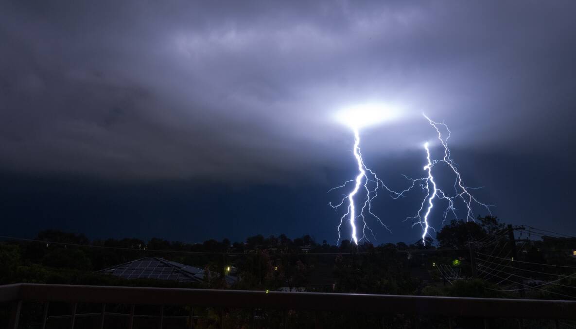
Thunderstorms continue to roll across the territory this summer, with many Canberrans wondering why the start to 2024 has been so wet for a period declared "El Nino".
After a wet Monday, Bureau of Meteorology said was a chance that thunderstorms would come through on Tuesday, possibly becoming severe.
The territory experienced a wet start to the week, with 7.2mm of rain recorded at Canberra Airport since 9am on Monday.
Conditions are expected to ease on Wednesday, although a slight chance of a shower remains.
South of Canberra, the bureau has issued an initial minor flood warning for Snowy River.
This rainy El Nino summer is 'unusual'
Long-range forecasts for spring 2023 showed the likelihood of an El Nino event, a positive Indian Ocean Dipole (warmer sea surface temperatures) and below average rainfall for large areas of the country.
It was predicted last year the climate would bring a scorching summer.
"The Bureau's outlook for the severe weather season indicated above-average risk for extreme heat and fire in southern Queensland and parts of NSW, the west, northwest and Top End," the agency said in a statement.
"The outlook also indicated a typical summertime risk of severe thunderstorms, and risk of riverine flooding. Based on historical patterns, the presence of El Nino provided a likelihood of fewer tropical cyclones than in any given summer."
However, the Bureau said no two El Nino and IOD events could be the same, they had differing effects on the continent, and this was particularly true of summer months in Australia.
"Once the northern monsoon arrives, the influence of both El Nino and a positive IOD is diminished, and the chance of summer rainfall events increases," the statement said.
Half of all El Ninos bring heavy rain
The agency reported about 50 per cent of El Nino events in the past had brought heavy rainfall events, particularly across areas in eastern Australia. It referred to December 2009 and August 2015 when the Illawarra region received more than 400 millimetres in 48 hours.
The reason for this year's wet El Nino summer could be a continuously positive Southern Annular Mode, a climate driver that influences rainfall in Australia.
In such an event the belt of strong westerly winds contracts towards Antarctica, which leads to weaker westerly winds and higher pressures over southern Australia, limiting cold fronts from piercing inland, the agency's website said.
"The presence of a positive SAM, combined with very high temperatures in the Tasman Sea, likely contributed to rainfall events in eastern Australia in December and January. It is unusual to see a persistently positive SAM during El Nino, as that is more typical during a La Nina phase. The widespread and regular rainfall across southeastern Australia across multiple months is similarly unusual for El Nino," the Bureau said.
The agency's January to March long-range forecast, issued on January 4, showed an increased chance of wetter conditions and cooler daytime temperatures over Canberra for the month.
Additionally, the forecast did not show a shift towards intense warmer or cooler conditions over the ACT until March.
"Likewise for rainfall there are no strong swings to wetter or drier conditions, though surrounding parts of NSW show some increased odds for above average rainfall," a Bureau spokesperson said.