Flooding and thunderstorms are threatening to cause disruption to large parts of the UK after the hottest day of the year so far was recorded on Friday.
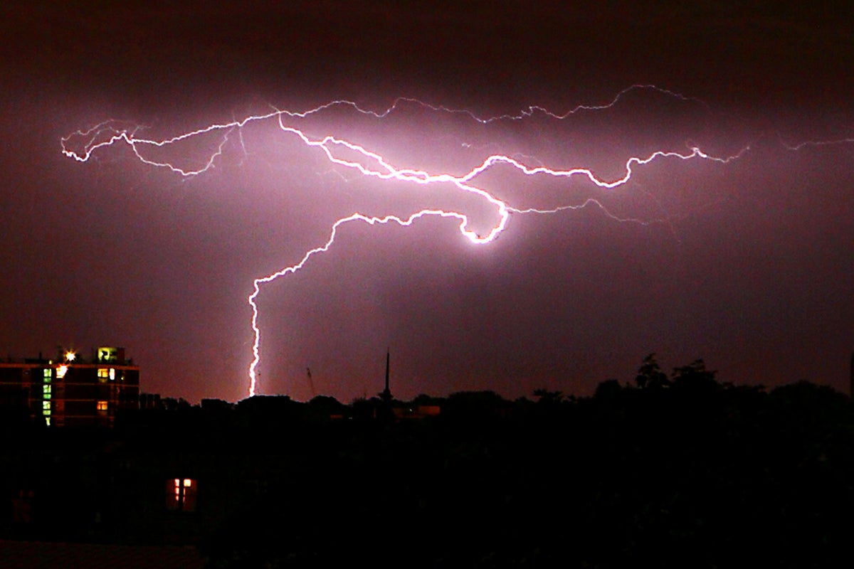
More than 30,000 lightning strikes were recorded up to 6am on Saturday, although the Met Office said the “vast majority” had been over the sea. Torrential downpours also hit land, causing significant flooding and disruption in Kent.
The Met Office has issued a yellow thunderstorm warning, in place until 6pm on Saturday, with experts warning that driving could become difficult and some communities could become cut off by flooding.
The thunderstorm warning covers the south west, north east, north of England, Wales and much of Scotland. The Met Office has warned that some areas could see 30-50mm of rain in a few hours, while a few locations could reach up to 80mm.
Trains and buses could be delayed, and homes and businesses could flood, the forecaster predicted.
The warning comes after Santon Downham in Suffolk recorded 29.4C on Friday, setting a new high for the year. An amber thunderstorm warning was also in place overnight for parts of the east and south east of England.
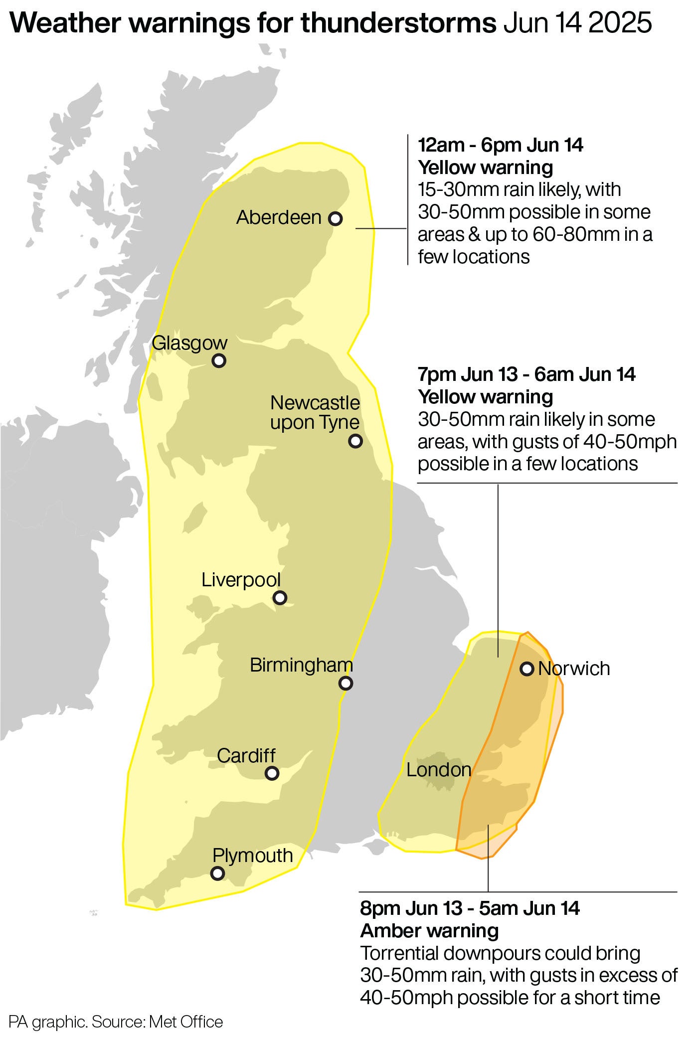
A further yellow warning comes into force in the eastern half of Northern Ireland from 6am to 6pm on Saturday.
Kent also experienced heavy rainfall overnight, with flooded roads in parts of Dover.
A lightning strike was the likeliest cause of a fire in a residential building in St Leonards-on-Sea on Friday night, according to East Sussex Fire and Rescue Service. It said there were no reports of casualties and the fire had been extinguished.
In Devon, where North Wyke near Okehampton saw 36.4mm of rain on Friday, five flood warnings were issued overnight by the Environment Agency, alongside 46 flood alerts in the south west, south east and Midlands.
National Rail said a landslip had stopped all services between Exeter St Davids and Okehampton, with the weather conditions meaning it is not safe for engineers to reach the site. Disruption is expected until 1pm.
Rail operators warned customers to check for updates on services on Saturday morning, while Heathrow Airport apologised to passengers late on Friday night for flights delayed by “adverse weather conditions”.
Met Office chief meteorologist Steve Ramsdale said: “While the warnings cover the areas of the country most at risk of seeing thunderstorms, not everyone within a warning area will experience a thunderstorm. For many, it will remain dry much of the time”
Heavy showers and thunderstorms are expected to ease slightly throughout the day, with the driest and brightest weather in the South East, which will remain very warm.
The Met Office said showers will continue to ease through Sunday, with dry weather for most of the country on Monday and Tuesday.
Katharine Smith, flood duty manager at the Environment Agency, said: “There is a risk of significant and localised surface water flooding impacts in parts of England.
“Environment Agency teams have ensured rivers and watercourses are clear ahead of the storms and stand ready to support local authorities in their response to surface water flooding.
“We urge people not to drive through flood water as just 30cm of flowing water is enough to move your car.”
Government plan to keep Pip payouts for 13 weeks ‘not very much’, says MP
Grenfell community gathers for final anniversary before tower demolition begins
More than 900 people arrived in small boats on Friday
Appeals for de-escalation after Israel bombarded by Iranian missiles
As David Beckham receives a knighthood, just one thing threatens Brand Beckham now
Petrol bombs thrown at police during fifth night of Northern Ireland disorder