AccuWeather meteorologists are tracking several more thunderstorm complexes that are expected to bring high winds and hail across portions of the Plains states into the weekend.
“Severe thunderstorms have been erupting with a regular cadence across the middle of the nation over the past several weeks, hitting some communities on consecutive days while sparing others altogether,” said AccuWeather metereologists.
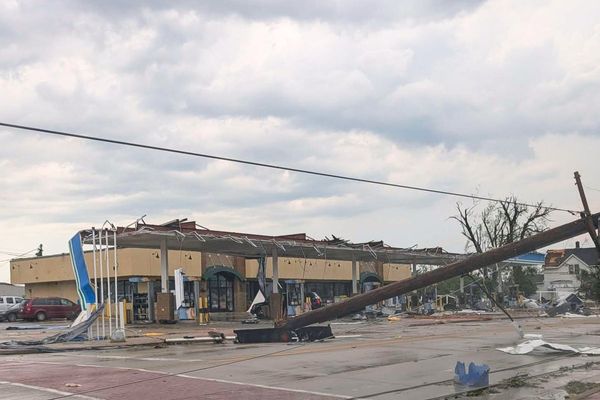
Downtown Chicago was one major metro area hit by damaging weather on Wednesday as a tornado-producing storm toppled large trees and damaged warehouses near O’Hare International Airport.
AccuWeather forecasters have all the details on the zones that will remain at the greatest risk of severe weather dangers in the coming days over the Central states. Farther east, catastrophic flooding, accompanied by damaging winds in some cases, has pummeled portions of the Northeast with more rounds of heavy rainfall and severe weather to come.
“Into this weekend, [AccuWeather forecasters] are focusing on the nation’s midsection as the area where severe thunderstorms can form and wreak havoc on outdoor plans,” said AccuWeather Senior Meteorologist Bill Deger.
The corridor between interstates 40 and 80 is expected to get hit by back-to-back rounds of severe weather on Thursday and again on Friday.
It is within this zone where the large dome of heat over the Southwest will collide against a cooler air mass trying to move south from the northern United States, according to Deger.
“Waves of energy rolling through will provide the spark for the storms, which will move swiftly from southwest to northeast in multiple rounds into the weekend,” said Deger.

Torrential downpours and large hail are also expected to be common hazards, forecasters say.
Motorists are encouraged to remain vigilant for areas of standing water on the roadways that could cause vehicles to hydroplane.

While any of these storms across the nation’s midsection can turn severe over the weekend, AccuWeather meteorologists say the greatest risk may lie farther to the east across part of the Great Lakes region, Ohio Valley and into the southern Appalachians.

Locations that get hit with the most persistent thunderstorms could receive 1-3 inches of rain into the weekend with localized higher amounts.
AccuWeather meteorologists expect rounds of severe weather to persist across the Plains into late July as the southwestern U.S. heat dome shifts a bit farther to the east and thunderstorm complexes continue to ride along the northern periphery of this feature.
Produced in association with AccuWeather
Edited by Judy J. Rotich and Newsdesk Manager