Emergency crews are scrambling to keep up with rising rivers and widespread damage as a powerful coastal storm battering eastern Australia leaves roads flooded, trees fallen and tens of thousands of people without power.
The storm system, initially referred to as a “bomb cyclone”, intensified overnight on Tuesday and dumped more than 150mm rain in parts of coastal New South Wales and triggered damaging winds reaching 125kmph.
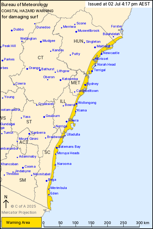
The Bureau of Meteorology warned of damaging winds and dangerous surf continuing into Thursday morning, with gusts of up to 100kmph still possible inland.
A coastal hazard warning remained in place for the entire NSW coastline, with waves of up to 7 metres forecast to pound beaches from Seal Rocks to the Victorian border, threatening severe coastal erosion.
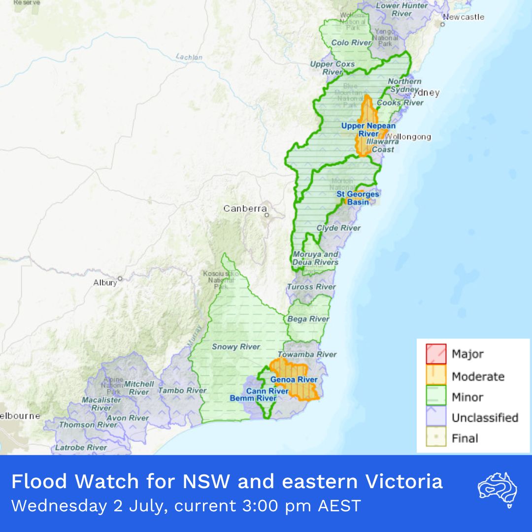
Flooding is now a key concern as rivers across Sydney’s west and the state’s south coast rise sharply. The NSW SES has issued advice-level flood warnings for Camden, Penrith and North Richmond, with the Nepean and Hawkesbury rivers expected to rise rapidly overnight.
Authorities also warned that the Warragamba Dam – Sydney’s largest water reservoir – was approaching full capacity and would likely spill by Thursday morning, raising fears of downstream flooding similar to past flood events in western Sydney.
In a statement, WaterNSW said the expected overflow would be “moderate”, with a peak spill rate of around 60 gigalitres a day, though the exact volume would depend on how much more rain fell across the catchment today.
Power outages have affected around 30,000 homes and businesses, with Endeavour Energy reporting about 400 electrical hazards caused by fallen trees and powerlines.
While crews restored power to most areas through the day, nearly 9,000 customers remained in the dark.
“We hope to get over 80 per cent of those customers that are currently affected back on tonight,” David Campbell, general manager of safety and operations at Endeavour Energy, told ABC. “There will be some customers unfortunately that will be without power tonight, we will get all of them back on tomorrow.”
Transport chaos has deepened with 140 flights cancelled at the Sydney airport, following 145 cancellations on Tuesday. Major rail lines have been suspended by fallen trees and power failures, and ferry services across Sydney Harbour have faced widespread disruptions.
Roads across Greater Sydney and the Illawarra remain littered with debris, with 20 closures reported at the peak of the storm.
Emergency services have responded to nearly 3,400 incidents since the wild weather began, including 10 flood rescues.
NSW SES deputy commissioner Debbie Platz said the storm’s southern flank was the current area of greatest concern, particularly around Sussex Inlet, Burrill Lake and Shoalhaven, with conditions expected to worsen into Thursday.
Experts say repeated flooding events are becoming more frequent and more psychologically and financially damaging in Australia.
“Any experience of flooding can have harmful psychological impacts but we know it’s even worse when people go through multiple events, especially back to back like we’re starting to see more often,” Dr Lauren Vinnell of Massey University said.
Climate experts point to unusually warm ocean waters off Australia’s east coast as a key driver of this storm’s intensity. Dr Martin Jucker of UNSW said: “The very high water temperatures off the eastern Australian coast would help such systems become intense by providing the necessary moisture from the warm ocean surface.”
While some people have referred to the storm as a “bomb cyclone” – a term used internationally when a low-pressure system deepens rapidly – Australia’s Bureau of Meteorology has avoided using it.
Senior meteorologist Jonathan How told Nine’s Today programme that they did not really use the term much. “We just talk about a low pressure system deepening very quickly because ‘bomb’ can sort of create a little bit more panic,” he explained, adding that this made it “a little bit more scary than what it actually is”.
A significant fall in pressure of 20 to 30 hectopascals over the past two days has transformed the coastal low into a severe storm but the bureau has instead described it as a “vigorous coastal low”.
The Bureau of Meteorology forecasts conditions to start easing late Thursday as the storm moves east into the Tasman Sea, but people across NSW’s south coast and inland catchments are being urged to stay alert for flash flooding, falling trees and continued power outages.