Get all your news in one place.
100’s of premium titles.
One app.
Start reading
Reuters
Reuters
Environment
Darren Whiteside

Volcano on Indonesia's Bali island at highest alert level, thousands evacuated

An evacuated villager from locations near the summit of Mount Agung, an active volcano which is showing increased seismic activity, is helped at a temporary shelter in Klungkung, on the resort island of Bali, Indonesia Antara Foto/Nyoman Budhiana/via REUTERS

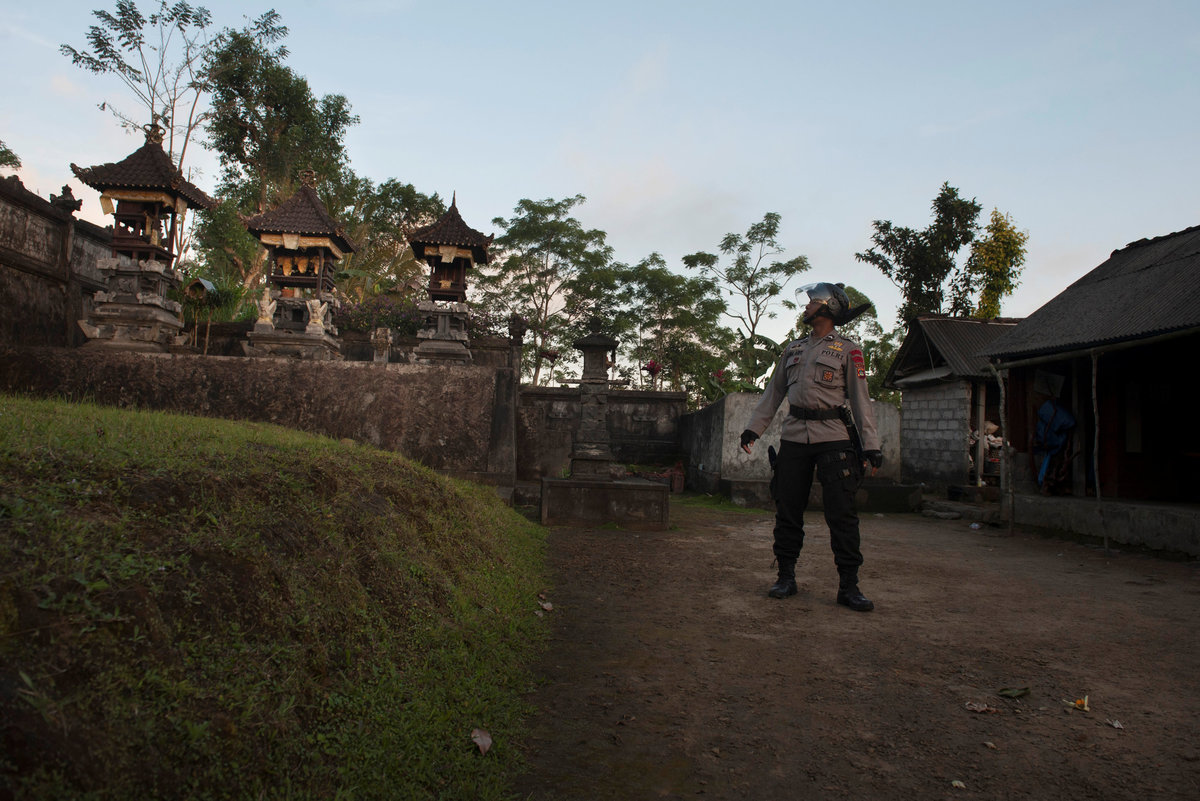
DENPASAR, Indonesia (Reuters) - Thousands of residents were evacuated from villages near an active volcano on the Indonesian island of Bali, officials said on Friday, as the alert status was raised to the highest level, meaning an eruption could be imminent.

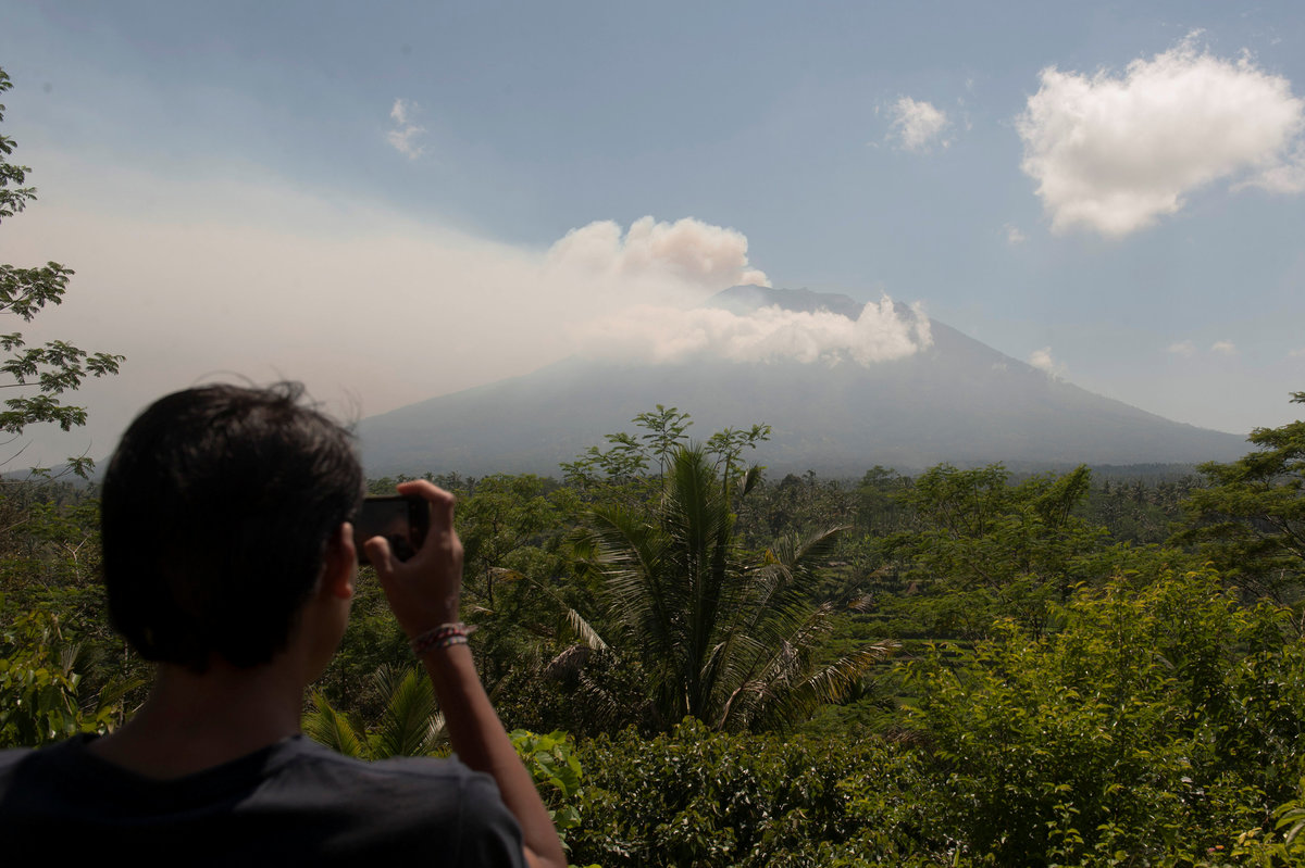
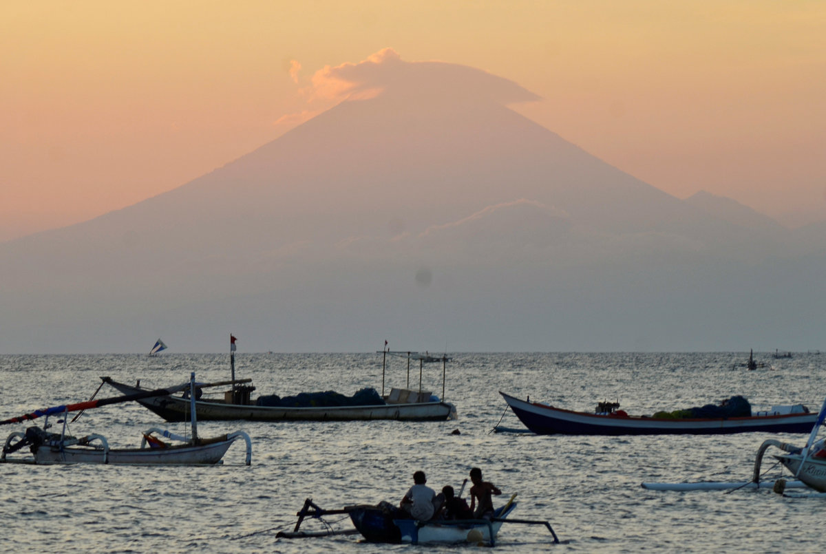
Authorities warned tourists and residents to avoid camping or hiking within a 9 km (6 mile) radius of the crater as seismic tremors rattled some areas and smoke rose above one of the world's most popular tourist spots.

Evacuated villagers from locations near the summit of Mount Agung, an active volcano which is showing increased seismic activity, relax in a temporary shelter in Klungkung, on the resort island of Bali, Indonesia Antara Foto/Nyoman Budhiana/via REUTERS

"Volcanic activity remains high and there are indications of magma rising to the surface and causing tremors," said Sutopo Purwo Nugroho of the National Disaster Management Agency.

"There should be zero public activity within the specified radius in case there is an eruption," Nugroho said.

However, flights at Bali's international airport were operating as normal and there was little disruption to tourism operators across the rest of the island, authorities said.

A local resident takes a picture of Mount Agung, an active volcano that authorities say is showing increased activity, from a monitoring station in Rendang Village, Karangasem on the resort island of Bali, Indonesia Antara Foto/Nyoman Budhiana via REUTERS

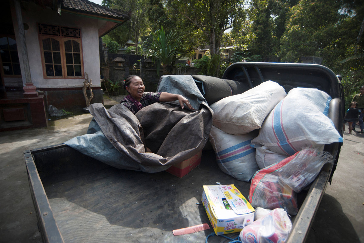
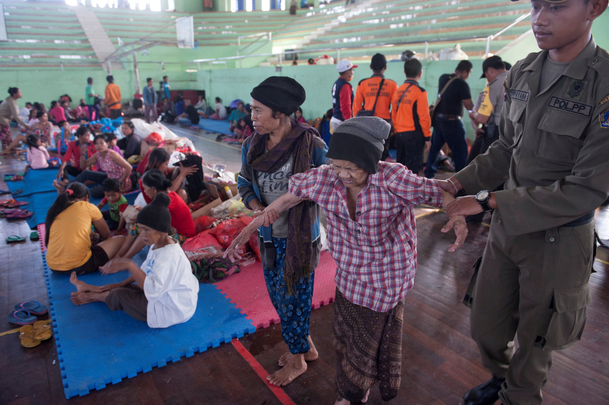
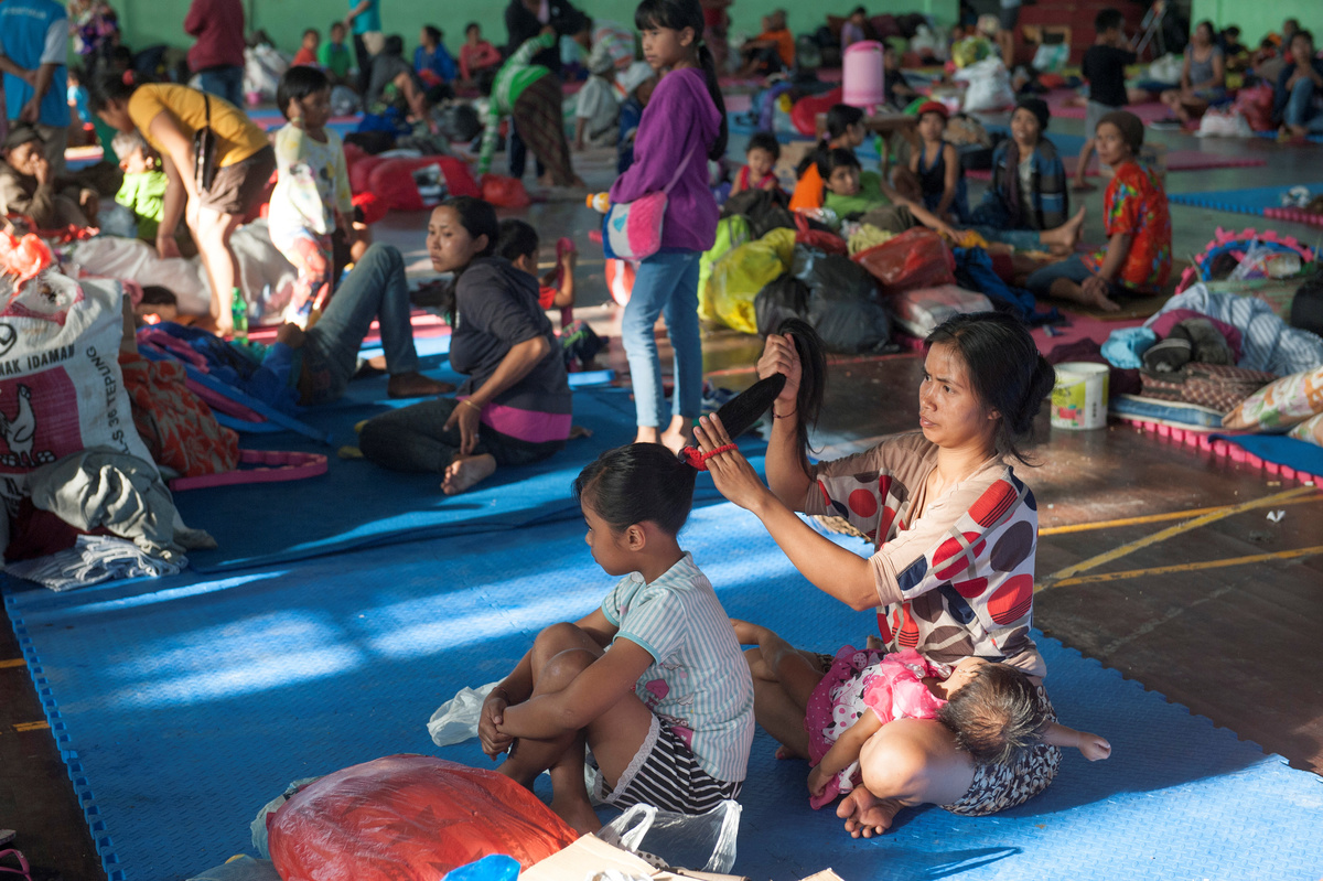
Nearly 10,000 people have been evacuated so far and that number was expected to rise, officials said.

Others packed their belongings into trucks for evacuation, while more stopped to watch as clouds of white smoke rose from the crater, which is around 3,000 meters (9,840 feet) above sea level.

Indonesia straddles the "Pacific Ring of Fire", where several tectonic plates meet and cause 90 percent of the world's seismic activity, according to the U.S. Geological Survey.

Mount Agung, an active volcano located on the resort island of Bali that has been placed on alert level 3 following recent seismic activity, is seen from Mataram on nearby Lombok island, Indonesia September 21, 2017, in this photo taken by Antara Foto. Picture taken September 21, 2017. Antara Foto/Ahmad Subaidi/via REUTERS

Indonesia has nearly 130 active volcanoes, more than any other country.

A series of eruptions at Mount Agung between 1963 and 1964 killed more than 1,000 people and injured hundreds.

A police officer searches for residents who did not evacuate an area close to the summit of Mount Agung following increased seismic activity on the volcano in Temukus village, Karangasem, Bali, Indonesia September 21, 2017, in this photo taken by Antara Foto. Antara Foto/Nyoman Budhiana/via REUTERS

(Reporting by Reuters stringer in DENPASAR and Kartika in JAKARTA; Writing by Kanupriya Kapoor; Editing by Paul Tait and Gareth Jones)

A resident packs up some belongings to evacuate from the village of Sebudi located on Mount Agung volcano following increased seismic activity in Karangasem on the resort island of Bali, Indonesia September 20, 2017 in this photo taken by Antara Foto. Antara Foto/Nyoman Budhiana/ via REUTERS
Sign up to read this article
Read news from 100’s of titles, curated specifically for you.
Already a member? Sign in here
Related Stories
Top stories on inkl right now
One subscription that gives you access to news from hundreds of sites
Already a member? Sign in here
Our Picks
Fourteen days free
Download the app
One app. One membership.
100+ trusted global sources.