In March of 2022, there was an unexpected seismic crisis in Portugal's São Jorge Island in the Azores province, plunging residents into a state of confusion and fear. The recent publication of an international study in the journal Nature Communications has revealed that the seismic activity was caused by a rapid intrusion of magma at a depth of approximately 26 kilometres beneath the Earth's surface. This resulted in the magma rising to a depth of 1.6 kilometres below the surface of the island, as noted in a study at University College London.
The researchers used a combination of seismometers (both surface-based and seabed), satellite data, and GPS data to identify this ‘failed eruption’. The researchers believe that this event offers another example for volcanologists on how large geologic faults can serve effectively both as paths for magma to travel and as pressure-release valves in times when there are signs of active volcanism. Such a geological resilience highlights how pre-existing tectonic fractures can mitigate volcanic hazards by redirecting subterranean pressure, potentially preventing catastrophic surface explosions despite significant deep-seated magmatic movement.
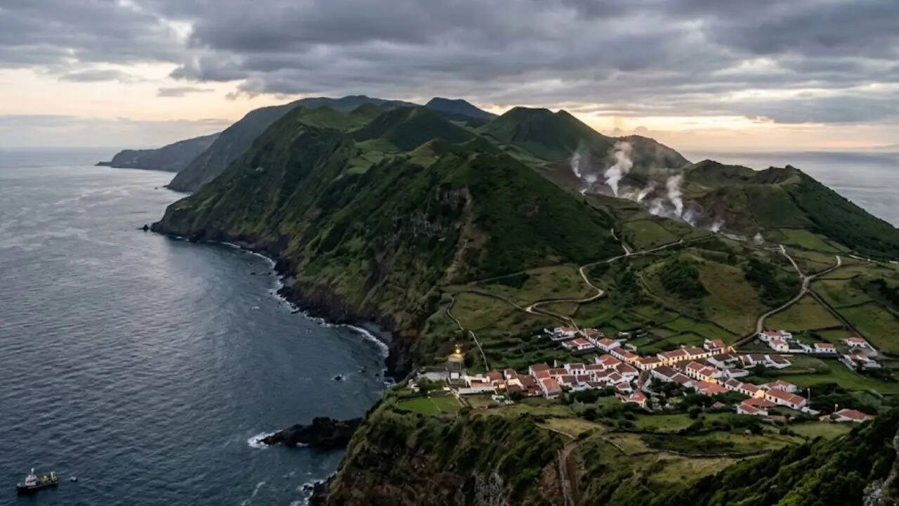
Portugal’s São Jorge Island, which narrowly escaped a ‘stealthy’ eruption
The movement of magma was slow until it reached the surface, making it very hard for volcanologists to predict whether a full eruption would occur. The intrusion was large enough to fill 32,000 Olympic-sized swimming pools with magma. According to the lead author of the study, Dr Stephen Hicks of UCL, the magma moved quickly through the Earth’s crust with largely aseismic, or silent, ascent, showing that predicting volcanic hazards can be extremely difficult.
The role of fault systems in volcanic activity
The magma moved along the Pico do Carvão Fault Zone, the island’s primary fault system. This fault zone is described as a dual-purpose fault in that it functions not only as a highway for moving magma towards the surface, but also as a ‘leak’ permitting gases and fluids to move laterally away from the magma, thus relieving pore fluid pressure in the magma and preventing the movement of the magma towards the surface, therefore preventing a volcanic eruption. This finding demonstrates that tectonic environments are complex and can directly affect whether volcanic unrest will result in a volcanic eruption or remain buried beneath the earth.
Why 'stealthy' intrusions need advanced data
The study published in Nature Communications also illustrates the critical need to use an integrated approach of placing onshore seismometers with offshore seafloor sensors in order to monitor large-scale geological changes that occur below the Earth’s surface. Furthermore, by using a combination of these data types, along with satellite radar imaging (InSAR) and high-precision GPS data, researchers were able to reconstruct the underground movements of magma with unparalleled accuracy.
Such findings provide a greater understanding of how large magma intrusions can take place in short amounts of time, with little to no surface indicators. Experts now believe that applying these types of monitoring techniques to other geologically complex areas will be key in enhancing the accuracy in forecasting future volcanic hazards, as well as how local emergency management agencies respond.