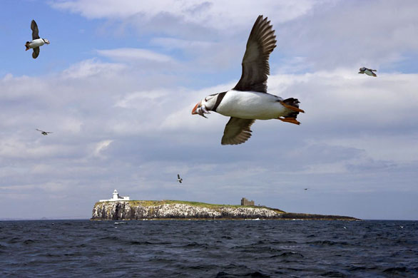
Internationally important for wildlife, 20 species of seabirds breed on the islands including 56,000 pairs of puffins and a colony of grey seals. But with increased storminess predicted over the next 40 years, it may be harder for visitors to get to the Farnes, while just one severe summer storm has the potential to wash away many of the chicks from their nests Photograph: Steve Allen Travel Photography/Getty
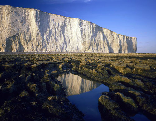
Birling Gap, with its gleaming white chalk cliffs, marks the start of the Seven Sisters and the sea around it is a marine nature reserve. On average, these cliffs are eroding by one metre each year. As sea-levels rise and storminess increases the erosion could accelerate and more buildings on the clifftop will be lost Photograph: The Travel Library/Rex Features
Studland beach stretches for 5km along the Purbeck coast in Dorset. Sea defences, installed to defend infrastructure from the ravages of winter storms, are now failing. Popular with holidaymakers, over one million people soak up the sun here throughout the year. But the action of the sea is eroding the southern section of the beach by two to three metres a year Photograph: Adam Burton/The Travel Library/Rex Features
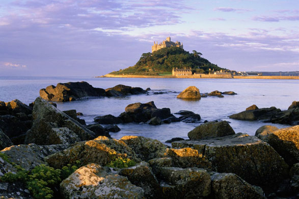
A rocky island crowned by a medieval church and castle just off the coast of Penzance. Home to a small community, the island is accessible by a causeway at low tide. In the early 18th century the causeway was accessible for six hours at low tide. Now it is accessible for four. In 40 years time it may be accessible for under an hour and eventually the Mount could become a true island Photograph: Peter Adams/Getty
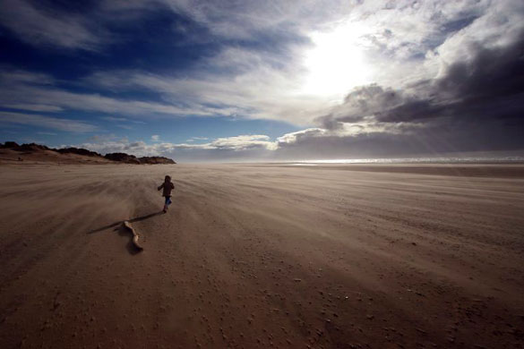
Formby is part of the Sefton coast, one of the largest sand dune systems in Britain. Along the shoreline prehistoric footprints of deer, wild cattle, birds and people are exposed and then covered up by the tides. In the past 100 years, the beach has been eroding at a rate of four metres a year. A single severe storm can take 12 to 15 metres in one go. Over the next 100 years, the sands are predicted to recede by a minimum of 400 metres Photograph: Colin McPherson/Corbis
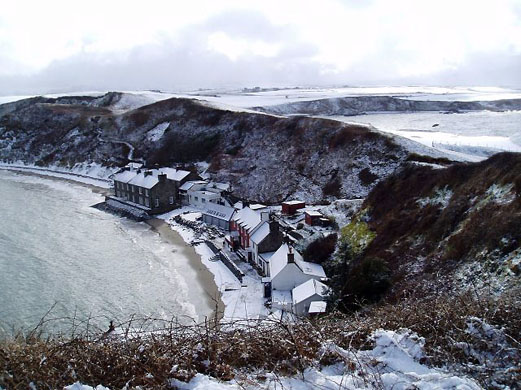
This pretty hamlet on the Llyn Peninsula is set on a beach fringed by cliffs and a ragged coastline. Already high tides can cause problems with services. If this coincides with stormy weather, buildings can flood and sea walls are damaged. As climate change takes hold the chance of flooding and landslides will increase Photograph: Public domain
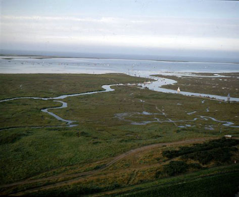
Blakeney NNR is a spectacular shingle spit which is constantly changing with the movement of the sea. Lying behind the spit is an area of saltmarsh, dunes and grazing marsh, home to several species of breeding bird and common and grey seals. As Blakeney lies just above high tide the area is already at risk from flooding. But more frequent storm events and higher tides could wash away important breeding colonies of terns Photograph: Angelo Hornak/Corbis
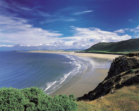
Considered one of the finest sandy beaches in the UK, Rhossili sweeps for three miles along the western edge of Gower Peninsula in Wales. A haven for holidaymakers, the area is rich in archaeology and wildlife. Erosion of the surrounding cliffs is leading to potentially dangerous rock falls and landslides. Beach erosion is eating away at the edges of an abandoned sand-covered village dating back to medieval times Photograph: ABEL/Getty

One of the most popular beaches on the Isle of Wight, the crumbling cliffs constantly reveal dinosaur fossils. It is one of the few strongholds for the Glanville Fritillary butterfly. In the past 20 years, the car park that serves the beach has already decreased in size by 50%. Soft geology means that the cliff will continue to fail as sea levels rise and the seas get stormier Photograph: John Farmar/Ecoscene/Corbis
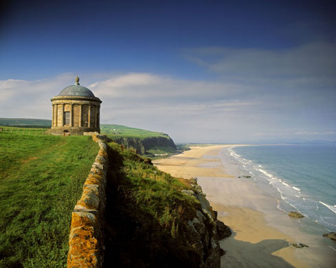
The magnificent beach and dunes of Portstewart Strand stretch for two miles along the Northern Ireland coast. As the sea levels rise and storminess increases in the coming decades the sand dunes will roll back inland. Beach access may be hampered, and the course of the river affected Photograph: Axiom/Getty


.png?w=600)