The race to map Africa's forgotten glaciers – in pictures
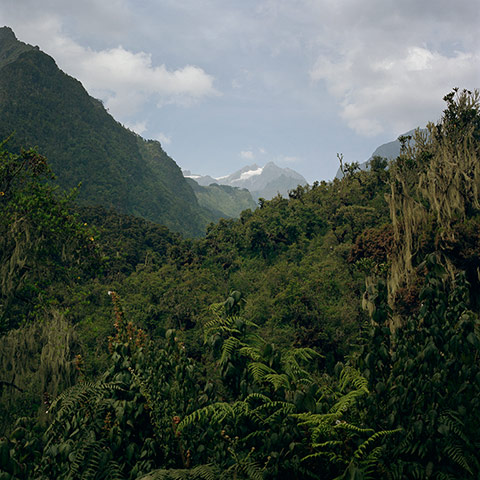
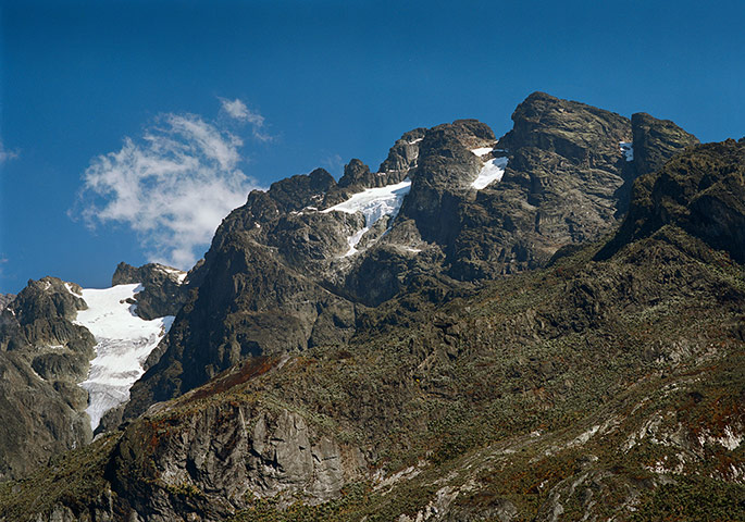
Project Pressure is a non-profit organisation which has set out to document the world’s vanishing glaciers. A recent expedition to Uganda and the Democratic Republic of the Congo started in burning sun trekking up through rainforest Photograph: Klaus ThymannThere are still glaciers on each of the three mountains of the Rwenzori. Mount Speke is captured from Mount Stanley in this picturePhotograph: Klaus ThymannLocal porters were hired to help carry kit and provisions. Their experience on ice is limitedPhotograph: Klaus Thymann
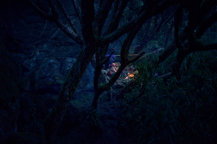
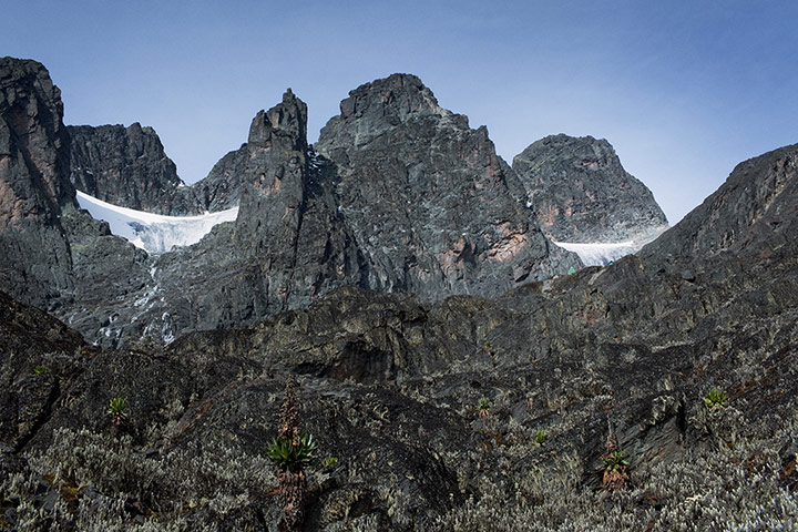
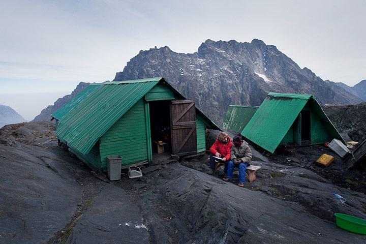
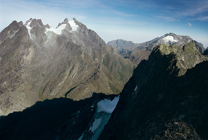
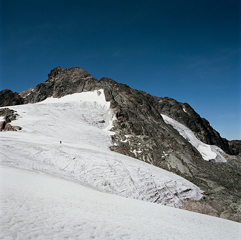
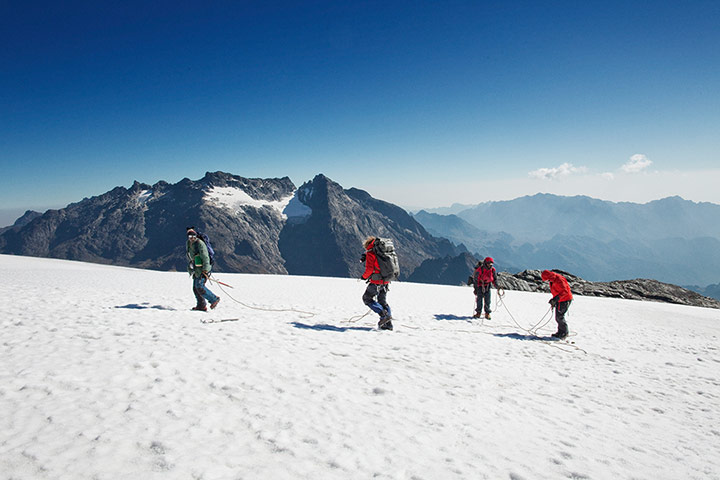
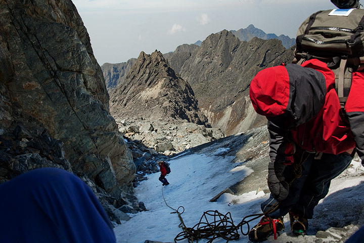
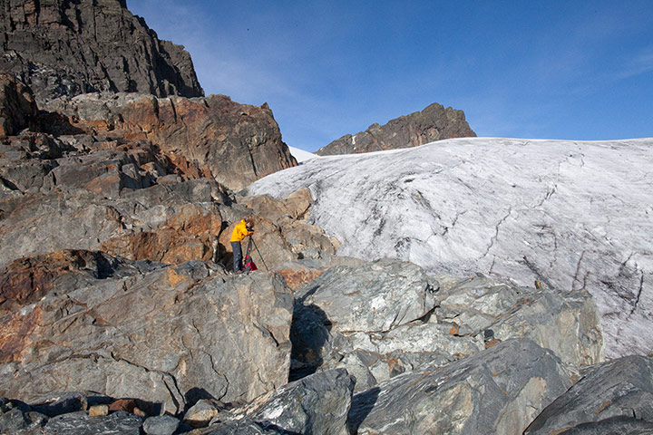
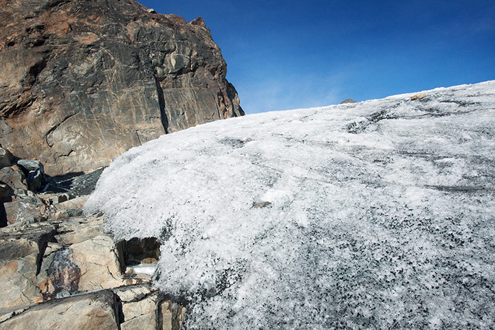
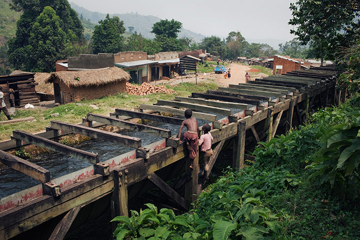
Vegetation creeps up the mountain as the temperature rises and the glaciers retreat. The Speke glacier used to reach where the lake now isPhotograph: Klaus ThymannThe Elena hut just below the Elena glacier to the right is located at 4,541 metres above sea level. The Coronation glacier can be seen to the leftPhotograph: Klaus ThymannIn order to get a view not seen for decades, and to establish if glaciers still exist on the western side of the Rwenzori, Project Pressure’s expedition went into the Democratic Republic of the Congo. Klaus Thymann, who heads Project Pressure, gives a briefing at the Elena hutPhotograph: Klaus ThymannFrom the top of Mount Baker (4,844 metres), it is possible to get a clear view of all three peaks. Mount Stanley is to the right, Speke to the leftPhotograph: Klaus ThymannView of the Stanley plateau. The figure of a porter gives an indication of scalePhotograph: Klaus ThymannThe expedition on top of Stanley plateau with Speke in the backgroundPhotograph: Klaus ThymannThe expedition is taking a new route into the Congo, going down the West Stanley Glacier. The few people who come to the Rwenzori never go down on the west sidePhotograph: Klaus ThymannThe glacier front is photographed and GPS co-ordinates are noted. Once published, Project Pressure’s material will be open source so it can be used for education and researchPhotograph: Klaus ThymannThe black particles on the glacier absorb more heat, which then increases the melt rate. This form of glacial retreat is not unique to Africa. In Greenland the consequences are very noticeablePhotograph: Klaus ThymannA unique view of the Rwenzori seen from the Congo side. A few days earlier the expedition roped down the West Stanley glacier (left). Project Pressure lead the expedition into Congo using an old disused route going through the burned-down war zone bordering Congo and UgandaPhotograph: Klaus ThymannSome of the glaciers are almost gone. The Moebius on the west side will soon disappear completelyPhotograph: Klaus Thymann400 metres below the disappearing icefield, the communities of coffee farmers, who use the glacial water for irrigation of coffee and other crops, say climate change has disrupted rainfall patternsPhotograph: Klaus Thymann
Sign up to read this article
Read news from 100's of titles, curated specifically for you.