If you're fit and able, you can't claim you are a true Canberran if you haven't walked up Mt Ainslie at least once. Of course, for many of us, it's part of a daily or weekly routine.
In fact, I can almost set my watch by who I encounter on the 4.5-kilometre (return) well-trodden Summit Track (also called the Kokoda Track - Mt Ainslie) that snakes up the southern face of the 843-metre landmark from behind the war memorial.
First, there are the early morning lycra-clad set, some of whom complete two "up and downs" in the time it takes me to huff and puff up once. Sometimes they run, sometimes they walk at Olympic pace, but they never make eye contact - they are too focused on setting a record time.
Around mid-morning retirees arrive in small clusters, enjoying a much gentler stroll while discussing the various merits of what they've heard on morning talkback radio. Around midday they give way to the rush of office workers out to grab gulps of fresh air during a hurried lunch break.
After work, especially during daylight savings, the fitness fanatics return (yes, sometimes the same dedicated runners from the morning), along with a sprinkling of Instagramers on their never-ending quest to snap that ultimate sunset shot.
Meanwhile, weekends are a melting pot of all the above, plus families and a decent dose of "Oh, I didn't think it'd be this steep" tourists thrown in for good measure.
However, unless you tackle the walk in the middle of the night (and yes, I have occasionally seen those diehards scrambling up in head torches), you are bound to encounter others on the track.
COVID, of course, made it even busier.
So, last year, in search of some solitude (I'd rather listen to birds than the intricate details of the love life of the couple walking just in front of me) I started walking a different route up Mt Ainslie. Sure, there are several unofficial summit routes where some over-zealous walkers have bush-bashed on paths from their back fence, often dismissing erosion control barriers, but this is an official alternative, known as the Quarry Walk. Not many know about it. Even fewer walk it.
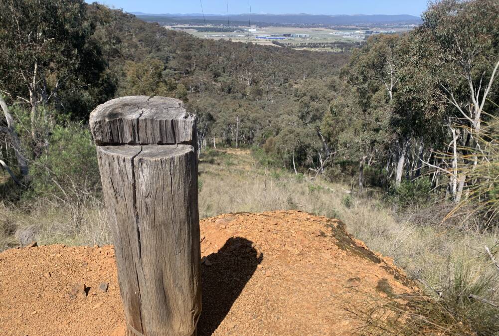
You can tackle the track in either direction. If you start at the bottom, you're best to park in Cobby Street, Campbell, and attempt to follow the infrequent and generally inadequate "Quarry Loop" signs. However, it's much easier to find the track head from the summit - it's just near where the road divides as you reach the first car park on the left.
From here the first 300 metres downhill is very steep but along a well-established footpad. Take care after rain as it can be slippery. Also, if you have young kids in tow, keep them close by as the track eventually skirts by an unfenced 15-metre vertical drop near the top of the first of two former quarry sites.
This upper Ainslie quarry opened in 1932 following the closure of the Mugga Quarry due to the extra hard stone resulting in unacceptable wear on the crusher. There were also health concerns surrounding silica dust at Mugga.
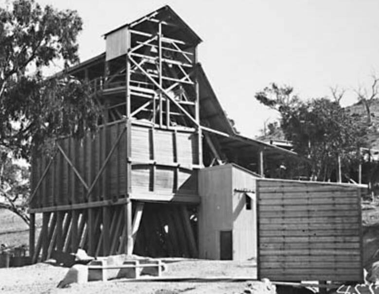
According to a Light Rail Research Society of Australia newsletter of December 2013, "the existing plant at Mugga was dismantled, reconditioned and re-erected at Mt Ainslie".
While the rock at the upper Ainslie quarry wasn't suitable for concrete, it was more than adequate for road making and at a much-reduced cost of transport to the city's expanding road network than the rock from Mugga which back then was well beyond Canberra's urban limits.
Despite this apparent economic advantage, the upper Ainslie quarry's life span was only short, and it closed in 1939 when cheap blue metal in large quantities became available from Sydney.
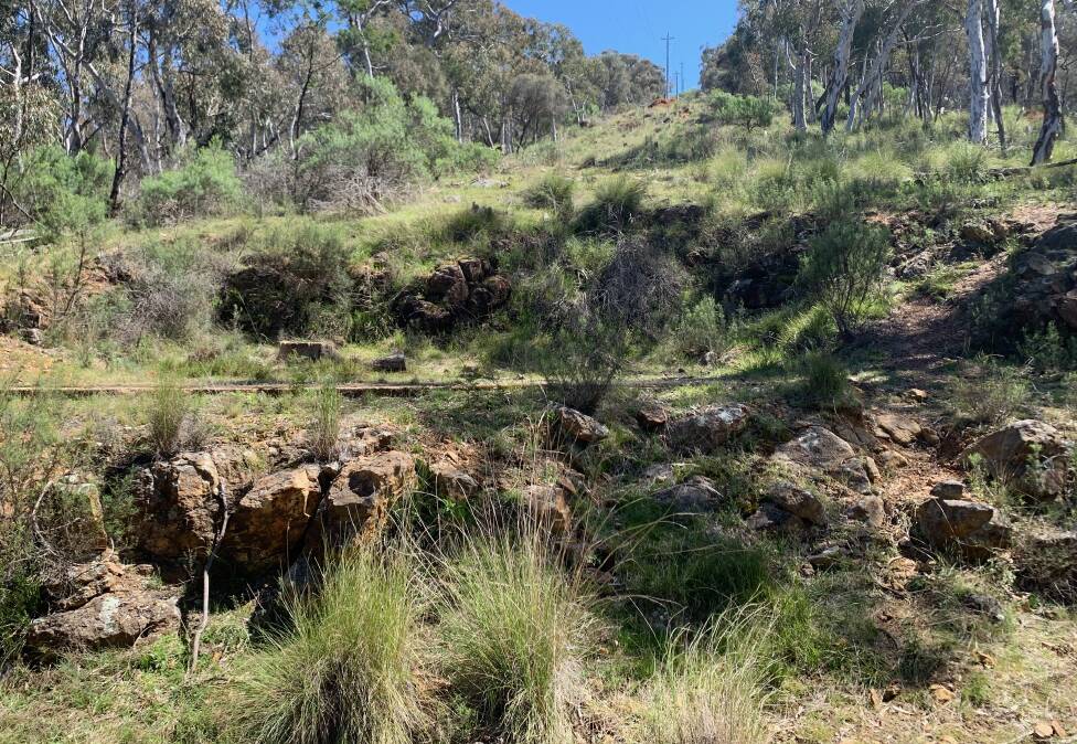
Today, 83 years since it was last operational, if you fossick around the bottom of the quarry, you can still see the remnants of a tramway which transported the rock around the hillside for about 220 metres.
The walking track follows this former tramline and about 100 metres along there's an unnamed track to the left which leads down to the former location of the crusher. You can then follow the fire trails to Cobby Street.
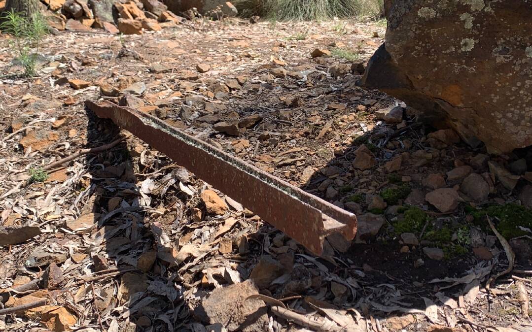
Alternatively, follow the old tramway for another 100 metres until you reach the powerlines and the earthen remains of the staging point where contents of the tram were emptied into chutes and conveyors for their final journey down to the crusher.
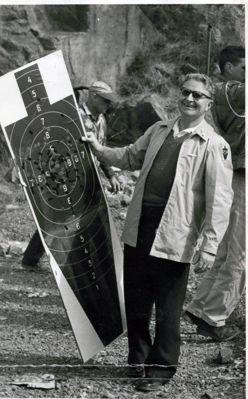
If you continue along the walking track for another 500 metres or so you will reach a fire trail which eventually leads to the second (lower) quarry on the walk. Cut into the gentle lower slopes of Mt Ainslie, there was no need for a tramway here and trucks could pull up right at the quarry, which, when it closed in 1959, became the shooting range of the National Pistol Club.
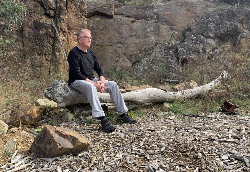
Although vandalism of the club's wooden sheds forced the club to move out in 1970, on a recent visit to the lower quarry, Neal Gowen of Kaleen - whose dad Jim Gowen was a foundation member of and later president of the club - "found a handful of old bullet casings on the ground".
Unlike Neal, I've never found any casings here, and despite obvious attempts to rehabilitate the site, it's a popular spot for kids to make stick cubbies and for illegal campfires.
All in all, the Quarry Walk is a much more adventurous alternative to the Summit Track. What's more, the only amorous advances you'll have to witness here are that of the many love-sick lizards which have recently woken from their winter slumber.
Things to know before you head off
Quarry Walk: Allow 1.5 hours to walk up and down this track and to look around both former quarry sites. It isn't very well sign-posted so best take a map. Unlike the main "Kokoda" summit track, steep sections of this track don't have any formed stairs, so take care.
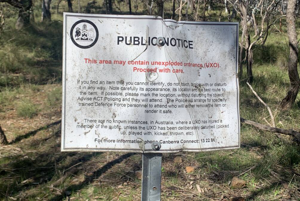
Also, don't wander too far off the track as there are signs warning of the possibility of unexploded ordinance - mortar shells left over from the 1940s and '50s, when the area was used as a military training ground and firing range.
Pistol club: The pistol club (not connected to the military firing range) was formed in 1956 by a group of Peace Officers Guard (later becoming the Commonwealth Police). The first shots of the club were fired into the banks of the Molonglo River, just below Government House, before the club moved to the lower quarry site on Mt Ainslie in 1959. In 1958 they changed their name from the Peace Officers Guard Pistol Club to the National Pistol Club (NPC) and in 1983 the NPC merged with the current Canberra National Pistol Club whose range is now on the eastern side of the Mt Ainslie Drive.
Close call: Sir Murray Tyrrell (1913-1994) who was private secretary for six governors-general, was the first and only patron of the NPC. Tyrell was to be a passenger on the doomed RAAF Lockheed Hudson bomber that crashed near Fairbairn on August 13, 1940, killing all 10 people on board, including several senior members of the Australian government. However, in a last-minute change of plans, Tyrell caught the train from Melbourne to Canberra.
Jim Gowen: A founding member and long-term president of the NPC, and, according to his son Neal, when he worked as a Peace Officer, one of his jobs was to guard The Lodge when Robert Menzies was PM. "On one especially cold night, Menzies' wife, Dame Pattie, came down with some scones for him." Nice.
WHERE IN CANBERRA?
Rating: Medium
Clue: New reserve
How to enter: Email your guess along with your name and address to tym@iinet.net.au. The first correct email sent after 10am, Saturday October 8, wins a double pass to Dendy, the Home of Quality Cinema.
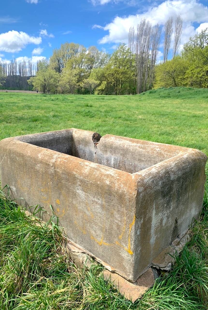
Last week: Congratulations to Sep Westerhuis of Harrison who was first to recognise last week's photo as a water trough at Palmerville Heritage Park, site of one of the earliest (1829-1959) substantial European settlements in the district, located just off Owen Dixon Drive in Evatt/McKellar. Sep just beat many eagle-eyed north-siders, including Diana Herrald of Melba, Ros Donohue of Giralang and Carolyn Cain of Flynn, to the prize. Interestingly, only a handful of correct entries were submitted from readers with southside addresses. Perhaps this historical gem isn't well known to those south of the lake?
Dick Parker of Page visits the park occasionally "but only in dry weather as the ground and the tracks always seem to be muddy after rain". Like several other readers, Dick is complimentary of the "Canberra Tracks" interpretation signs dotted around the site. "They are very informative, and if you've never been before, it's well worth a visit," he explains.
Meanwhile, Kate Cumming confesses to having "an incredibly soft spot" for the heritage park. "So much so myself and my hubby married here 11 years ago," she reveals. Aww.
I am working on an upcoming feature on the park, so if you have any personal anecdotes or questions about the park, I'd love to hear from you.
SIMULACRA CORNER
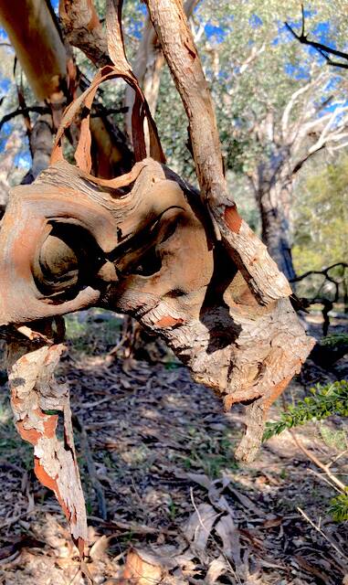
On a recent walk near Mt Ainslie, Debbie Cameron stumbled upon this bark "mask", complete with head strap. "It was one of those times when nature just stops you in your tracks," she explains.
CONTACT TIM: Email: tym@iinet.net.au or Twitter: @TimYowie or write c/- The Canberra Times, GPO Box 606, Civic, ACT, 2601
We've made it a whole lot easier for you to have your say. Our new comment platform requires only one log-in to access articles and to join the discussion on The Canberra Times website. Find out how to register so you can enjoy civil, friendly and engaging discussions. See our moderation policy here.