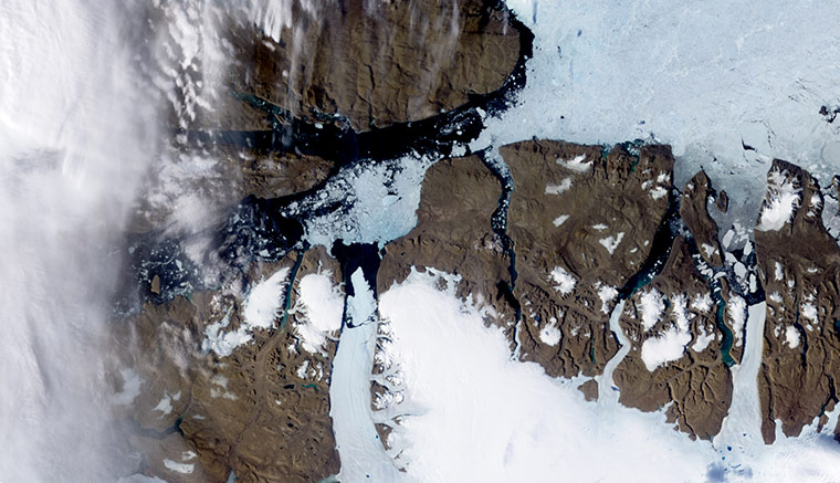
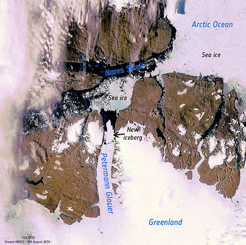
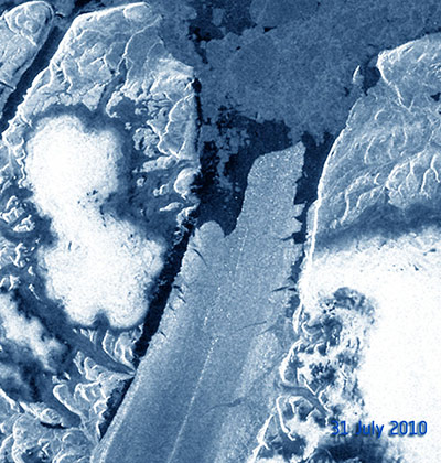
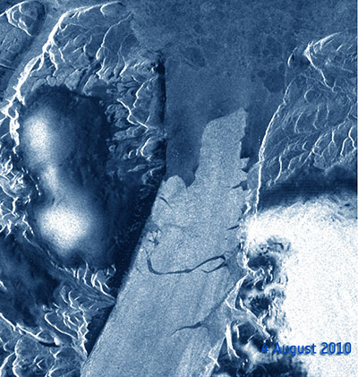
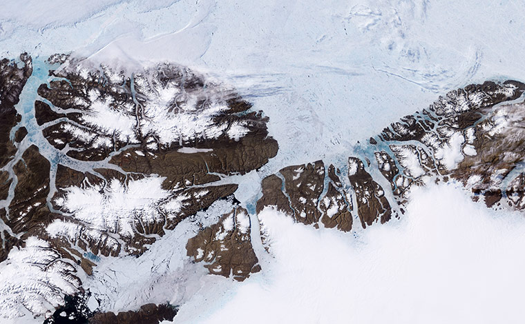
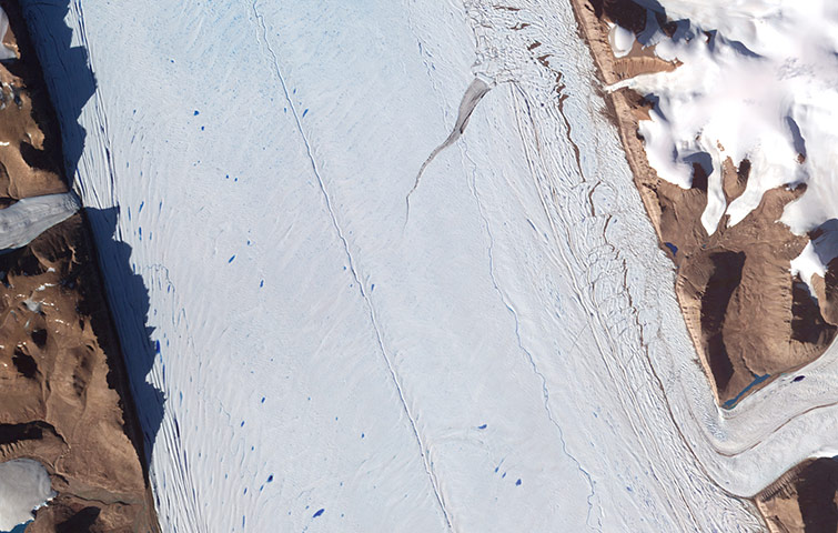
On 5 August 2010, an enormous chunk of ice, roughly 97 square miles (251 square kilometres) in size, broke off the Petermann Glacier along the north-western coast of Greenland. The glacier lost about one-quarter of its floating ice shelf, said researchersPhotograph: Terra/Modis/NASAOn 5 August, the iceberg was already separated from the main glacier tongue. The ice loss from the Petermann Glacier was the largest such event in nearly 50 years, although there have been regular and smaller 'calvings'Photograph: MERIS/ESA31 July: the breaking of the Petermann Glacier and the movement of the new iceberg towards Nares StraitPhotograph: ASAR/Envisat/ESA
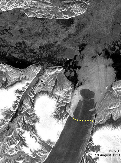
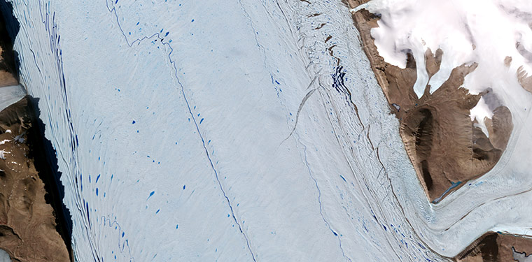
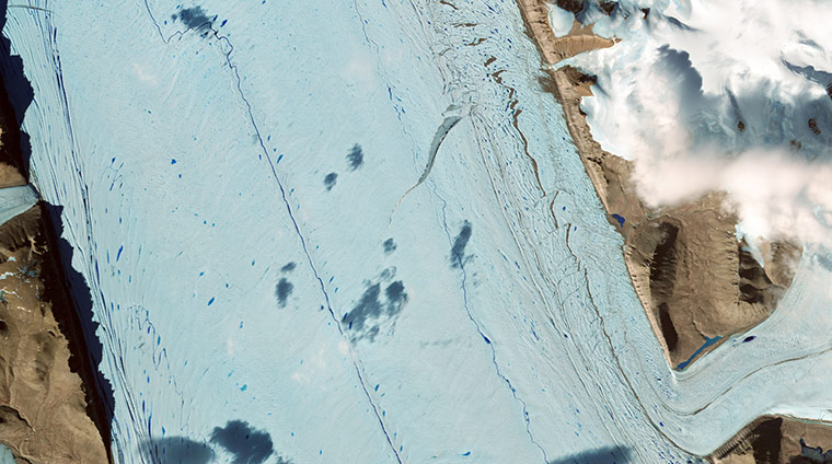
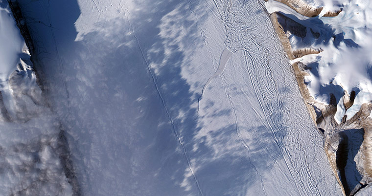
4 August: the iceberg continues to break off from the glacierPhotograph: ASAR/Envisat/ESA7 August: The 100 sq mile chunk of ice drifts into the North Strait between Greenland and CanadaPhotograph: ASAR/Envisat/ESAOn Greenland, tens of thousands of years of snowfall have settled and solidified into a massive sheet of ice. Each summer, snow retreats briefly at low elevations, and a narrow strip of rocky coastline emerges. As it thins and fractures, sea ice that packed into the mouths of fjords over the winter takes on the look of a mosaic made from blue and white stained glass. Glaciers flowing down from the highland interior get a little slushy, at least on top; turquoise blue pools of melt water dot the surface. These seasonal changes are apparent in this image of the Petermann Glacier Photograph: Terra/MODIS/NASAA radar image featuring the north-eastern tip of Ellesmere Island (left) in the Canadian Arctic and north-western Greenland (right). The green and purple-coloured water pictured in the lower part of the image is Nares Strait. The northernmost part of Nares Strait is the Robeson Channel, which empties into Lincoln Sea (upper left corner of image), part of the Arctic Ocean. The aqua blue and white-coloured areas on the right side of the image show a portion of the Greenland ice sheet, the second largest concentration of frozen freshwater on Earth. In reddish colours, the northern hemisphere's longest-floating glacier, Petermann, can be seen stretching across the centre of the lower part of the image and emptying into Nares StraitPhotograph: Envisat/ESAAlmost 19 years ago to the day, this image from August 1991 shows a much longer ice-tongue protruding further towards Nares Strait, a few days before the calving of three large icebergs. The dot line across the glacier indicates the line of fracture of the icebergs in 1991. Petermann spawned two smaller breakaways: one of 34 sq miles in 2001 and another of 10 sq miles in 2008 Photograph: ESAThe glacier tongue in July 2002. Scientists began to express concerns about a rift which had appeared in 2001 - visible here in the centre right of this image running horizontallyPhotograph: NASAThe glacier tongue in July 2005. The rift is filled with thin ice and covered with snow Photograph: NASAA thin fracture near the edge of the rift indicates that it has continued to widen in this image captured in August 2007Photograph: NASAThe size of the rift in September 2008. After its initial formation, the rift on Petermann Glacier advanced toward the glacier front, widening as it movedPhotograph: Terra/MODIS/NASA
Sign up to read this article
Read news from 100’s of titles, curated specifically for you.