New satellite images have captured the trail of devastation left in the wake of Texas' deadly flash floods earlier this week.
The flooding, which began in the early hours of Friday (July 4), has been catastrophic, with 121 people reported to have died and at least 150 people still missing, at the time of writing.
Most of the deaths have occurred in Kerr County, where extreme rainfall caused the Guadalupe River to swell and burst its banks.
Space technology company Maxar Technologies has released satellite images that show the Guadalupe River before and after the flooding. Click on the right of the images below to see how the landscape changed as a result of the floods.
Related: Why were the Texas flash floods so catastrophic?
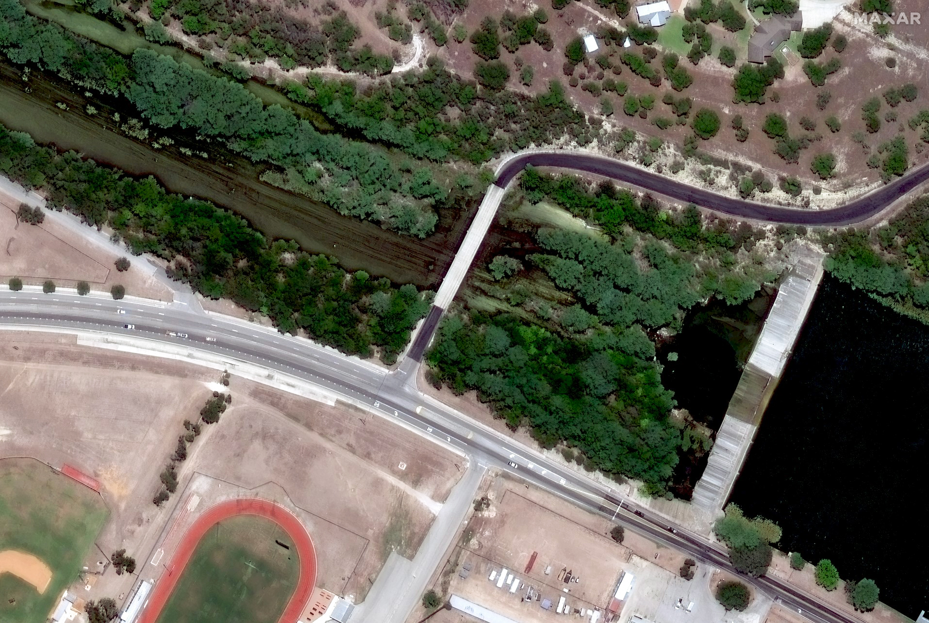
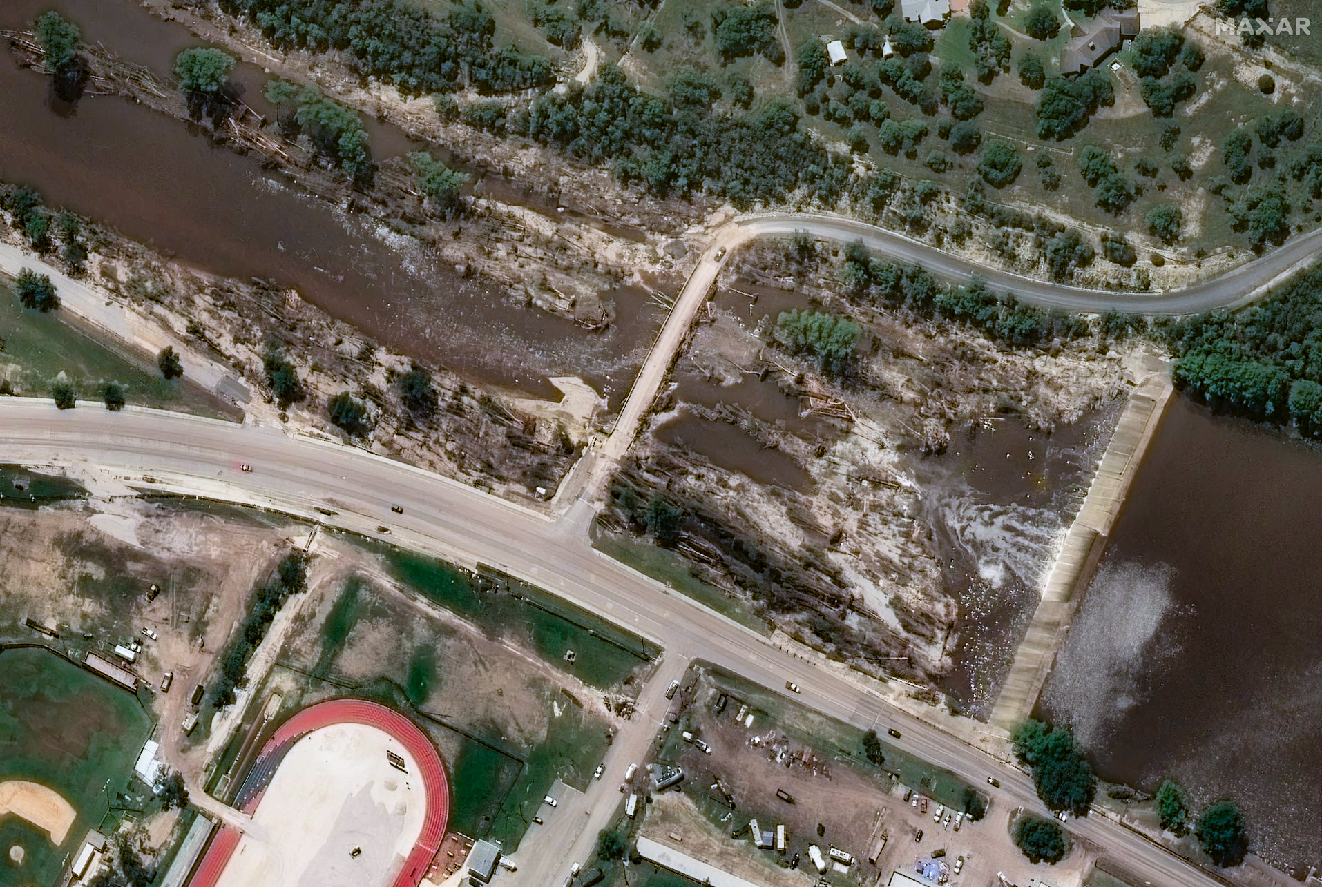
These images show the Ingram Dam, located in Kerr County, before and after the devastating floods. The first image was taken in July 2022, while the second was taken on Tuesday (July 8). Last Friday, water levels in the river rose by more than 26 feet (8 meters) in just 45 minutes.
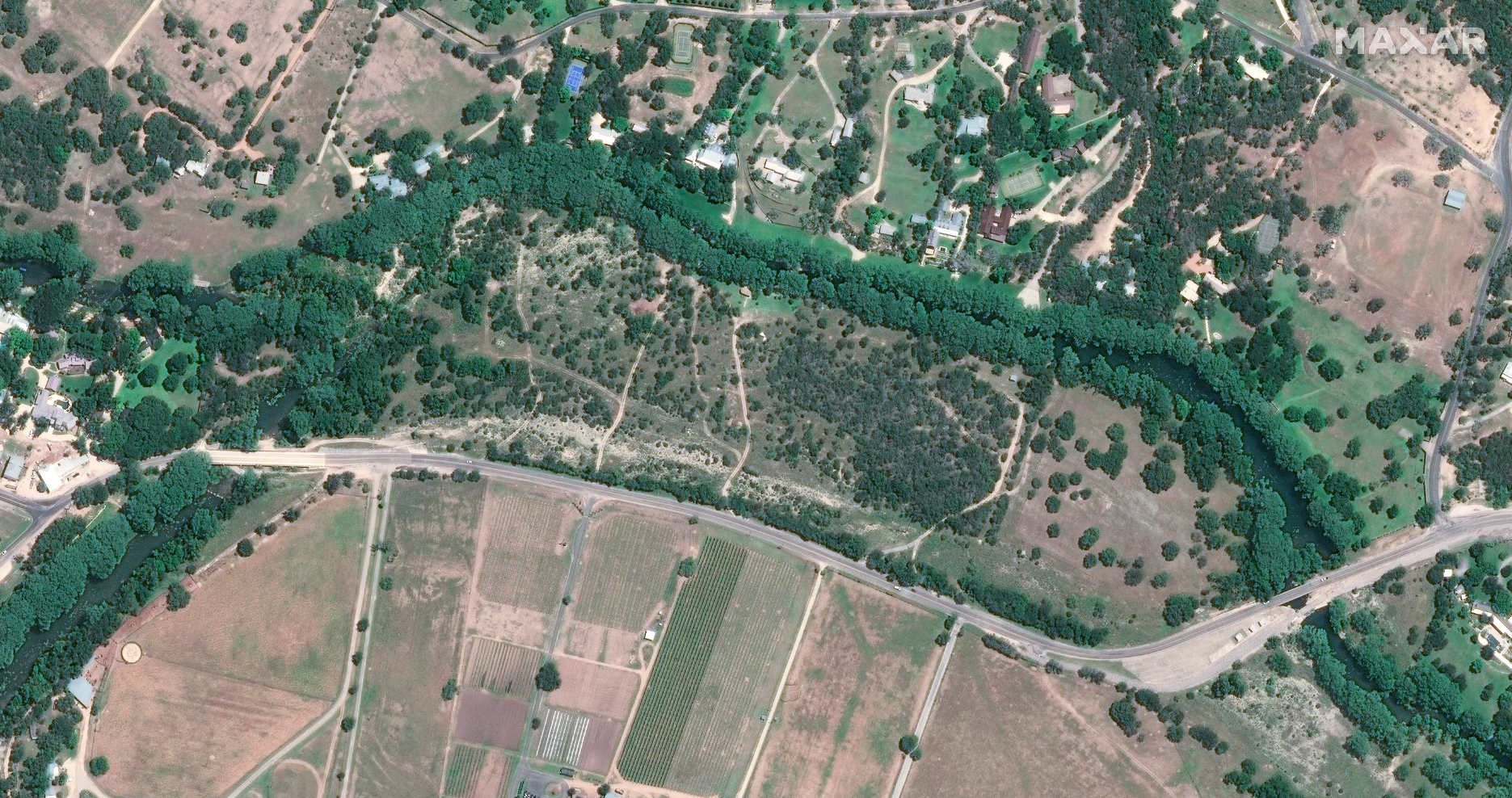
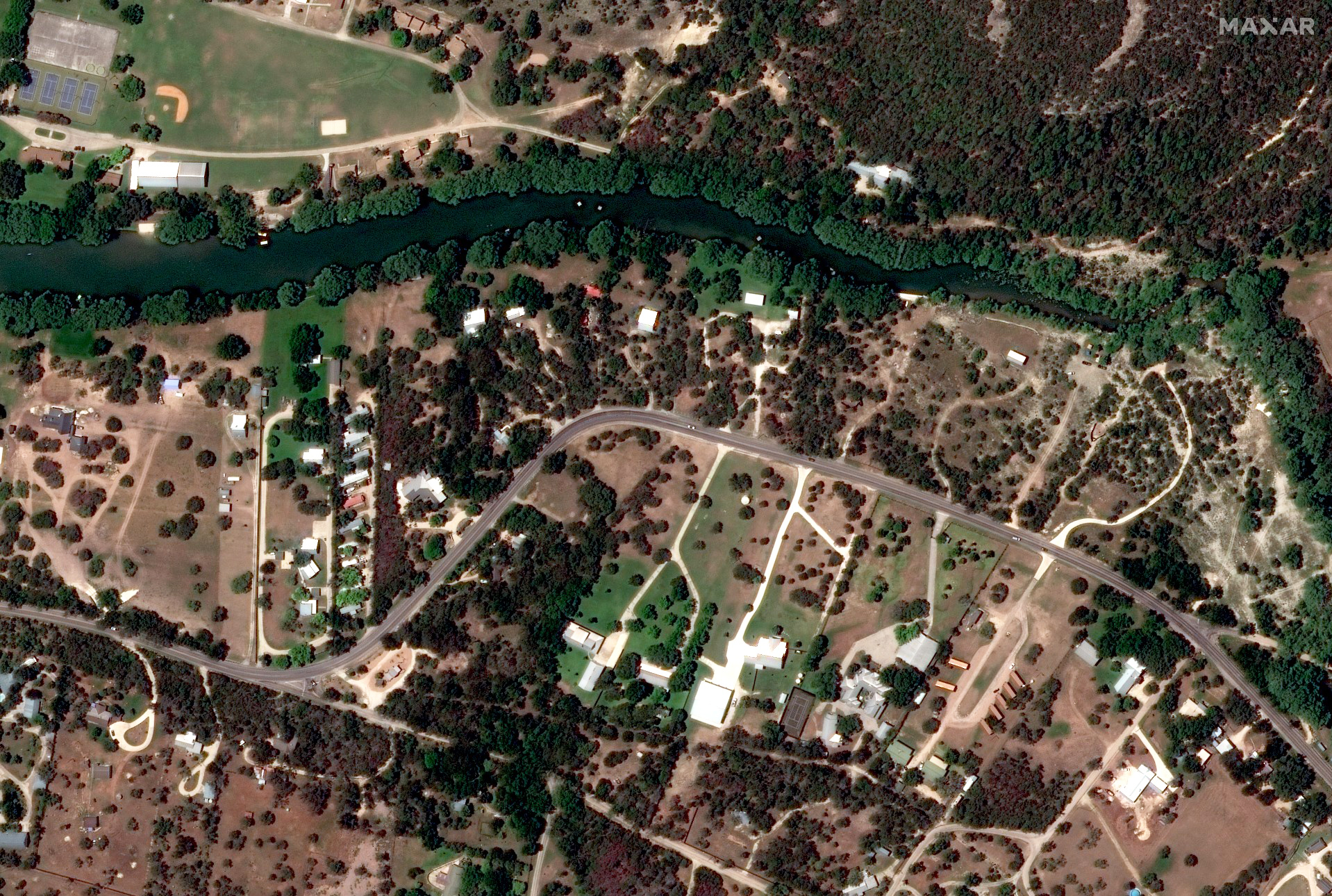
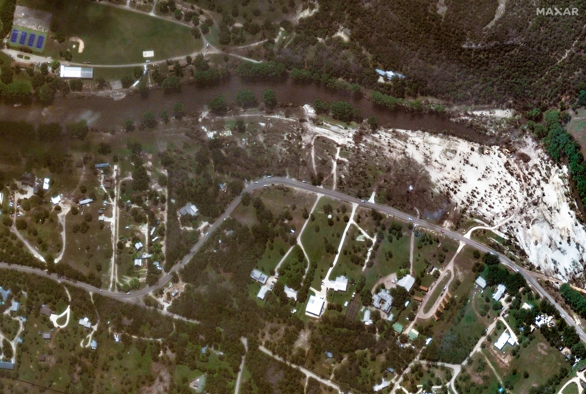
These two satellite images show vegetation along the Guadalupe River before and after the flooding. The first image was taken in June 2023, while the second was taken on July 8. Much of the vegetation visible in the first image has been washed out in the second.
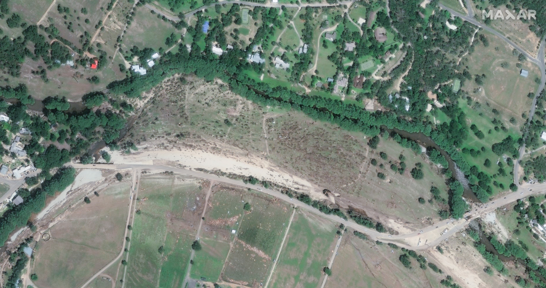
These before-and-after photos from along Texas State Highway 39 illustrate some of the catastrophic damage the waters caused. In the second image, taken after the flooding on July 8, homes just above the highway have been swept away.
These floods are the deadliest inland flooding in the U.S. since 1976, when the Big Thompson Canyon flood killed 144 people in Colorado, The Associated Press reported.
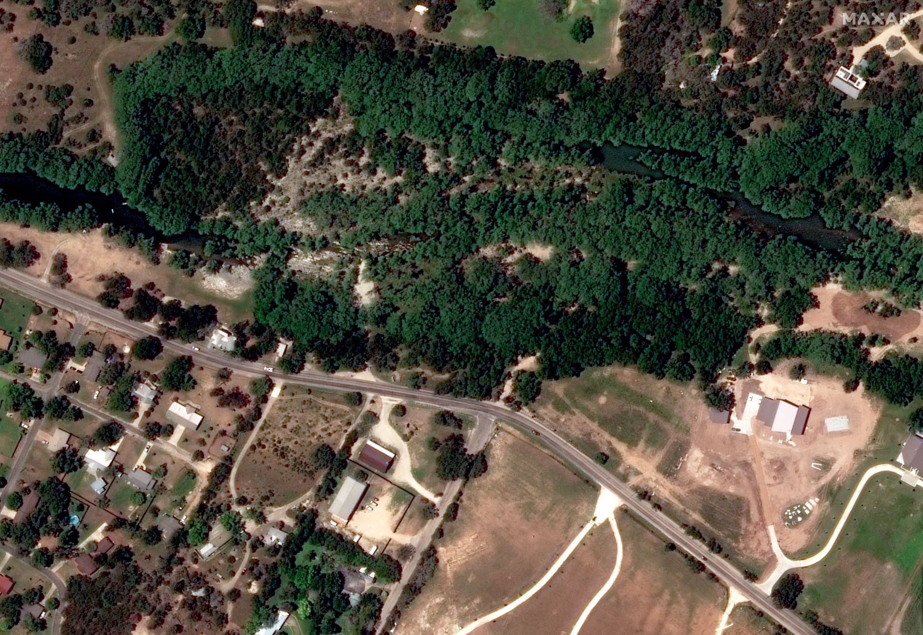
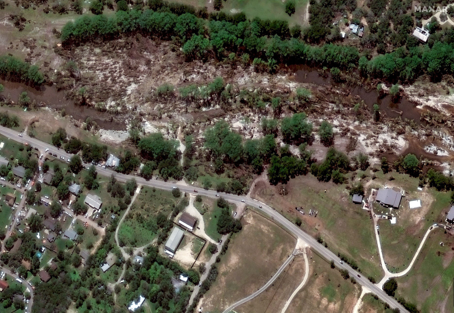
These before-and-after shots show how the river expanded and swept through trees, causing many to tumble down. The first satellite image was taken in June 2023, while the second was taken on July 8. Many trees have either fallen or are completely missing in the second image.