An intensifying storm associated with a strong atmospheric river hit Central to Southern California with heavy rains, damaging winds and heavy mountain snowfall on Tuesday.
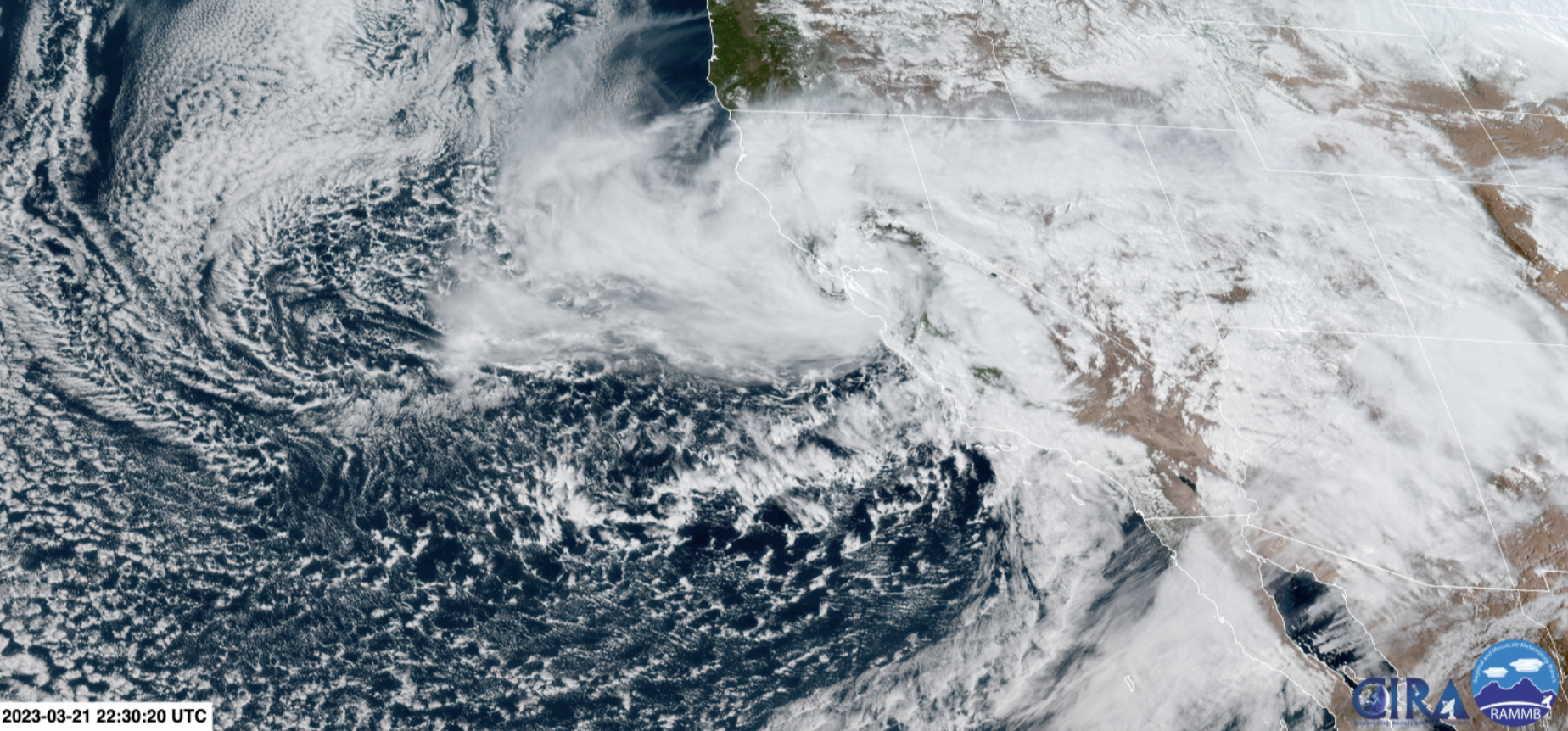
Of note: It's an unusually intense March storm for Central California, with satellite and radar imagery exhibiting swirling clouds around the center — almost resembling a tropical cyclone.
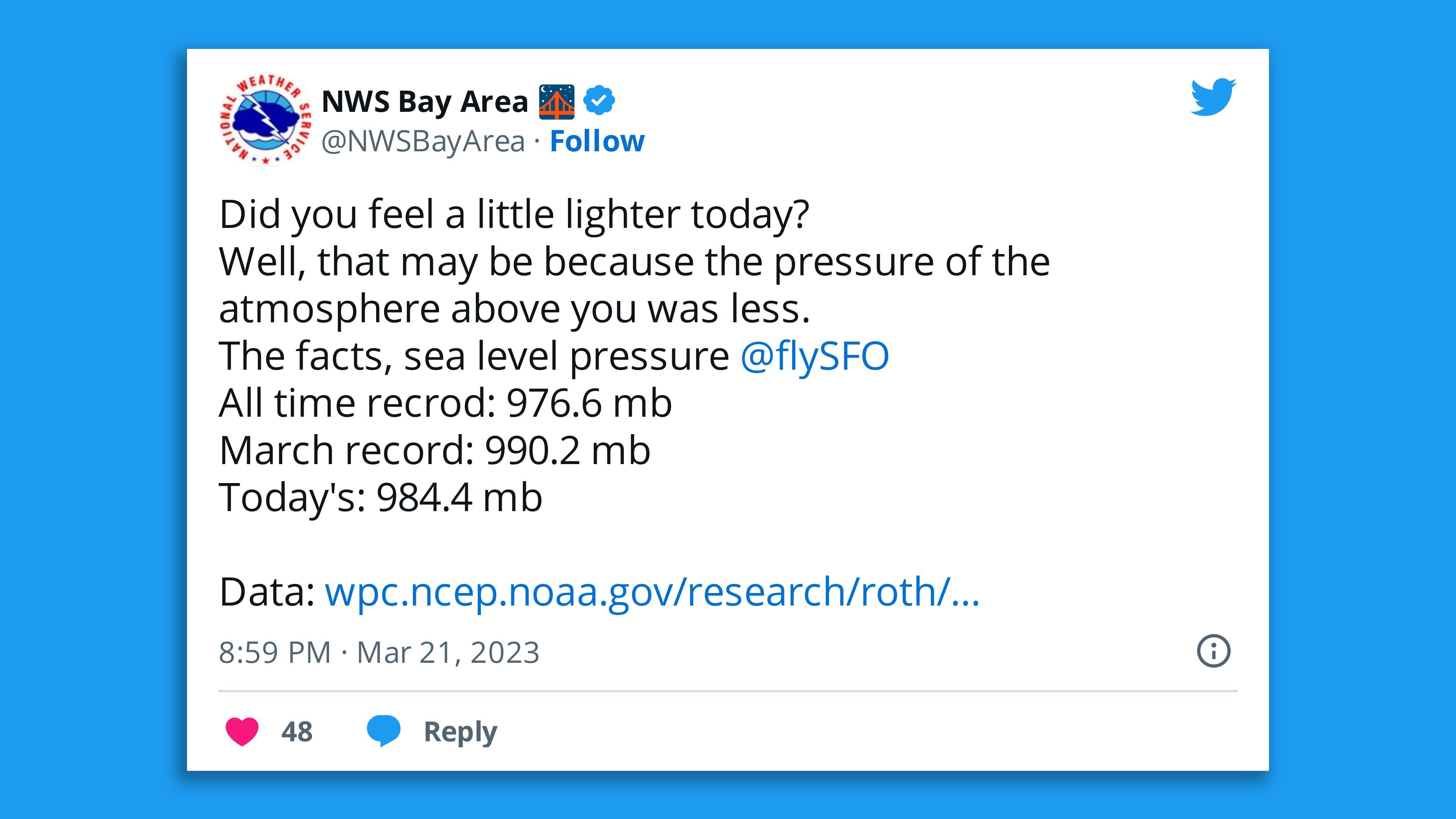
- Data from the National Weather Service's Bay Area office indicates it's the strongest storm on record there in March, judging by atmospheric pressure.
- The pressure was much lower than had ever been recorded in the Bay Area for this month.
State of play: Nearly 179,000 customers were without power overnight with the Bay Area and Central Coast among the worst hit, per utility tracker poweroutage.us. The Santa Cruz hills were going dark in the afternoon with 80 mph winds.
- The NWS' Los Angeles office issued a special weather statement on Tuesday evening due to the threat of landspouts, wind gusts up to 50 mph, and pea size hail, as it warned "torrential rain" was occurring that could trigger flooding.
- "Gusty winds could knock down trees, tree limbs, and power lines, and blow around unsecured objects," the office warned.
- The San Francisco Fire Department tweeted that it's responded "to numerous tree and wires down calls."
- The Department of Public Works in San Diego County reported that a section of a key road in the area was closed due to flooding.
Meanwhile, satellite imagery on Tuesday afternoon showed the eye-like center of the storm making landfall near the San Francisco area, though the strongest winds were south of there.
What we're watching: High wind warnings and wind advisories were in effect throughout the state from San Francisco south to San Diego, with gusts up to 75 mph or greater possible in higher terrain.
- Flood watches were in effect for central and southern California, where "[n]umerous flash floods are likely," the Weather Prediction Center said in a forecast discussion Tuesday.
- Snowfall was expected to total up to 4 feet in the southern and central Sierra Nevada Mountains, putting strain on already buried infrastructure, given the record-breaking snowpack so far this year.
Of note: Departures to San Francisco International Airport were grounded due to wind from Tuesday afternoon into the evening, per the Federal Aviation Administration.
Context: With increasing ocean and air temperatures, climate change is adding even more moisture to atmospheric rivers, enabling them to dump higher rain and snow totals.
What we're watching: A very strong low pressure system that's offshore of San Francisco Bay will continue to bring high winds, heavy rain and heavy mountain snow for California and adjacent areas of the Southwest into Wednesday, per an NWS Weather Prediction Center forecast discussion Tuesday evening.
- Precipitation was expected to change to snow over the Tejon Pass along Interstate-5, the NWS in Los Angeles warned.
Editor's note: This is a breaking news story. Please check back for updates.